Download presentation
Presentation is loading. Please wait.

1
Aim: Are accepted geographical divisions of the Earth right or wrong? Do Now: Where are you? How do you know?

2
I A Brief History of Cartography “Maps are perhaps as fundamental to society as language and the written word. They are the preeminent means of recording and communicating information about the location and spatial characteristics of the natural world and of society and culture.” http://www.colorado.edu/ A) Cartography is the art and science of making maps. B) Look at the ancient Greek world maps below. What changed? Ptolemy Map 150 CE
 Cartography is the art and science of making maps. B) Look at the ancient Greek world maps below. What changed. Ptolemy Map 150 CE.")
3
A Brief History of Cartography Continued… C) What do you notice about the medieval European and medieval Chinese world maps below?
 What do you notice about the medieval European and medieval Chinese world maps below")
4
A Brief History of Cartography Continued… D) During the Age of Exploration (15-16 th centuries), European explorers like Columbus used portolan maps. Lines radiate from compass points. E) A Mercator Projection (invented in 1569), enables a navigator to plot a straight-line course. *It distorts the size and shape of land areas. F) The Robinson Projection shows the entire world at once. *It makes plotting latitude and longitude easier, but it distorts the world as flat.
 A Mercator Projection (invented in 1569), enables a navigator to plot a straight-line course. *It distorts the size and shape of land areas. F) The Robinson Projection shows the entire world at once. *It makes plotting latitude and longitude easier, but it distorts the world as flat..")
5
A Brief History of Cartography Continued… G) Don’t forget the differences between latitude and longitude, the equator and Prime Meridian!
 Don’t forget the differences between latitude and longitude, the equator and Prime Meridian!")
6
A Brief History of Cartography Continued… H) GPS (Global Positioning System), is a radio navigation system that determines exact location and time. The first GPS satellites were launched in the 1970s.

7
II Our Place in the Universe Is our place in the universe significant or insignificant?

8
Our Place in the Solar System

9
Our Place in the Milky Way Galaxy

10
Our Place in our Local Cluster of Galaxies

11
Our Place in the Observable Universe

12
III Maps for the AP Exam

13
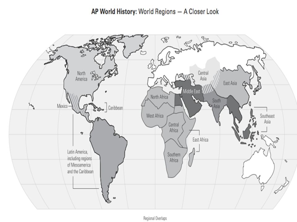
The Maps You Need to Know for the AP Exam

15
III What is Big Geography? Big geography is geography in the context of the entire globe.

16
The Conventional Map of 7 Continents A continent is defined as a large land mass surrounded by water. If that is true, then why are Europe and Asia separate continents? Should Greenland be considered a continent instead of a large island?

17
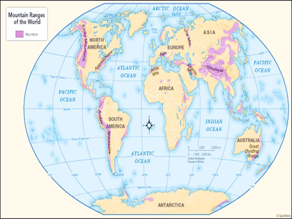
The Ural Mountains as a Dividing Line? Since the 19th century, most scholars have accepted the Ural Mountains as part of the dividing Line between “Europe” and “Asia” as continents.

18
Ural Mts. Another part of the dividing line: Bosporus and Dardanelles (Straits) EUROPE ASIA Here’s a highway bridge across the Bosporus. Today, you can drive from “Asia” to “Europe” in a few minutes.
 EUROPE ASIA Here’s a highway bridge across the Bosporus. Today, you can drive from Asia to Europe in a few minutes..")
19
Asia + Europe = Eurasia E U R A S I A The dividing line between “Europe” and “Asia” is not something that is “natural.” That is, it does not exist as a fact of the natural world. Many geographers have therefore been willing to unite the two regions as a single continent called “Eurasia.”

20
But Africa is only separated from Eurasia by the man-made Suez Canal… so should Africa and Eurasia be dubbed Afroeurasia? A F R O E U R A S I A

21
Are the Americas one continent or two? Are the Americas a single “super continent”? Gulf of Mexico Caribbean Sea

22
Or should we go by Earth’s tectonic plates?

25
The major winds and currents of the oceans summer winter Indian Ocean Monsoon Winds Until the coming of steamships in the 19th century, sailors had to know winds and currents to have confidence that they could sail from one place to another in an approximate amount of time. These winds and currents follow large global patterns. It was a matter of discovering what those patterns were.

26
The wind cycle in the North Atlantic helped Christopher Columbus sail both ways across the ocean. WIND

27
“Mapping Crimea” by Michael Blanding, March 2014 After word came down this week that the Crimean parliament had officially voted to secede from Ukraine and join Russia, Western governments immediately condemned the move. But one influential institution broke ranks to recognize the peninsula’s new political status: National Geographic. Not two days after the vote, the magazine’s editors decided to update its maps of the area to show Crimea as a part of Russia—shading it as a disputed territory, similar to the way it handles Gaza and the West Bank. If Russia votes to annex Crimea, the magazine says, it will take away the shading to show the territory as a full-fledged part of the Russian Federation. “We map de facto, in other words we map the world as it is, not as people would like it to be,” the magazine’s chief geographer told U.S. News & World Report. The fact is, however, that very little about mapping is de facto or absolute.

28
“Mapping Crimea” Continued… Maps always show the world as we their creators choose to interpret it—often reflecting political motivations or desired reality as much as objective geography. As it is in history or politics, perception is everything. Not only are maps made by the victors, but often they foreshadow or even determine victory before the fact… During the Cold War, American students took for granted that the United States was located in the center of the world, with Asia split to the left and right. Soviet schoolchildren, meanwhile, grew up with world maps showing Asia in the middle (dominated by the Soviet Union) with North America split in two. In the 1970s German journalist Arno Peters exposed the fraud within the world’s most common map projection, the Mercator Projection, which distorts the size of countries farther away from the equator—emphasizing the United States and Europe over developing countries in the “global south.” His own projection reversed this trend, shrinking the developed countries and emphasizing Africa and Latin America…
 with North America split in two. In the 1970s German journalist Arno Peters exposed the fraud within the world’s most common map projection, the Mercator Projection, which distorts the size of countries farther away from the equator—emphasizing the United States and Europe over developing countries in the global south. His own projection reversed this trend, shrinking the developed countries and emphasizing Africa and Latin America….")
29
“Mapping Crimea” Continued… And so it goes: India, Pakistan, and China all use different maps to define the boundaries of Kashmir. Moroccan maps include the disputed area of Western Sahara as part of the kingdom. China uses ancient maps to assert its legitimacy over Tibet. Israelis and Palestinians refer to maps created in 1919 and 1947 as the basis to claim their own boundaries… The fact is, the very act of trying to render 3D geography on a flat surface forces the mapmaker to make choices about what to include and how—and that includes interpretations about who they think controls what. As maps of territorial claims over the years in Africa, Asia, and North America have shown, those depictions can then have a big influence on later events. If history is any lesson, then as the conflict in Crimea plays out in the coming weeks and months, the maps made of the region may not only reflect the reality on the ground, but also help create it.

30
Crimea – Disputed Territory?

31
HW Questions 1. What is our place in the universe? (You can describe it or draw a diagram) 2. List 5 countries for each of the following regions: a) Western Europeb) Eastern Europe c) East Asiad) Southeast Asia e) Southwest Asiaf) Central Asia g) South Asiah) North Africa i) West Africaj) East Africa k) Central Africal) Southern Africa m) Oceania n) North America & the Caribbean o) South America 3. What are the differences between the Mercator and Robinson projections? Which do you prefer and why? 4. Why do geographers disagree as to how many continents there are on Earth? How many continents do you think there are and why? Should it even matter? Why or why not? 5. In a paragraph, summarize the main points of the article “Mapping Crimea”. Do you agree or disagree with National Geographic’s decision to label Crimea as “disputed territory”? 6. Must – Know Vocabulary: See the next slide!
 2. List 5 countries for each of the following regions: a) Western Europeb) Eastern Europe c) East Asiad) Southeast Asia e) Southwest Asiaf) Central Asia g) South Asiah) North Africa i) West Africaj) East Africa k) Central Africal) Southern Africa m) Oceania n) North America & the Caribbean o) South America 3. What are the differences between the Mercator and Robinson projections. Which do you prefer and why. 4. Why do geographers disagree as to how many continents there are on Earth. How many continents do you think there are and why. Should it even matter. Why or why not. 5. In a paragraph, summarize the main points of the article Mapping Crimea . Do you agree or disagree with National Geographic’s decision to label Crimea as disputed territory . 6. Must – Know Vocabulary: See the next slide!.")
32
HW Continued… Must – Know Key Terms Write definitions for the following words on index cards OR in the Review Section of your notebook. *This part of your HW will not be checked along with the rest of your HW, but there will be periodic “quizzes” to ensure you are doing this! AfroeurasiaBig GeographyBosphorus Strait CartographyCrimeaEquator EurasiaGISLatitude LongitudeMap Mercator ProjectionPrime Meridian Robinson ProjectionUral Mountains

Similar presentations