Download presentation
Presentation is loading. Please wait.

1
CVPS wetland review Presented by Central Vermont Public Service Corporation Vermont Water Resources Panel September 7, 2006

2
CVPS Service Territory ~8,000 miles distribution, 600+ miles transmission 100+ substations

3
Utility line project design CVPS Work Management System software Computer-based design/inventory tool Projects have four phases: Initiation, Design, Construction, Closed All Pre-construction requirements must be complete before work tickets can be printed Permitting requirements: Automatically activated for any design with more than three pole installations, or any amount of primary-voltage underground Security features prevent anyone but the Permit Coordinator from completing or overriding permit requirements Several thousand construction projects annually

6
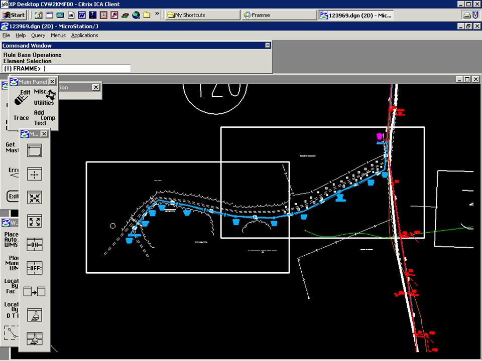
Framme Intergraph mapping software Construction prints generated through automated process, taking design information from WMS Other information added by designers (roads, treelines, easement info, etc.)
")
9
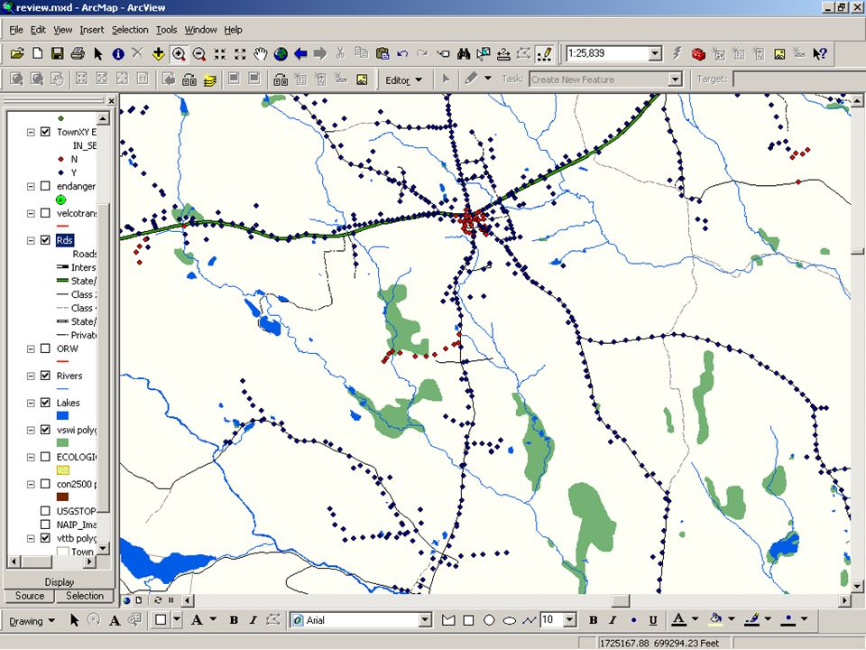
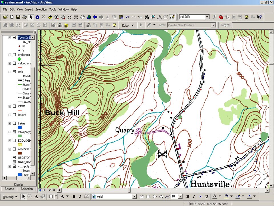
GIS data ArcView is used to review every project flagged through WMS, plus others identified by field designers Project designs include X,Y coordinates for every pole (and foundation for underground cabinets/transformers) Pole locations are overlaid onto roads, buildings, VSWI, NHI, surface waters, NAIP color aerial photos, and USGS topo maps
 Pole locations are overlaid onto roads, buildings, VSWI, NHI, surface waters, NAIP color aerial photos, and USGS topo maps")
18
Utility of maps VSWI maps, combined with other data, allow for very reliable screening of projects for possible review and permitting under state wetland rules. Loss of VSWI maps with current system would guarantee non-compliance despite best efforts. Loss of VSWI maps combined with state GP would slightly increase risk of non-compliance, significantly reduce the level of project review, and increase the amount of wetland impacts, however small and/or temporary they may be.

Similar presentations


 Loops Stacey Mighty Malcolm Distribution.>")


 860-0600 BIA 10 th Annual Indian Energy & Minerals Conference Osage Nation Environmental & Natural Resources.>")