Download presentation
Presentation is loading. Please wait.

1
Potential effects of climate change on the Columbia River Basin: Hydrology and water resources Dennis P. Lettenmaier Department of Civil and Environmental Engineering and Climate Impacts Group University of Washington UW School of Communications/Knight Foundation Seminar for Journalists June 28 2002 JISAO Climate Impacts Group Joint Institute for the Study of Atmosphere and Oceans

2
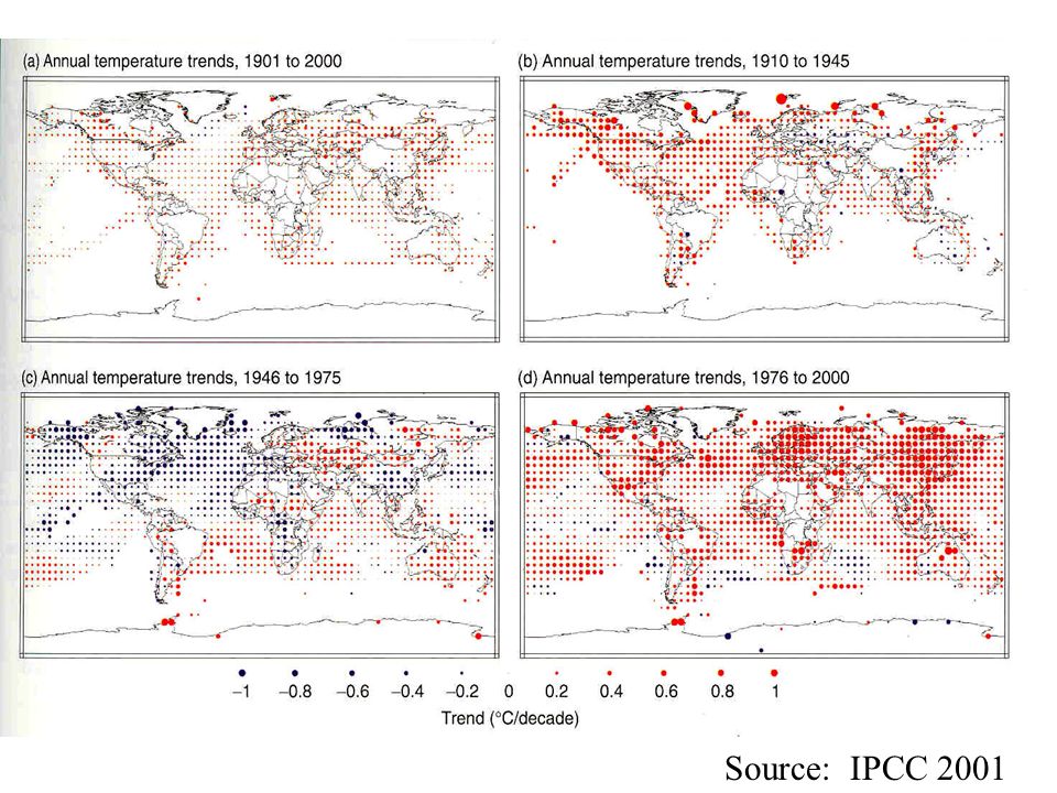
A regional perspective on a global problem What is known? On a global basis, temperature has been increasing, appears to be well out of the range of natural variability Picture is less clear for hydrology Modeling is the basis for future projections Models essentially all agree on direction of temperature change and regional coherence, less so on precipitation Some consistency in direction of model predictions for precipitation change over land at intermediate to high latitudes

4
Source: IPCC 2001

6
What is a climate model? Abstraction of the true climate (“average weather”) system, based on the laws of physics Typically a set of equations, solved numerically, over a (global) grid, for “climate time scales” (decades to centuries) In practice, so-called General Circulation Models (GCMs) are close cousins of numerical weather prediction models
 system, based on the laws of physics Typically a set of equations, solved numerically, over a (global) grid, for climate time scales (decades to centuries) In practice, so-called General Circulation Models (GCMs) are close cousins of numerical weather prediction models.")
7
Source: NRC 1975

8
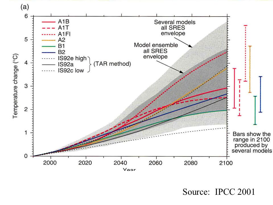
Source: IPCC 2001

11
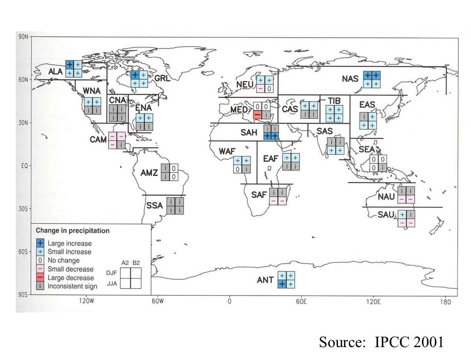
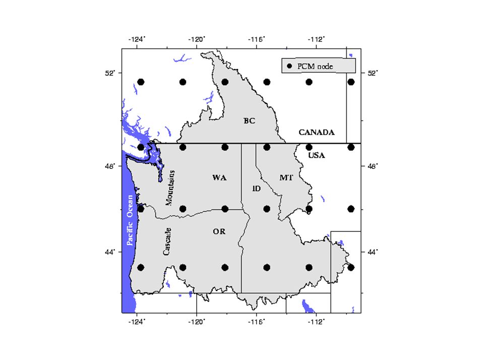
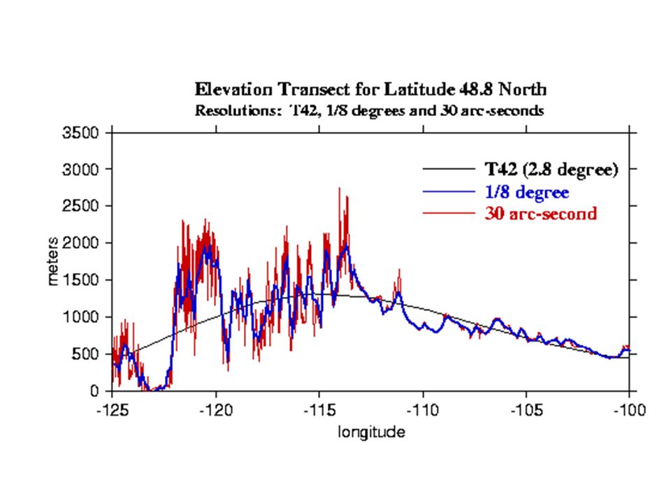
Interpreting the hydrologic implications Scale mismatch – the critical roadblock Interpreting hydrologic consequences requires a river basin perspective, GCM scale of degrees lat-long doesn’t resolve any but the very largest rivers Topographic effects on precipitation and temperature at poorly resolved by global GCMs

14
Topography as a constraint (or why the situation is not hopeless) In the PNW (and most of the West) streamflow originates predominantly as winter snowfall (> 70% westwide) Topography exerts a strong control on partitioning of precipitation into rain vs snow (~ 6 o C/1000 m mean lapse rate), and amount of precipitation (orographic enhancement) Hence hydrologic implications of warming can be extracted from large scale information about warming, as can some information about spatial distribution of precipitation (changes will be most important over mountainous source areas, especially in interior of west where lowlands tend to be arid or semi-arid)
 In the PNW (and most of the West) streamflow originates predominantly as winter snowfall (> 70% westwide) Topography exerts a strong control on partitioning of precipitation into rain vs snow (~ 6 o C/1000 m mean lapse rate), and amount of precipitation (orographic enhancement) Hence hydrologic implications of warming can be extracted from large scale information about warming, as can some information about spatial distribution of precipitation (changes will be most important over mountainous source areas, especially in interior of west where lowlands tend to be arid or semi-arid)")
15
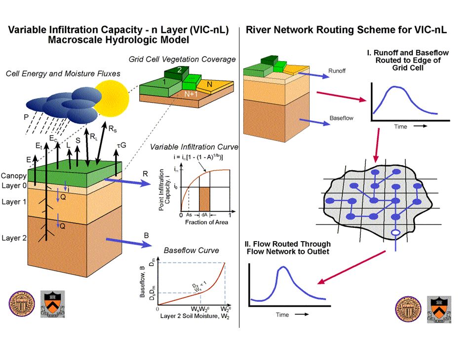
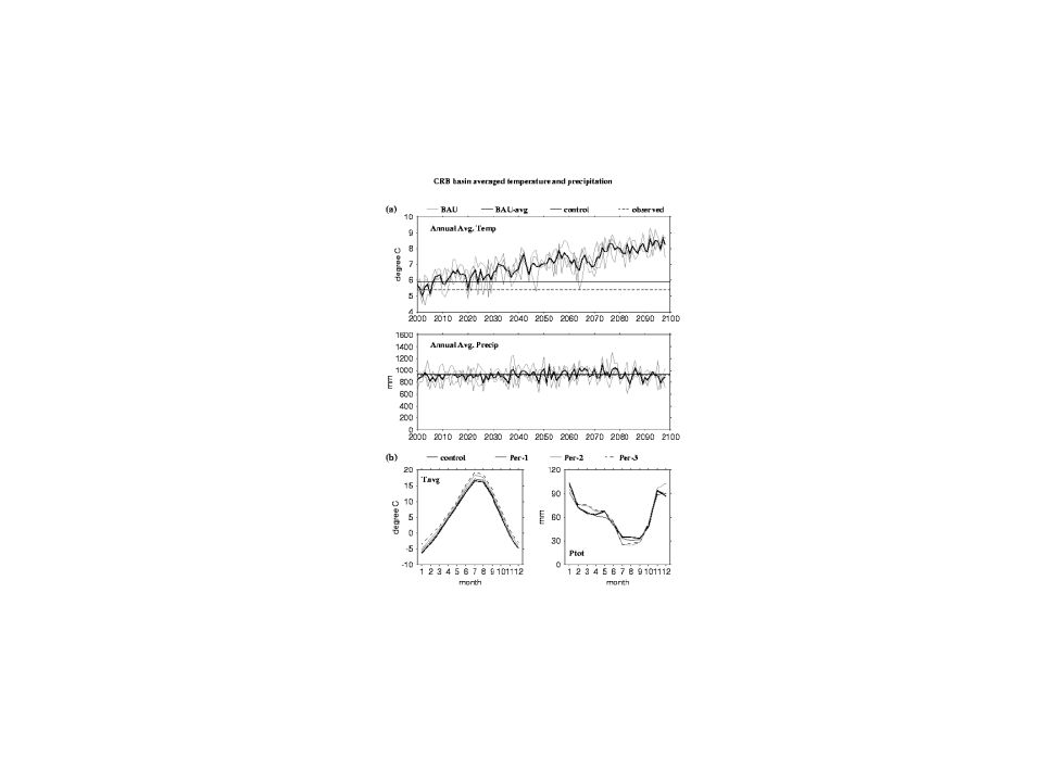
Climate Scenarios Transient GCM Simulations for Increasing CO2 and Aerosols Adjustments To Observed Meteorology Delta Precip, Temp Hydrologic Model (VIC) Natural Streamflow Reservoir Model (ColSim) DamReleases, Regulated Streamflow Performance Measures Reliability of System Objectives
 Natural Streamflow Reservoir Model (ColSim) DamReleases, Regulated Streamflow Performance Measures Reliability of System Objectives")
16
ColSim Reservoir Model VIC Hydrology Model Changes in Mean Temperature and Precipitation from GCMs

18
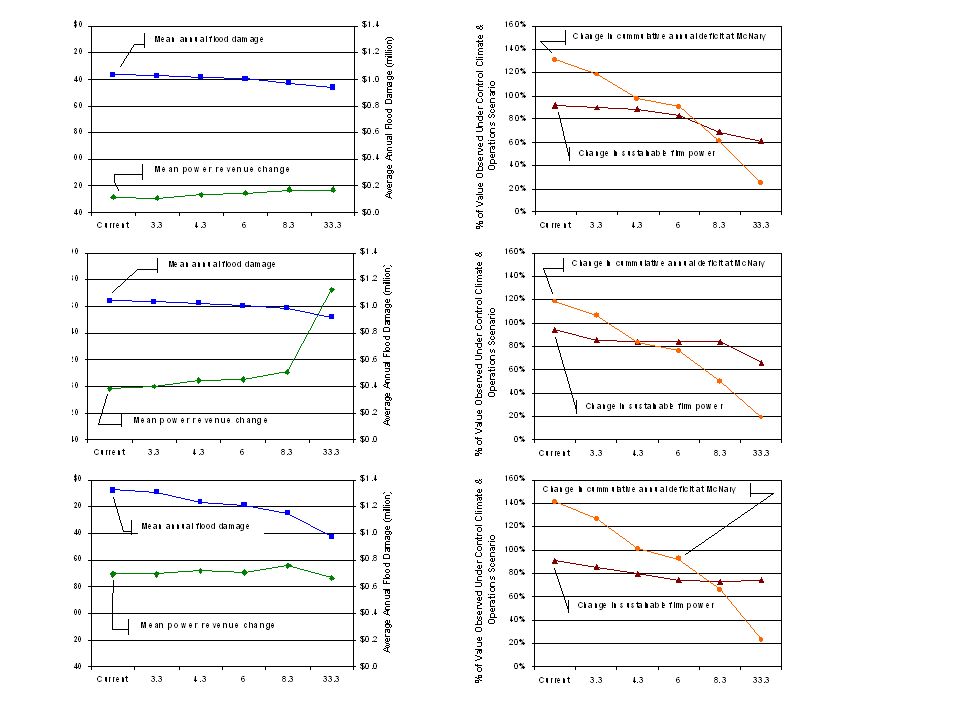
Overview of ColSim Reservoir Model Physical System of Dams and Reservoirs Reservoir Operating Policies Reservoir Storage Regulated Streamflow Flood Control Energy Production Irrigation Consumption Streamflow Augmentation Streamflow Time Series

20
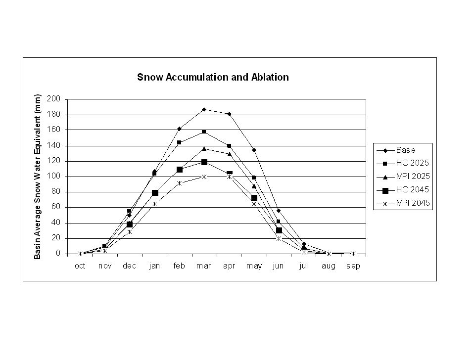
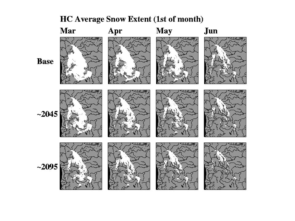
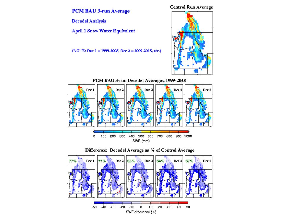
VIC Simulations of April 1 Average Snow Cover Extent MPI ECHAM4 Scenarios Base Case ~2025~2045

23
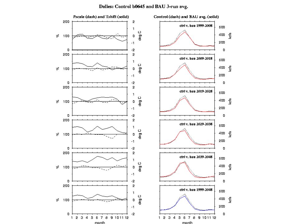
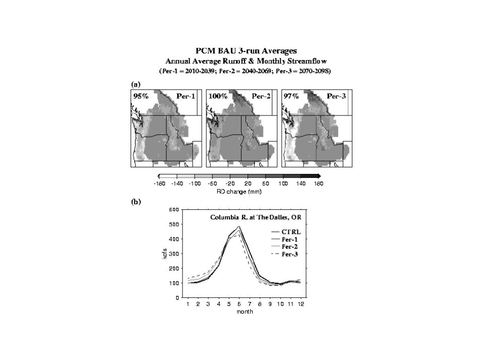
Changes to Mean Hydrographs Columbia Basin 2045

25
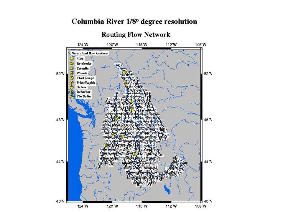
The Dalles Libby Lower Granite McNary Grand Coulee Snake R. Mica Corra Linn Priest Rapids Chief Joseph Ice Harbor Columbia Falls Hungry Horse Oxbow 1

26
ColSim Reliability of System Objectives

27
VIC/ColSim 2040’s

Similar presentations


 the water year for which the December to February Sea Surface Temperature in the NINO 3.4.>")


