Download presentation
Presentation is loading. Please wait.

1
2 nd Block: Find your table group, sit down, and start on your Warm-Up! Red: Jake, Raeva, Natalie, Kushi Green: Shashank, Sydney, Sonal, Ryan Blue: Ethan, Francis, Ayesha, Pranav Yellow: Siddharth, Noemi, Akshata, Kylie Purple: Ella, Ashley, Cooper, Rehman Pink: Kyle, Emma, Jacob, Demi Orange: Olivia, Ryann, Roshni

2
3 rd Block: Find your table group, sit down, and start on your Warm-Up! Red: Matt, Tanya, Rhea, Maddie Green: Ikhlaas, Justin, Daniela, Viola Blue: Leila, Luke, Nicki, Siddharth Yellow: Ethan, Aaron, Mikayla, Leilani Purple: Mitchell, Abby, Aidan, Sofia Pink: Nick, Shriya, Trang Orange: Ronith, Britney, Maddie

3
4 th Block: Find your table group, sit down, and start on your Warm-Up! Red: Erin, Gavin, Priya, Emre Green: Eric, Carson, Rakshita, Kate Blue: Morgan, Kylie, Michael, Ryan Yellow: Ben, Matthew, Sanjana, Emma Purple: Trevon, Jasmin, Cyr’sten, Joey Pink: Ellie, Mitchell, Brenna, Howard Orange: Kaitlyn, Jenna, Aimee

4
Warm Up: Use pages 11 and 12 to review the bodies of water! 1.Which river forms the border between Texas and Mexico? 2.Which river forms the Northeastern border between the United States and Canada? 3.Which river flows from North to South and empties into the Gulf of Mexico? 4.Which river is known as “Gateway to the West”? Why? 5.Why did port cities grow on the banks of the Great Lakes?

5
Today’s Agenda: 1.Vocabulary Review 2.GRUNGEBALL!! 3.Questions on study guide?

6
Name 2 mountain ranges in the United States.

7
Which region has rolling hills and broad rivers?

8
Which region has strange flat toped hills…plateaus?

9
Which region has wide areas of grassland…plains?

10
Which region (or regions) has peninsulas?
 has peninsulas")
11
Name an island in the United States

12
Can you name the 5 Great Lakes?

13
What gulf was used by explorers to travel to Mexico and other parts of America?

14
What river is a tributary of the Mississippi?

15
GRUNGEBALL: Each time will start out with 10 “Xs.” The object of the game is to KEEP your “Xs.” 1.When everyone is quiet, I will ask a question 2.SIELNTLY write down your answer 3.I will say “talk with your team”—compare answers, make sure everyone agrees 4.I will pick a desk number from the hat 5.If that person answers correctly, they can erase an “X” from another team 6.Then, they can shoot a basket. If you make it from the first line, erase 1 more “X,” second line 2 “Xs,” third line 3 “Xs.” *If a team is working together well, I can add an “X.” If a team is off task, I can delete an “X.”

16
Which lines run from north to south on the globe?

17
Wide grasslands with few trees; elevation increases westward

18
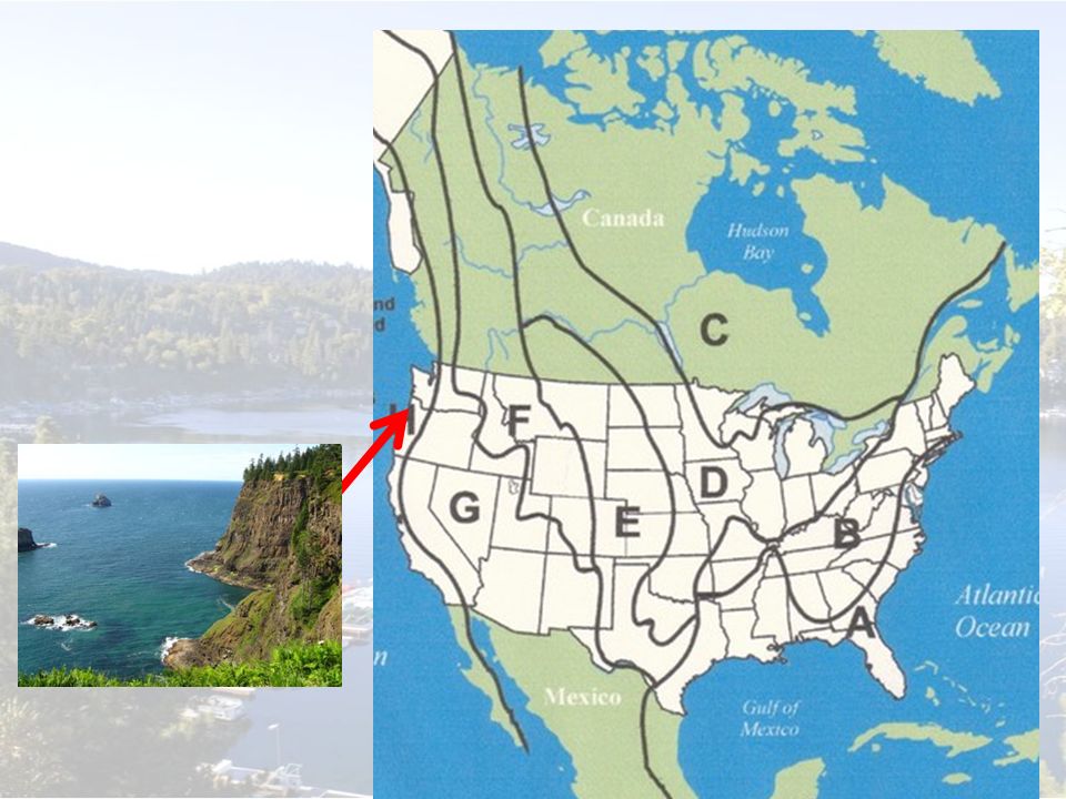
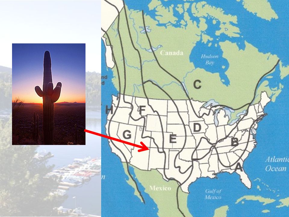
Death Valley National Park, California and Nevada

19
Which river is A?

20
Which continent?

21
Which river connects the Great Lakes to the Atlantic Ocean?

22
Which ocean?

23
Which ocean is located along California’s coastline?

24
Which ocean?

25
Tallgrass Prairie National Preserve, Kansas

26
Which region is EAST of the Interior Lowlands, WEST of the Coastal Plain?

27
Which lines run from east to west on the globe?

28
Give ONE example how explorers used waterways.

29
Which region is EAST of the Great Plains, WEST of the Appalachian Mountains?

30
What is another name for lines of longitude?

32
Which continent?

33
What is another name for lines of longitude?

34
Old, eroded mountain range

35
New York Harbor

36
Which river is known as the “Gateway to the West?” Why?

37
Shenandoah National Park, Virginia

38
Which region is EAST of the Coastal Range, WEST of the Rocky Moutains?

39
Give TWO examples of how Native Americans used waterways.

40
Broad lowlands, warm sunny beaches, many harbors and bays

42
What is another name for lines of latitude?

44
What river was used by people living in the United States to transport farm and industrial products North to South?

45
Which river is C?

47
Which region is EAST of the Basin and Range, WEST of the Great Plains?

48
Which river was explored by Lewis and Clark?

49
What is another name for lines of latitude?

51
What line is 0 degrees latitude?

52
Which river is B?

53
Which region is EAST of the Rocky Mountains, WEST of the Interior Lowlands?

54
Tall mountains along the Pacific Coast; fertile valleys

56
Which river is E?

57
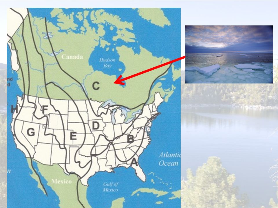
Forms a horseshoe shape around the Hudson Bay; glaciers carved out thousands of lakes

58
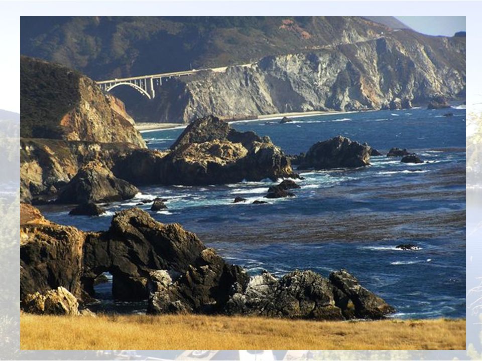
San Francisco, California

59
Map Game!

Similar presentations


 Coastal Range 2) Basin & Range 3) Rocky Mountains 4) Great Plains 5) Interior Lowlands 6) Canadian Shield 7) Appalachian.>")


