Download presentation
Presentation is loading. Please wait.

1
WVDOT GTI SECTION Status Update for Miss Utility

2
AGENDA Introduction. Introduction. Status Update. Status Update. How to Spatially Enable Database. How to Spatially Enable Database. Challenges. Challenges. Conclusion. Conclusion.

3
Phased Approach Phase One -Research and Planning Phase One -Research and Planning Phase Two - Build Geometric Network Phase Two - Build Geometric Network Phase Three -Design and Build Server Phase Three -Design and Build Server Phase Four -Application Development Phase Four -Application Development Phase Five -Application Testing Phase Five -Application Testing Phase Six -Operation and Maintenance Phase Six -Operation and Maintenance Diagram One Diagram One

4
Goals & Responsibilities GIS: Provide accurate base layers to support WVDOT’s geospatial needs. This will include the following: GIS: Provide accurate base layers to support WVDOT’s geospatial needs. This will include the following: Roads Roads Bridges Bridges Intersections Intersections Assets Assets Critical Infrastructure Critical Infrastructure

5
Goals & Responsibilities Mapping: Will be taking GIS base layers to create the following cartographic maps: Mapping: Will be taking GIS base layers to create the following cartographic maps: Official State Highway Map Official State Highway Map State General Highway Map State General Highway Map State Functional Classification Map State Functional Classification Map State Highway Base Map State Highway Base Map State Outline Map State Outline Map District Maps District Maps Regional Planning Councils Maps Regional Planning Councils Maps State Traffic Flow Map State Traffic Flow Map General Highway County Maps (55) General Highway County Maps (55) City Maps (187) City Maps (187) Urban Area Maps (26) Urban Area Maps (26) On-Demand Homeland Security Maps On-Demand Homeland Security Maps
 General Highway County Maps (55) City Maps (187) City Maps (187) Urban Area Maps (26) Urban Area Maps (26) On-Demand Homeland Security Maps On-Demand Homeland Security Maps")
6
Goals & Responsibilities Straight Line Diagrams: This program will be electronic and will require less time to update. Straight Line Diagrams: This program will be electronic and will require less time to update. Linear Referencing System: This is the procedures for determining and retaining a record of specific points or segments along a highway. The system includes the location reference methods together with the procedures for storing, maintaining, and retrieving location information about points and segments on the roads. Linear Referencing System: This is the procedures for determining and retaining a record of specific points or segments along a highway. The system includes the location reference methods together with the procedures for storing, maintaining, and retrieving location information about points and segments on the roads.

7
WVDOT GIS Status Update Working to Complete the Location Referencing Model. Working to Complete the Location Referencing Model. Completed Year One of GIS Training Program. Completed Year One of GIS Training Program. Completed Website for GIS Section. Completed Website for GIS Section. Completed Fueling Location Book. Completed Fueling Location Book. Created Geo-spatial Data Policy. Created Geo-spatial Data Policy.

8
WVDOT GIS Status Update December 2006 4155 Miles September 2007 13,509 Miles

9
Cont: WVDOT GIS Status Update Created Web-based Applications Created Web-based Applications STIP STIP Proto-type Crash Analysis Proto-type Crash Analysis Port Locations Port Locations Other Information Systems evaluated and considered for GIS integration; Road Inventory Log (RIL) Road Inventory Log (RIL) Project Tracking System (PTS) Project Tracking System (PTS) Average Daily Traffic (ADT) Average Daily Traffic (ADT) Pavement Management Pavement Management Document Management Document Management Coal Resource Tracking Systems (CRTS) Coal Resource Tracking Systems (CRTS)
 Road Inventory Log (RIL) Project Tracking System (PTS) Project Tracking System (PTS) Average Daily Traffic (ADT) Average Daily Traffic (ADT) Pavement Management Pavement Management Document Management Document Management Coal Resource Tracking Systems (CRTS) Coal Resource Tracking Systems (CRTS)")
10
Cont: WVDOT GIS Status Update GIS Maps Developed: GIS Maps Developed: Project Tracking System Project Tracking System Port Locations Port Locations Fuel Locations Fuel Locations HPMS Sample Locations HPMS Sample Locations Homeland Security Homeland Security

11
Cont: WVDOT GIS Status Update Created Road Naming Committee for standards on development of road naming and classification. for standards on development of road naming and classification. Created a subcommittee to establish a plan for a relational database for RIL. Consisting of database administrators and engineers to make recommendations for standards. Consisting of database administrators and engineers to make recommendations for standards.

16
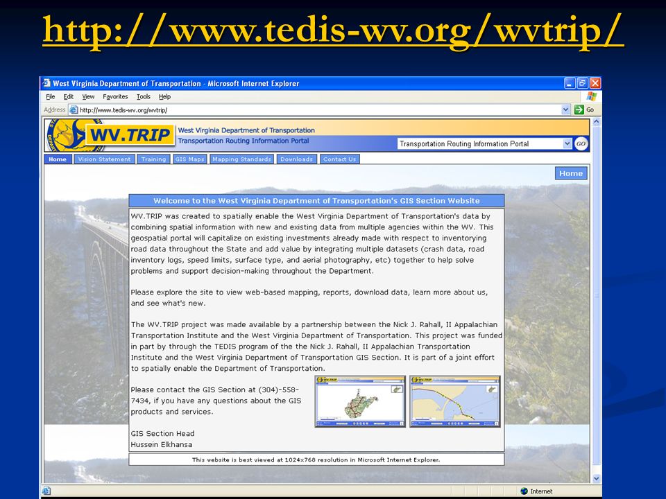
http://www.tedis-wv.org/wvtrip/
18
WVDOT GIS Data Examples WVDOT GIS Data Examples PLANIMETRICS Lakes and Ponds Building Footprints Building Centroids Other Dataset Railroads Bridges River Banks & Streams Mineral Wells Comfort Suite Road Centerlines

19
WVDOT GIS Data Examples WVDOT GIS Data Examples Roadware Data GPS Centerline

20
SELECTING THE BEST LOCATION FOR DISEGN 3D USGS VIEW 3D ORTHO PHOTO VIEW

22
Linear Referencing Methods Sign Roughness Pothole Barrier / Guardrail Accident Complaint Traffic Offset from asset State - Route – Mile log County-Route–Segment-Offset Street Address Street Intersection Traffic Section Machine Link to GPS State Line County Line Survey Stationing Station 2+34.5 Bridge

23
Interchange with ramps Ramp Identification 4010640017 Route Identification 4010640000

24
Interchange with ramps Ramp Identification with Direction 4010640017WB Route Identification 4010640000WB

25
Interchange with ramps Ramp Identification with Direction and Number 4010640017WB46 Ramp Identification with Direction and Number 4010640017WB45

26
Supplemental Code 0 Not Applicable 1Alternate 2Wye 3Spur 4North 5South 6East 7West 8business 9 North Bound (Business) 10 South Bound (Business) 11 East Bound (Business) 12 West Bound (Business) 13 Truck Route 14Bypass 15Loop 16Toll 17Ramp 18Other 19 City Streets Non-State 20 Roads Under construction 21Footbridges 22 Historical Bridges Supplemental Code 0 Not Applicable 1Alternate 2Wye 3Spur 8Business 13 Truck Route 14Bypass 15Loop 16Toll 17Ramp 18Other 19 City Streets Non-State 20 Roads Under construction 21Footbridges 22 Historical Bridges Direction Direction 0 Not Applicable NB North Bound SB South Bound EB East Bound WB West Bound
 10 South Bound (Business) 11 East Bound (Business) 12 West Bound (Business) 13 Truck Route 14Bypass 15Loop 16Toll 17Ramp 18Other 19 City Streets Non-State 20 Roads Under construction 21Footbridges 22 Historical Bridges Supplemental Code 0 Not Applicable 1Alternate 2Wye 3Spur 8Business 13 Truck Route 14Bypass 15Loop 16Toll 17Ramp 18Other 19 City Streets Non-State 20 Roads Under construction 21Footbridges 22 Historical Bridges Direction Direction 0 Not Applicable NB North Bound SB South Bound EB East Bound WB West Bound")
28
Conclusion All roads owned by the WVDOT should have a unique ID, that all departments and sections should utilize. All roads owned by the WVDOT should have a unique ID, that all departments and sections should utilize. This unique ID should be a key added to each database with the same formatting. This unique ID should be a key added to each database with the same formatting. A relational database needs to be established for the Road Inventory Log. A relational database needs to be established for the Road Inventory Log. Identify additional fields that need to added and collect on Road Inventory Log. Identify additional fields that need to added and collect on Road Inventory Log. District offices need GIS personnel to start collecting asset inventory such as culvert, drains, etc. District offices need GIS personnel to start collecting asset inventory such as culvert, drains, etc.

Similar presentations


 1,800 CULVERTS 5,000+ SIGNS 10 RAILROAD CROSSINGS (at grade) CURRENT.>")


