Download presentation
Presentation is loading. Please wait.

2
By: Ms. Susan M. Pojer Horace Greeley HS Chappaqua, NY Adapted By: Mr. Dennis Sugrue & Mrs. Melissa Sisco By: Ms. Susan M. Pojer Horace Greeley HS Chappaqua, NY Adapted By: Mr. Dennis Sugrue & Mrs. Melissa Sisco

3
US Geography Basics Third largest country in the world. Half the size of Russia. One third the size of Africa. Half the size of South America. 2 ½ times the size of Western Europe.

4
Regions & Time Zones of the U. S.

5
United States Geography We will learn: 1. What maps tell us 2. The location of all the states 3. The location of major bodies of water 4. The location of major topography 5. The major regions

6
Label as many states as you can:

8
JAMESTOWN vs PLYMOUTH QUESTION: How were the locations of these early settlements similar? How might geography have affected the development of these two settlements? Label and Date Jamestown and Plymouth.

9
Label the early regions of the English colonies: 1. Southern 2. Middle 3. New England

11
Label the original 13 colonies:

13
ORIGINAL 13 COLONIES QUESTIONS What do you think the purpose of the Proclamation of 1763 was? What physical feature (not shown on this map) may have helped enforce the Proclamation? What were the northern most/ southern most colonies?
 may have helped enforce the Proclamation. What were the northern most/ southern most colonies .")
14
Territorial Expansion Which geographic feature was the boundary between the US in 1783 and the Louisiana Purchase? If the Great Plains were shown in this map, where would they mostly be located?

16
Topography of the US What type of map is this?

17
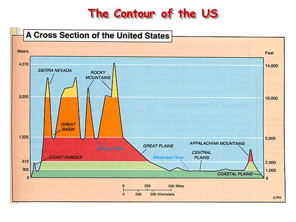
The Contour of the US

18
Topography of the Northeast

19
New York, New York!

20
New York’s Canals QUESTION: What was the importance of these early canals? Label the Erie Canal and Hudson.

21
Erie Canal

22
Boston: The Hotbed of Revolution

23
Philadelphia: The Birth of Liberty

24
A New England Fall Kancamagus Highway, Maine Covered Bridge over the Connecticut River The back roads of Vermont

25
North-South Divide: The Mason-Dixon Line Charles Mason & Jeremiah Dixon: 1763-1767

26
Topography of the Southeast

27
Charleston, SC: The South’s First Port

28
New Orleans, LA: The Big Easy

29
Topography of the Midwest

30
Chicago Skyline: The “Second” City

31
The Great Plains What Americans first explored this region? Who was move into this region in the 1830s and 40s? What natural disaster happened in this region in the 1930s?

32
Topography of the West

33
Los Angeles: The City of Angels?

34
Hollywood: City of Lost Dreams

36
How did these many rivers impact the development of America?

37
Name all the major bodies of water: 1.Atlantic Ocean 2.Pacific Ocean 3.Mississippi River 4.Hudson River 5.St. Lawrence River 6.Ohio River 7.Erie Canal 8.Great Lakes 9.Missouri River 10.Colorado River 11.Rio Grande 12. Chesapeake Bay

38
Bodies of Water Chesapeake Bay Chesapeake Bay Great Salt Lake Great Lakes

39
RiversRivers Hudson R. Potomac R. Mississippi R. Ohio R. Missouri R. Arkansas R. Colorado R. Columbia R. Yukon R. Rio Grande R. St. Lawrence R.

40
The Mississippi: America’s Great River Road The “Big Muddy”. Part of Louisiana Purchase 1803 w/ Port of N.O. 2,350 miles. Draining all or part of 31 states & 2 Canadian provinces. Covers 40% of the U. S.

41
Mississippi Riverboat

42
The Gulf of Mexico

44
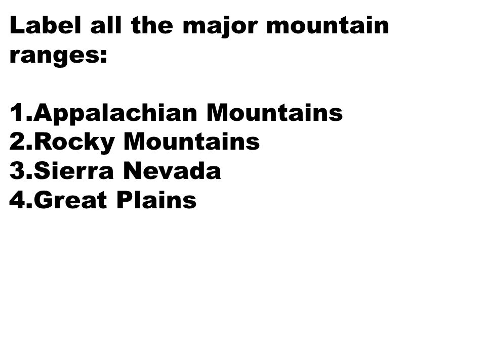
Label all the major mountain ranges: 1.Appalachian Mountains 2.Rocky Mountains 3.Sierra Nevada 4.Great Plains

45
Mountains & Plateaus Appalachian Mts. Rocky Mts. Cascade Mts. Sierra Nevada Mts. Alaskan Range ^ Mt. Whitney ^ Mt. McKinley ^ Pike’s Peak Adirondack Mts. Great Plains

47
The Contour of the US

48
The Continental Divide

49
Grand Canyon

50
PlainsPlains Central Plains Atlantic Coastal Plains Gulf Coastal Plains Great Basin

51
The Great Plains

52
PlateausPlateaus Cumberland Plateau

53
Cumberland Plateau & ‘Gap’ AL, KY, TN, VA, WV 24,640 sq. mi. Natural passage [Gap] through the Cumberland Mts.

54
DesertsDeserts Mohave Desert Death Valley

55
Mohave Desert – 3,000’

56
Death Valley, CA 3.3 million acres. 95% wilderness.

57
Completed Map Lake Okeechobee Chesapeake Bay Chesapeake Bay Appalachian Mts. Rocky Mts. Cascade Mts. Sierra Nevada Mts. Alaskan Range ^ Mt. Whitney ^ Mt. McKinley ^ Pike’s Peak Adirondack Mts. Central Plains Atlantic Coastal Plains Gulf Coastal Plains Great Basin Cumberland Plateau Hudson R. Potomac R. Mississippi R. Ohio R. Missouri R. Arkansas R. Colorado R. Columbia R. Yukon R. Rio Grande R. St. Lawrence R. Great Salt Lake Mohave Desert Death Valley

60
Climate of the U.S.

62
308,400,408308,400,408 One birth every 8 seconds. One death every 12 seconds. One international migrant (net) every 37 seconds. Net gain of one person every 14 seconds. U. S. Population as of August 2010
 every 37 seconds. Net gain of one person every 14 seconds. U. S. Population as of August")
63
Make some generalizations about population density in the United States. Were the any population shifts from 1990 to 2000?

65
Seismography Data: 1977-1997 Earthquakes!

66
Tornadoes Per Year: 1950-1997

67
Hurricane Camille: The Storm of the Century? August 17, 1969 Category 5 Killed 412 people

68
Andrew: The Most Expensive Hurricane? August 24, 1992 Category 5 Killed 65 people Cost $30,000,000,000

69
Hurricane Katrina: August 2005

70
The costliest natural disaster in US History One of the 5 deadliest hurricanes in US History 6th Strongest overall Almost 1,900 people lost their lives Thousands more were displaced Over 81 Billion dollars in damage (triple Hurricane Andrew 1992

71
Hurricane Katrina and Race: Looting vs. Finding

73
National Parks

74
US National Parks (1) Glacier National Park, MT Grand Teton National Park, WY Mt. Rushmore National Park, SD

75
US National Parks (2) Everglades National Park, FL Yellowstone National Park, MT Grand Canyon National Park, AZ
 Everglades National Park, FL Yellowstone National Park, MT Grand Canyon National Park, AZ")
76
Essential Questions 1.How does geography affect how and where people live? 2.How did geographic factors affect political, social, and economic settlements of early Americas? 3.How does geography continue to affect the United States today? 4.Make some generalizations about the geography of America. Now let’s take a QUIZ!

77
HOMEWORK Study for a map quiz on the 50 states and key geographic features. Note: You must achieve mastery on this quiz 85%! Otherwise you must retake it after school until you do!

Similar presentations


 Top 5 Cities (2010 Census, within city limits) Growth Since 2000 New York8,175,133.>")

