Download presentation
Presentation is loading. Please wait.

1
Europe’s Geography © 2014 Brain Wrinkles

2
Standards SS6G8 The student will locate selected features of Europe.
a. Locate on a world and regional political- physical map: the Danube River, Rhine River, English Channel, Mediterranean Sea, European Plain, the Alps, Pyrenees, Ural Mountains, Iberian Peninsula, and Scandinavian Peninsula. b. Locate on a world and regional political-physical map the countries of Belgium, France, Germany, Italy, Poland, Russia, Spain, Ukraine, and United Kingdom. © 2014 Brain Wrinkles

3
Rhine River The Rhine River starts in Switzerland and flows through Germany, France, Luxembourg, and the Netherlands. It’s the longest river in Germany. The Rhine is an important waterway for trade for the European continent.

5
Danube River The Danube River flows through 12 countries (Germany, Austria, Slovakia, Hungary, Serbia, Croatia, Bosnia and Herzegovina, Slovenia, Bulgaria, Romania, and Ukraine) for a total of 1,770 miles! It is the 2nd largest river in Europe. (The Volga River is first.) It has played a vital role in the development of central Europe in terms of trade and cultural diffusion.
 for a total of 1,770 miles! It is the 2nd largest river in Europe. (The Volga River is first.) It has played a vital role in the development of central Europe in terms of trade and cultural diffusion.")
7
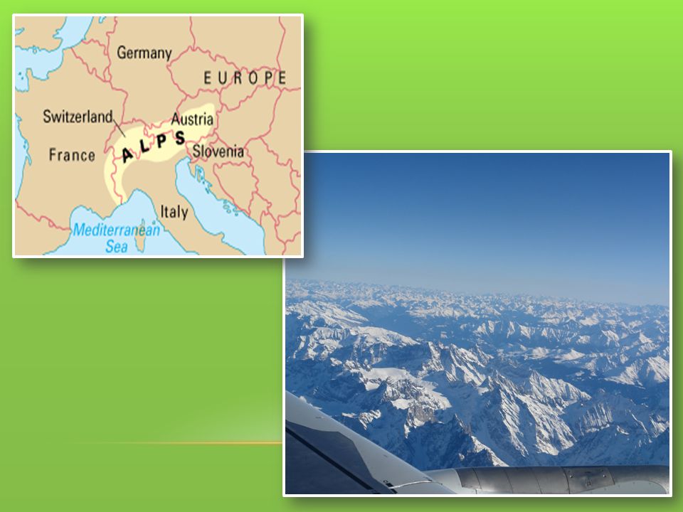
The Alps The Alps are a mountain range located in Austria, France, Germany, Switzerland, Italy, Slovenia, and Liechtenstein. They extend for almost 700 miles! The Alps are a major tourist destination.

9
Pyrenees Mountains The Pyrenees are a mountain range that form the natural border between France and Spain. They extend for roughly 270 miles.

11
Ural Mountains The Ural Mountains are considered to be the natural boundary between Europe and Asia. They actually divide Russia between the continents -- ¼ of Russia is in Europe and ¾ of the country is in Asia. They extend for almost 1,500 miles! The Ural Mountains are among the world’s oldest mountain ranges. They have huge deposits of gold, nickel, silver, platinum, coal, iron, and other minerals.

13
English Channel The English Channel is a small body of water that separates the United Kingdom from the European mainland (specifically, from France). It is 350 miles long. In the past, it was used as a good system of defense for England. The English Channel was and still is an important waterway for trade.
. It is 350 miles long. In the past, it was used as a good system of defense for England. The English Channel was and still is an important waterway for trade.")
15
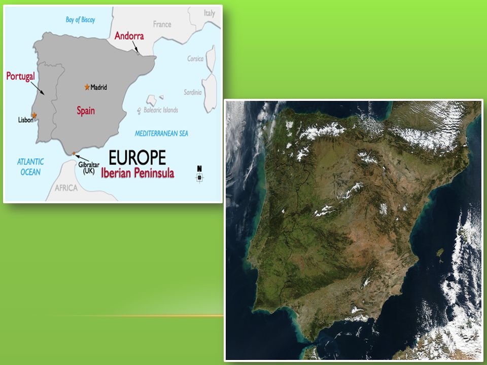
Iberian Peninsula The Iberian Peninsula includes the countries of Spain and Portugal. The Pyrenees Mountains form the northern border. It is the second largest peninsula in Europe.

17
Scandinavian Peninsula
The Scandinavian Peninsula consists of Norway, Sweden, and the northern region of Finland. It is the largest peninsula in Europe. It’s 1,150 miles long. The region is rich in timber, iron, and copper.

19
Mediterranean Sea The Mediterranean Sea is the crossroads for 3 continents: Europe, Africa, and Asia. The name means “in the middle of the earth” (it’s surrounded by land). It surrounds Italy. This sea cover an area of 965,000 square miles. It has always been an important route for trade and cultural exchange. © 2014 Brain Wrinkles
. It surrounds Italy. This sea cover an area of 965,000 square miles. It has always been an important route for trade and cultural exchange. © 2014 Brain Wrinkles.")
21
European Plain The European Plain stretches from the Pyrenees in the west to the Ural Mountains in the east. It extends for 2,000 miles. It is the largest mountain-free landform in Europe. The European Plain is a successful agricultural area.

22
European Plain

Similar presentations


 Locate on a world and regional political‐ physical map: the Danube River,>")


 Locate on a world and regional political‐ physical map: the Danube River,>")

