Download presentation
Presentation is loading. Please wait.

1
A Brief History of Weather Forecasting

2
The Stone Age Prior to approximately 1955, forecasting was basically a subjective art, and not very skillful. Observations were sparse, with only a few scattered ship reports over the oceans. The technology of forecasting was basically subjective extrapolation of weather systems using the upper level flow (the jet stream). Local weather details—which really weren’t understood-- were added subjectively.
. Local weather details—which really weren’t understood-- were added subjectively..")
3
Upper Level Chart

4
1955-1965: The Advent of Modern Forecasting During this period, numerical weather prediction—forecasting future weather with digital computers-- became the key tool in the meteorologists tool bag. The launch of the first weather satellite (1960) gave meteorologists a view of the entire planet. Weather radars were placed around the U.S. explicitly showing areas of precipitation.
 gave meteorologists a view of the entire planet. Weather radars were placed around the U.S. explicitly showing areas of precipitation..")
5
Numerical Weather Prediction The advent of digital computers in the late 1940s and early 1950’s made possible the simulation of atmospheric evolution numerically. The basic idea is if you understand the current state of the atmosphere, you can predict the future using the basic physical equations that describe the atmosphere.

6
Numerical Weather Prediction One such equation is Newton’s Second Law: F = ma Force = mass x acceleration Mass is the amount of matter Acceleration is how velocity changes with time Force is a push or pull on some object (e.g., gravitational force, pressure forces, friction) This equation is a time machine!
 This equation is a time machine!")
7
Using a wide range of weather observations we can create a three-dimensional description of the atmosphere… known as the initialization Numerical Weather Prediction

8
This gives the distribution of mass and allows us to calculate the various forces. Then… we can solve for the acceleration using F=ma But this gives us the future…. With the acceleration we can calculate the velocities in the future. Similar idea with temperature and humidity. Numerical Weather Prediction

9
These equations can be solved on a three- dimensional grid. As computer speed increased, the number of grid points could be increased. More (and thus) closer grid points means we can simulate (forecast) smaller and smaller scale features. We call this improved resolution.
 closer grid points means we can simulate (forecast) smaller and smaller scale features. We call this improved resolution..")
10
A Steady Improvement Faster computers and better understanding of the atmosphere, allowed a better representation of important physical processes in the models More and more data became available for initialization As a result there has been a steady increase in forecast skill from 1960 to now.

11
Forecast Skill Improvement Forecast Error Year Better National Weather Service

12
Satellite and Weather Radars Give Us a More Comprehensive View of the Atmosphere

13
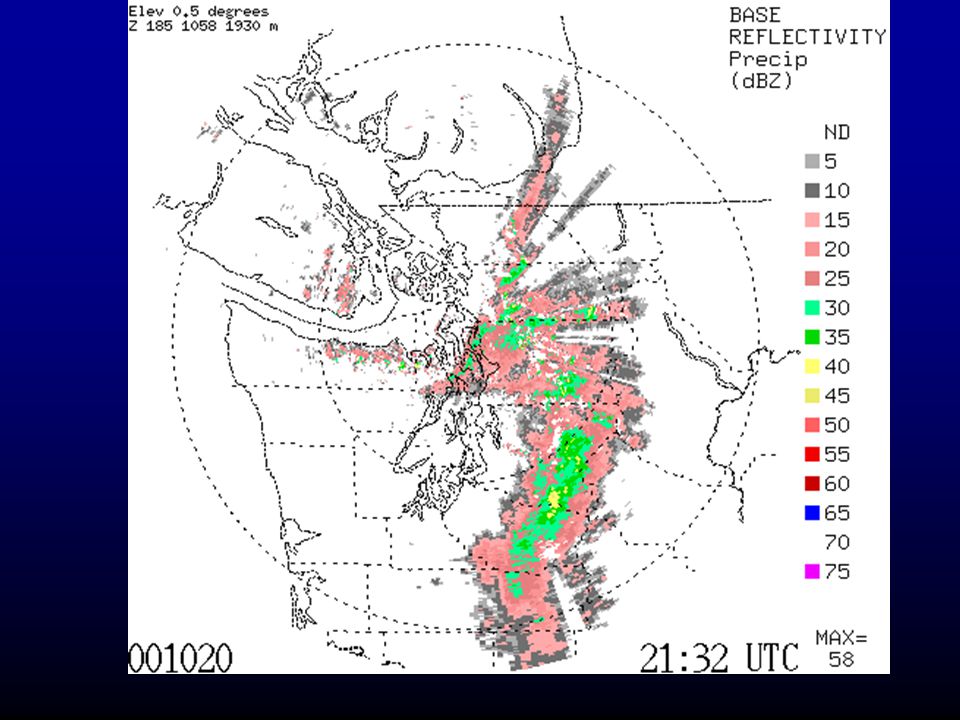
Camano Island Weather Radar

14
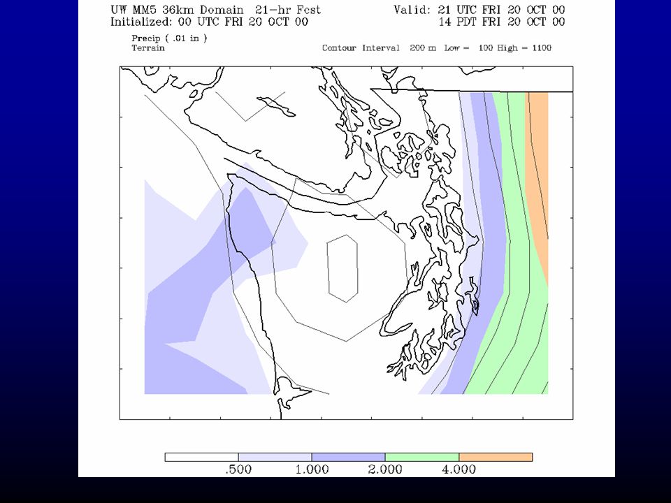
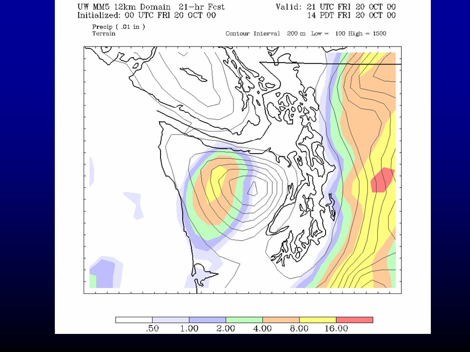
1995-2003+ The computers models become capable of simulating/forecasting local weather. As the grid spacing decreased to 15 km and below… it became apparent that many of the local weather features could often be simulated and forecast by the models.

19
Forecaster at the Seattle National Weather Service Office The National Weather Service

20
But even with all this improving technology, some forecasts fail or are inadequate. Why?

21
Problems with the Models Some forecasts fail due to inadequacies in model physics…. How the model handles precipitation, friction, and other processes. Example: too much precipitation on mountain slopes Intensive work at the UW to address this problems.

22
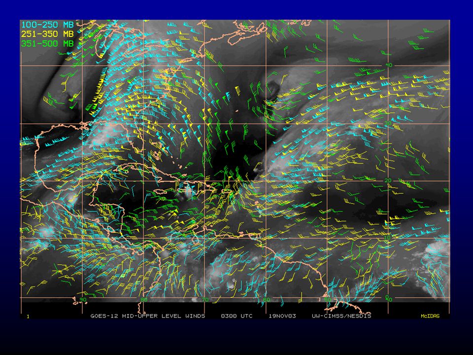
Some forecasts fail due to poor initialization, i.e., a poor starting description of the atmosphere. This is particularly a problem for the Pacific Northwest, because we are downstream of a relatively data poor region…the Pacific Ocean.

23
Eta 48 hr SLP Forecast valid 00 UTC 3 March 1999 3 March 1999: Forecast a snowstorm … got a windstorm instead

24
Eta Model Sea Level Pressure: 12 UTC 2 March 99 Major Initialization Errors

25
Pacific Analysis At 4 PM 18 November 2003 Bad Observation

26
The problem of initialization should lessen as new observation technologies come on line and mature. New ways of using or assimilating the data are also being developed.

28
Seascan Unmanned Aircraft

29
There is a lack of detailed weather information immediately off the Northwest Coast. Major issue… lack of a coastal weather radar. The Northwest has the worst coastal weather radar coverage in the nation. Often can’t see the details of weather features before they make landfall. Seriously impacts short-term forecasts. Lack of Coastal Weather Information NWS Doppler Radar

30
NowWith Two New Radars

31
A More Fundamental Problem In a real sense, the way we have been forecasting is essentially flawed. The atmosphere is a chaotic system, in which small differences in the initialization…well within observational error… can have large impacts on the forecasts, particularly for longer forecasts. Not unlike a pinball game….

32
A More Fundamental Problem Thus, there is fundamental uncertainty in weather forecasts that can not be ignored. Similarly, uncertainty in our model physics also produces uncertainty in the forecasts. We should be using probabilities for all our forecasts or at least providing the range of possibilities. There is an approach to handling this issue that is being explored by the forecasting community…ensemble forecasts.

33
Ensemble Prediction Instead of making one forecast…make many…each with a slightly different initialization Possible to do now with the vastly greater computation resources that are available.

34
The Thanksgiving Forecast 2001 42h forecast (valid Thu 10AM) 13: avn* 11: ngps* 12: cmcg* 10: tcwb* 9: ukmo* 8: eta* Verification 1: cent 7: avn 5: ngps 6: cmcg 4: tcwb 3: ukmo 2: eta - Reveals high uncertainty in storm track and intensity - Indicates low probability of Puget Sound wind event SLP and winds
 13: avn* 11: ngps* 12: cmcg* 10: tcwb* 9: ukmo* 8: eta* Verification 1: cent 7: avn 5: ngps 6: cmcg 4: tcwb 3: ukmo 2: eta - Reveals high uncertainty in storm track and intensity - Indicates low probability of Puget Sound wind event SLP and winds")
35
Ensemble Prediction Can use ensembles to provide a new generation of products that give the probabilities that some weather feature will occur. Can also predict forecast skill! It appears that when forecasts are similar, forecast skill is higher. When forecasts differ greatly, forecast skill is less.

36
Ensemble-Based Probabilistic Products

37
Forecast Dissemination: The Achilles Heal Although the technology of weather prediction is rapidly improving, our ability to communicate what we know to the public is inadequate. Although the Internet and wireless communication provides—for the first time—the potential to distribute large amounts of weather information, we have not yet found an effective way to do so. The amount of information is massive, how do we distill and filter it for a wide variety of users? We are failing to communicate our degree of confidence in the forecasts.

Similar presentations