Download presentation
Presentation is loading. Please wait.

1
What data do we require for extremes analysis and what is available? (an intro to the BOG on data) Albert Klein Tank KNMI, The Netherlands Warning: no attempt to be comprehensive; bias towards land-atmosphere; bias towards Europe
 Albert Klein Tank KNMI, The Netherlands Warning: no attempt to be comprehensive; bias towards land-atmosphere; bias towards Europe.")
2
Outline Russian heat wave (yes, one more time) GCOS IP-2010 Data Policy white paper from the Exeter workshop on creating surface temperature datasets Other relevant initiatives Further issues for BOG discussion
 GCOS IP-2010 Data Policy white paper from the Exeter workshop on creating surface temperature datasets Other relevant initiatives Further issues for BOG discussion")
3
Example: Russian heat wave July 2010

4
Courtesy John Christy (top), Adrian Simmons (bottom) Example: Russian heat wave July 2010 Enough data for statistical modelling, event attribution, or studying physical processes, but…
, Adrian Simmons (bottom) Example: Russian heat wave July 2010 Enough data for statistical modelling, event attribution, or studying physical processes, but…")
5
Example: Russian heat wave July 2010

6
31 days with Tx>25°C; normal is 9.5 days Data available from http://eca.knmi.nl Example: Russian heat wave July 2010

7
16 nights with Tn>20°C; normal is 0.5 night Data available from http://eca.knmi.nl Example: Russian heat wave July 2010

8
16 nights with Tn>20°C; normal is 0.5 night Data available from http://eca.knmi.nl Example: Russian heat wave July 2010 No significant trend at Moscow

9
Daily gridded product (E-OBS) Based on station records Daily fields 1950 – now 0.25 deg resolution Matching RCM grids Associated error fields exist, but rarely used! Haylock et al., J. Geophys. Res., 2008; data available from http://eca.knmi.nl

10
Daily gridded product (E-OBS) Based on station records Daily fields 1950 – now 0.25 deg resolution Matching RCM grids Associated error fields exist, but rarely used! Haylock et al., J. Geophys. Res., 2008; data available from http://eca.knmi.nl …but interpolation leads to reduction of extremes temperature precipitation

11
Traceability About 60% is “public”, i.e. available from the ECA&D website For the other stations, only the metadata and derived products can be released Data available from http://eca.knmi.nl

12
GCOS IP-10

13
Observations are required for: informed decisions on prevention, mitigation, and adaptation strategies; to support research; to initialise predictions; to develop the models; to assess social and economic vulnerabilities Observations are essential public goods: benefits of global availability of data exceed any economic or strategic value to individual countries from withholding national data Observations underpin all efforts by Parties to the United Nations Framework Convention on Climate Change (UNFCCC) to mitigate, and adapt to, climate change
 to mitigate, and adapt to, climate change")
19
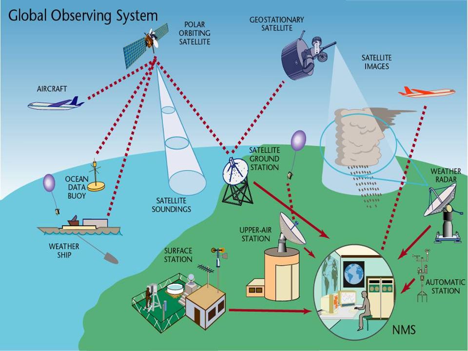
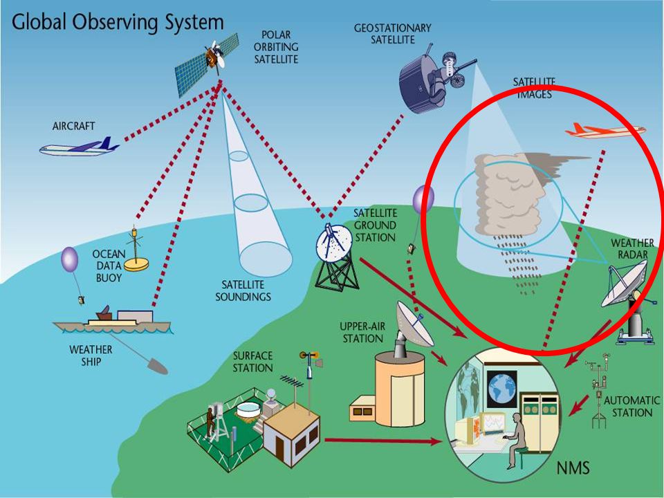
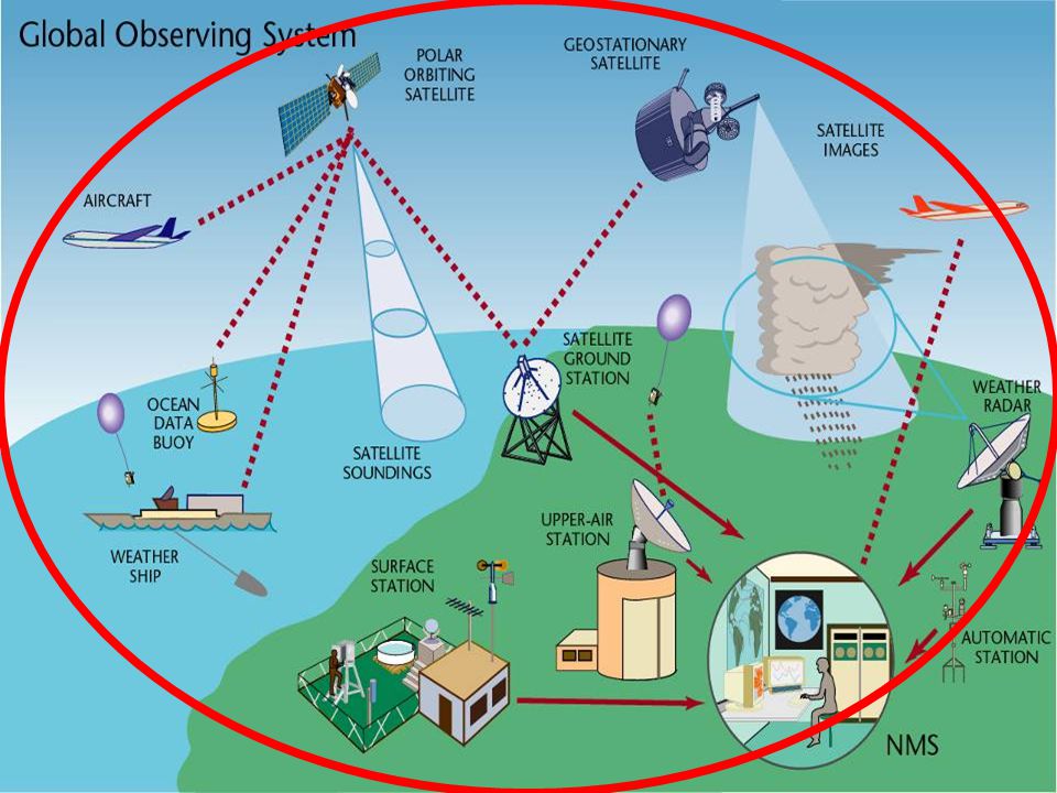
Some GCOS IP-10 issues Increasing need for local, high-frequency surface atmospheric data on climate to characterise extremes Satellite remote-sensing systems become more important, but surface-based and airborne in situ and remote-sensing systems will always remain essential Metadata (i.e., information on where and how the observations are taken) are absolutely essential Limited progress in developing countries, and support for capacity-building is small in relation to needs Flow of data to the user community and to the international data centres is inadequate Parties should produce national plans on their climate observing system
 are absolutely essential Limited progress in developing countries, and support for capacity-building is small in relation to needs Flow of data to the user community and to the international data centres is inadequate Parties should produce national plans on their climate observing system")
20
Exeter workshop

21
Several white papers, e.g. on Data Policy: Gap exists between theory (including GCOS and GEO requirements) and practice Partly due to data policy, but not alone Also lack of engagement, lack of resources, and inadequate data-system infrastructures Data policy issues are persistent and unlikely to go away in the near future See: http://www.surfacetemperatures.org
 and practice Partly due to data policy, but not alone Also lack of engagement, lack of resources, and inadequate data-system infrastructures Data policy issues are persistent and unlikely to go away in the near future See:")
22
Exeter workshop Some recommendations: Accept trade off between traceability and data completeness Acknowledge that involvement of data providers from countries throughout the world is essential Involves more than simply sending the data to an international data centre Scientific community to deliver information to support local climate services (= return of investment important in particularly for developing countries) Support digitization of paper archives
 Support digitization of paper archives")
23
Other relevant initiatives Global: – coordinated inter-callibration (GSICS) and reprocessing (SCOPE-CM) of satellite data – ICOADS version 3 released (almost) – several reanalyses datasets released (MERRA, CFSR, JRA) – 20th Century reanalysis (based on surface pressure data only) – new global reanalysis project by ECMWF (ERACLIM) with much attention for improving reanalysis data input – new project (CLIMDEX) for updating the global dataset of extremes indices and developing global daily gridded datasets (building on GHCN-Daily)
 and reprocessing (SCOPE-CM) of satellite data – ICOADS version 3 released (almost) – several reanalyses datasets released (MERRA, CFSR, JRA) – 20th Century reanalysis (based on surface pressure data only) – new global reanalysis project by ECMWF (ERACLIM) with much attention for improving reanalysis data input – new project (CLIMDEX) for updating the global dataset of extremes indices and developing global daily gridded datasets (building on GHCN-Daily)")
24
Other relevant initiatives Regional: – regional reanalysis for North America (NARR) and Europe (http://www.euro4m.eu )http://www.euro4m.eu – daily station collections (+ daily gridded datasets) for Asia (APHRODITE) and South America (CLARIS-LPB) – several new national high resolution datasets More in: WOAP4 Meeting Report Hamburg, Germany March 2010 GCOS Publication No. 142

25
Index for heavy falls Alexander et al., JGR, 2006; also in IPCC-AR4 What about the blank regions in the map?

26
ETCCDI Regional Workshops (complemented by APN) Peterson and Manton, BAMS, 2008
 Peterson and Manton, BAMS, 2008")
27
Organised by the Expert Team on Climate Change Detection and Indices (ETCCDI) ETCCDI is a group of scientists jointly sponsored by several international agencies (WMO-CCl/WCRP-CLIVAR/JCOMM) Environment Canada provides, maintains, and further develops the R-based workshop software (freely available from http://cccma.seos.uvic.ca/ETCCDI) Regional workshops
 ETCCDI is a group of scientists jointly sponsored by several international agencies (WMO-CCl/WCRP-CLIVAR/JCOMM) Environment Canada provides, maintains, and further develops the R-based workshop software (freely available from Regional workshops")
28
ETCCDI Regional Workshops (complemented by APN) Working together GH Africa Workshop (WCRP/World Bank) 04/2010 Indonesia, Malaysia, Thailand, Philippines (NL) 12/2009 Southeast Asia (USA) 12/2007 Mexico (UK) 03/2009 West Indian Ocean (France) 09/2009 Central Africa (USA) 4/2007 Peterson and Manton, BAMS, 2008 Regional workshops: successful concept,… …but often no access to original data!
 Working together GH Africa Workshop (WCRP/World Bank) 04/2010 Indonesia, Malaysia, Thailand, Philippines (NL) 12/2009 Southeast Asia (USA) 12/2007 Mexico (UK) 03/2009 West Indian Ocean (France) 09/2009 Central Africa (USA) 4/2007 Peterson and Manton, BAMS, 2008 Regional workshops: successful concept,… …but often no access to original data!")
29
Further issues for BOG (1 of 2) Tension between traceability (access to the primary sources) and data completeness (use whatever available) Need high density, high frequency, sharing, and long records Adaptive strategies for dealing with extreme events place even higher demands on observations Datasets need continuous work, both for updating and improving quality/homogeneity Including scientist developing datasets in research projects is a good idea, e.g. in CMIP5 climate model evaluation Met Services are not keen if their only role is providing data; application relevant products are a necessary return of investment

30
Further issues for BOG (2 of 2) Need to close the gap between rapid IT developments and actually implementing modern distributed database management systems Reprocessing of data and reanalysis important Some (satellite) datasets are becoming so large that it is difficult for many users to acquire them Users ask for products that meet their requirements, often through integration of data from different sources (in situ, satellite, reanalysis) Work needs to comply with WMO/GCOS/GEO ideas on systems/standards, but in the end the actual delivered datasets count rather than nice words
 Need to close the gap between rapid IT developments and actually implementing modern distributed database management systems Reprocessing of data and reanalysis important Some (satellite) datasets are becoming so large that it is difficult for many users to acquire them Users ask for products that meet their requirements, often through integration of data from different sources (in situ, satellite, reanalysis) Work needs to comply with WMO/GCOS/GEO ideas on systems/standards, but in the end the actual delivered datasets count rather than nice words")
31
mailto: Albert.Klein.Tank @ KNMI.nl

Similar presentations


 started in 1999 jointly sponsored by CCl, CLIVAR and JCOMM.>")


 on Climate Change Detection and Indices (ETCCDI) + its predecessor.>")


>")


