Download presentation
Presentation is loading. Please wait.

1
Air Masses, Frontal Systems, and Weather Systems
Science 1206

2
Objectives Define weather systems and the movement of weather systems
identify air masses (tropical, polar, maritime, continental) identify and explain the formation of low-pressure (cyclone) and high-pressure (anti-cyclone) systems define front and distinguish between the four types of fronts formed along pressure systems
 identify and explain the formation of low-pressure (cyclone) and high-pressure (anti-cyclone) systems. define front and distinguish between the four types of fronts formed along pressure systems.")
3
Air Masses, Frontal Systems, and Weather Systems
Air Masses: are relatively large regions of air that stay together for several days at a time. In North America, there are six air masses that tend to affect North American weather systems.

4
Polar Air Masses (See p. 546)
The polar air masses tend to move southward into Canada and may move as far south as the U.S. or even Mexico. The continental polar air mass originates over the central north so it tends to be cold and dry. Two other polar air masses are called maritime polar air masses because they originate over the ocean.

5
Tropical Air Masses There are three tropical air masses which originate in the tropics to the south of the U.S. The continental tropical air mass tends to be relatively smaller in area and originates over Mexico. Two are maritime tropical air masses which originate over the oceans (one in the tropical Atlantic, southeast of the U.S., and the other in the tropical Pacific, southwest of the U.S.).
.")
6
Air Masses Affecting North America

7
The prevailing mid-latitude westerlies cause the air masses to move primarily from west to east as can often be seen in satellite sequences.

8
Weather Systems A weather system is the total of all the conditions of temperature, humidity, atmospheric pressure, wind speed and direction for a relatively large geographical region that moves over the surface of the region for a period of several days.

9
Atmospheric Pressure Atmospheric pressure is the result of gravitational pull on the particles of air. The pressure of air at the surface is indicated using a series of lines known as isobars.

10
Characteristics of Low-Pressure (Cyclonic) Systems
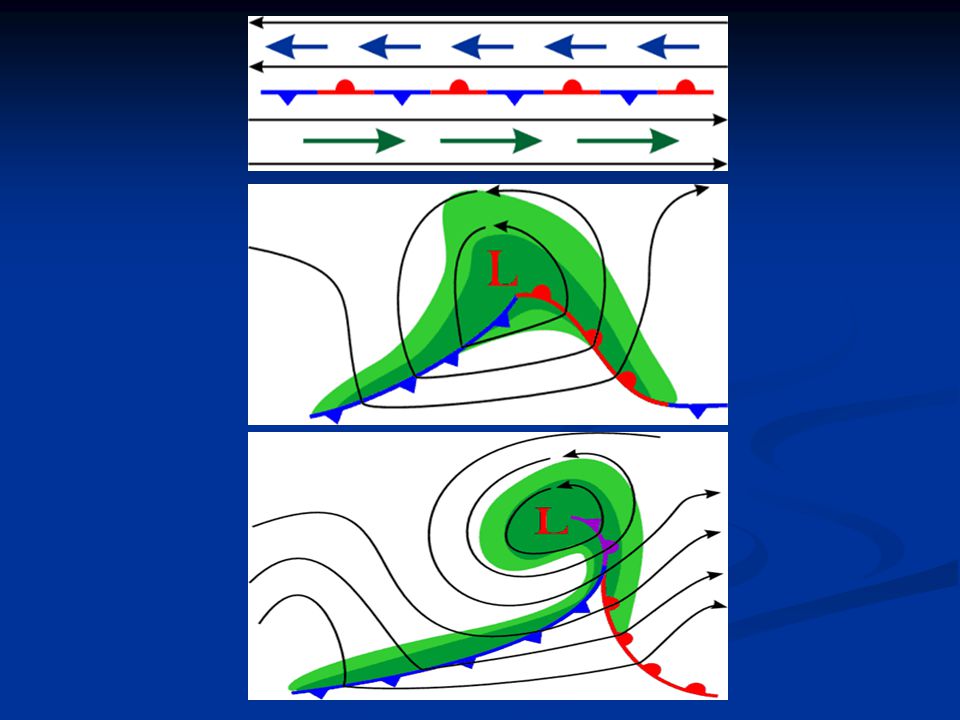
Low pressure systems (often called a low pressure trough or simply trough when elongated) are generally associated with cloudy conditions. Low pressure systems are marked using the symbol L on the weather map. When viewed from satellite, low pressure systems tend to form an inward moving spiral.
 are generally associated with cloudy conditions. Low pressure systems are marked using the symbol L on the weather map. When viewed from satellite, low pressure systems tend to form an inward moving spiral.")
11
Characteristics of Low-Pressure (Cyclonic) Systems
As a result of Coriolis and frictional effects, the spiral tends, in the northern hemisphere, to rotate in a counter-clockwise (cyclonic) direction. This rotation is known as a cyclone.
 direction. This rotation is known as a cyclone.")
13
Characteristics of High-Pressure (Anticyclonic) Systems
High pressure systems (often called a high pressure ridge or simply ridge when elongated) generally bring clear weather. When viewed from satellite, the air mass surrounding a high pressure center (marked H on a weather map) tends to move outward from the high pressure center toward the low pressure center and due to the Coriolis effect tend to spiral outward in a clockwise direction.
 generally bring clear weather. When viewed from satellite, the air mass surrounding a high pressure center (marked H on a weather map) tends to move outward from the high pressure center toward the low pressure center and due to the Coriolis effect tend to spiral outward in a clockwise direction.")
14
Characteristics of High-Pressure (Anticyclonic) Systems
Since this pattern of rotation is opposite the low pressure pattern (known as a cyclone), the high pressure pattern is said to be anticyclonic. As the high pressure system moves generally from west to east, the clockwise rotation tends to push polar air masses toward the eastern edge of a high pressure system. At the same time the tropical air masses tend to be pushed toward the western edge of the high pressure system.
, the high pressure pattern is said to be anticyclonic. As the high pressure system moves generally from west to east, the clockwise rotation tends to push polar air masses toward the eastern edge of a high pressure system. At the same time the tropical air masses tend to be pushed toward the western edge of the high pressure system.")
15
Frontal Systems The term front refers to the leading edge of an air mass, or the boundary that forms between two air masses that meet.

16
Four different types of fronts are recognized (See p 547)
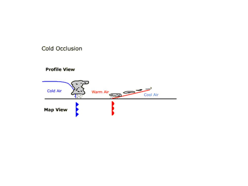
Cold Front: the cold front is the leading edge of a cold air mass. Warm Front: the warm front is the leading edge of a warm air mass. Occluded Front: an occluded front occurs when a warm front and a cold front meet. Stationary Front: a stationary front occurs when warm and cold fronts meet but remain fairly motionless for several hours if not days.

Similar presentations