Download presentation
Presentation is loading. Please wait.

1
Application of GPS data on Severe Weather Forecasting To investigate correlation between PWV and VIL, and hence its role in lightning/damaging winds monitoring/nowcasting Summer Internship at the Hong Kong Observatory 2006 Law Ka Hei (CUHK/PHY/3) Supervisor: Linus Yeung
 Supervisor: Linus Yeung")
2
Motivation Project Goal Use PWV for severe weather nowcasting PWV - Precipitable Water Vapor Represent amount of water vapor in an atmospheric column VIL - Vertically Integrated Liquid Represent amount of liquid water in an atmospheric column Highly related to rainfall

3
Calculation of PWV GPS Signal Delay Ionospheric Delay Tropospheric Delay Hydrostatic Delay Wet Delay PWV

4
Selection of Data PWVPWV ErrorRaw Data Source Latest Best Accuracy Center 04a

5
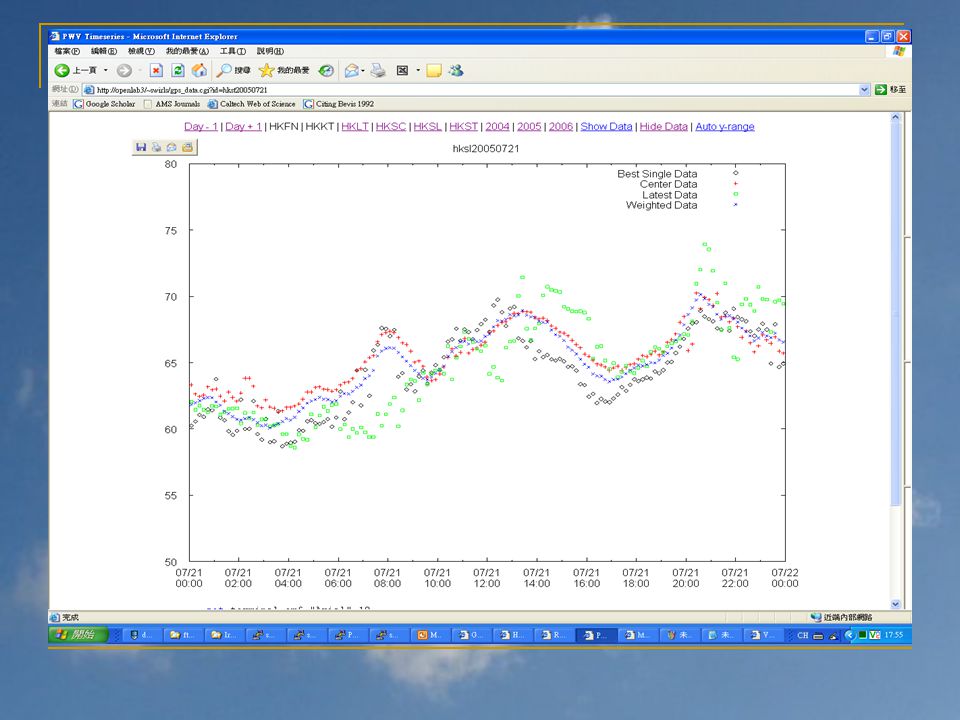
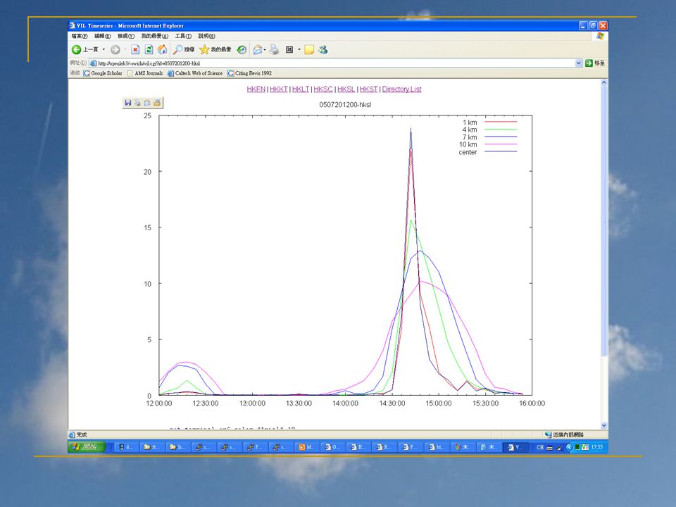
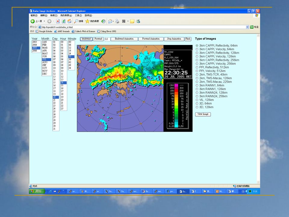
Visualization Tool – Web PWV http://openlab3/~swirls/2005.html http://openlab3/~swirls/2005.html VIL http://openlab3/~swirls/vil.cgi?id=0507201200- hksl http://openlab3/~swirls/vil.cgi?id=0507201200- hksl Radar Image http://openlab3/~swirls/radar_js.html http://openlab3/~swirls/radar_js.html

6
PWV Climatology

7
Mean

8
Standard Deviation

9
PWV before Rainstorm

10
Scatter Plot: VIL vs PWV

11
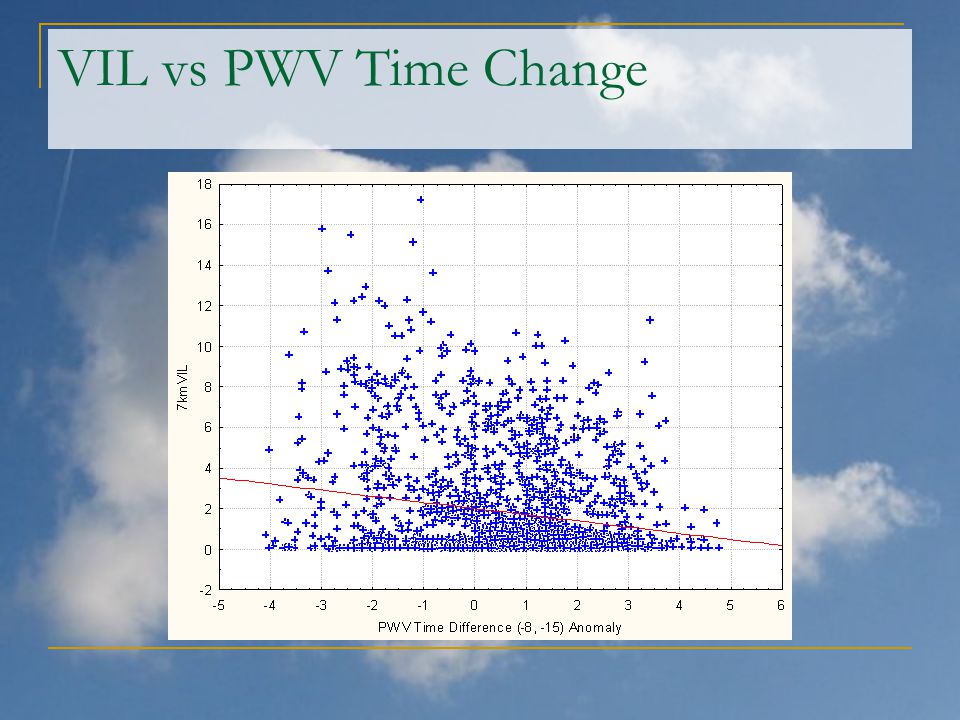
VIL vs PWV Time Change

13
Thank You Any Questions?

Similar presentations

 C Asia Air Survey co., ltd New Forecast Technologies for Disaster Prevention and Mitigation 1.>")


 35º S 45º S 160º E175º E.>")
![NEXRAD or WSR-88D [Next Generation Radar] [Weather Surveillance Radar, 1988, Doppler]](/13/4044452/big_thumb.jpg "NEXRAD or WSR-88D [Next Generation Radar] [Weather Surveillance Radar, 1988, Doppler]>")


 is responsible for forecasts several times.>")

