Download presentation
Presentation is loading. Please wait.

1
Remote Sensing Forest Fires: Before and After Rob Gaboy & Aimee Treutlein

2
Outline Why remote sensing is useful Current methods & problems with them Future of remote sensing –LIDAR –Landsat –AVHRR –ASTER –Hyperspectral satellites

3
Why? Human population Environmental planning More cost/time efficient than current methods Better understanding Detailed mapping Improved accuracy

4
Current Methods Aerial photography Field measurements and mapping Passive remote sensing Medium spatial resolution multi-spectral satellite

5
Aerial Photography Problems Limited number of bands Limited coverage Time consuming Can’t take photos as often Development cost Difficulty assessing fuel –subjective

6
Problems in the Field Time consuming Accessibility issues Subjective Costly –Human and instrument Low updating frequency

7
Passive Sensors Effectiveness Can’t see understory Depends on intended application

8
Medium Resolution Superficial observations Reflectance Rely on field obs

9
LIDAR Light Detection and Ranging Penetrability Accuracy Data computed Applications

10
Landsat Multispectral –visible and mid-infrared High resolution Surface/Canopy characteristics Vegetation categories Recalibrate

12
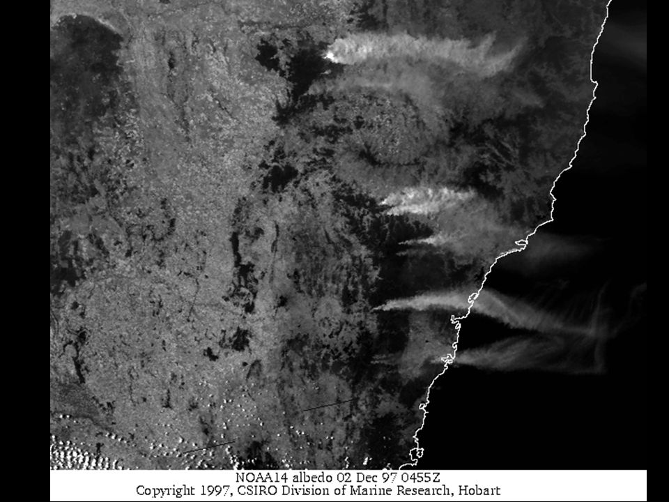
AVHRR Advanced Very High Resolution Radiometer Originally Met. Satellite Multispectral –visible and thermal infrared Long-term monitoring Remote and isolated areas Restricted

15
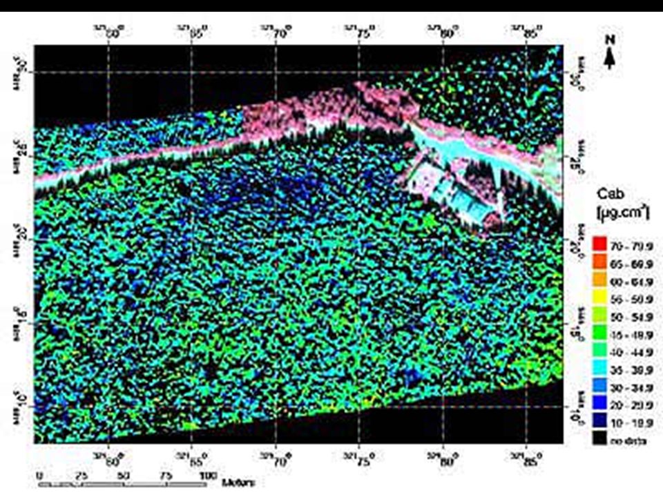
ASTER Multispectral –visible and near-infrared telescope Vegetation Mapping fuel characteristics Quantitative accuracy

17
Hyperspectral Directly related analysis Map vegetation Species mapping Vegetation classification Preventative measure Limited spatial coverage

19
Conclusions Better than aerial/ground obs Don’t use alone Need for surface info Most cost efficient Helpful in mapping and analyzing –both before and after Don’t generalize, need to know underlying process

20
References Remote Sensing Techniques to Assess Active Fire Characteristics and Post-Fire Effects. Lentile, Leigh B. et al., International Journal of Wildland Fire, 2006, 15, 319-345 Evaluating ASTER Satellite Imagery and Gradient Modeling for Mapping and Characterizing Wildland Fire Fuels. Falkowski, Michael J. et al., ASPRS Annual Conference Proceedings, May 2004 Assessing Fuel Loads using Remote Sensing Technical Report Summary. Roff, A. et al., The University of New South Wales, 2005 http://earthobservatory.nasa.gov/Library/GlobalFire/fire_5.html http://www.eduspace.esa.int/subdocument/default.asp?document=353

Similar presentations


 and Landsat Thematic Mapper (TM) Sensor System Characteristics.>")


 Temporal data - Time-lapse movies Spatial data - Photos and.>")


-Polar Orbiting Environmental Satellite (POES) Orbital characteristics.>")


