Download presentation
Presentation is loading. Please wait.

1
Geotechniques - Geog 081 T –Th 9:30-10:45 Prof. Sasha Davis Prof. Sasha Davis TA Josh Kowalski TA Josh Kowalski

2
Geotechniques - Geog 081 Remote sensing Remote sensing Map interpretation Map interpretation Geographical data acquisition, management, and analysis Geographical data acquisition, management, and analysis Introduction to Geographic Information Systems Introduction to Geographic Information Systems Map production Map production

3
So What???????? Remote sensing Remote sensing Map interpretation Map interpretation Geographical data acquisition, management, and analysis Geographical data acquisition, management, and analysis Introduction to Geographic Information Systems Introduction to Geographic Information Systems Map production Map production

4
Redrocks 62

5
Redrocks 88

6
Redrocks 98

7
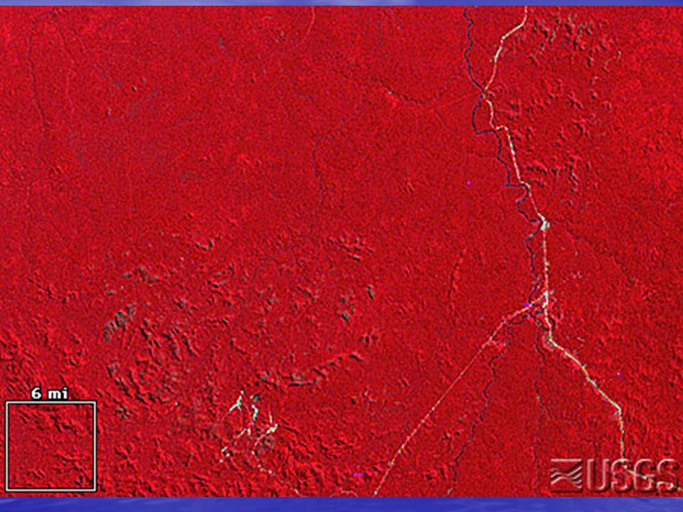
Appletree point 62

8
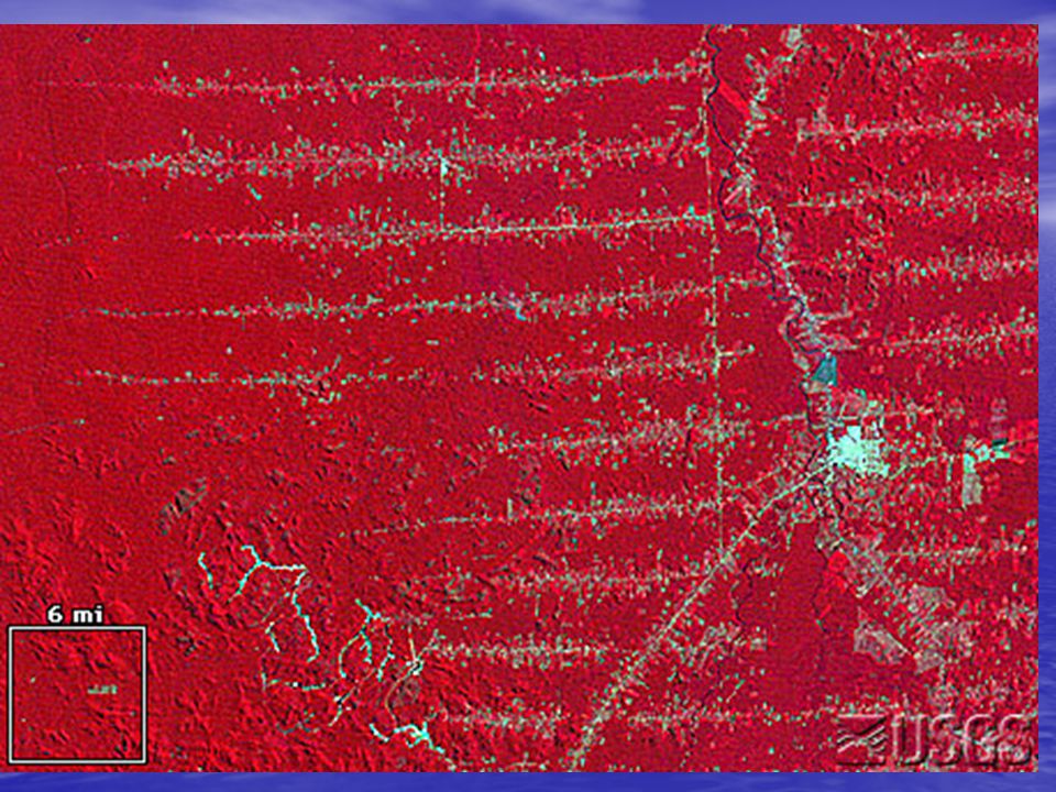
Appletree point 88

9
Appletree point 98

12
Remote Sensing http://na.unep.net/OnePlanetManyPeople/ AtlasDownload/UNEP_Atlas/Atlas_3-4- Forest_Screen.pdf http://na.unep.net/OnePlanetManyPeople/ AtlasDownload/UNEP_Atlas/Atlas_3-4- Forest_Screen.pdf http://na.unep.net/OnePlanetManyPeople/ AtlasDownload/UNEP_Atlas/Atlas_3-4- Forest_Screen.pdf http://na.unep.net/OnePlanetManyPeople/ AtlasDownload/UNEP_Atlas/Atlas_3-4- Forest_Screen.pdf http://na.unep.net/OnePlanetManyPeople/ AtlasDownload/UNEP_Atlas/Atlas_3-7- Urban_Screen.pdf http://na.unep.net/OnePlanetManyPeople/ AtlasDownload/UNEP_Atlas/Atlas_3-7- Urban_Screen.pdf http://na.unep.net/OnePlanetManyPeople/ AtlasDownload/UNEP_Atlas/Atlas_3-7- Urban_Screen.pdf http://na.unep.net/OnePlanetManyPeople/ AtlasDownload/UNEP_Atlas/Atlas_3-7- Urban_Screen.pdf

13
Introducing ourselves…

15
The Syllabus

16
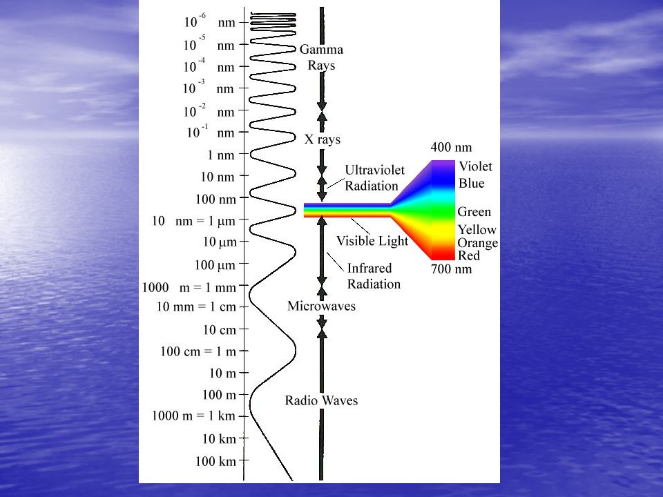
Remote Sensing

17
…is the gathering of information by means of a sensor that is not in contact with the object being detected. …is the gathering of information by means of a sensor that is not in contact with the object being detected.

19
Remote Sensing –Interpretation Shape Shape size size tone tone color color texture texture pattern pattern relative location relative location shadow shadow

20
Remote Sensing –Interpretation Shape Shape size size tone tone color color texture texture pattern pattern relative location relative location shadow shadow

22
Appletree point 88

Similar presentations

 11. (Definition) (Object) (Phenomena)>")


 Types Interpretation Applications.>")
