Download presentation
Presentation is loading. Please wait.

1
Wiring it all together: Spatial Data Infrastructures for archaeology Stuart Dunn Centre for e-Research King’s College London

2
Spatial Data Infrastructures -OpenLayers -OpenStreetMap -Google Earth/Maps -Yahoo! Maps -Bing Earth (Microsoft) -GeoNames.org -Etc etc. (see e.g. Batty et. al. Data mash-ups and the future of mapping – http://www.jisc.ac.uk/techwatch for more) http://www.jisc.ac.uk/techwatch
 -GeoNames.org -Etc etc. (see e.g. Batty et. al. Data mash-ups and the future of mapping – for more)")
3
Location is a complex concept © Copyright Salisbury and South Wiltshire Museum Reconstructions – geographic and ‘representational’ Many cultural reconstructions have a spatial element Pitt Rivers and the establishment of ‘scientific’ archaeology Furumark/Evans – ceramic classification system based on Helladic, Cycladic, Minoan

4
Google Earth [v. 4.2 (beta)] Berkshire [v. 1.0] Ecotricity Asda, Lower Earley 1. Declarative - ‘Ecotricity is near the M4 motorway’ 2. Procedural - ‘I can walk home from here by undertaking certain actions 3. Configurational - ‘it would be difficult for me to walk from the supermarket to Ecotricity, but less so from here to home How are sites experienced?
![Google Earth [v. 4.2 (beta)] Berkshire [v. 1.0] Ecotricity Asda, Lower Earley 1.](http://images.slideplayer.com/15/4766552/slides/slide_4.jpg "Declarative - ‘Ecotricity is near the M4 motorway’ 2. Procedural - ‘I can walk home from here by undertaking certain actions 3. Configurational - ‘it would be difficult for me to walk from the supermarket to Ecotricity, but less so from here to home How are sites experienced .")
5
Case 1: MiPP/Silchester

8
2004-2009 – VERA project

10
Visualisation technologies Motion - capture 3D animation Motion - tracking

11
“Interpretation occurs at the trowel’s edge” Ian Hodder

12
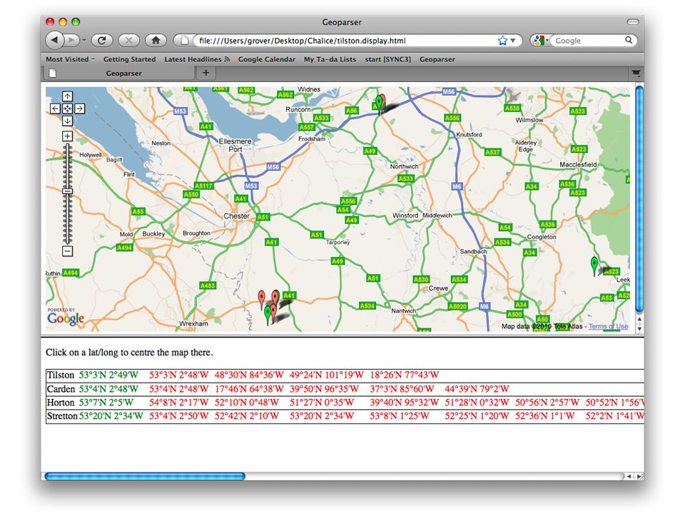
Case 2: CHALICE Extract information from EPNS volumes to create a gazetteer containing linking modern places to historical forms of their names. Where possible, link the entries to GeoNames entries to acquire grid references. Use the new resource to link to and between other historical resources.

20
Conclusions - Most outputs of SDIs are visualizations – need to move to more analytical modes of enquiry (a la GIS) - SDIs need to accommodate the complex and varied non- digital processes in the field/laboratory/library etc and connect these to data tools and hubs. But... - The main challenge and main potential for archaeology is to provide hubs of linkable, interoperating data -...which will allow us to rethink our approaches to different kinds of evidence

Similar presentations


 Geography is the study of locational and spatial trends about the earth’s surface, the objects found on it, and the.>")


