Download presentation
Presentation is loading. Please wait.

1
Warm Up

2
Lines of Latitude, Longitude, & Hemispheres
Geography is filled with imaginary lines….

3
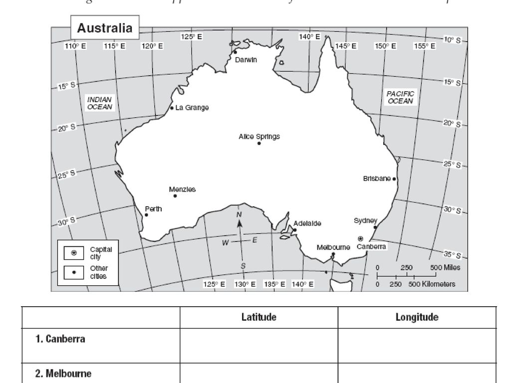
Imaginary Lines Geographers divide the Earth into lines of latitude and longitude

4
Latitude Lines of Latitude run from east to west
Also called Parallels b/c they will never intersect (touch) Latitude
 Latitude.")
5
The Equator Equator The Equator is 0 degree latitude
Is located halfway between the North and South Poles Divides the Earth into the Northern and Southern Hemispheres Equator

6
Measurement of Latitude
Lines of latitude are always measured in degrees north or south of the Equator For example: 15° N

7
Longitude Lines run from north to south Also referred to as Meridians
The lines meet at the North and South Poles Longitude

8
The Prime Meridian The Prime Meridian measures at 0 degrees longitude Divides the Earth into the Eastern and Western Hemispheres

9
Measurement of Longitude
Lines of longitude are always measured in degrees east or west of the Prime Meridian For example: 15° W

13
Earth rotates west to east Solar time is based on the position of the sun NIGHT IS FALLING ON EARTH
Look at the East Coast of the United States. The lights are already lit. California the sun is still visible.

14
This pictures shows AMERICAN CITIES at night.

15
It’s still daylight in California
Saguenay Sept-Iles Thunder Bay Toronto St.John Ottawa It’s still daylight in California Québec Montréal Those light are Boston, New York, Philadelphia and Washington. Detroit Dallas Puerto Rico Houston Miami Mexico City Havana Port-au-Prince

16
Iceland England Atlantic Ocean France Spain Italy AFRICA

Similar presentations


 splitting the earth into the Northern Hemisphere.>")


 splitting the earth into the Northern Hemisphere.>")

 splitting the earth into the Northern Hemisphere.>")


