Download presentation
Presentation is loading. Please wait.

1
Wednesday August 24, 2016 Pick up an “All about Me” worksheet at the front, and get your folders/spirals. Begin filling out your information. We will practice group activities. Then we will do a Map Activity.

2
For Map Activity You need one pen. One pencil.

4
The student will: locate places of importance during the 17 th, 18 th, and 19 th centuries that will be studied this year. apply map skills by creating and analyzing U.S. and World maps. Content Learning Objectives

5
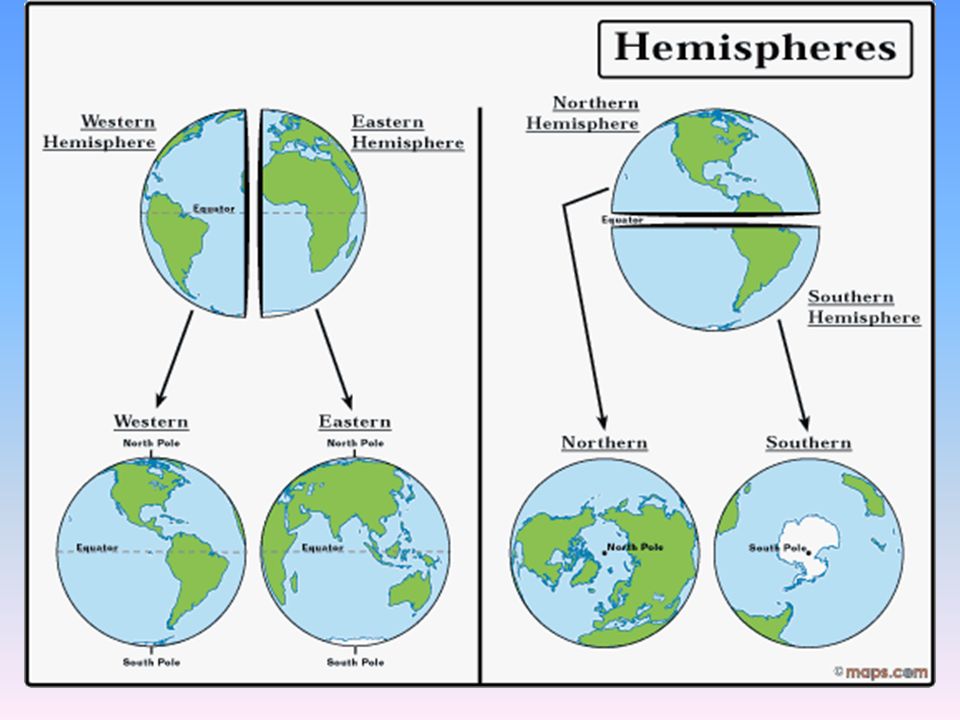
7 continents 4 oceans 4 hemispheres

6
ASIAEUROPE NORTH AMERICA SOUTH AMERICA AFRICA ANTARCTICA AUSTRALIA

7
Atlantic Ocean Pacific Ocean Indian Ocean Arctic Ocean

9
On which continent do we live?On which continent do we live? What countries are on our continent?What countries are on our continent? Label the countries on your map.Label the countries on your map.

10
North America We live on the continent of North America.

11
United States Canada Mexico Atlantic Ocean Pacific Ocean Here are the countries in North America:

12
England Spain France Italy On your map, locate Europe and label these countries: England, France, Spain, Italy

13
England Spain France Italy Spain France England Italy

14
Label the following: Atlantic and Pacific Oceans Gulf of Mexico Mississippi River Great Lakes Appalachian Mountains Rocky Mountains

15
Gulf of Mexico Pacific Ocean Appalachian Mountains Mississippi River Atlantic Ocean RockMountains Great Lakes

16
Now you know some of the important places we’ll be studying this year as we learn about the history of the United States from its beginnings to Reconstruction.

17
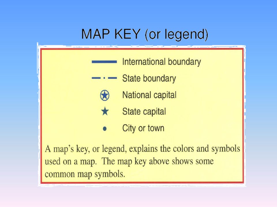
What are the five parts (components) of a map? Title Compass Rose Key or Legend Grid Scale
 of a map Title Compass Rose Key or Legend Grid Scale")
18
The title tells what the map is about: purpose, key concept(s), and/or time period. United States: Population, Percent Change, 1990 to 2000 What is the purpose, key concept, and time period of this map?

19
U.S. Territorial Map 1860 What does this title tell you?

20
The compass rose shows the directions on a map. Cardinal directions Intermediate directions Southwest NorthwestNortheast Southeastt

22
A key or legend explains the symbols or colors on the map. United States: Population, Percent Change, 1990 to 2000 Use the key to explain the colors on this map.

23
U.S. Territorial Map 1860 How does the key help you interpret this map?

24
A grid system helps locate exact places on a map.

25
A scale shows distance on a map.

26
To use a scale, you need to measure.

27
Use the scale to calculate the distance of the trails west.

28
Latitude and Longitude The earth is divided into lots of lines called latitude and longitude.

29
Lines Longitude lines run north and south. Latitude lines run east and west. The lines measure distances in degrees. Latitude Longitude

30
Where is 0 degree? The equator is 0 degree latitude. It is an imaginary belt that runs halfway point between the North Pole and the South Pole. Equator

31
Where is 0 degree? The prime meridian is 0 degrees longitude. This imaginary line runs through the United Kingdom, France, Spain, western Africa, and Antarctica. PRIMEPRIME MERIDIANMERIDIAN

Similar presentations


>")


