Download presentation
Presentation is loading. Please wait.

1
Geo-referencing an aerial photo of Newton Park and overlay a vector layer HW Britz GISV431 & GEN 405

2
ArcGIS is a geographic-information-system (GIS) developed by ESRI. Being widely used and the sheer amount of functions and add-ons are maybe the important causes for being a big-player at universities as well. How to geo-reference a Aerial photo in ArcGIS? Objective To connect a scanned map or Aerial photo with other geographical data the map needs to be referenced. This means, that every pixel in the scanned image gets a new dimension: besides its location in the image (e.g. 326th pixel from left and 124th pixel from the top) it gets a real-world coordinate as well (e.g. 33°56′16”S and 25°33’11”E ). The objective of this tutorial is to show you how to translate these pixel-coordinates in real-world coordinates, aka. Georeferenciation Is (this even a word???)
 it gets a real-world coordinate as well (e.g. 33°56′16 S and 25°33’11 E ). The objective of this tutorial is to show you how to translate these pixel-coordinates in real-world coordinates, aka. Georeferenciation Is (this even a word ).")
3
OPEN ArcGIS

4
Now we need to adjust the visibility of the Geo-referencing Toolbar First open the Editor. There we choose Toolbar options ->Customize and a list with available toolbars will be opened. Now search for the Georeferencing and check it. The Toolbar shows up in your working window.

5
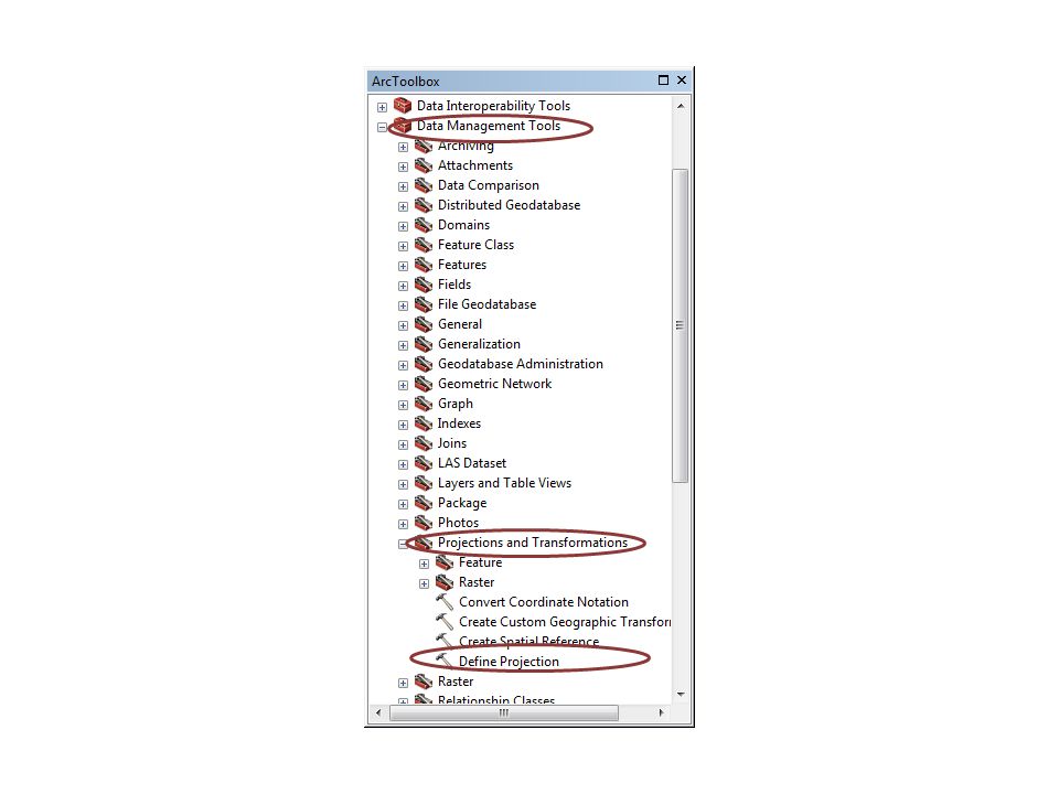
Define a projection In the first step we need to define a projection for the map: so the same term is also the function in ArcGIS: Define Projection

7
In the tool Define Projection we choose the scanned map as Input Dataset and the coordinate system that is defined in the description of the map

9
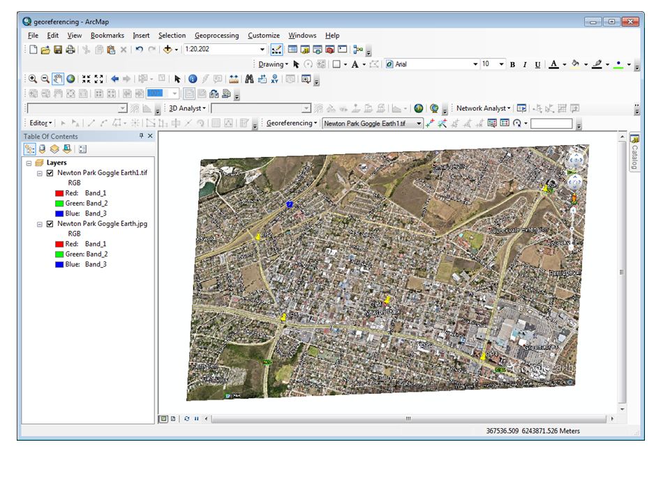
Zoom to your first Control Point.

10
Now create a point on this control point using the function Add Control Points. After marking the point use a right-click and choose the option “Input DMS of lon and lat” or if your CPs are in meters choose “Input X and Y”: a window will open. where you can record your pairs of input and output coordinates. Record the values that belongs to the latitude and longitude as DMS or Y- and X-value. Do this for the all of the CPs as well! if you don’t want to struggle with auto-projection use always opposing pairs (lower left, upper right, upper left, lower right).
..")
12
As the transformation we will use 1st Order Polynomial (look here: Georeferencing- >Transformation. The result of the transformation needs to be exported using a right-click on the layer: Data->Export Data. It is important to give a name, file format and the storage place for the resulting raster in the Export Data dialogue.

13
In a new ArcMap document add the vector data you would like to overlay. Note that your coordinate System differs from your newly geo-referenced aerial photo

14
When you try to add the vector layer to your aerial photo the following massage appears: The Transformation will be done on the fly

Similar presentations


. CS 128/ES 228 - Lecture 5a2 Spatial modeling in raster format Basic entity is the cell Region represented.>")
 732-7188 GIS and Mapping Procedures in ArcMap 9.x Creating an ArcMap Project Editing an ArcMap Project Printing an ArcMap Project.>")


