Download presentation
Presentation is loading. Please wait.

1
Published by the Oregon Dept. of Agriculture (ODA), in cooperation with the Oregon Dept. of Forestry (ODF). Contact: Pete Parsons, ODF Meteorologist 503-945-7448 peter.gj.parsons@oregon.gov ODA Production support from Diana Walker and Andy Zimmerman Published by the Oregon Dept. of Agriculture (ODA), in cooperation with the Oregon Dept. of Forestry (ODF). Contact: Pete Parsons, ODF Meteorologist 503-945-7448 peter.gj.parsons@oregon.gov ODA Production support from Diana Walker and Andy Zimmerman Seasonal Climate Forecast Verification March – May 2016 Issued: June 8, 2016
. Contact: Pete Parsons, ODF Meteorologist ODA Production support from Diana Walker and Andy Zimmerman Published by the Oregon Dept. of Agriculture (ODA), in cooperation with the Oregon Dept. of Forestry (ODF). Contact: Pete Parsons, ODF Meteorologist ODA Production support from Diana Walker and Andy Zimmerman Seasonal Climate Forecast Verification March – May 2016 Issued: June 8,")
2
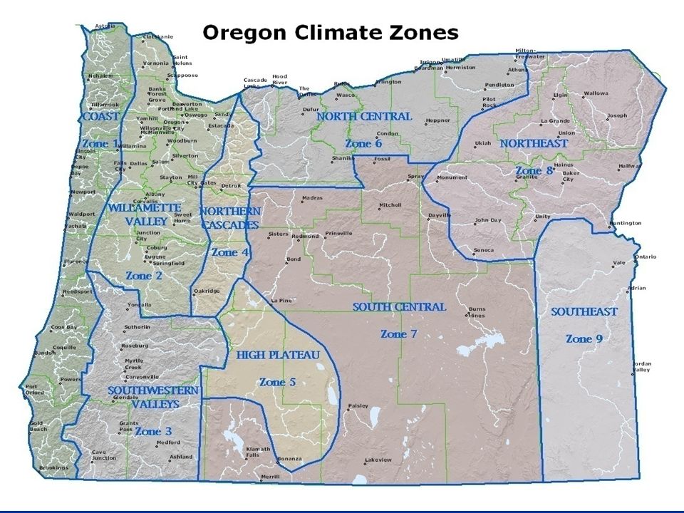
Format and Purpose: A side-by-side comparison of the “Seasonal Climate Forecast” vs. what (Actually Occurred) is done for both the 1-month & 3-month forecasts.* A side-by-side comparison of the “Seasonal Climate Forecast” vs. what (Actually Occurred) is done for both the 1-month & 3-month forecasts.* To assess the utility of this forecast and form a basis for “adjustments” to the forecast method.** To assess the utility of this forecast and form a basis for “adjustments” to the forecast method.** *Utilizes 1981-2010 long-term averages *Utilizes 1981-2010 long-term averages ** See “Forecasting Methods…” at: http://www.oregon.gov/ODA/programs/NaturalResources/Pages/Weather.aspx
 is done for both the 1-month & 3-month forecasts.* A side-by-side comparison of the Seasonal Climate Forecast vs. what (Actually Occurred) is done for both the 1-month & 3-month forecasts.* To assess the utility of this forecast and form a basis for adjustments to the forecast method.** To assess the utility of this forecast and form a basis for adjustments to the forecast method.** *Utilizes long-term averages *Utilizes long-term averages ** See Forecasting Methods… at:")
4
March 2016 (Forecast Issued February 18, 2016) Forecast Temperatures Actual Temperatures Data courtesy of the National Climatic Data Center (NCDC)
 Forecast Temperatures Actual Temperatures Data courtesy of the National Climatic Data Center (NCDC)")
5
March 2016 (Forecast Issued February 18, 2016) Forecast Precipitation Actual Precipitation Data courtesy of the National Climatic Data Center (NCDC)
 Forecast Precipitation Actual Precipitation Data courtesy of the National Climatic Data Center (NCDC)")
6
March 2016 (Forecast Issued February 18, 2016)/(Actual) Above average temperatures, although increased cloud-cover may hold southern zones close to average. (Temperatures ranged from 0.6°F to 1.8°F above average with considerable cloud-cover and precipitation throughout the month.) Above average temperatures, although increased cloud-cover may hold southern zones close to average. (Temperatures ranged from 0.6°F to 1.8°F above average with considerable cloud-cover and precipitation throughout the month.) Although storms are expected to split and weaken, as they come onshore, precipitation totals may still be above average. (A split-flow jet stream pattern did prevail, but storms still had enough energy to drop above-average precipitation across most of the state.) Although storms are expected to split and weaken, as they come onshore, precipitation totals may still be above average. (A split-flow jet stream pattern did prevail, but storms still had enough energy to drop above-average precipitation across most of the state.) Above average temperatures, although increased cloud-cover may hold southern zones close to average. (Temperatures ranged from 0.6°F to 1.8°F above average with considerable cloud-cover and precipitation throughout the month.) Above average temperatures, although increased cloud-cover may hold southern zones close to average. (Temperatures ranged from 0.6°F to 1.8°F above average with considerable cloud-cover and precipitation throughout the month.) Although storms are expected to split and weaken, as they come onshore, precipitation totals may still be above average. (A split-flow jet stream pattern did prevail, but storms still had enough energy to drop above-average precipitation across most of the state.) Although storms are expected to split and weaken, as they come onshore, precipitation totals may still be above average. (A split-flow jet stream pattern did prevail, but storms still had enough energy to drop above-average precipitation across most of the state.)
 Above average temperatures, although increased cloud-cover may hold southern zones close to average. (Temperatures ranged from 0.6°F to 1.8°F above average with considerable cloud-cover and precipitation throughout the month.) Although storms are expected to split and weaken, as they come onshore, precipitation totals may still be above average. (A split-flow jet stream pattern did prevail, but storms still had enough energy to drop above-average precipitation across most of the state.) Although storms are expected to split and weaken, as they come onshore, precipitation totals may still be above average. (A split-flow jet stream pattern did prevail, but storms still had enough energy to drop above-average precipitation across most of the state.) Above average temperatures, although increased cloud-cover may hold southern zones close to average. (Temperatures ranged from 0.6°F to 1.8°F above average with considerable cloud-cover and precipitation throughout the month.) Above average temperatures, although increased cloud-cover may hold southern zones close to average. (Temperatures ranged from 0.6°F to 1.8°F above average with considerable cloud-cover and precipitation throughout the month.) Although storms are expected to split and weaken, as they come onshore, precipitation totals may still be above average. (A split-flow jet stream pattern did prevail, but storms still had enough energy to drop above-average precipitation across most of the state.) Although storms are expected to split and weaken, as they come onshore, precipitation totals may still be above average. (A split-flow jet stream pattern did prevail, but storms still had enough energy to drop above-average precipitation across most of the state.).")
7
April 2016 (Forecast Issued March 17, 2016) Actual Temperatures Data courtesy of the National Climatic Data Center (NCDC) Forecast Temperatures
 Actual Temperatures Data courtesy of the National Climatic Data Center (NCDC) Forecast Temperatures")
8
April 2016 (Forecast Issued March 17, 2016) Forecast Precipitation Actual Precipitation Data courtesy of the National Climatic Data Center (NCDC)
 Forecast Precipitation Actual Precipitation Data courtesy of the National Climatic Data Center (NCDC)")
9
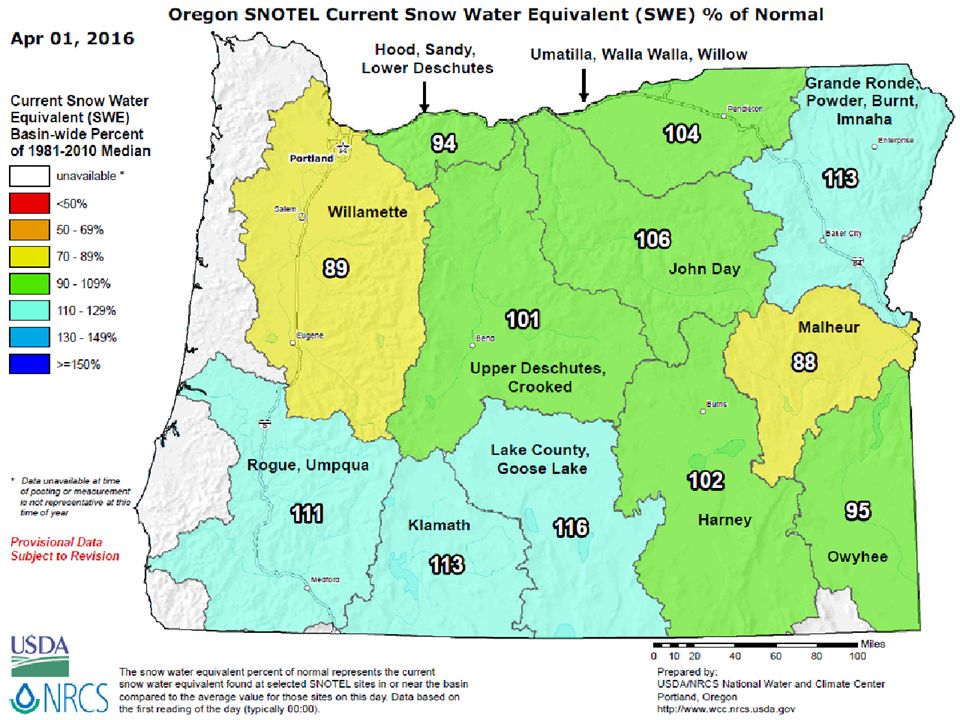
April 2016 (Forecast Issued March 17, 2016)/(Actual) Near-average temperatures. Coolest, relative to average, in the south. (It was a very warm month, relative to average, statewide.) Near-average temperatures. Coolest, relative to average, in the south. (It was a very warm month, relative to average, statewide.) Near-average precipitation. Snowpacks peaking slightly below average north and near to slightly above average south. (Precipitation was below average statewide with the greatest negative departures in north-central and NE Oregon. Snowpacks peaked close to average statewide.) Near-average precipitation. Snowpacks peaking slightly below average north and near to slightly above average south. (Precipitation was below average statewide with the greatest negative departures in north-central and NE Oregon. Snowpacks peaked close to average statewide.) Near-average temperatures. Coolest, relative to average, in the south. (It was a very warm month, relative to average, statewide.) Near-average temperatures. Coolest, relative to average, in the south. (It was a very warm month, relative to average, statewide.) Near-average precipitation. Snowpacks peaking slightly below average north and near to slightly above average south. (Precipitation was below average statewide with the greatest negative departures in north-central and NE Oregon. Snowpacks peaked close to average statewide.) Near-average precipitation. Snowpacks peaking slightly below average north and near to slightly above average south. (Precipitation was below average statewide with the greatest negative departures in north-central and NE Oregon. Snowpacks peaked close to average statewide.)
 Near-average temperatures. Coolest, relative to average, in the south. (It was a very warm month, relative to average, statewide.) Near-average precipitation. Snowpacks peaking slightly below average north and near to slightly above average south. (Precipitation was below average statewide with the greatest negative departures in north-central and NE Oregon. Snowpacks peaked close to average statewide.) Near-average precipitation. Snowpacks peaking slightly below average north and near to slightly above average south. (Precipitation was below average statewide with the greatest negative departures in north-central and NE Oregon. Snowpacks peaked close to average statewide.) Near-average temperatures. Coolest, relative to average, in the south. (It was a very warm month, relative to average, statewide.) Near-average temperatures. Coolest, relative to average, in the south. (It was a very warm month, relative to average, statewide.) Near-average precipitation. Snowpacks peaking slightly below average north and near to slightly above average south. (Precipitation was below average statewide with the greatest negative departures in north-central and NE Oregon. Snowpacks peaked close to average statewide.) Near-average precipitation. Snowpacks peaking slightly below average north and near to slightly above average south. (Precipitation was below average statewide with the greatest negative departures in north-central and NE Oregon. Snowpacks peaked close to average statewide.).")
10
May 2016 (Forecast Issued April 21, 2016) Forecast Temperatures Actual Temperatures Data courtesy of the National Climatic Data Center (NCDC)
 Forecast Temperatures Actual Temperatures Data courtesy of the National Climatic Data Center (NCDC)")
11
May 2016 (Forecast Issued April 21, 2016) Forecast Precipitation Actual Precipitation Data courtesy of the National Climatic Data Center (NCDC)
 Forecast Precipitation Actual Precipitation Data courtesy of the National Climatic Data Center (NCDC)")
12
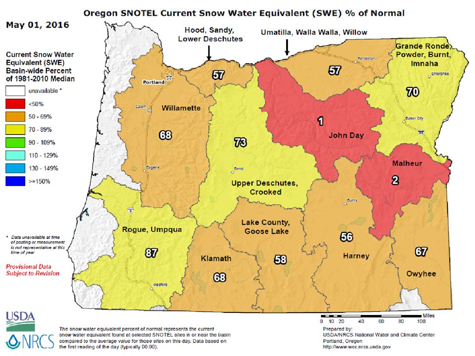
May 2016 (Forecast Issued April 21, 2016)/(Actual) Near to slightly below-average temperatures. (It was a warmer-than-average month, with the greatest positive temperature departures during the first two weeks. Overall departures ranged from +0.7°F, in SE Oregon, to +3.1°F for the coast and NW interior.) Near to slightly below-average temperatures. (It was a warmer-than-average month, with the greatest positive temperature departures during the first two weeks. Overall departures ranged from +0.7°F, in SE Oregon, to +3.1°F for the coast and NW interior.) El Niño-enhanced storms should bring near or above-average rain and mountain snow, with the greatest positive departures south. (Precipitation ranged from only about 40% of average, along the coast, to slightly above average in south-central Oregon, where mid-month snow to 4500 feet.) El Niño-enhanced storms should bring near or above-average rain and mountain snow, with the greatest positive departures south. (Precipitation ranged from only about 40% of average, along the coast, to slightly above average in south-central Oregon, where mid-month snow to 4500 feet.) Near to slightly below-average temperatures. (It was a warmer-than-average month, with the greatest positive temperature departures during the first two weeks. Overall departures ranged from +0.7°F, in SE Oregon, to +3.1°F for the coast and NW interior.) Near to slightly below-average temperatures. (It was a warmer-than-average month, with the greatest positive temperature departures during the first two weeks. Overall departures ranged from +0.7°F, in SE Oregon, to +3.1°F for the coast and NW interior.) El Niño-enhanced storms should bring near or above-average rain and mountain snow, with the greatest positive departures south. (Precipitation ranged from only about 40% of average, along the coast, to slightly above average in south-central Oregon, where mid-month snow to 4500 feet.) El Niño-enhanced storms should bring near or above-average rain and mountain snow, with the greatest positive departures south. (Precipitation ranged from only about 40% of average, along the coast, to slightly above average in south-central Oregon, where mid-month snow to 4500 feet.)
 Near to slightly below-average temperatures. (It was a warmer-than-average month, with the greatest positive temperature departures during the first two weeks. Overall departures ranged from +0.7°F, in SE Oregon, to +3.1°F for the coast and NW interior.) El Niño-enhanced storms should bring near or above-average rain and mountain snow, with the greatest positive departures south. (Precipitation ranged from only about 40% of average, along the coast, to slightly above average in south-central Oregon, where mid-month snow to 4500 feet.) El Niño-enhanced storms should bring near or above-average rain and mountain snow, with the greatest positive departures south. (Precipitation ranged from only about 40% of average, along the coast, to slightly above average in south-central Oregon, where mid-month snow to 4500 feet.) Near to slightly below-average temperatures. (It was a warmer-than-average month, with the greatest positive temperature departures during the first two weeks. Overall departures ranged from +0.7°F, in SE Oregon, to +3.1°F for the coast and NW interior.) Near to slightly below-average temperatures. (It was a warmer-than-average month, with the greatest positive temperature departures during the first two weeks. Overall departures ranged from +0.7°F, in SE Oregon, to +3.1°F for the coast and NW interior.) El Niño-enhanced storms should bring near or above-average rain and mountain snow, with the greatest positive departures south. (Precipitation ranged from only about 40% of average, along the coast, to slightly above average in south-central Oregon, where mid-month snow to 4500 feet.) El Niño-enhanced storms should bring near or above-average rain and mountain snow, with the greatest positive departures south. (Precipitation ranged from only about 40% of average, along the coast, to slightly above average in south-central Oregon, where mid-month snow to 4500 feet.).")
13
March – May 2016 (Forecast Issued February 18, 2016) Forecast Temperatures Actual Temperatures Data courtesy of the National Climatic Data Center (NCDC)
 Forecast Temperatures Actual Temperatures Data courtesy of the National Climatic Data Center (NCDC)")
14
March – May 2016 (Forecast Issued February 18, 2016) Forecast Precipitation Actual Precipitation Data courtesy of the National Climatic Data Center (NCDC)
 Forecast Precipitation Actual Precipitation Data courtesy of the National Climatic Data Center (NCDC)")
15
March – May 2016 (Forecast Issued February 18, 2016)/(Actual) Near-average temperatures, with the coolest readings, relative to average, across the southern zones. (Temperatures were above-average all three months, with April being the warmest and southern zones being the coolest, relative to average.) Near-average temperatures, with the coolest readings, relative to average, across the southern zones. (Temperatures were above-average all three months, with April being the warmest and southern zones being the coolest, relative to average.) Near or above-average rain and mountain snow. (Precipitation was above average in March but below average in April and May, except for sections of south- central Oregon. Overall, rainfall was near average. Mountain snowpacks melted earlier than average, especially north and west.) Near or above-average rain and mountain snow. (Precipitation was above average in March but below average in April and May, except for sections of south- central Oregon. Overall, rainfall was near average. Mountain snowpacks melted earlier than average, especially north and west.) Near-average temperatures, with the coolest readings, relative to average, across the southern zones. (Temperatures were above-average all three months, with April being the warmest and southern zones being the coolest, relative to average.) Near-average temperatures, with the coolest readings, relative to average, across the southern zones. (Temperatures were above-average all three months, with April being the warmest and southern zones being the coolest, relative to average.) Near or above-average rain and mountain snow. (Precipitation was above average in March but below average in April and May, except for sections of south- central Oregon. Overall, rainfall was near average. Mountain snowpacks melted earlier than average, especially north and west.) Near or above-average rain and mountain snow. (Precipitation was above average in March but below average in April and May, except for sections of south- central Oregon. Overall, rainfall was near average. Mountain snowpacks melted earlier than average, especially north and west.)
 Near-average temperatures, with the coolest readings, relative to average, across the southern zones. (Temperatures were above-average all three months, with April being the warmest and southern zones being the coolest, relative to average.) Near or above-average rain and mountain snow. (Precipitation was above average in March but below average in April and May, except for sections of south- central Oregon. Overall, rainfall was near average. Mountain snowpacks melted earlier than average, especially north and west.) Near or above-average rain and mountain snow. (Precipitation was above average in March but below average in April and May, except for sections of south- central Oregon. Overall, rainfall was near average. Mountain snowpacks melted earlier than average, especially north and west.) Near-average temperatures, with the coolest readings, relative to average, across the southern zones. (Temperatures were above-average all three months, with April being the warmest and southern zones being the coolest, relative to average.) Near-average temperatures, with the coolest readings, relative to average, across the southern zones. (Temperatures were above-average all three months, with April being the warmest and southern zones being the coolest, relative to average.) Near or above-average rain and mountain snow. (Precipitation was above average in March but below average in April and May, except for sections of south- central Oregon. Overall, rainfall was near average. Mountain snowpacks melted earlier than average, especially north and west.) Near or above-average rain and mountain snow. (Precipitation was above average in March but below average in April and May, except for sections of south- central Oregon. Overall, rainfall was near average. Mountain snowpacks melted earlier than average, especially north and west.).")
19
Contact: Pete Parsons, ODF Meteorologist at 503-945-7448 or peter.gj.parsons@oregon.govpeter.gj.parsons@oregon.gov Contact: Pete Parsons, ODF Meteorologist at 503-945-7448 or peter.gj.parsons@oregon.govpeter.gj.parsons@oregon.gov Updated Mid-Month Your Feedback is Welcome! Sign-up for Email notification of updates at: http://listsmart.osl.state.or.us/mailman/listinfo/seasonalclimateforecast Your Feedback is Welcome! Sign-up for Email notification of updates at: http://listsmart.osl.state.or.us/mailman/listinfo/seasonalclimateforecast

Similar presentations
 This Product is Published by the Oregon Department of Agriculture (ODA), in.>")
 This Product is Published by the Oregon Department of Agriculture (ODA), in Cooperation.>")


, in Cooperation.>")

, in cooperation with the Oregon Department of Forestry (ODF). Contact: Pete.>")
 (Revised: May 26, 2012) This product is published by the Oregon Department of Agriculture (ODA), in cooperation.>")
 This Product is Published by the Oregon Department of Agriculture (ODA), in.>")


 Winter Weather Forecast Conference OMSI / Oregon Chapter of the AMS 29 October 2011 Winter Weather Forecast Conference OMSI.>")
