Download presentation
Presentation is loading. Please wait.

1
Defining Hazard & Risk for Land Use Planning Xavier Anderson, New Mexico State Forestry Joy Esparsen, New Mexico Association of Counties

2
Wildland Fire Fire is a Natural Part of Our Environment People Live in This Fire Environmental Today’s Wildfires Burn with Increased Intensity Potential Loss of Life Increased Property Loss Damage to Natural Resources

3
What is the WUI? The Wildland Urban Interface (WUI) can be defined as “The geographic areas where structures and other human development meets or intermingles with wildland or vegetative fuels”
 can be defined as The geographic areas where structures and other human development meets or intermingles with wildland or vegetative fuels .")
4
New Mexico Fires are concentrated around population centers, mountain regions, and in “light fuels” such as grass or brush fuels

5
Considering the Whole Community Firewise to Fire Adapted Communities

6
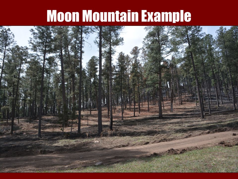
Moon Mountain Example

8
Insurance Insurance companies are concerned about their exposure to risk: State Farm inspects over 1000 policies in the New Mexico WUI each year Homeowners must comply with defensible space standards or face cancellation of their policies Other insurance companies are requiring measures such as water tanks or defensible space before they will write a policy

9
Government The public expects government to plan ahead and be prepared for potential disasters The USDA Inspector General has recommended that state and local governments be required to pay a larger share of wildland firefighting costs because they control the development of WUI areas

10
Elected Officials Take Action In 2003, after a number of significant WUI fires, the Legislature passed, and the Governor signed, a law creating a “Fire Planning Task Force”

11
Fire Planning Task Force Purpose 1.Identify areas within the state that are most vulnerable to wildfires because of the interface between forests and urban buildings; 2.Develop standards for building codes and ordinances that will reduce the threat of forest fires; 3.Work with communities to adopt and implement the WUI building codes and ordinances

12
International Code Council The selection of the International Code Council WUI Code was suggested for two primary reasons: 1.It explicitly recognizes the various levels of fire hazard severity, which makes it more cost effective to implement 2.Many communities have implemented the International Building Code and the International Fire Code which are part of the same family of codes

13
Overview of the Code Authority of the Code Officials Compliance Alternatives Appeals Permits Plans and Specifications Inspection and Enforcement Certificate of Completion

14
Zone 1 Structure Protection (0 to 10 feet from structure or deck) This Zone should be devoid of flammable vegetation as much as possible. Trees within this Zone shall be considered a part of the structure and the Zone extended accordingly. Remove all non-decomposing flammable ground materials Remove all ladder fuels Separation between crowns Maximum of 5 similar sized trees Prune all species at least 15 feet above ground Remove conifers that can’t be trimmed Permit for trees greater than 20 DBH No wood chips except in beds No firewood stored w/o cover No flammable construction material No standing dead trees allowed Grass and common weeds trimmed Planted vegetation shall be fire resistant No low growing flammable vegetation Roofs and gutters free of debris

15
Zone 2 Defensible Space (greater than 10 feet up to 200 feet from structure or deck) The intent of this zone is to reduce the threat to a structure from an advancing wildfire. Remove all flammable ground materials Remove all ladder fuels Minimum crowns separation of trees Separation of brush species Pine needles and grasses on vacant properties shall be removed Prune all species a minimum of 10 feet from ground within 30 feet of structure or one third of tree height, whichever is less Minimum 10 feet recommended between planting beds Removal of any live tree greater than 20 inches DBH requires a permit No wood chips allowed except in planting beds within 30 feet of structure No firewood stacked w/o fire retardant cover Firewood must be stacked with no more than two cords per stack No flammable conifers within 20 feet of vents, windows or doors No standing dead trees within 60 feet of structure

16
Zone 3 Forest Woodlands (from the end of Zone 2 to the edge of the property) This zone includes vacant lots and properties less than 5 acres in size. Remove all ladder fuels Make every effort to remove and utilize wood Trim all species and insure that shorter tree groups are upwind Removal of any live tree greater than 20 DBH requires a permit (with exceptions) Mastication and chipping of slash are allowed for slash disposal Alternative fuels management slash treatments may be approved by the director of forestry Green wood shall be treated for beetle habitat Up to three 12 inch DBH or larger trees may be retained All ground debris greater than 5 inches shall be removed
 Mastication and chipping of slash are allowed for slash disposal Alternative fuels management slash treatments may be approved by the director of forestry Green wood shall be treated for beetle habitat Up to three 12 inch DBH or larger trees may be retained All ground debris greater than 5 inches shall be removed.")
17
Eddie Tudor, State Forester New Mexico State Forestry 1220 South St. Francis Drive Santa Fe, NM 87505 (505) 467-3325
")
Similar presentations
 Found predominately in the.>")
 Vegetated hillsides and freeway corridors.>")

 890-4330 www.fire.lacounty.gov.>")


