Download presentation
Presentation is loading. Please wait.

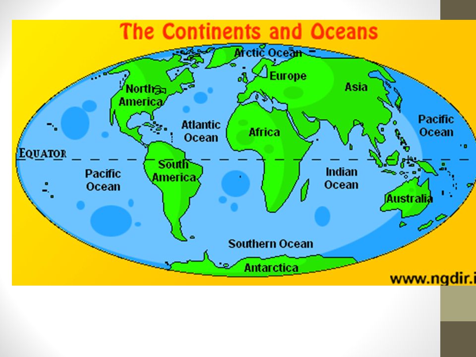
3
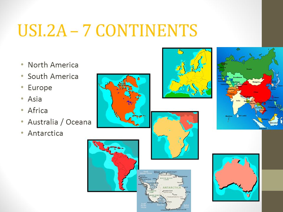
USI.2A – 7 CONTINENTS North America South America Europe Asia Africa Australia / Oceana Antarctica

4
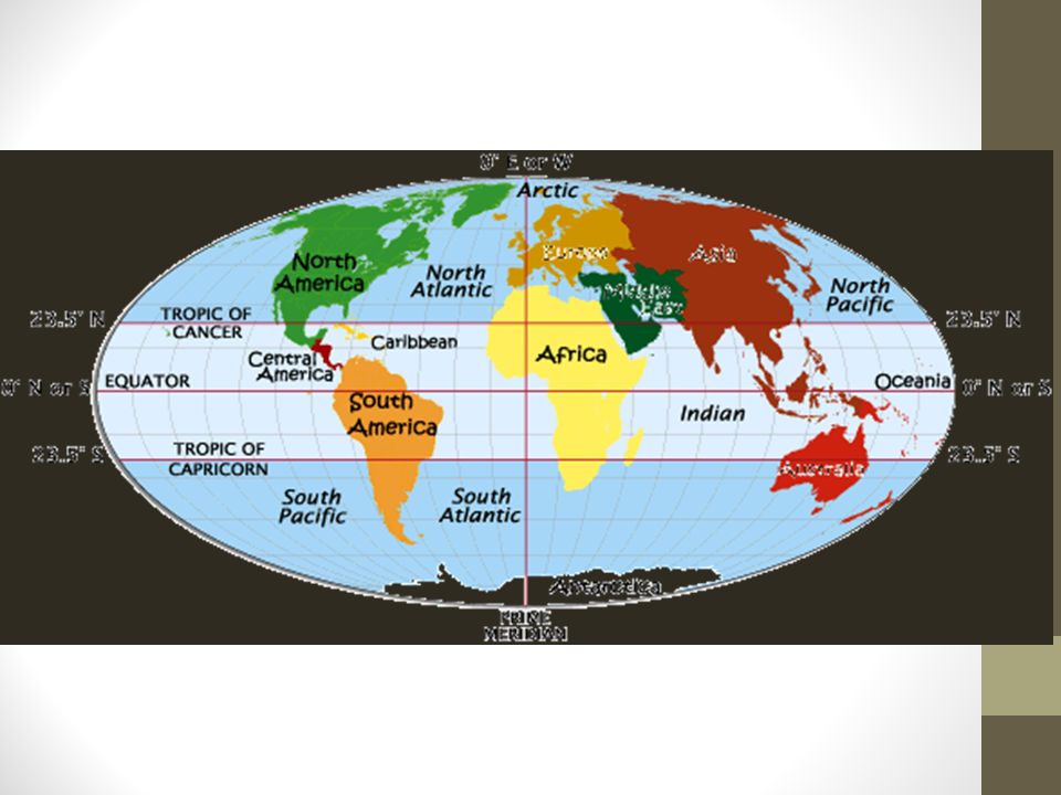
SOL 1.2a: The student will use maps, globes, photographs, pictures and tables to: locate the 7 continents. *** Europe is considered a continent even though it is not entirely surrounded by water. The land mass is frequently called Eurasia. 1 2 3 5 6 7 4

5
? ? ? ? ? ?
7
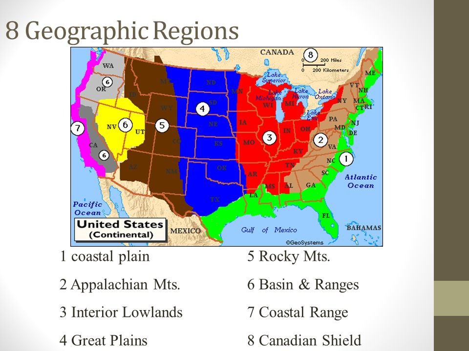
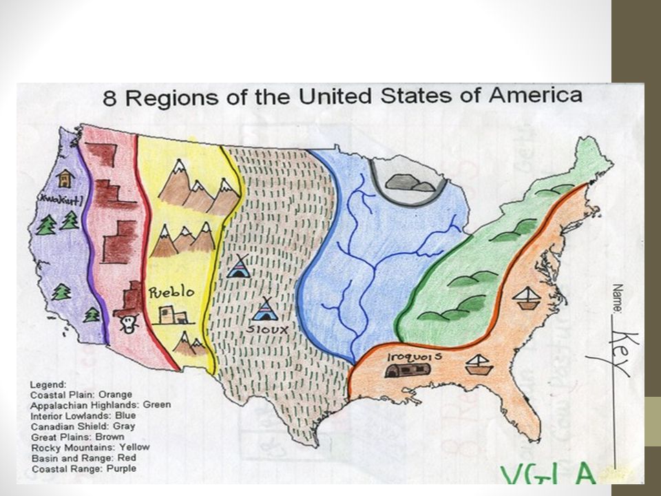
8 Geographic Regions 1 coastal plain5 Rocky Mts. 2 Appalachian Mts.6 Basin & Ranges 3 Interior Lowlands7 Coastal Range 4 Great Plains8 Canadian Shield

8
Coastal Range West of the Rocky Mountains Stretches from Canada to California Made up of Rugged Mountains and Fertile Valleys

9
Coastal Range West of the Rocky Mountains Stretches from Canada to California Made up of Rugged Mountains and Fertile Valleys

10
Basin and Range West of the Rocky Mountains Varying elevations and isolated mountain ranges Death Valley Death Valley is the lowest point in North America

11
Basin and Range West of the Rocky Mountains Varying elevations and isolated mountain ranges Death Valley Death Valley is the lowest point in North America

12
West of the Great Plains East of the Great Basin Rugged Mountains with High Elevations Includes the Continental Divide The Continental Divide determines the directional flow of rivers

13
West of the Great Plains East of the Great Basin Rugged Mountains with High Elevations Includes the Continental Divide The Continental Divide determines the directional flow of rivers ROCKY MOUNTAINS

14
West of the Interior Lowlands East of the Rocky Mountains Flatlands that increase in elevation slightly to the west Known for grasslands

15
GREAT PLAINS West of the Interior Lowlands East of the Rocky Mountains Flatlands that increase in elevation slightly to the west Known for grasslands

16
? West of the Appalachian Mountains East of the Great Plains Lowlands of rolling flatlands Rivers Broad valleys and Grassy hills

17
INTERIOR LOWLANDS West of the Appalachian Mountains East of the Great Plains Lowlands of rolling flatlands Rivers Broad valleys and Grassy hills

18
? Wraps around the southern portions of the Great Lakes and the Hudson Bay Hills worn by erosion Hundreds of glacier carved lakes Some of the oldest rock formations in North America

19
CANADIAN SHIELD Wraps around the southern portions of the Great Lakes and the Hudson Bay Hills worn by erosion Hundreds of glacier carved lakes Some of the oldest rock formations in North America

20
CANADIAN SHIELD

21
? West of the Coastal Plains Range from Canada to western Alabama Oldest mountains in North America Old eroded mountains

22
APPALACHIAN MOUNTAINS West of the Coastal Plains Range from Canada to western Alabama Oldest mountains in North America Old eroded mountains

23
? Stretches along the Atlantic Ocean Broad lowland with excellent harbors Borders the Gulf of Mexico Long sandy beaches

24
COASTAL PLAIN Stretches along the Atlantic Ocean Broad lowland with excellent harbors Borders the Gulf of Mexico Long sandy beaches

26
Major Bodies of Water SOL I.2c

27
Lets double check Gateway to the West

28
Lets double check Ohio river Gateway to the West

29
Lets double check Ohio river River explored by Lewis and Clark

30
Lets double check Ohio river Columbia River River explored by Lewis and Clark

31
Lets double check Ohio river Columbia River River explored by the Spanish (Coronado

32
Lets double check Ohio river Columbia River Colorado River explored by the Spanish (Coronado)
")
33
Lets double check Ohio river Columbia River Colorado River River forms border with Mexico

34
Lets double check Ohio river Columbia River Colorado River Rio Grande River forms border with Mexico

35
Lets double check Ohio river Columbia River Colorado River Rio Grande Important trade River

36
Lets double check Ohio river Columbia River Colorado River Rio Grande Mississippi river Important trade River

37
Lets double check Ohio river Columbia River Colorado River Rio Grande Mississippi river Forms border With Canada

38
Lets double check Ohio river Columbia River Colorado River Rio Grande Mississippi river St Lawrence River Forms border With Canada

39
? Inland port cities grew in the Midwest along the ?

40
The Great Lakes Cities grew in the Midwest along the Great Lakes.

41
The _______ Ocean served as the highway for explorers, early settlers, and later immigrants. A. Pacific B. Atlantic C. Arctic D. Indian

42
The _____River was the gateway to the west. F. Mississippi G. Missouri H. Colorado J. Ohio

43
Inland port cities grew in the Midwest along the _________. A. Mountains B. Factories C. Great Lakes D. Oregon Trail

44
The _____________ Rivers were the transportation arteries for farm and industrial products. F. Mississippi & Missouri G. Columbia & Colorado F.Ohio & James G.York & Mississippi

45
The __________ River was explored by Lewis and Clark. A.Colorado B.Columbia C.York D.Mississippi

46
What river forms a border between the USA and Mexico? A.Mississippi River B.Missouri River C.Rio Grande River D.Colorado River

47
What is the name of the inlet that is beside Mexico? A.Pacific Ocean B.Gulf of Mexico C.Mississippi River D.Atlantic Ocean

48
The Appalachian Mountains are lower than the Rocky Mountains because they are: F. newer G. older H. farther south J. more volcanic

49
Compared with the Atlantic Coast, the Pacific Coast has: A. Very little flat land along the coast. B. More land at sea level C. Fewer mountain ranges near the coast D. fewer volcanoes

50
Which landform region covers eastern Virginia? F. Coastal Plain G. Piedmont H. Appalachian Plateau J. Blue Ridge

51
The largest body of water on Earth is the: A. Atlantic Ocean B. Pacific Ocean C. Indian Ocean D. Arctic Ocean

52
The Continental Divide is an imaginary line that separates: A. western and eastern rivers B. the Appalachian Mountains from the Rocky Mountains C. rivers that drain into the Atlantic Ocean from those that drain into the Pacific Ocean D. the United States from Canada

53
What is the central line of longitude called? A. Prime Meridian B. Equator C. Tropic of Cancer D. Tropic of Capricorn

54
44. Which of these is a line of longitude? F. 10 S G. 50 N H. 100 N J. 30 E

55
Which river rises in the Rocky Mountains? A. Colorado River B. Hudson River C. Mississippi River J. Ohio River

56
The equator passes through the center of: A. Africa B. Asia C. Australia J. Europe

57
Which Europeans were the first to explore the Colorado River? F. The English G. The French H. The Portuguese J. The Spanish

58
Which of the Great Lakes lies entirely within the United States? A. Lake Erie B. Lake Huron C. Lake Michigan D. Lake Superior

59
Archeology -ology = the study of -or / er / ist = person who Archeology The study of past cultures Archeologist person who studies past cultures

60
Archaeologists study human behavior and cultures of the past through the recovery and analysis of artifacts.

61
_______________is located on the Nottoway River in southeastern Virginia. Evidence that humans lived as early as 18,000 years ago makes it one of the oldest archaeological sites in North America.

62
Cactus Hill Cactus Hill is located on the Nottoway River in southeastern Virginia. Evidence that humans lived at Cactus Hill as early as 18,000 years ago makes it one of the oldest archaeological sites in North America.

63
Native Americans USI.3B/C Pueblo, Inuit, Kwakuitl

65
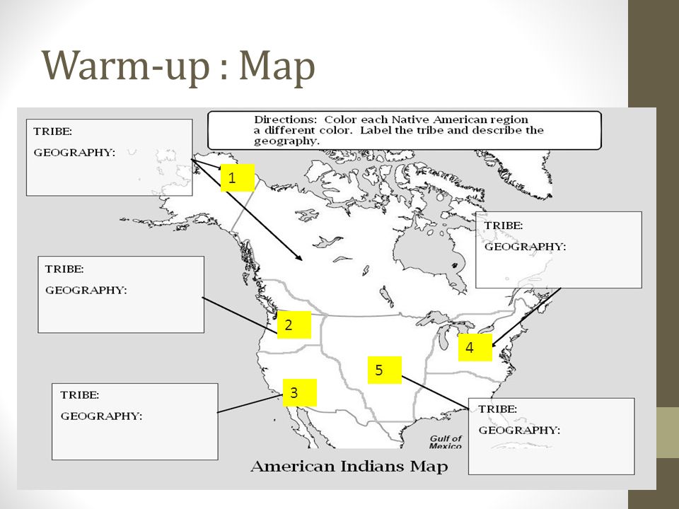
Warm-up : Map 1 2 3 4 5

66
1 2 3 4 5 Inuit Arctic (Canada) Kwakiutl Pueblo Southwest North East Iroquois Lakota (Sioux) Great Plains Pacific Northwest
 Kwakiutl Pueblo Southwest North East Iroquois Lakota (Sioux) Great Plains Pacific Northwest")
67
Native Americans: SOL 3B Inuit Kwakiutl Sioux (Lakota) Pueblo Iroquois Lived in the Arctic (Canada) Environment: Freezing temperatures all year Pacific Northwest Environment: Rainy, mild climate Great Plains of the U.S.A Environment: Dry Grass lands Southwest U.S.A near Mexico Environment: Desert areas with cliffs and mountains Eastern U.S.A. Environment: Woodlands and Forests

68
Native Americans: SOL 3C Types of resources Natural Resources Human resources Capital resources Natural resources: Things that come directly from nature Human resources: People working to produce goods and services Capital Resources Goods produced and used to make other goods and services The fish American Indians caught, wild animals they hunted, and crops they grew were examples of natural resources. People who fished, made clothing, and hunted animals were examples of human resources. The canoes, bows, and spears American Indians made were examples of capital resources.

69
lived in Present day Alaska and Canada The Artic has temperatures below freezing for most of the year

70
Inuit Indians The Inuit lived in Present day Alaska and Canada The Artic has temperatures below freezing for most of the year

71
Inuit Indians The Inuit had to hunt and fish for their food NO FARMING! They built igloos that they lived in

72
lived in the Pacific Northwest The environment was mostly rainy and mild (Think! Twilight movies….)
")
73
Kwakiutl Indians The Kwakiutl lived in the Pacific Northwest The environment was mostly rainy and mild (Think! Twilight movies….)
.")
74
Resources Used Canoe’s to travel Pacific Northwest Forest Totem Pole Fishing and hunting for food

75
Kwakiutl Indians They made their clothing from plants and animals Their homes were built from wood, Plank houses

76
Where did the LAKOTA Settle?

77
Location : Great Plains

78
Resources

79
Natural resource Capital resource Human Resource

80
Lived in Southwest They farmed and hunted for what they needed Built their homes, called Adobes

81
Pueblo Indians Lived in Southwest They farmed and hunted for what they needed Built their homes, called Adobes

82
Pueblo Pueblo Farm land Traditional dress Pueblo Cliff Dwelling Pueblo sun dried brick housing

84
Where did the Iroquois Settle?

86
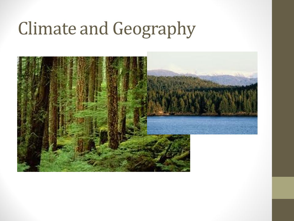
Climate and Geography

87
Resources

88
Iroquois Indians Longhouse Eastern Woodlands Natural resources Capital resources Human resource

Similar presentations


 Coastal Range 2) Basin & Range 3) Rocky Mountains 4) Great Plains 5) Interior Lowlands 6) Canadian Shield 7) Appalachian.>")


