Download presentation
Presentation is loading. Please wait.

1
Adapted from Ms. Susan M. Pojer Horace Greeley High School Chappaqua, NY Adapted from Ms. Susan M. Pojer Horace Greeley High School Chappaqua, NY

2
Europe’s Latitude v. U.S.

3
Former Soviet Region Compared in Latitude & Area with the United States

4
Satellite View of Europe

5
3,800 square miles

6
REGIONSREGIONSREGIONSREGIONS REGIONSREGIONSREGIONSREGIONS

7
Continents by Size (sq. km.) Asia44,579,000Africa30,065,000 North America 24,256,000 South America 17,819,000 Antarctica13,209,000 Europe Europe9,938,000 Oceania (incl. Australia) Oceania (incl. Australia) 7,687,000
 Asia44,579,000Africa30,065,000 North America 24,256,000 South America 17,819,000 Antarctica13,209,000 Europe Europe9,938,000 Oceania (incl. Australia) Oceania (incl. Australia) 7,687,000.")
8
The accurate and detailed drawing of a place and its surface features like hills, mountains, valleys, lakes, and rivers.

9
Europe: A Peninsula of Peninsulas? Europe: A Peninsula of Peninsulas? OROR A Peninsula of Asia?

10
Europe: An Asian Peninsula?

11
Northern Peninsulas Jutland Peninsula Scandinavian Peninsula

12
Southern Peninsulas Iberian Peninsula Italian Peninsula Balkan Peninsula Crimean Peninsula

13
PeninsulasPeninsulasPeninsulasPeninsulas PeninsulasPeninsulasPeninsulasPeninsulas Scandinavian Pen. Jutland Pen. Iberian Pen. Italian Pen.Balkan Pen. Crimean Pen.

14
B o d i e s of W a t e r B o d i e s of W a t e r Mediterranean Sea North Sea Atlantic Ocean Baltic Sea Black Sea Aegean Sea Adriatic Sea Tyrrhenian Sea Bay of Biscay Strait of Gibraltar Dardanelles Strait Arctic Ocean English Channel Caspian Sea

15
The Mediterranean Sea 2,400 miles long & 1,000 miles wide “Crossroads of 3 Continents” Strait of Gibraltar & the “Pillars of Hercules”

16
RiversRiversRiversRivers RiversRiversRiversRivers Danube R. Seine R. Rhine R. Loire R. Po R. Tiber R. Tagus R. Thames R. Elbe R. Oder R. Vistula R. Dnieper R. Volga R. Don R. Ebro R.

17
The Danube River 1770 miles

18
The Danube River Flows through the 12 countries of Germany, Austria, Slovakia, Hungary, Serbia, Croatia, Bosnia and Herzegovina, Slovenia, Bulgaria, Romania, and the Ukraine. Flows through the 12 countries of Germany, Austria, Slovakia, Hungary, Serbia, Croatia, Bosnia and Herzegovina, Slovenia, Bulgaria, Romania, and the Ukraine. Where Buda & Pest Meet Biking along the Danube

19
The Volga River It’s the longest river in Europe --> 2,300 miles.

20
The Volga River The river is so polluted that the sturgeon catch has been decreased by 60%. The river is so polluted that the sturgeon catch has been decreased by 60%.

21
Why are most of the capitals of Europe on major rivers?

22
Capitals on the Rivers Paris, right bank of the Seine London on the Thames Prague on the Vltava Budapest on the Danube

23
Capitals on the Rivers Berlin on the Spree Moscow on the Moscow River Rome on the Tiber Vienna on the Danube

24
What’s the answer??

25
Answer:Answer: They are Europe’s lifeline!

26
Moutains&PeaksMoutains&PeaksMoutains&PeaksMoutains&Peaks Moutains&PeaksMoutains&PeaksMoutains&PeaksMoutains&Peaks Alps Mts. Pyrennes Mts. Apennines Mts. Dinaric Alps Carpathian Mts. Caucasus Mts. Ural Mts. Mt. Etna ^ Mt. Vesuvius ^ Mt. Olympus ^

27
ElevationElevation Alps Carpathians Caucasus Urals Pyrennes Apennines

28
The Alps The Alps cover most of Switzerland, Austria, and parts of Italy and France.

29
Mt. Blanc in the Alps It’s the highest mountain in the Alps: 15,771 feet.

30
The Caucasus Mountains The origin of the word Caucasian. The origin of the word Caucasian.

31
Transylvania in the Carpathian Mountains Home of Vlad Tepeš, the Drakul (“Count Dracula”) Home of Vlad Tepeš, the Drakul (“Count Dracula”)
 Home of Vlad Tepeš, the Drakul ( Count Dracula )")
32
Ural Mountains: “The Great Divide” It divides the European and Asian sections of Russia. 1500 miles

33
The Ural Mountains

34
PlainsPlainsPlainsPlains PlainsPlainsPlainsPlains Northern European Plain Steppes Siberian Lowlands

35
The BENELUX Countries * Belgium * Netherlands * Luxembourg * Belgium * Netherlands * Luxembourg

36
Holland’s Dikes

37
Amsterdam’s Canals

38
PlateausPlateausPlateausPlateaus PlateausPlateausPlateausPlateaus Meseta

39
CompletedCompletedMapMapCompletedCompletedMapMap CompletedCompletedMapMapCompletedCompletedMapMap North Sea Atlantic Ocean Baltic Sea Black Sea Aegean Sea Adriatic Sea Tyrrhenian Sea Bay of Biscay Strait of Gibraltar Dardanelles Strait Arctic Ocean English Channel Caspian Sea Danube R. Seine R. Rhine R. Loire R. Po R. Tiber R. Tagus R. Thames R. Elbe R. Oder R. Vistula R. Dnieper R. Volga R. Don R. Ebro R. Alps Mts. Pyrennes Mts. Apennines Mts. Dinaric Alps Carpathian Mts. Caucasus Mts. Ural Mts. Mt. Etna ^ Mt. Vesuvius ^ Mt. Olympus ^ Siberian Lowlands Northern European Plain Steppes Scandinavian Pen. Jutland Pen. Iberian Pen. Crimean Pen. Balkan Pen. Anatolean Pen. Peloponnesian Pen. Italian Pen.

40
10,000 BCE – Ice Age

41
Norwegian Fjords laciers cut deep valleys in the ocean during the Ice Age. Glaciers cut deep valleys in the ocean during the Ice Age.

42
Earthquake Zones

43
Reykjavik, Iceland: “The Youngest Oldest Country” Volcanoes Volcanoes Hot Springs Hot Springs Geysers Geysers

44
Mediterranean Islands The are generally rugged & mountainous. The are generally rugged & mountainous. The Mediterranean Sea is so polluted that it will take 1000 years to clean up. The Mediterranean Sea is so polluted that it will take 1000 years to clean up. Sardinia Cyprus Malta

45
Mt. Etna, Sicily an active volcano an active volcano

46
Mt. Vesuvius, Italy 1944 eruption Pompeii, 79 CE Herculaneum, 79 CE Herculaneum, 79 CE

48
Eastern Europe

49
Russia’s 10 Time Zones

50
Siberia --> Permafrost The average temperatures of January vary from 0 to -50°C and in July from 1 to 25°C. 150,000,000 population. a former “gulag” Soviet prison camp a former “gulag” Soviet prison camp

51
Lake Baikal, Siberia It’s the oldest and deepest lake in the world. It’s the oldest and deepest lake in the world. 20% of the world’s total unfrozen water supply 20% of the world’s total unfrozen water supply

52
Trans-Siberian Railroad It was completed in 1905.

53
Trans-Siberian Railroad The main line runs 5,785 miles.

55
Europe’s Latitude v. US

56
ClimateClimate

57
Average Annual Precipitation

59
Europe’s Natural Regions

60
The North European Plain

61
The Northern European Plain --> An Invasion Route into Asia (& Vice Versa?)
")
62
Steppes: “Soviet” Breadbasket

63
The Steppes 25% of the old Soviet Union’s food supply 25% of the old Soviet Union’s food supply

64
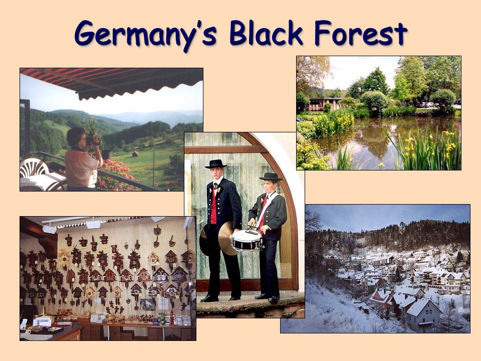
Germany’s Black Forest

66
Tundra: The Not-So-Barren Land Below the Arctic Circle

67
LandLandUseUseLandLandUseUse LandLandUseUseLandLandUseUse

68
Agricultural Activity

70
RESOURCESRESOURCESRESOURCESRESOURCES RESOURCESRESOURCESRESOURCESRESOURCES

71
Major Industrial Resources

72
Oil Export Routes in the Caucasus Area

74
Major Environmental Disasters & Pollution Problems

75
Acid Rain

77
World Population by Continents Asia3,737,000,000 Africa823,000,000 Europe729,000,000 North America 486,000,000 South America 351,000,000 Oceania (incl. Australia) Oceania (incl. Australia) 31,000,000 Antarctica no permanent population
 Oceania (incl. Australia) 31,000,000 Antarctica no permanent population.")
78
Population Density [People Per Square Mile] Belgium336.82Mexico52.15 Japan336.72 United States 29.77 India336.62World14.42 United Kingdom 244.69Norway14.42 Italy192.96Canada 3.36 France108.09Russia 8.61
![Population Density [People Per Square Mile] Belgium336.82Mexico52.15 Japan United States India336.62World14.42 United Kingdom Norway14.42 Italy192.96Canada 3.36 France108.09Russia 8.61](http://images.slideplayer.com/32/9857277/slides/slide_78.jpg "Population Density [People Per Square Mile] Belgium336.82Mexico52.15 Japan United States India336.62World14.42 United Kingdom Norway14.42 Italy192.96Canada 3.36 France108.09Russia 8.61")
79
Population Distribution

80
Population Growth

81
Major Religious Groups in Europe

82
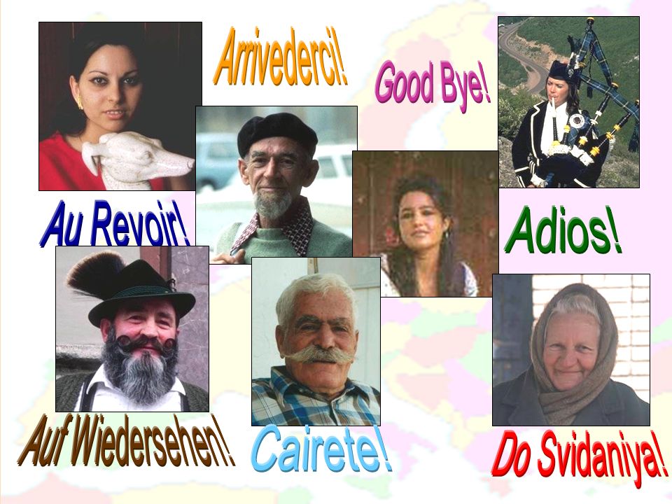
Members of the Indo-European Language Family

Similar presentations