Download presentation
Presentation is loading. Please wait.

1
Geography Understanding our planet

2
INTRODUCTION TO: -Latitude and Longitude -Hemispheres -Cardinal/Intermediate directions -Scale -Time Zones -Legend

3
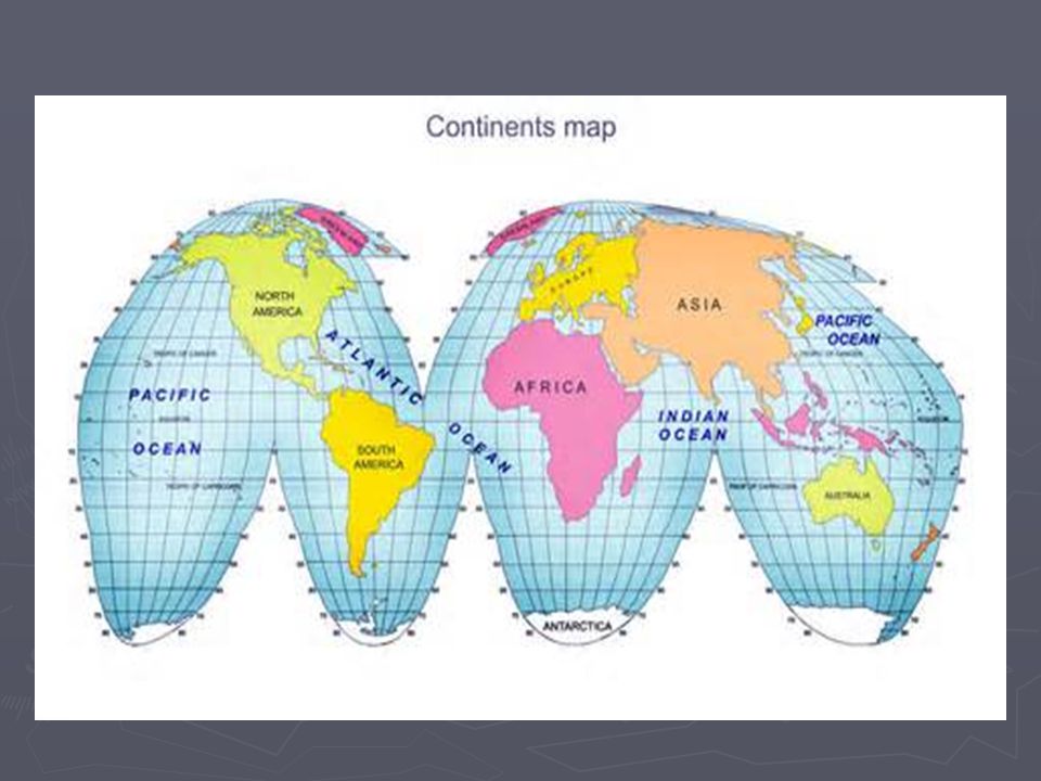
Review of Continents ► Our Planet has 7 Continents North America South America Europe Asia Africa Australia Antarctica

5
Latitude and Longitude ► The earth is divided into lots of lines called latitude and longitude.

6
Lines ► LATITUDE lines measure how far north and south of the equator. (horizontal) ► LONGITUDE lines measure how far east and west of the prime meridian.(Vertical) ► The lines measure distances in degrees. Latitude Longitude
 ► LONGITUDE lines measure how far east and west of the prime meridian.(Vertical) ► The lines measure distances in degrees. Latitude Longitude.")
7
Where is the Equator? ► The equator is 0 degrees latitude. ► It is an imaginary belt that runs halfway point between the North Pole and the South Pole. (Middle of the world) Equator
 Equator.")
8
Where is 0 degree? ► The prime meridian is 0 degrees longitude. It runs from pole to pole. This imaginary line runs through the United Kingdom, France, Spain, western Africa, and Antarctica. Prime Meridian

9
How do we write it? ► Latitude is always measured and written first and longitude is always measured and written second. ► For example: Vancouver BC is ► 49 N and 124 W

11
Hemispheres ► By using the equator and prime meridian, we can divide the world into four hemispheres, north, south, east, and west.

13
Compass ► A compass is a tool that helps the user know what direction one is headed. A compass has a magnetized needle. The needle moves to help the user.

14
Compass Rose ► A Compass Rose appears on a map and displays the four major directions. Source: http://aerocompass.larc.nasa.govhttp://aerocompass.larc.nasa.gov

15
Directions ► The CARDINAL DIRECTIONS are north, south, east, and west. ► The INTERMEDIATE DIRECTIONS are northeast, southeast, southwest and northwest. ►.►.►.►.

16
Scale ► Maps are made to scale; that is, there is a direct connection between a unit of measurement on the map and the actual distance. ► For example, each inch on the map represents one mile on Earth. So, a map of a town would show a mile-long strip of fast food joints and auto dealers in one inch.

17
Scale

18
Time Zones ► The Earth is divided into 24 time zones, corresponding to 24 hours in a day. ► As the earth rotates, the sun shines in different areas, moving from east to west during the course of a day. ► Places that have the same longitude will be in the same time zone. longitude

20
Map Legends ► The legend is the key to unlocking the secrets of a map. Objects or colors in the legend represent something on the map. Religions Legend

21
Can you understand this legend?

22
Age Expectancy Legend

Similar presentations