Download presentation
Presentation is loading. Please wait.

1
North America and Antarctica

2
North America

3
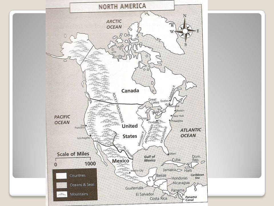
Label your map to look like mine! Make sure you have labeled. ◦United States ◦Canada ◦Mexico ◦Great Lakes ◦Rio Grande River ◦Mississippi River ◦Rocky Mountains ◦Appalachian Mountains ◦West Indies ◦Atlantic Ocean ◦Pacific Ocean ◦Gulf of Mexico ◦Central America ◦Panama Canal ◦Great Plains ◦St. Lawrence River ◦West Indies

5
Please take C-notes over the following information on Page 13 in your passport

6
North America World’s 3 rd largest continent. In the Western Hemisphere

7
Central America Connects North America to South America. Contains 7% of the world’s biodiversity – plants and animals. Have warm humid climates and rainforests.

8
West Indies Made up of a large number of islands in the Caribbean Sea. Have warm humid climates and rainforests.

9
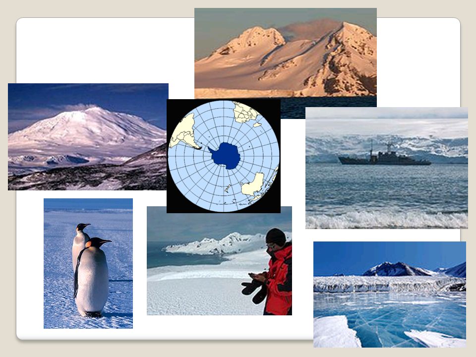
Antarctica The coldest, driest, and windiest continent. Has the highest average elevation of all the continents. 98% of the continent is covered by ice that is about a mile thick. Covers the South Pole.

10
Please label: -Transantarctic Mountains, Pacific Ocean, Atlantic Ocean, Indian Ocean, South Pole

Similar presentations


>")
