Download presentation
Presentation is loading. Please wait.

1
CANADIAN LANDFORM REGIONS

2
Canada can be Divided into 7 Landform Regions:
Western Cordillera Interior Plains Canadian Shield Great Lakes- St.Lawrence Lowlands Appalachian Region Hudson Bay- Arctic Lowlands Innuitian Mountains

3
Landform Regions of Canada

4
THE CANADIAN SHIELD THE CANADIAN SHIELD REGION COVERS ALMOST HALF OF CANADA (including most of Nunavut, Quebec, Labrador, Ontario, and Manitoba, and a large part of Saskatchewan) THE SHIELD WAS FORMED ABOUT 3 BILLION YEARS AGO
 THE SHIELD WAS FORMED ABOUT 3 BILLION YEARS AGO.")
7
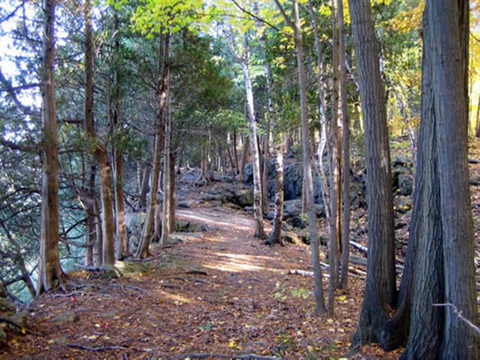
Cdn Shield: DESCRIPTION OF THE LAND
ROCKY- some of the world’s oldest rocks LOTS OF LAKES LOTS OF TREES LOTS OF RIVERS

10
Cdn Shield: RESOURCES MINERALS WATER for hydroelectric power TREES

11
Underground Mining Above ground mining

12
Hydroelectric Power Damn

14
Cdn. Shield: POPULATION
Most people live in the southern part Population is very scattered Only a few cities have 100,000 people (Sudbury, Thunder Bay and Saguenay) MEDIUM POPULATED
 MEDIUM POPULATED.")
15
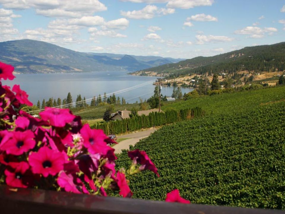
Great Lakes – St. Lawrence Lowlands

16
GREAT LAKES – ST. LAWRENCE LOWLANDS
SMALLEST LANDFORM REGION THIS IS A LOW-LYING AREA LOCATED NEAR THE GREAT LAKES (ONTARIO AND QUEBEC)
")
19
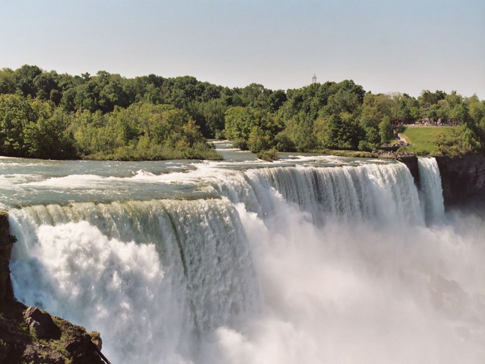
DESCRIPTION LARGE LAKES TREES FARMLAND MANY LARGE CITIES
HAS AN ESCARPMENT (a change in the height of land due to erosion of soft sedimentary rock)- Niagara Falls
- Niagara Falls.")
21
RESOURCES SEDIMENTARY ROCK: Limestone rock, shale, and sandstone are mined to provide stone and cement for building industry. SOIL: The area has a lot of great soil for farming. WATER for shipping, commercial fishing, power generation, use in factories, and for drinking

25
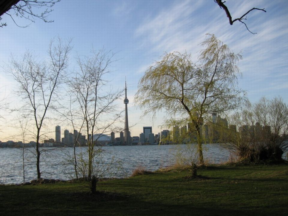
POPULATION HIGHLY POPULATED 2/3 of Canada’s population lives here
Major Cities: Greater Toronto and Montreal

26
THE APPALACHIANS

27
THE APPALACHIANS

29
THE APPALACHIANS THE APPALACHIAN REGION IS MADE UP OF NEW BRUNSWICK, NOVA SCOTIA, P.E.I., NEWFOUNDLAND, AND A SMALL PART OF QUEBEC

32
DESCRIPTION LOW MOUNTAINS & HILLS FLAT PLAINS COASTLINE TREES

34
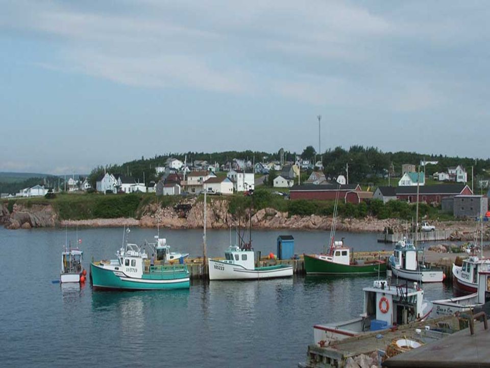
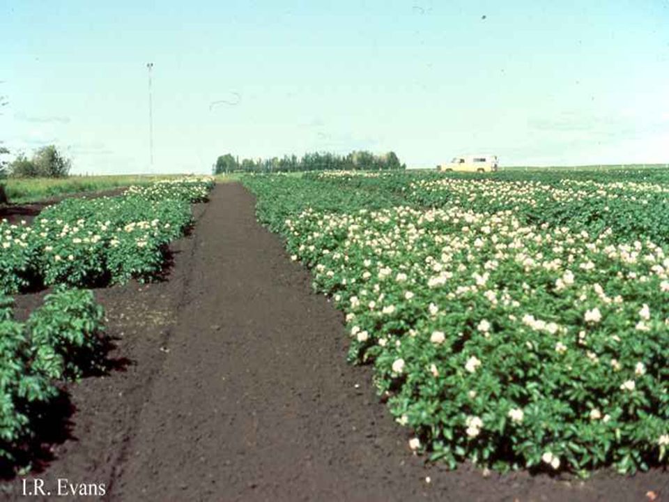
RESOURCES FISH: all the provinces are near the Atlantic Ocean catch and sell fish for food. SOIL: P.E.I. and New Brunswick have good soil for growing food (POTATOES!). TREES: for making paper and building things.
. TREES: for making paper and building things.")
37
POPULATION MEDIUM POPULATION Most people live near the coast
1/10 of Canada’s population lives here There are only 4 cities of 100,000 people: Sherbrooke (Que.), Halifax (N.S.), Saint John (N.B.), and St. John’s (N.F.L.)
, Halifax (N.S.), Saint John (N.B.), and St. John’s (N.F.L.)")
38
INTERIOR PLAINS

39
INTERIOR PLAINS

40
INTERIOR PLAINS MOST OF ALBERTA AND SASKATCHEWAN, AND SOME OF NWT AND MANITOBA THE PLAINS ARE MADE UP OF 200-MILLION-YEAR-OLD SEDIMENTARY ROCK

43
DESCRIPTION FLAT, WIDE-OPEN AREAS LOTS OF FARM FIELDS

46
RESOURCES OIL: Edmonton is centre of Canada’s oil industry
SOIL : one of the best farming regions in Canada Wheat Cattle OIL: Edmonton is centre of Canada’s oil industry

50
POPULATION MEDIUM POPULATED
Most people live in the south, near the Canada-U.S. border 2 cities in this region have populations close to 1 million: Edmonton and Calgary

51
WESTERN CORDILLERA

52
WESTERN CORDILLERA

53
WESTERN CORDILLERA Cordillera means “Mountains” in Spanish
BRITISH COLUMBIA, THE YUKON, AND SMALL PARTS OF ALBERTA AND THE N.W.T. MAKE UP THE WESTERN CORDILLERA

56
DESCRIPTIONS LARGE MOUNTAINS -(Rockies) VALLEYS LOTS OF TREES
LOTS OF RIVERS

58
RESOURCES Rich in Minerals and Trees

61
POPULATION MEDIUM POPULATION
Most people live the cities of Vancouver and Victoria 1/8 of Canada’s population lives here

64
INNUITIANS

65
INNUITIANS

66
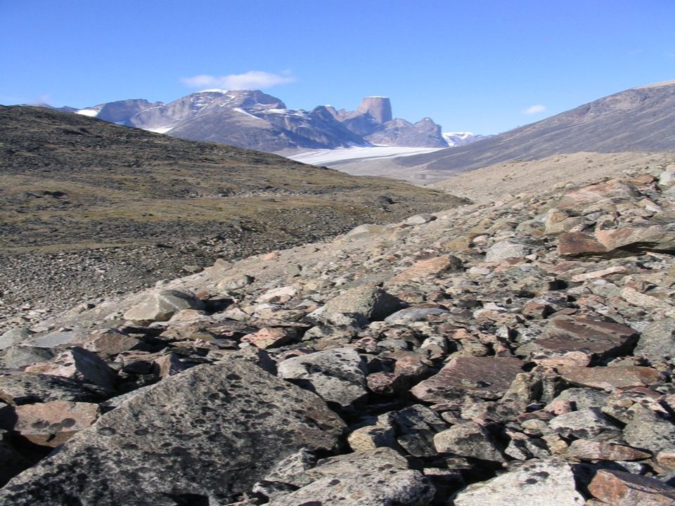
INNUITIANS Nunavut and the Northwest Territories

69
DESCRIPTION LOW MOUNTAINS GLACIERS ROCKY NO TREES

72
RESOURCES & POPULATION
OIL and GAS DEPOSITS ANIMALS for food (hunting) POPULATION LOW POPULATION Most people that live in this region are Inuit
 POPULATION. LOW POPULATION. Most people that live in this region are Inuit.")
73
HUNTING

75
ARCTIC

76
ARCTIC

77
ARCTIC SERIES OF ISLANDS IN FAR NORTH
THE SURFACE OF THE LAND IS VERY ROCKY WITH VERY LITTLE PLANT LIFE

80
DESCRIPTION MANY ISLANDS VERY ROCKY NOT MANY PLANTS
FLAT AND HILLY PARTS

83
RESOURCES & POPULATION
OIL and GAS DEPOSITS ANIMALS (for food) POPULATION VERY LOW POPULATION
 POPULATION. VERY LOW POPULATION.")
84
Oil Extraction

85
Hunting

Similar presentations