Download presentation
Presentation is loading. Please wait.

1
Introduction to GPS/GIS

2
Collecting location data Coordinates that denote the location of an infestation –Using a hand-held GPS unit –Online method (more on this later)
")
3
GPS Equipment Handheld Survey Palm

4
Coordinate Systems Coordinate settings –UTM – x,y, and zone –Lat/Long – x and y –Datum (NAD27 and NAD83)
")
5
UTM Coordinates Universal Transverse Mercator –Originally used by US Army on large scale maps –Grid system –Divides the earth into 60 zones (each 6 degrees of longitude wide) –X,Y system in meters east of zone line and north of equator (in Northern Hemisphere)
 –X,Y system in meters east of zone line and north of equator (in Northern Hemisphere)")
7
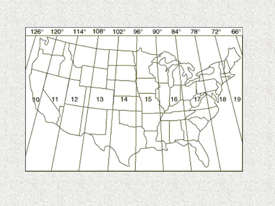
UTM Coordinates Location data in a combination of X,Y and zone Southeast lies within Zone 16, Zone 17 and Zone 18

8
Lat/Long Coordinates Based on degrees of a circle (360º total) Latitude expressed as degrees north of equator (Southern Hemisphere is denoted by a negative) Longitude expressed as degrees east of the Prime Meridian (west is denoted by a negative with the maximum value of 180º and minimum value of -180º) Lines of Latitude Lines of Longitude “meridians”
 Latitude expressed as degrees north of equator (Southern Hemisphere is denoted by a negative) Longitude expressed as degrees east of the Prime Meridian (west is denoted by a negative with the maximum value of 180º and minimum value of -180º) Lines of Latitude Lines of Longitude meridians")
9
- +

10
Latitude-Longitude Latitude Starts at Equator 90ºN and 90ºS U.S. = 24º and 49º Longitude Starts at Prime Meridian 180ºE and 180ºW (denoted with a negative) U.S. = -65º and -125º
 U.S. = -65º and -125º.")
11
Latitude-Longitude All values for longitude in the United States will be a negative number

12
33.75333, -86.59917

13
33.75333, 86.59917

14
Latitude-Longitude data DD/MM/SS (Degrees,minutes,seconds) DD/MM.MMM (Degrees, decimal minutes) DD.DDDDD (Decimal degrees) Same coordinate system, different ways of expressing it
 DD/MM.MMM (Degrees, decimal minutes) DD.DDDDD (Decimal degrees) Same coordinate system, different ways of expressing it")
15
Latitude-Longitude data 32º 45’ 12” x -84º 35’ 57” DD/MM/SS 32º 45.2000’ x -84º 95.00’ DD/MM.MMM 32.75333º x -84.59917º DD.DDDDD

17
Datum Set of surveyed points used as a reference for making maps –Most USGS topographic maps used the survey points from 1927 (NAD27) –Those points were re-surveyed and corrected in 1983 (NAD83) –WGS84 is another datum often used, essentially the same as NAD83
 –Those points were re-surveyed and corrected in 1983 (NAD83) –WGS84 is another datum often used, essentially the same as NAD83")
18
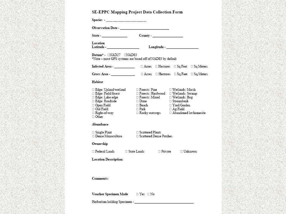
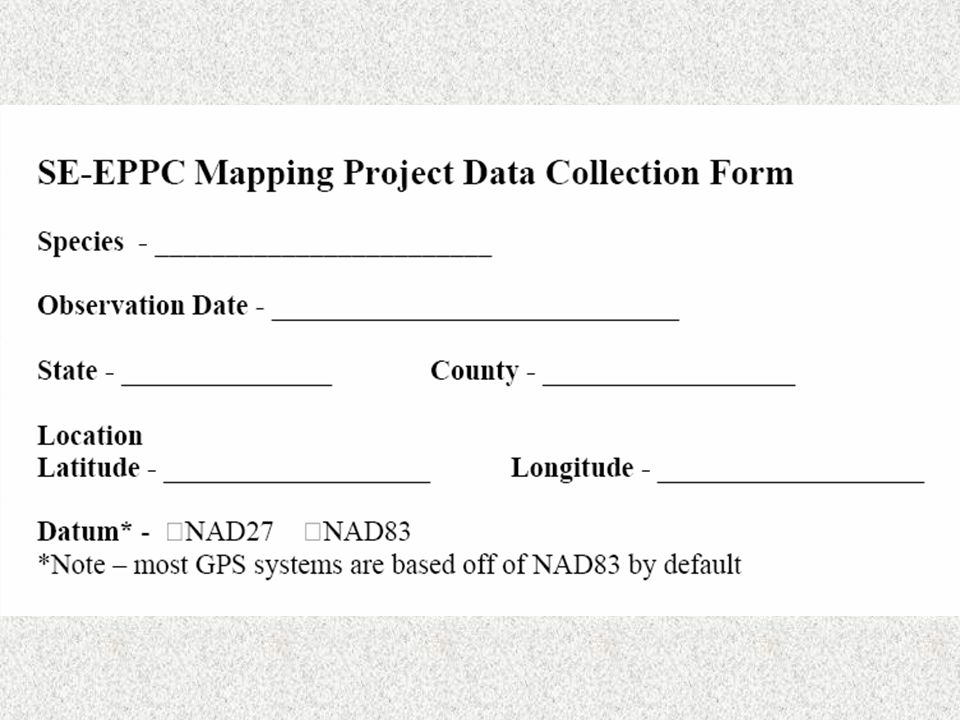
Collecting location of an infestation We prefer that you use Latitude/Longitude expressed in Decimal degrees With NAD83 (or WGS84) datum Most GPS units have the ability to set coordinate system
 datum Most GPS units have the ability to set coordinate system")
19
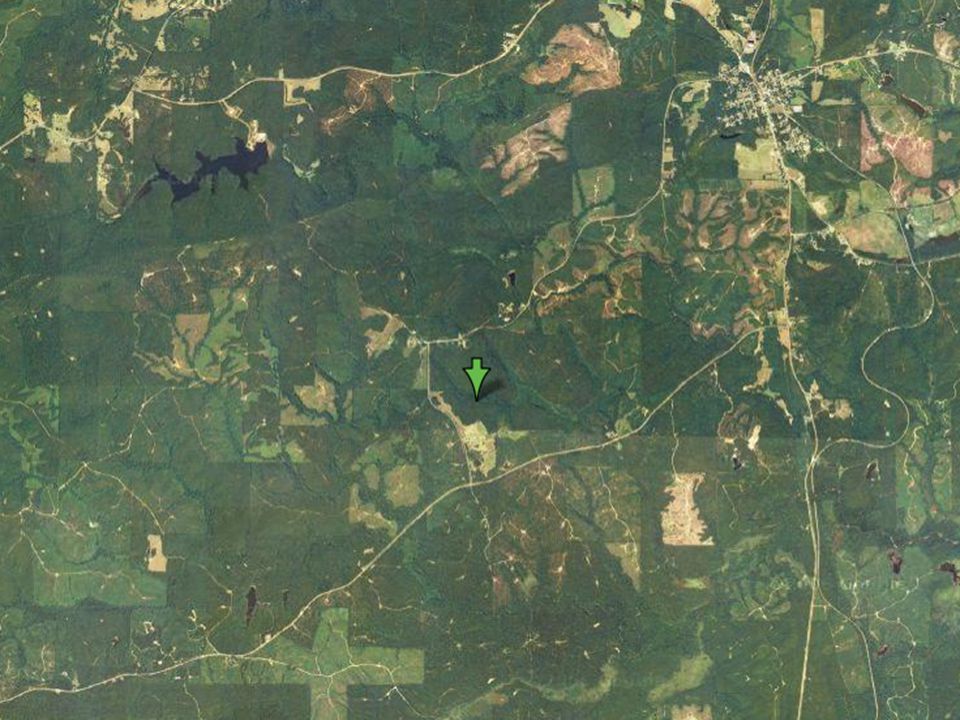
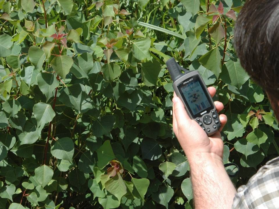
Using a handheld GPS Single point to denote entire infestation Try to collect that point in the center of the infestation

20
Using a handheld GPS

21
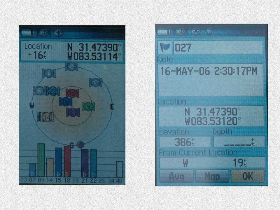
Recording point data Stand at, or as near as you can to, the center of the infestation Make sure the GPS is set to show lat/long data in decimal degrees (DD.DDD) Make sure datum is set to 1983 (NAD83) Often, the longer the GPS is stationary, the more accurate the point is
 Make sure datum is set to 1983 (NAD83) Often, the longer the GPS is stationary, the more accurate the point is")
23
Recording point data Either write-down the coordinates (record at least 5 decimal places) or create a waypoint (so that you can write it down later) Title the point something that can associate it with the area or invasive species (“Doug’s farm” or “Garlic Mustard #1”)
 or create a waypoint (so that you can write it down later) Title the point something that can associate it with the area or invasive species ( Doug’s farm or Garlic Mustard #1 )")
Similar presentations


 Francisco Olivera, Ph.D., P.E. Center for Research in Water Resources University of Texas at Austin.>")


