Download presentation
Presentation is loading. Please wait.

1
Multi-Jurisdictional GIS Data Sharing, Maintenance, and Application in the Fargo – Moorhead Metropolitan Area The Cities of Fargo and Moorhead, and the Counties of Cass, ND and Clay, MN, work collaboratively to share geospatial data to support the needs of GIS users and applications in the metropolitan area of Fargo & Moorhead. From multi-jurisdictional aerial imagery and LiDAR projects to provisioning GIS data and support for the first 911 dispatch center that covers an area which crosses state lines, GIS staff are kept busy with many challenges. 2006 North Dakota GIS Users Conference

2
Fargo – Moorhead: Multi-Jurisdictional GIS Cass County, ND Kay Anderson – GIS Coordinator 11 Years of GIS Experience 4 Years at Cass http://www.casscountygov.com/departments/gis/ Clay County & the City of Moorhead, MN Mark Sloan – GIS Coordinator 14 Years of GIS Experience 9 Years at Clay http://www.gis.co.clay.mn.us/ The City of Fargo, ND Brad Anderson – GIS Coordinator 12 Years of GIS Experience 7 Years at Fargo http://www.cityoffargo.com/CityInfo/Departments/GeographicInformation Systems/

3
Fargo – Moorhead: Multi-Jurisdictional GIS

4
Both Cass and Clay Counties are experiencing rapid growth. 119 Dedication Plats so far in 2006 for Cass County. … that equates to 860 new parcels so far in 2006, - just for Fargo alone.

5
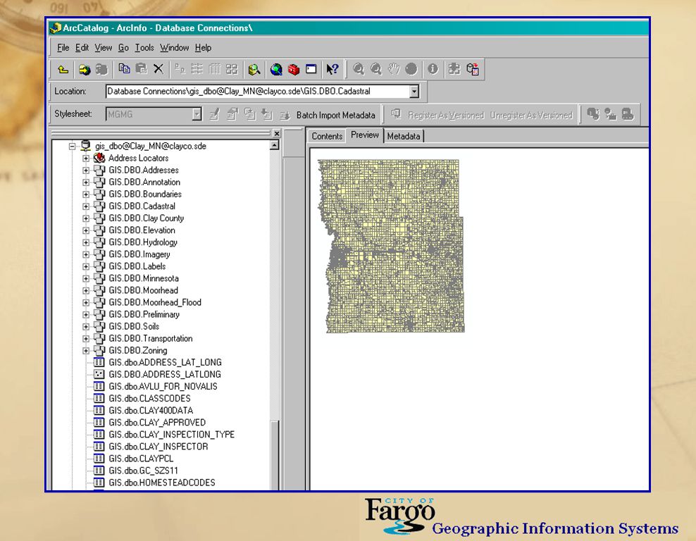
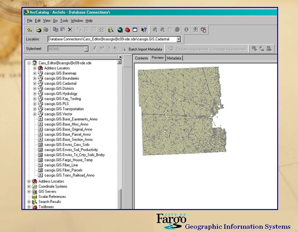
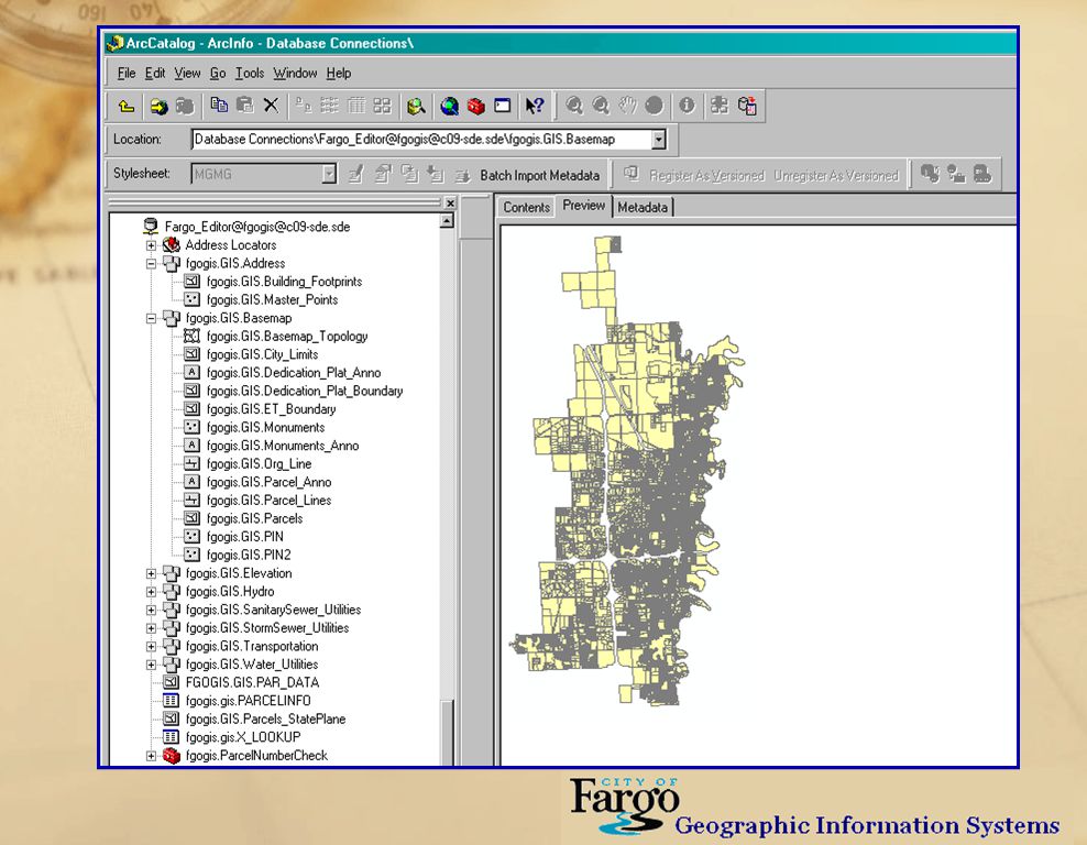
Fargo – Moorhead: Multi-Jurisdictional GIS Parcel Count by Jurisdiction : (October 2006) Cass County 55,359 City of Fargo 27,553 ( Unique Owners = 29,821) Clay Co 27,169 City of Moorhead 12,138
 Cass County 55,359 City of Fargo 27,553 ( Unique Owners = 29,821) Clay Co 27,169 City of Moorhead 12,138")
6
Fargo – Moorhead: Multi-Jurisdictional GIS Data Maintenance: Clay County GIS Department: Performs maintenance of the GIS data and tax parcels for the County and all of it’s cities. SQL – ArcSDE server houses the Clay County Geodatabase. ESRI shop, with licenses of ArcINFO. Currently converting AutoCAD drawings into the Geodatabase with the goal of having the ability to reproduce a digital Dedication Plat in AutoCAD drawing format that is identical to the original.

7
Fargo – Moorhead: Multi-Jurisdictional GIS Clay County Current Projects: Clay County has implemented a new Digital Plat Submission Policy. Digital format Plat uploaded to Clay FTP site. ESRI shapefile or AutoCAD drawing format. Submitted in Clay County Coordinate System. Predefined layer naming scheme per FM COG. Name & date stamp scheme for naming the digital file. Preliminary and Final FTP location for upload; Final must be uploaded 15 days before their hearing at planning commission meeting.

8
Fargo – Moorhead: Multi-Jurisdictional GIS Clay County Current Projects: Implementing web browser based GIS application for Clay County and City Moorhead staff to replace local desktop application. Continued working relationship with ProWest & Associates to develop and refine WebFusion. Continued development of the Clay County & City of Moorhead ArcSDE Enterprise Geodatabases.

10
GoMoorhead – from Moorhead’s Public Service. City of Moorhead staff utilize wireless technology for mobile applications.

11
Fargo – Moorhead: Multi-Jurisdictional GIS Data Maintenance: Cass County GIS Department. Performs maintenance of the tax parcels for the City of West Fargo, ND. SQL – ArcSDE server houses the Cass County and West Fargo Geodatabase. Also an ESRI shop, with licenses of ArcINFO. Performs maintenance on a variety of GIS datasets for Cass County.

12
Fargo – Moorhead: Multi-Jurisdictional GIS Cass County Current Projects: Implementing web browser based GIS application for Cass County and City of West Fargo staff to replace local desktop application. Continued working relationship with ProWest & Associates to develop and refine WebFusion. Continued development of the Cass County & West Fargo ArcSDE Enterprise Geodatabases. Developing Internet application for search and retrieval of all Plats in a digital image format. Creation of Master Address point file for Cass County and the City of West Fargo.

13
Fargo – Moorhead: Multi-Jurisdictional GIS Cass County Current Projects: Geocoding all possible voter address records for local and state-wide voter precinct locator application. Vector control breeding ground and spraying application mapping. Collation of 2006 weed spraying and treatment location mapping.

15
Cass County’s current version of WebFusion

16
Fargo – Moorhead: Multi-Jurisdictional GIS Data Maintenance: City of Fargo GIS Department. Performs maintenance of the tax parcels for the City of Fargo, and for Cass County, ND. SQL – ArcSDE server houses the City of Fargo Geodatabase. Also an ESRI shop, with licenses of ArcINFO. Performs maintenance on City of Fargo GIS datasets. Performs maintenance on a variety of GIS datasets for Cass County.

17
Fargo – Moorhead: Multi-Jurisdictional GIS City of Fargo Current Projects: Building web browser based GIS application for City of Fargo staff to replace existing desktop application. Continued working relationship with ProWest & Associates to develop and refine WebFusion. Continued development of the City of Fargo ArcSDE Enterprise Geodatabase. Continued creation of Master Address point file for City of Fargo. Implementing automatic process to make daily (copy) conversions of the City’s Basemap Section DWGs into the Geodatabase to improve accessibility for city staff.
 conversions of the City’s Basemap Section DWGs into the Geodatabase to improve accessibility for city staff..")
19
Fargo – Moorhead: Multi-Jurisdictional GIS Data Sharing: The Fargo Moorhead Metropolitan area has a fiber optic loop which connects most of it’s government buildings, schools, universities and libraries; and provides Internet access via the State of North Dakota. If the fiber gets cut, we will not loose our connection to the state. The three GIS Departments are on separate networks, however. ‘Holes’ are being punched through the firewalls so that GIS staff can have ‘read only’ viewer account access to each other’s Geodatabases.

20
Fargo – Moorhead: Multi-Jurisdictional GIS Multi-Jurisdictional Orthophotography Projects 1999 was the first year that aerial orthophotography and DTM data was collected for the entire Fargo and Moorhead metropolitan area. Projects ensued in 2002 and 2005 with color digital imagery, each one expanding in area in response to the region’s rapid growth.

22
Fargo – Moorhead: Multi-Jurisdictional GIS Multi-Jurisdictional Orthophotography Projects The City of Fargo is the lead agency for these projects, coordinating the deliveries of thousands of image and elevation data files. The imagery and elevation data is delivered in three different coordinate systems which are in use in the Fargo Moorhead Metropolitan area.

23
Fargo – Moorhead: Multi-Jurisdictional GIS Multi-Jurisdictional Orthophotography Projects Participating jurisdictions and organizations: Clay County, MN Clay County Coordinate System Moorhead, MN Clay County Coordinate System Dilworth, MN Clay County Coordinate System FM Metropolitan COG Clay County Coordinate System Cass County, ND North Dakota State Plane South Fargo, ND Fargo_Ground_Coordinate_System West Fargo, ND North Dakota State Plane South Houston Engineering All 3 Coordinate Systems!

24
Fargo – Moorhead: Multi-Jurisdictional GIS A few statistics and logistics from the 2005 multi- jurisdictional imagery and DTM project: Imagery TIF & TFW files, ¼ Section tiles, for each Coordinate System: Resolution# FilesFile Size 0.5 ft1,64480 GB 1.0 ft2,26028.5 GB 2.0 ft2,2608.5 GB 4.0 ft2,2602 GB 8.0 ft2,260500 MB TOTAL = 10,684119.5 GB

25
Fargo – Moorhead: Multi-Jurisdictional GIS A few statistics and logistics from the 2005 multi- jurisdictional imagery and DTM project: Elevation DTM Data ¼ Section tiles, for each Coordinate System: Product & Format# FilesFile Size 1 Foot Contour DWGs397500 MB ASCII xyz Text Files Breaklines397100 MB Points3978 GB DTM Mass Point DWGs39713 GB LAS Files for MARs ® 1,13024 GB TOTAL = 2,71845.6 GB

26
Directory structure as a form of metadata to assist staff in finding the data that they need and to assist data administrator (i.e. GIS Coordinator) in managing and organizing the data files.
 in managing and organizing the data files..")
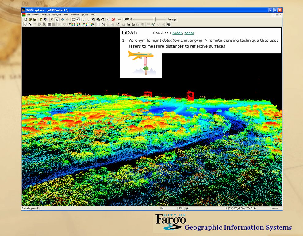
28
*.LAS files in MARs® program’s 3D point mode Looking NNE over Island Park and Dike West

30
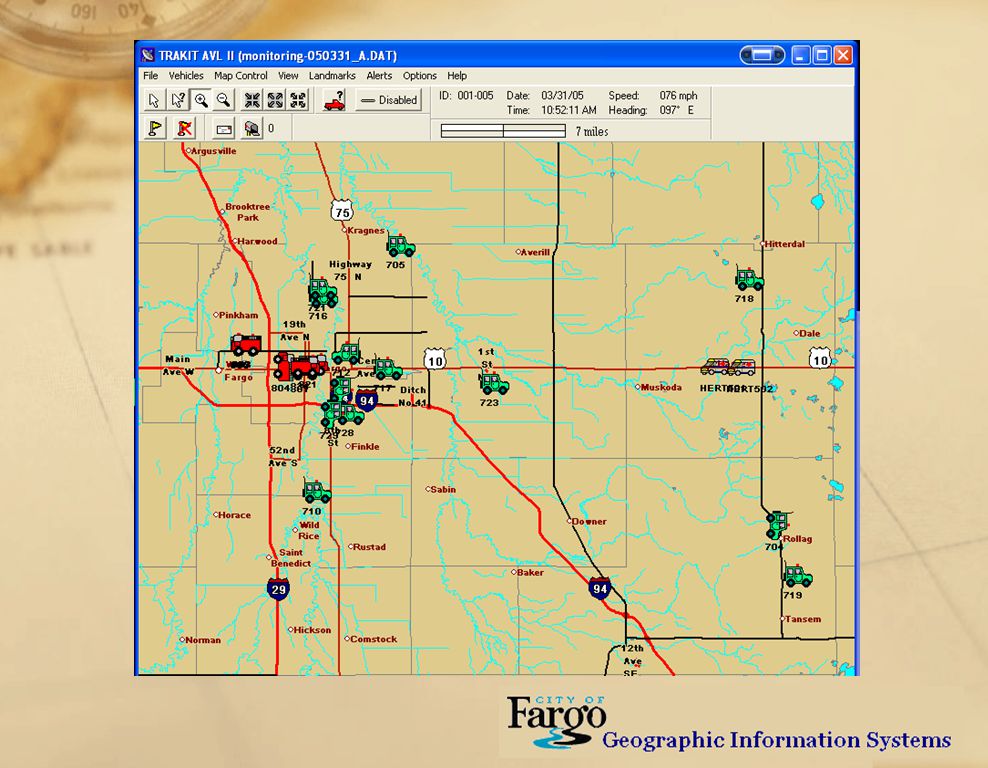
Fargo – Moorhead: Multi-Jurisdictional GIS GIS Support for the Red River Regional Dispatch Center Formed in 2002 to provide 9-1-1 and public safety dispatch for all of Cass County, ND and Clay County, MN. The three GIS Coordinators began providing GIS support and geospatial data for 9-1-1 call mapping, including Phase II compliancy for cellular phones. The RRRDC lays claim to be the first 9-1-1 call center in the nation to consolidate across state lines.

31
Fargo – Moorhead: Multi-Jurisdictional GIS GIS Support for the Red River Regional Dispatch Center The RRRDC dispatches 24 rural volunteer first responders, two major fire departments, two sheriff departments, six police departments, and six ambulance services. In 2004 the call center processed 51,000 emergency, and 193,315 non-emergency calls. An estimated 46% of the emergency calls are now from cellular phones. Incoming VOIP calls are beginning to present problems for 9- 1-1 call centers across the nation.

32
Fargo – Moorhead: Multi-Jurisdictional GIS GIS Support for the Red River Regional Dispatch Center RRRDC has two mapping programs to assist staff. Fargo Fire and Clay Sheriff can be monitored with a vehicle tracking program that is GPS enabled. The incoming 9-1-1 landline calls are automatically geocoded to the street centerline, and the Phase II cellular calls are mapped to the phone’s x,y coordinates. “Re-bidding” the call will allow the mapping program to follow the movement of the cellular caller. The three GIS Departments supply all the GIS data for the mapping programs. The main datasets include; attributed road centerlines, City limits, ESN zones, aerial orthoimagery, and ancillary data like footprints, parcels and water features.

33
Fargo – Moorhead: Multi-Jurisdictional GIS GIS Support for the Red River Regional Dispatch Center Because of the rapid growth in the Fargo Moorhead area, the GIS Departments update all relevant GIS datasets biannually. The most important are the street centerlines, City limits, and ESN zones. Again, all three Coordinate systems come into play for the provision of GIS data for the RRRDC.

34
Call station with six monitor setup and touch-screen features. ND & MN state radio, local and rural responders, mapping and incoming caller information. Ability to access shared data between agencies.

38
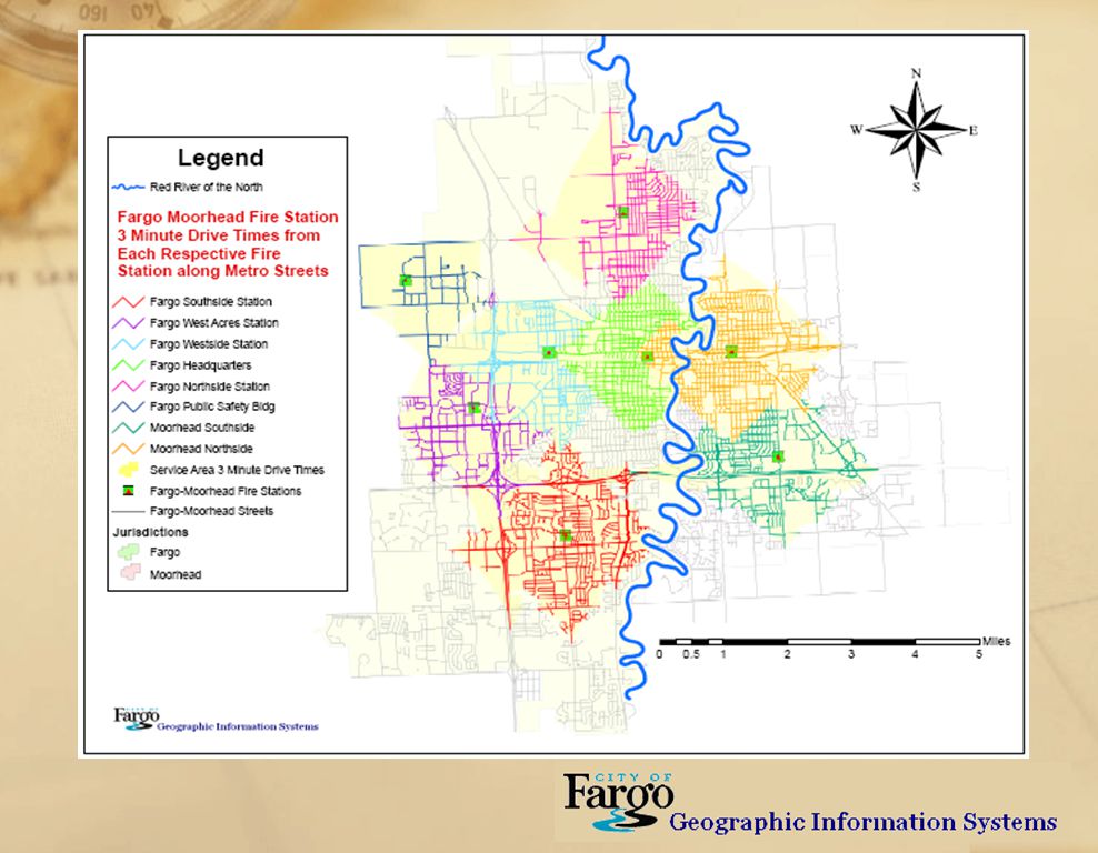
Fargo Fire Network Analyst: hydrants in 1.5 mile drive from proposed station

39
Special needs evacuation analysis and planning

40
Fargo Police Sex Offender mapping

41
Fargo Police Crime Point mapping

42
Flood mapping – ½ foot river stage inundation modeling

43
Quality assurance checks in Master Address file with fishbone tool.

44
Questions & Comments Thank You! Brad Anderson GIS Coordinator City of Fargo BAnderson@cityoffargo.com

Similar presentations


. Primary Data Layers Sites Addressable Non-addressable Other Road Centerlines.>")


 is composed of twelve regions. Each regional planning council is a public organization.>")
