Download presentation
Presentation is loading. Please wait.

1
Topographic Maps

2
Scale Linear Scale Representative Fraction Statement of scale

3
Scale If 1cm = 2km on a 1:50,000 scale map
How many cm is 1km on a 1:25,000 scale map? 4cm Calculate distance Area Help to calculate gradient

4
Location

6
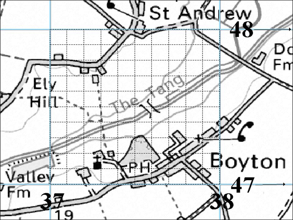
Relief describes the lie of the land
CONTOURS - Show lines of equal height on a map. LAYER COLOURING SPOT HEIGHTS / TRIANGULATION POINTS

7
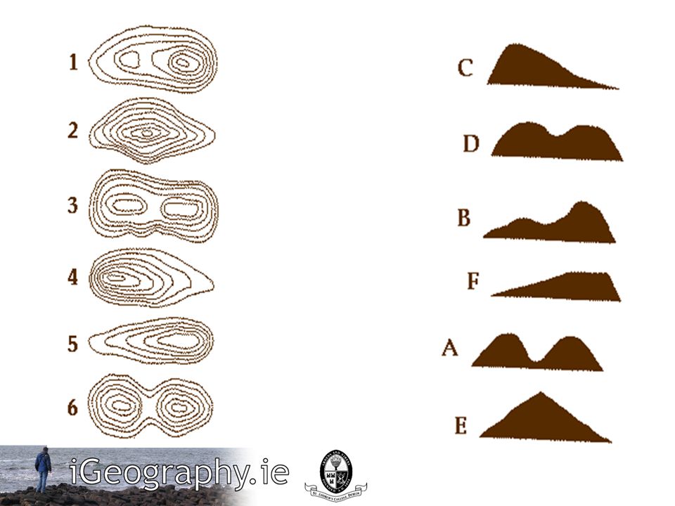
Drawing a cross-section

9
Gradient Gradient is also known as the slope.
Calculate gradient by dividing the difference in elevation between two points by the horizontal distance between the same points. An easy way to remember this is to think of dividing the "rise" by the "run" (or "rise over run"). Measure elevation difference using the contour lines (high elevation-low elevation) and the horizontal distance using the map scale. Make sure that your measurements are in the same units, or convert them to the same units.
. Measure elevation difference using the contour lines (high elevation-low elevation) and the horizontal distance using the map scale. Make sure that your measurements are in the same units, or convert them to the same units.")
10
Which is steeper? 1: : :2?

11
Invisibility

12
Describe relief by... Height of land Slope of the land
Using actual figures taken from contours or spot heights (high & low is meaningless without actual figures) Slope of the land Flat or sloping? What direction do the slopes face? (why significant?) Gentle or steep? Bare cliffs / vegetated? Presence of features? (dry valleys / valleys)
 Slope of the land. Flat or sloping What direction do the slopes face (why significant ) Gentle or steep Bare cliffs / vegetated Presence of features (dry valleys / valleys)")
13
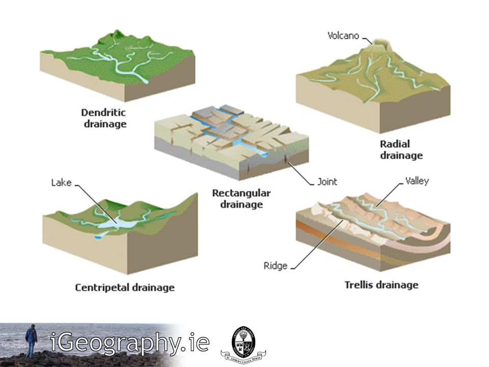
The presence of absence & flow of water.
Drainage... The presence of absence & flow of water. Describing drainage... Presence of rivers Direction of flow Dense network of rivers? Single of multi-channelled? Add names / distances / heights / directions to answers

14
Underground drainage: Patterns of rivers:
Springs / wells Patterns of rivers:

16
The influence of people
Canals Embankments Artificial lakes (dams)
")
17
Photographs

18
When producing a sketch...
Draw in pencil / label in pen Draw frame to scale (for map) Lightly add guidelines Add title / north arrow / scale Sketch in coastline (if applicable) Label / annotate information
 Lightly add guidelines. Add title / north arrow / scale. Sketch in coastline (if applicable) Label / annotate information.")
19
Rural / Urban Settlements...
Functions of a settlement?

20
Settlements Site Situation
The actual location of a settlement. For example; Toulouse is at Latitude 43,38 ° N, Longitude 1,22 ° E, approximately 580 km south from Paris. Situation The location of a settlement in relation to places (human and physical) surrounding it. For example; Toulouse is a city in southwest France on the banks of the Garonne River, half-way between the Atlantic Ocean and the Mediterranean Sea.
 surrounding it. For example; Toulouse is a city in southwest France on the banks of the Garonne River, half-way between the Atlantic Ocean and the Mediterranean Sea.")
21
Location Factors Wet-Point Site Dry-Point Site Building Materials
Defence Fuel Supply Food Supplies Nodal Point Bridging Point Shelter Aspect

22
Settlement patterns...

Similar presentations

 of the Earth’s surface.>")


>")


