Download presentation
Presentation is loading. Please wait.

1
IDWR State Water Supply Meeting March 8, 2012 Hoodoo Basin SNOTEL Clearwater River Feb 12, 2012

3
Time is running out……

5
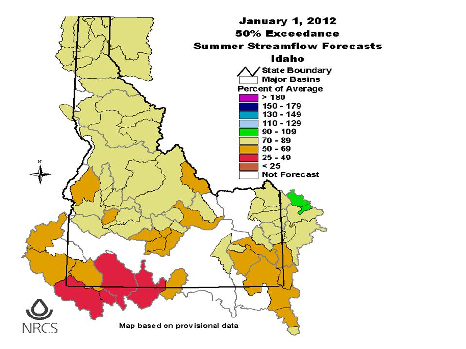
As of March 7 Snowpacks Range from : Lowest : Big Lost Today % of Peak 58% 47% Highest: N Panhandle & Clearwater Today % of Peak 100% 87%

16
Minimum = -3.2 C = 26 F 2” 8” 20” deep Chocolate Gulch Soil Temperatures WY2012

17
Chocolate Gulch Soil Temperatures WY2011 2” 8” 20” deep Minimum = -1.5 C = 29 F

18
Chocolate Gulch Soil Temperatures WY2005 2” 8” 20” deep Minimum = -7.3 C = 19 F

19
The best analogs years from Pete Parson’s are now: 2009, 1972, and 1968. Here’s what they reveal: Contact: ODF Meteorologist Pete Parsons at 503-945-7448 pparsons@odf.state.or.usbest analogs http://oregon.gov/ODA/NRD/weather.shtml#Weather_forecasts

21
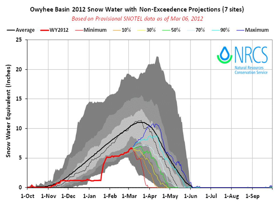
Owyhee River, March –July Runoff: 2012 Forecast 25% of Average 2011 Runoff 191% 1987 23%

22
Bruneau River March –July Runoff: 2012 Forecast 62% of Average 3 months with flow above 1000 cfs 2011 Runoff 191% 1968 44%

23
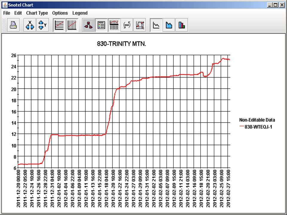
2012 Problems at SNOTEL Sites Mountain Meadows – Clearwater- Salmon basin divide: tree fell on top of 5 feet of snow covering snow pillow. Used winterized chainsaws to remove trees before snow melts that may puncture pillow. Measuring Creator Meadows SNOTEL Site NF Clearwater River Basin Feb 12, 2012

24
Snow Pillow suddenly went flat Feb 25 Snow depth still OK. Possible leak in shelter under pillow/plumbing

25
Pole Creek R.S. SNOTEL, Nevada This site at 8,330 feet is a challenge to: Access and measure. Edit due to wind allowing and snow water values to exceed year to date precipitation every year. Use with caution this year.

26
BOGUS BASIN Elev. 6340 ******************** Date, PST time SWE AIR Depth 12-03-05 00:00 16.8E 2.9 51.0 12-03-05 01:00 17.0 2.3 52.0 12-03-05 02:00 17.1 1.5 122.0S 12-03-05 03:00 17.0 1.5 122.0S 12-03-05 04:00 17.0 2.0 122.0S 12-03-05 05:00 17.0 1.8 122.0S 12-03-05 06:00 17.0 0.9 121.0S 12-03-05 07:00 17.0 1.1 51.0 12-03-05 08:00 17.0 1.9 51.0 12-03-05 09:00 16.9 8.0 -144.0S 12-03-05 10:00 17.0 6.3 1.0 Snow Depth Sensors

27
Four “shifts” downward. They occurred on 12/31, 1/22, 2/19, 2/26. Each time the depth decreased ~10”. Looking at date/time of each shift, shows a pattern, with each occurring on Sundays around lunch, the weekend after a good snowfall. Theory is snowmobilers are riding across the area under the depth sensor and packing the snow down. On 2/19,removed 0.7 of SWE by possibly sliding/spinning their sleds/tracks on pillow.

29
Lochsa River Looking west-southwest towards Selway confluence Feb 12, 2012 Questions - Comments

Similar presentations


 Review snow conditions and seasonal precipitation Comparison of daily flows along the Animas River >")


 A Project for the Pacific Northwest Regional Collaboratory.>")


 at the University of.>")