Download presentation
Presentation is loading. Please wait.

1
Post-Disaster Redevelopment Planning with HAZUS-MH Chris Zambito, CFM Hillsborough County Hazard Mitigation zambitoc@hillsboroughcounty.org June 2007PDRP Planning with HAZUS-MH: HAZUS/ESRI UC/San Diego 2007

2
June 2007 PDRP Planning with HAZUS-MH: HAZUS/ESRI UC/San Diego 2007 Outline of Today’s Rambling, Semi-Coherent Session

4
Web

5
Hazard Mitigation: Limiting Vulnerability to Disasters

6
Examples of Disasters from the 1980’s to the PresentNew COKE is It ! 1985 2007 HAZUS is sooo hot 1999 Jar Jar Binks

7
Sea Surface Representation from ESRI Map Book

8
Hillsborough County Development Over Time Web

9
Hillsborough County Coastal Vulnerability Factors Considered in Risk Model: Age of Structure Presence of Mobile Homes Vulnerability to Storm Surge Population >65 Vulnerability to Inland/Riverine Flooding Population <5 Text

10
Hillsborough County Zip Codes Within Storm Surge Areas (By Number of Employees) This map is intended for planning purposes only and represents the zip code business patterns from the US Department of Commerce: http://censtats.census.gov/cbpnaic/c bpnaic.shtml The most recent data are for 2003. Zip codes are colored light to dark with darker areas representing higher dollar values per zip code. Hillsborough County Hazard Mitigation Building Services Division Planning and Growth Management Dept. Chris Zambito, CFM 813.307.4510 zambitoc@hillsboroughcounty.org Created February 2006

11
Hillsborough County Zip Codes Within Storm Surge Areas (By Annual Payroll In Millions $) This map is intended for planning purposes only and represents the zip code business patterns from the US Department of Commerce: http://censtats.census.gov/cbpnaic/c bpnaic.shtml The most recent data are for 2003. Zip codes are colored light to dark with darker areas representing higher dollar values per zip code. Hillsborough County Hazard Mitigation Building Services Division Planning and Growth Management Dept. Chris Zambito, CFM 813.307.4510 zambitoc@hillsboroughcounty.org Created February 2006

12
Hillsborough County Zip Codes Within Storm Surge Areas (Predominant Industry by Count of Businesses Per Zip Code) This map is intended for planning purposes only and represents the zip code business patterns from the US Department of Commerce: http://censtats.census.gov/cbpnaic/c bpnaic.shtml The most recent data are for 2003. Hillsborough County Hazard Mitigation Building Services Division Planning and Growth Management Dept. Chris Zambito, CFM 813.307.4510 zambitoc@hillsboroughcounty.org Created February 2006

13
Hillsborough County Zip Codes Within Storm Surge Areas (Business Size Breakdown Per Zip Code) Hillsborough County Hazard Mitigation Building Services Division Planning and Growth Management Dept. Chris Zambito, CFM 813.307.4510 zambitoc@hillsboroughcounty.org Created February 2006 This map is intended for planning purposes only and represents the zip code business patterns from the US Department of Commerce: http://censtats.census.gov/cbpnaic/c bpnaic.shtml The most recent data are for 2003.

14
At least 83,900 structures at risk of surge that are not required to carry flood insurance

15
HAZUS –Software incompatibility in first attempts in early 2000’s –HAZUS Essential facilities vs County’s Critical Facility Inventory –State Database vs Study Region Data Other Software –DHS Regional Domestic Security Task Force using a software called “SiteProfiler” Different Facilities Terrorism oriented although looking to integrate natural hazards in update Conceptual Differences (ex. a “Site”) –“Site” and “Asset” - SiteProfiler –“Thing” with a “Thing” – Ontology oriented –Single “Point” with related “Point of Entry” for relation to routing tools Critical Infrastructure Data capture started in 1998 under the State of Florida’s “Local Mitigation Strategy” initiative Interns went out with GPS and cameras for approximately 2,000 facilities Work through the Disaster Recovery Committee where approximately 80 agencies are represented (few, if any provide updated data) Spatially corrected in 2005 and used to create debris management clearance routes In 2007, updating list and working with electric utility, TECO, to create a list that sync’s “Power Restoration” and “Community Recovery” priorities Ongoing Nightmare… Ongoing Quirks…
 – Site and Asset - SiteProfiler – Thing with a Thing – Ontology oriented –Single Point with related Point of Entry for relation to routing tools Critical Infrastructure Data capture started in 1998 under the State of Florida’s Local Mitigation Strategy initiative Interns went out with GPS and cameras for approximately 2,000 facilities Work through the Disaster Recovery Committee where approximately 80 agencies are represented (few, if any provide updated data) Spatially corrected in 2005 and used to create debris management clearance routes In 2007, updating list and working with electric utility, TECO, to create a list that sync’s Power Restoration and Community Recovery priorities Ongoing Nightmare… Ongoing Quirks….")
16
Post-Disaster Redevelopment Overview And HAZUS-MH Implementation

17
Post-Disaster Redevelopment Overview – Part 1

18
Post-Disaster Redevelopment Overview – Part 2

19
Post-Disaster Redevelopment Overview – Part 3

20
Post-Disaster Redevelopment Exercise Scenario

21
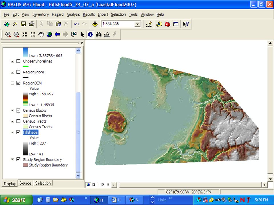
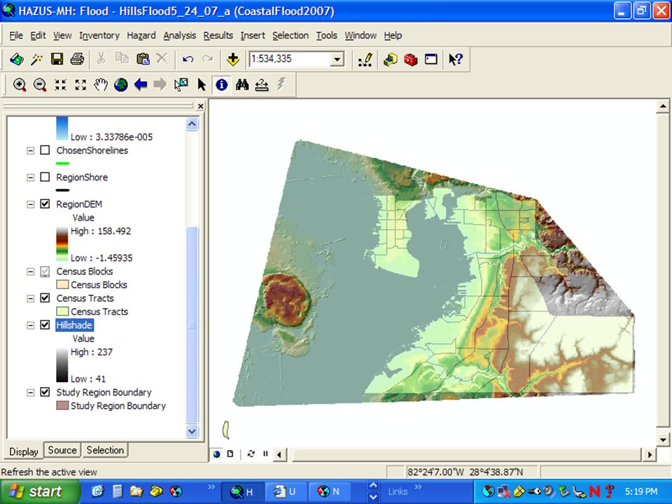
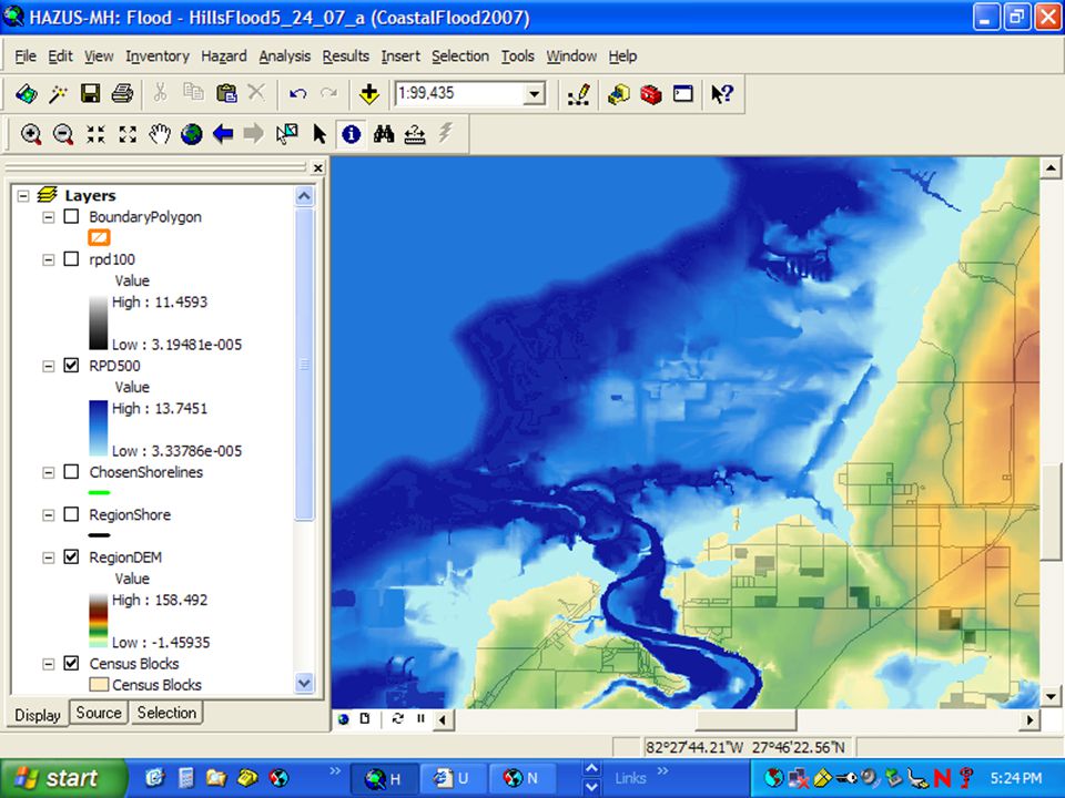
General Plan for Modeling Localized Event for Area Vulnerable to Storm Surge

26
When you zoom into the street level, the results are surprisingly effective at communicating meaning…

27
Where to Go From Here Attend an intro class! Look at output of 2 models by census block Create multipliers for damages (trying to reduce double-counting damages) –Wind Multiplier –Water Multiplier Compare loss of functions for essential facilities for each model and consider use of multipliers (or new ones as required) Compare economic data outputs Refine data and parameters –Housing stock –Essential facilities –Flood model transect data –Flood height data to coincide with potential surge effects in the flood model
 –Wind Multiplier –Water Multiplier Compare loss of functions for essential facilities for each model and consider use of multipliers (or new ones as required) Compare economic data outputs Refine data and parameters –Housing stock –Essential facilities –Flood model transect data –Flood height data to coincide with potential surge effects in the flood model.")
28
General HAZUS Gripes What the heck am I doing?! –Complicated software with nuances between models and need for heavy investment in data generation/quality control for effective use –Easy to misuse or misrepresent output data –Where’s a SLOSH like tool to eliminate double counting effects/damages? Why the secrecy? –Training is infrequent, in few locations, and virtually no basic documents or help via the web –Data protection and proprietary formulas should be guarded, but rest of the process should be as public as possible (no HAZUS 101, Data Management 101, etc. available online) Are we using a sledgehammer to push a thumbtack in? –Most communities need general, quick, reliable data if using to assist in preparedness/response activities…data output is too general for this purpose or to arduous to collect in order to use appropriately Who is the target audience? –Identified as a mitigation tool (planners), marketed at conferences as disaster tool (emergency managers), and model should be run/created as a technical tool (engineers).
 Are we using a sledgehammer to push a thumbtack in. –Most communities need general, quick, reliable data if using to assist in preparedness/response activities…data output is too general for this purpose or to arduous to collect in order to use appropriately Who is the target audience. –Identified as a mitigation tool (planners), marketed at conferences as disaster tool (emergency managers), and model should be run/created as a technical tool (engineers)..")
29
Any Other Concerns/Questions? THANKS FOR YOUR TIME (and for keeping your snoring to a minimum) !
 !")
Similar presentations


 445-6831.>")


 MITIGATION.>")


 and land-use zoning (planning). 2.Give examples of where.>")


