Download presentation
Presentation is loading. Please wait.

1
NAV 3 CHARTS & FLIGHT PLANNING

2
VNC 5000

4
WAC Chart

5
VTA

7
Waldseemuller’s Map of 1507

8
CHARTS Graticule - grid over the globe made up of circles Parallels of Latitude Meridians of Longitude Prime Meridian International Date Line

9
CHARTS Great circle or great circle route will be a circle that cuts through the center of the globe Small circles – all parallels of latitude except the equator All meridians are great circles ADIS ABABA LONDON GREENLAND VANCOUVER

10
MEAN TIME Time between two transits of a meridian is apparent solar day – varies Mean sun travels at assumed constant speed Mean solar day same all year 360 o passes in 24 hours so 24 hr = 360 o 1 hr = 15 o 1 min = 15’ 1 sec = 15” Local mean time set to mid-meridian 15 o

11
Latitude 0 o to 90 o from equator to poles Degrees 0 Minutes ’ Seconds ”

12
Longitude 0 o to 360 o from prime meridian Degrees 0 Minutes ’ Seconds ”

13
Meldrum Bay is at 45 0 55 ’ 35 ” lat 83 0 07 ’ 10 ” long

14
One nautical mile is 6080 feet, a statute mile is 5280 A nautical mile is one minute of arc along a great circle 6080 feet to 5280 feet 70 to 60 1.15 to 1 1 knot is slighter faster than 1 mph 60 knots = about 70 mph

15
Aircraft: Cessna 150 C-GULP White with Red/Orange trim Owner: Yourself c/o Kingston Federal Pen, Kingston, ON Radio equipment: 1 NAV/COM, 1 Transponder with Mode C, 1 ADF receiver ELT: Pointer Sentry Fixed ELT Route: CYGK (Kingston) Direct CYOW (Ottawa). Set heading point will be overhead Kingston Power Setting: Closest to 60% at your cruising altitude of 5,500’ ASL Weather: Assume Standard temperature, Altimeter setting 29.92” Wind at 5,500 ASL forecast to be 220°T at 18 knots Pilot Licence: PA321123 Allow 6 minutes at cruise power for circuit before landing at Ottawa. For start, run-up, takeoff and climb, allow fuel as indicated on the charts. Proposed departure time is 0200 EDT. Complete a flight log and a flight plan for the proposed flight.

17
Measure track at mid meridian

18
FLIGHT PLANNING LOG CYGK Start, t/o 67 NE 13w:101.5 0.8 CYOW 559297 031 220/18 029 13w04211476:403.1 contingency 20% fuel1.9 circuit:060.5 CYGK GULPME22 MAR 01 76 :56 7.8 76 1:26 10.0 :30 2.2 4.5gph

19
MAG vs COMPASS HEADING FROM PLANNING LOG TO FLIGHT LOG INCLUDE DEVIATION (From the magnetic meridian)
")
20
26 92 044 042 114 76 40 10 1415 5500 CYOW 67 O/H CYGK 1405 1454 1414 1405 0056 1501 CYOW 06

21
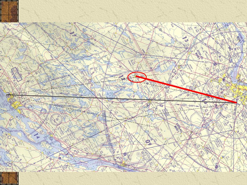
Cross Country #2 Twenty two (22) minutes after setting heading, you pinpoint your position over the town of Perth (N44°54’ W76°15’) What is your groundspeed? What winds are you encountering? What magnetic heading will take you to Ottawa? When will you be overhead Ottawa?

23
Twenty two (22) minutes after setting heading, you pinpoint your position over the town of Perth (N44°54’ W76°15’) 1414 042 1436 042 PERTH 43nm in 22 (E6B 76/39) 1414 042 set heading
 minutes after setting heading, you pinpoint your position over the town of Perth (N44°54’ W76°15’) PERTH 43nm in 22 (E6B 76/39) set heading")
24
What is your groundspeed? When will you be overhead Ottawa? 1414 042 set heading 1436 042 PERTH 43nm in 22 (E6B 76/39)117 1453
")
25
What winds are you encountering? 1414 042 1436 042 PERTH 43nm in 22 (E6B 76/39) 1453 117 Drift left 10 o open 1414 042 set heading
 Drift left 10 o open set heading.")
26
Wind Calculation 1 – actual true track 021 o (031 o – 10 o drift left) and gs 117k
 and gs 117k")
27
Wind Calculation 2 - tas 97k (mag hdg 029 o – mag trk 021 o ) from 8 o right
 from 8 o right")
28
Wind Calculation 3 – 170 o @25

30
What magnetic heading will take you to Ottawa? 1414 042 1436 042 PERTH 43nm in 22 (E6B 76/39) 1453 117 Drift left 10 o open +13 o close 065 1414 042 set heading
 Drift left 10 o open +13 o close set heading.")
31
X XX XX X

32
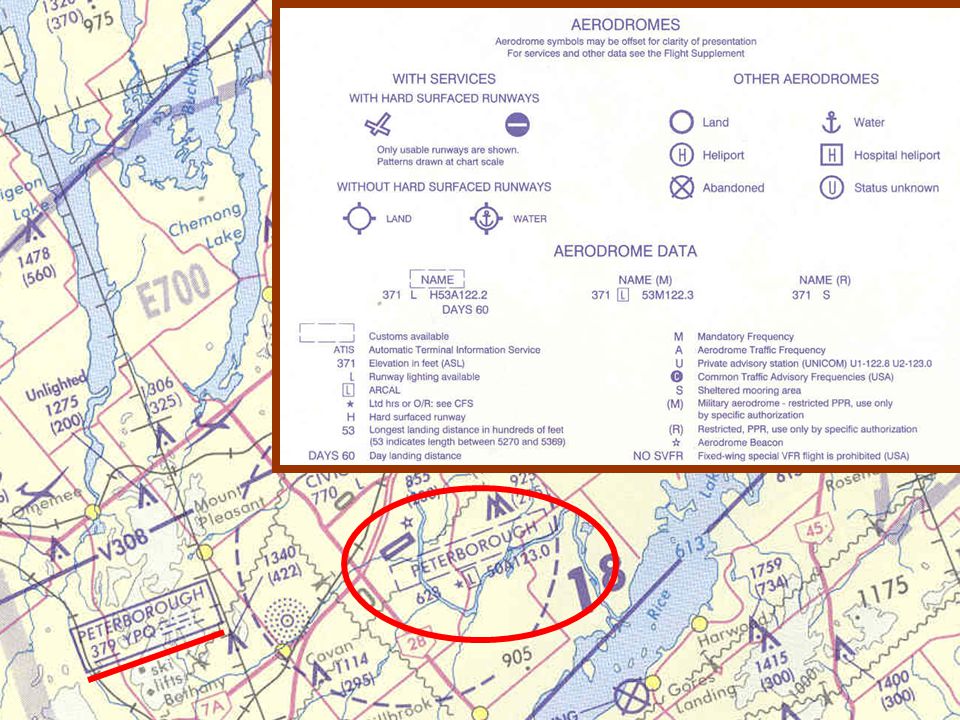
MORE CHART STUFF CYR 511 Military airfield Parachute area Abandoned airfield Isogonic line vs agonic line

35
Landing & CLOSE the flight plan (do you still have the wind in mind?)
")
Similar presentations