Download presentation
Presentation is loading. Please wait.

2
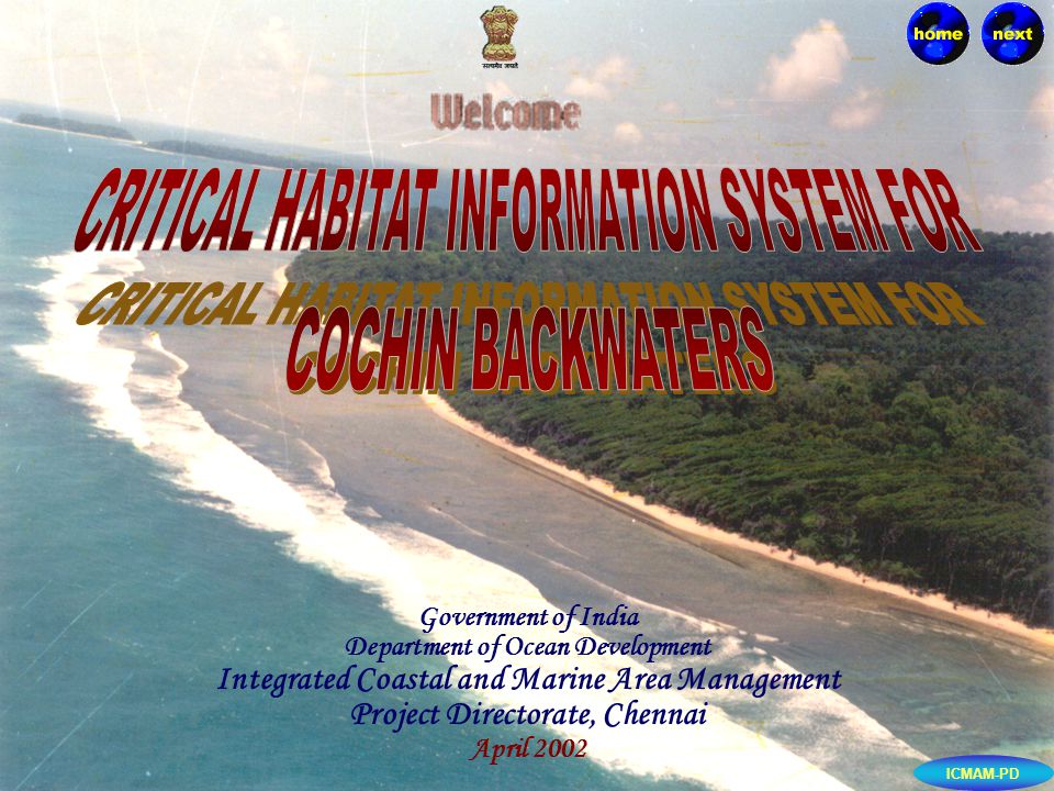
Government of India Department of Ocean Development Integrated Coastal and Marine Area Management Project Directorate, Chennai April 2002 ICMAM-PD

3
About Cochin Backwaters Islands of Cochin Ecological importance Geomorphology Landuse / Landcover Biodiversity of Cochin Backwaters Fishery Resources Mangroves Major threats to Cochin Backwaters Management suggestion Conclusion Programme Physico-Chemical Parameters Water quality parameters - comparison CONTENTS ICMAM-PD

4
School of Marine Sciences, Cochin University of Science and Technology, CochinThis information system has been developed by the ICMAM Project Directorate of DOD under the project "Environment Management Capacity Building" funded by the International Development Association. Primary data on Physico-chemical and biological parameters were collected by School of Marine Sciences, Cochin University of Science and Technology, Cochin during 1998-99.

5
ICMAM-PD The major objective of this study is to create an information system on the resources of Cochin Backwaters in order to help decision makers in effective monitoring and management of the biological wealth of this area. Critical habitat information system for Cochin Backwaters is developed using relational-hybrid Geographical Information System (GIS). A relational hybrid GIS uses the power of GIS to portray the geometry and topology of spatial objects while utilising the strong capabilities of the commercially available RDBMS (like Oracle, Informix, etc) to store voluminous attributes of the spatial data.
. A relational hybrid GIS uses the power of GIS to portray the geometry and topology of spatial objects while utilising the strong capabilities of the commercially available RDBMS (like Oracle, Informix, etc) to store voluminous attributes of the spatial data..")
6
ICMAM-PD The major components in the creation of the information system are A. REMOTE SENSING : A. REMOTE SENSING : IRS IC LISS III data of June 1998 were used and analysed using ERDAS-IMAGINE 8.4 image processing software to study the landuse of this region. B.FIELD SURVEY: B.FIELD SURVEY: Data on physico-chemical and biological parameters were collected in seven stations along the estuarine and neritic zones. C. RELATIONAL DATABASE MANAGEMENT SYSTEMS (RDBMS) : C. RELATIONAL DATABASE MANAGEMENT SYSTEMS (RDBMS) : RDBMS is the acronym for Relational Database Management Systems. All the attribute data collected from the various sources were stored as separate tables in the Oracle database. D. GEOGRAPHICAL INFORMATION SYSTEM (GIS) : D. GEOGRAPHICAL INFORMATION SYSTEM (GIS) : Geographical Information System (GIS) is a system for capturing, storing, checking, manipulating, analysing and displaying data which are spatially referenced to the earth.
 : C. RELATIONAL DATABASE MANAGEMENT SYSTEMS (RDBMS) : RDBMS is the acronym for Relational Database Management Systems. All the attribute data collected from the various sources were stored as separate tables in the Oracle database. D. GEOGRAPHICAL INFORMATION SYSTEM (GIS) : D. GEOGRAPHICAL INFORMATION SYSTEM (GIS) : Geographical Information System (GIS) is a system for capturing, storing, checking, manipulating, analysing and displaying data which are spatially referenced to the earth..")
7
ICMAM-PD The Cochin Backwaters is part of a long chain of lakes and canals extending between 9 40' 12" and 10 10' 46 N and 76 09 52' and 76 23' 57"E with its northern boundary at Azheekodu and southern boundary at Thannirmukham bund. Rivers, Periyar and Muvattupuzha discharge into the backwaters. The Thannirmukham bund regulates the flow from four rivers namely, Meenachil, Manimala, Achankovil and Pamba.

8
ICMAM-PD The islands off Cochin considered for study are Vypeen, Vallarpadam, Bolghatty. The total area of three islands is 56.95 sq.km (SOI toposheet, 1981) with a population of 1,88,251 (1991 census). The population density of these islands is 2158 sq.km. The main occupation of the islanders is fishing and agriculture. VYPEEN ISLAND VALLARPADDAM ISLAND BOLGATTY ISLAND
 with a population of 1,88,251 (1991 census). The population density of these islands is 2158 sq.km. The main occupation of the islanders is fishing and agriculture. VYPEEN ISLAND VALLARPADDAM ISLAND BOLGATTY ISLAND.")
9
ICMAM-PD Vypeen island is the biggest island and is bound by the Arabian Sea on the Western side and the Cochin Backwaters on the eastern side. The total area of the island is about 1.49 sq.km.The inter-island accessibility is only through boats. However, bus services are available within the island. VALLARPADAM ISLAND BOLGATTY ISLAND VYPEEN ISLAND IN COCHIN BACKWATERS

10
ICMAM-PD Vallarpadam lies between Vypeen and Bolghatty islands and covers an area of about 2.8 sq.km. VALLARPADDAM ISLAND BOLGATTY ISLAND VALLARPADDAM ISLAND IN COCHIN BACKWATERS

11
ICMAM-PD The Bolghatty island is a long narrow palm fringed island and is easily accessible from the mainland by boats. The Bolghatty palace is situated here amidst 15 acres of lush green lawns built by the Dutch. The total area of the island is 2.61 sq.km. VALLARPADAM ISLAND VYPEEN ISLAND BOLGATTY ISLAND IN COCHIN BACKWATERS

12
ICMAM-PD The Salinity gradient in the Cochin Backwaters supports diverse species of flora and fauna according to their tolerance for salinity. This tropical estuary with high productivity acts as a nursery ground for many marine and estuarine finfish, molluscs and crustaceans. The low-lying swamps and tidal creeks with sparse patches of mangroves provide shelter to juveniles of many important species. The areas of backwaters with fine sediments and rich organic matter support abundant and diverse benthic fauna. The changes in the hydrology of the backwaters controlled by the seas play an important role in regulating the migrant fauna of the estuary.

13
ICMAM-PD The Cochin Backwaters is a coastal plain and topographically a low lying area. It is characterised by its long axes running parallel to the coast and is separated from the sea by barrier spits interrupted by tidal passes. It has a free permanent connection with the sea. It has three dredged channels namely the approach channel oriented along east-west direction and the two inner channels located on either side of the Willingdon Island.

14
ICMAM-PD The area around Cochin Backwaters comprises a variety of landuse/landcover classes such as Agriculture, aquaculture, plantations, wasteland, human settlement, etc. Agriculture is one of the major occupations in this region. Coconut plantation is the dominant vegetation, with paddy, red gram, groundnut, maize, millets, tapioca, cereals, banana and papaya are grown successfully as intercrops. It also supports intense shrimp farming activities. The traditional system of shrimp farming is carried out on paddy fields adjacent to the Vembanad lake (Pokkali fields). M ajor Landuse categories as classified using IRS ID Reclamation of Cochin Backwaters over the decades Landuse/Landcover around Cochin Backwaters
. M ajor Landuse categories as classified using IRS ID Reclamation of Cochin Backwaters over the decades Landuse/Landcover around Cochin Backwaters.")
15
ICMAM-PD The major landuse categories as classified using IRS ID satellite imagery are tabulated below. S.noLanduse / Landcover Area (sq.km) 1.Backwater 132.0 2.Built-Up area133.0 3.Beach 4.5 4.Aquaculture 31.0 5.Fallow Land 7.0 7.Settlement & Vegetation Mixed854.0 8.Agriculture (Paddy field) 4.5 9.Agri.Plantation132.0 10.Waste land 12.0 11.Wetland 65.0 The results from the present study showing reduction in the Backwaters and increase in island areas are shown below. Toposheet Satellite data (SOI, 1981) (IRS IC, LISS III) Backwaters157.00132.00 Vypeen island 51.49 56.02 Vallarpadam 2.85 4.23 Bolghatty 2.61 2.34 TOTAL213.95194.59
 1.Backwater Built-Up area Beach Aquaculture Fallow Land Settlement & Vegetation Mixed Agriculture (Paddy field) Agri.Plantation Waste land Wetland 65.0 The results from the present study showing reduction in the Backwaters and increase in island areas are shown below. Toposheet Satellite data (SOI, 1981) (IRS IC, LISS III) Backwaters Vypeen island Vallarpadam Bolghatty TOTAL")
16
ICMAM-PD Cochin Backwaters has been experiencing high level of anthropogenic pressure during the last five decades. The area of Backwaters in 1912 was 315 sq.km which has shrunk to 157 sq.km during 1989 (SOI Toposheet). As per the satellite data of 1998 it has reduced to 132 sq.km. Large areas have been reclaimed for harbour and urban development. The reclamation of Cochin Backwaters over the decades for various purposes is given below. PERIOD AREA RECLAIMEDPURPOSE (ha) 1834-19032227Agriculture 1912-19315253Agriculture 1920-1936364Willington Island 1941-19501325Agriculture Till 19705100Paddy-cum-shrimp Culture 1970-1984800Paddy-cum-shrimp culture 19756900Bunding at Thannirmukham 197811Fishing harbour 1981-1985142Vallarpadam-Ramanthuruthu, Candle Island 1981-1985142Southern extension to Willington Island 1981-198524Urban development 1981-198512Cochin Shipyard and tanker berth
. As per the satellite data of 1998 it has reduced to 132 sq.km. Large areas have been reclaimed for harbour and urban development. The reclamation of Cochin Backwaters over the decades for various purposes is given below. PERIOD AREA RECLAIMEDPURPOSE (ha) Agriculture Agriculture Willington Island Agriculture Till Paddy-cum-shrimp Culture Paddy-cum-shrimp culture Bunding at Thannirmukham Fishing harbour Vallarpadam-Ramanthuruthu, Candle Island Southern extension to Willington Island Urban development Cochin Shipyard and tanker berth.")
17
ICMAM-PD TEMPERATURE The average atmospheric temperature ranged from 23.8° C to 34.52° C with minimum and maximum values in January and May respectively.HUMIDITY The average relative humidity values varied from 77.09% in January to 93.66% in September.RAINFALL The climate is typical of tropical areas. The average monthly rainfall (south-west monsoon) during 1998 ranged from 5 mm in March to 649 mm in September and the rainfall from the north-east monsoon was negligible.TIDES Cochin estuary has a perennial connection with the Arabian sea near the main entrance of Cochin harbour. This region is subjected semi-diurnal tidal influence with a maximum range of about 1m.CURRENT The maximum speed of the flood current varied from 1 to 1.5 knots, while the ebb current always have a greater intensity and during the monsoon months it varies from 2.5 to 3.5 knots.
 during 1998 ranged from 5 mm in March to 649 mm in September and the rainfall from the north-east monsoon was negligible.TIDES Cochin estuary has a perennial connection with the Arabian sea near the main entrance of Cochin harbour. This region is subjected semi-diurnal tidal influence with a maximum range of about 1m.CURRENT The maximum speed of the flood current varied from 1 to 1.5 knots, while the ebb current always have a greater intensity and during the monsoon months it varies from 2.5 to 3.5 knots..")
18
ICMAM-PD The salinity in Cochin Backwaters varied across three distinct periods in an year (i) a period of low salinity (June-September), (ii) a period of gradual rise in salinity (October -January) and (iii) a period of high salinity (February to May). The low values were observed in Backwater region and high values in neritic zone (near barmouth). During south-west monsoon, the entire Backwaters became a freshwater zone barring the barmouth. In neritic zone (near barmouth) there was a stratification in the surface layer with a low salinity and bottom layer with a high salinity, showing an increase in salinity with depth.
. During south-west monsoon, the entire Backwaters became a freshwater zone barring the barmouth. In neritic zone (near barmouth) there was a stratification in the surface layer with a low salinity and bottom layer with a high salinity, showing an increase in salinity with depth..")
19
ICMAM-PD The dissolved oxygen content of the surface water did not show much fluctuation though realtively higher oxygen values were found during the monsoon season. DO in the surface waters varied from 3.9 to 5.27 mg/l (pre -monsoon), 3.59 to 5.39 mg/l (monsoon) and 3.44 to 5.59 mg/l (post monsoon).
, 3.59 to 5.39 mg/l (monsoon) and 3.44 to 5.59 mg/l (post monsoon)..")
20
ICMAM-PD The water column has maximum suspended materials during the monsoon period, but this quantity declines progressively during the post- monsoon and pre-monsoon months. Short-term changes induced by the tidal currents are quite large and during the pre-monsoon and post- monsoon months the total material transported from sea into the backwater amounts approximately to 900 tonnes/day.

21
ICMAM-PD Nitrite The nitrite concentration ranged from 0.20 to 1.63 in pre-monsoon, 0.14 to 1.27 µmol/l in monsoon and 0.07 to 0.4 in post- monsoon season. Nitrate Nitrate content in water varied from 5.25 to 11.8 in pre-monsoon, 0.80 to 7.86 umol/l in monsoon, and 0.92 to 19.16 in post- monsoon. The concentration of nitrate was high in estuarine zone compared to neritic environment due to fresh water input in the backwater region. Phosphate Phosphate content varied from 1.02 to 4.92 umol/l in pre- monsoon, 1.84 to 17.7 µ mol/l in monsoon and 0.44 to 3.29 in post- monsoon season. Silicate Silicate content varied from 62.87 to 410.78 µ mol/l in pre- monsoon, 139.6 to 717.4 in monsoon and 5.7 - 51.0 in post-monsoon period. The concentration of nitrate, nitrite, phosphate and silicate exhibited pronounced seasonal variation and also indicated large inputs from industrial units, sewage waste and agricultural run offs. On the northern parts of the estuary high values during monsoon suggests the presence of an external input source.

22
ICMAM-PD Petroleum hydrocarbon values recorded in the Cochin Backwaters ranged from 0.09 – 70.23 gm/l in monsoon season and 6.65 – 17.9gm/l in the post- monsoon season. The maximum values were recorded during monsoon season at the barmouths of Cochin (42.92 gm/l) and Azheekodu region (70.23 gm/l). This is associated with shipping, fishing vessel operation, transportation, urban run-off, accidental spillages during tanker operations, etc.
 and Azheekodu region (70.23 gm/l). This is associated with shipping, fishing vessel operation, transportation, urban run-off, accidental spillages during tanker operations, etc..")
23
ICMAM-PD As per the Environmental (Protection) Act, 1985 (29 of 1986), the Cochin Backwaters have been classified under the Ecologically Sensitive Zone. In the following table the water quality of Cochin Backwaters is compared against the standards set for the SW-I waters by Ministry of Environment and Forests. S.No 1. 2. 3. 4. 5. Hydrological Parameters pH range Dissolved Oxygen Suspended Solids Lead Cadmium Standards set by MoEF 6.5 – 8.5 3.5 – 5.0 mg/l None from sewage and industrial effluents 0.01 g/l In Cochin Backwaters 6.5 – 8.6 3.44 to 5.59 mg/l 3.3 – 35.16 mg/l 0.008 g/l 1.26 g/l Remarks Within permissible limits High values observed due to Sedimentation, sewage and industrial effluents predominantly in the Cochin Barmouth area Very high values observed in the Cochin Harbour area Very high values observed in the Cochin Harbour area

24
ICMAM-PD Cochin Backwaters support diverse species of flora and fauna. Totally 685 species of flora and fauna comprising 194 species of Phytoplankton, 135 species of zooplankton, 199 species of benthos, 150 species of fishes and 7 species of mangroves were recorded between 1958 and 1997. BIODIVERSITY – REVIEW OF LITERATURE GROUP No. of species recorded (1958-1997) PHYTOPLANKTON194 ZOOPLANKTON Coelenterata 39 Cladocera 4 Copepoda47 Ostracoda 7 Mysidacea 2 Cumacea 2 Tanaidacea 2 Isopoda 1 Amphipoda 7 Decapoda16 Chaetognatha 5 Tunicata 1 Molluscan larvae 2 GROUP No. of species recorded (1958-1997) BENTHOS Foraminifera52 Coelenterata6 Polychaeta64 Crustacea48 Mollusca29 PISCES150 MANGROVES7 TOTAL685
 PHYTOPLANKTON194 ZOOPLANKTON Coelenterata 39 Cladocera 4 Copepoda47 Ostracoda 7 Mysidacea 2 Cumacea 2 Tanaidacea 2 Isopoda 1 Amphipoda 7 Decapoda16 Chaetognatha 5 Tunicata 1 Molluscan larvae 2 GROUP No. of species recorded ( ) BENTHOS Foraminifera52 Coelenterata6 Polychaeta64 Crustacea48 Mollusca29 PISCES150 MANGROVES7 TOTAL685.")
25
ICMAM-PD In the current study (1998-99), 123 species of phytoplankton were recorded, comprising 89 species of Bacillariophyceae, 31 species of Dinophyceae, 2 species of Chlorophyceae and one species of Cyanophyceae. The density of phytoplankton varied from 33 to 10275 cells/l in estuary and 34 to 395 cells/l in neritic zone. The species diversity of Phytoplankton varied in estuarine and neritic regions. The dominant species were Asterionella japonica, Bacteriastum delicatalum, B.elongatum, B. hyalinum, Biddulphia mobiliensis, Pleurosigma sp, Thalassiosira sp, Chaetoceros, Coscinodiscus, Dinophysis, Fragilaria, Noctiluca, Oscillatoria, Pediastrum and Volvox. During pre-monsoon, the phytoplankton production in the estuary was high and fairly stable. During monsoon the flora was mostly freshwater species of the genera Pedorina, Volvox, Pediastrum and Desmedium. During post-monsoon gradually the freshwater species disappear coinciding with the predominance of marine forms. - -

26
ICMAM-PD In the present study (1998-99), 24 species of Zooplankton were recorded, comprising 14 species of Calanoida, 2 species of Cladocera, 3 species of Cyclopoida, one species each of Amphipoda, Aphragmophora, Cydippida, Decapoda, and Myodocopina. The copepods constitute one of the dominant taxa of zooplankton. Both diversity and abundance of the zooplankton were high during pre-monsoon and post-monsoon seasons. The dominant species of copepods are Sapphirna, Eucalanus, Acartia, Acrocalanus, Classocalanus, Oithona, Pseudodiaptomus, Paracalanus and Limura, sp.

27
ICMAM-PD In the present study (1998-99), 24 species of benthic organisms were recorded in estuarine and neritic zones of Cochin Backwaters. The qualitative distribution of macrobenthos is given below: Groups Monsoon Post-Monsoon Pre-MonsoonOverall EstuarineNeriticEstuarineNeriticEstuarine Neritic Crustacea 2 - 4 - 3 1 5 Polychaeta 7 5 9 9 9 10 16 Bivalves - - - 1 1 2 2 Echinoidea - - - - 1 - 1 In the past, 92 species were recorded, comprising 33 species of polychaetes, 28 sp. of crustaceans and 15 species of molluscs. The nature of substratum is another important factor in the distribution of macrofauna where clay bottom (organic matter 1.5-6%) supports poor fauna, whereas areas with sand, silt and clay in equal proportions support dense and diverse benthic populations. However, during the present study restricted to only one year, only a few species were recorded. Distribution of benthic fauna in Cochin Backwaters
 supports poor fauna, whereas areas with sand, silt and clay in equal proportions support dense and diverse benthic populations. However, during the present study restricted to only one year, only a few species were recorded. Distribution of benthic fauna in Cochin Backwaters.")
28
ICMAM-PD Totally 150 species of fishes belonging to 100 genera under 56 families were identified from Cochin Backwaters. The fish which inhabit the different zones of the estuary are oligohaline (23 species) and the truly estuarine fishes (38 species). Fishery Resources as recorded from the landing centres is given in the Table. (Catches in Kg)
 and the truly estuarine fishes (38 species). Fishery Resources as recorded from the landing centres is given in the Table. (Catches in Kg).")
29
ICMAM-PD Fishing in the Cochin Backwaters is done by using an incredibly complex array of fishing gears. The operation of different types of gear starts from post-monsoon season and attains its peak during the pre- monsoon season. Stake nets and dipnets accounted for 73% of the total landings. The contribution from gill nets, seines, castnets and other indigenous fishing methods are 10%, 4%, 2% and 11% respectively. Stake nets and dipnets are almost confined to the northern sector (Cochin estuary). The major part of the landings is obtained from gill nets (34%), seines (25%) and cast nets (19%). Chinese dipnet
. The major part of the landings is obtained from gill nets (34%), seines (25%) and cast nets (19%). Chinese dipnet.")
30
ICMAM-PD Shrimps form a major constituent of the marine fish landing in India. Of this, a majority of penaeid shrimp is harvested from the Kerala coast. In the estuarine and backwaters of Kerala, M.dobsoni is the dominant species contributing to the capture as well as the traditional culture fisheries. The following species of shrimps are common. They are Metapenaeus dobsoni, M. affinis, M. monoceros, Penaeus indicus, P.semisulcatus, P.monodon, P. canaliculatus, Acetes indicus and A.erythraeus.

31
ICMAM-PD Cochin Backwaters also support rich crab fisheries. The economically important species are Scylla serrata (mud crabs), Portunus pelagicus and P.sanguinolentus, which constitute 4% of the exploited fishery resources of Cochin Backwaters yielding an annual production of 25.5, 22.01 and 10.5 tonnes, respectively. Crabs are obtained as by-catch in shore seines, boat seines, gill nets, cast nets, drag nets and stake nets used for finfishes. Scylla serrata
, Portunus pelagicus and P.sanguinolentus, which constitute 4% of the exploited fishery resources of Cochin Backwaters yielding an annual production of 25.5, and 10.5 tonnes, respectively. Crabs are obtained as by-catch in shore seines, boat seines, gill nets, cast nets, drag nets and stake nets used for finfishes. Scylla serrata.")
32
ICMAM-PD The molluscan fishery of the Cochin Backwaters is exclusively sustained by the black-clam Villorita cyprinoides. The other dominant species like V.cyprinoides var Cochinnensis, V.cyprinoides var delicatula, V.cornulopia, Meretrix meretrix, M.casta var ovum and Paphia malabarica are also distributed in the Cochin Backwaters. The peak clam landing is registered during the months of May and October. However, the exploited clam resources show a declining trend over theyears; This is attributed to the increased and indiscriminate fishing practices resulting in disturbances in spat settlement, mass removal of the undersized clams, and pollution hazards from coconut husk retting grounds and industrial pollutants. Meretrix meretrix Villorita cyprinoides Paphia malabarica Katelysia opima

33
ICMAM-PD In Kerala, the mangrove vegetation is found in Cochin, Vembanad, Quilon, Trivandrum, Cannanore, Kozhikode and Kottayam covering an area of 16 sq.km, of which 6.9 sq.km is in and around the Cochin Backwater region. Mangrove species occur sparsely on the islands of Vypeen, Vallarpadam, and Bolghatty. The dominant mangrove species in Cochin Backwaters are Avicennia marina, A.officinalis, Exoecaria agallocha, Clerodentron sp., Aegiceras corniculatum, Rhizopora apiculata and Acanthus ilicifolius. Mangroves

34
ICMAM-PD 1.Reclamation of backwaters for various developmental purposes 2. Construction of Thannirmukham bund 3. Siltation 4. Sewage disposal 5. Pollution due to coconut husk retting activities 6. Industrial pollutants 7. Over-exploitation of resources.

35
ICMAM-PD For conservation and management of these habitats and sustainable development of resources, the following are recommended : Strict enforcement of the fisheries regulation to cover the seasonal and mesh size restrictions. To regulate and monitor industrial pollution in Periyar river bed. To ban the collection of natural shrimp seed and under sized clam. Sea ranching of commercially threatened species like clams (Villorita cyprinoides and Paphia malabarica) for sustainable utilisation. Conducting of training and awareness programmes to coastal communities for community based resource management. To update the fishery regulation from time to time on scientific basis. To control the reclamation activities & sewage disposal in and around the backwater region. To regulate and monitor coconut husk retting activities in the Cochin Backwaters.
 for sustainable utilisation. Conducting of training and awareness programmes to coastal communities for community based resource management. To update the fishery regulation from time to time on scientific basis. To control the reclamation activities & sewage disposal in and around the backwater region. To regulate and monitor coconut husk retting activities in the Cochin Backwaters..")
36
This Information system can be used as a baseline to conduct monitoring of biodiversity in future. Studies show that there is a decrease in the backwater area and floral and faunal diversity due to anthropogenic effect and increased human activities like construction of dams, barriers, reclamation etc. However, long-term studies on shore-line changes, bathymetry and biodiversity, etc need to be carried out using effective standard methodology to supplement the basic information provided in the information system. This information system developed using remote sensing and GIS has demonstrated that these scientific tools could be effectively used for monitoring and management of coastal resources of the Cochin backwaters. ICMAM-PD

Similar presentations


 Motion Controller Design for A Class of Second-order Systems Center for Self-Organizing Intelligent.>")


