Download presentation
Presentation is loading. Please wait.

1
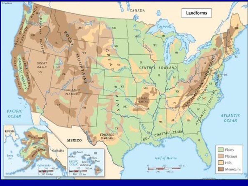
TYPES of LANDFORMS Plains : large flat land areas
Plateaus : elevated flat land areas Mountains : high elevated landmass

3
Plains Coastal Plains Interior Plains

4
Plateaus

5
Mountains

6
Folded Mountains

7
Upwarped Mountains

8
Black Hills of South Dakota

10
Fault-Block Mountains

11
Grand Tetons of Wyoming

12
Volcanic Mountains

13
Mount Shasta

14
Mount St. Helens

15
Latitude Lines Run East and West
Help locate places North and South of the Equator Also called PARALLELS since all lines are parallel to each other

16
Important Latitude Lines
0 degrees is the Equator 23 ½ degrees north is the tropic of cancer 23 ½ degrees south is the tropic of capricorn 66 ½ degrees north is the artic circle 66 ½ degrees south is the antarctic circle 90 degrees north is the north pole 90 degrees south is the south pole

17
North Pole

18
South Pole

19
How were the lines of Latitude determined ?

24
Run north and south Help locate place that are east and west of the prime meridian Also called meridians and intersect at the poles Longitude Lines

25
Prime Meridian 0 degrees Longitude Starting point for
measuring longitude Runs through Greenwich, England

27
The Royal Observatory Greenwich, England

28
International Date Line
This is where the day officially begins and ends. It is the 180th meridian. East meets West.

29
How were the lines of Longitude determined ?

30
How is your time of day determined ?

31
United States Time Zones

32
Types of Map Projections
Mercator : Latitude lines are parallel Longitude lines are parallel Used for surface navigation Polar : Latitude lines appear as circles Used to study the polar regions Conic : Shows detailed information of small areas EX. Road & Weather Map

33
Mercator Projection

34
Polar Projection

35
Conic Map Projection

36
Topographic Maps Show elevation by using contour lines
Show landscape features such as mountains, hills, lakes, and rivers Show cultural features such as roads, bridges, and important buildings

39
Rules of Contour Lines They join points of equal elevation
They never cross They are close together when there is a hill or steep slope They form a “V” whenever crossing a stream or river that points upstream

40
Hachures : lines drawn on the inside of a contour line that indicate a depression
Contour interval : how much the elevation changes between 2 adjacent contour lines Relief : how much change in elevation an area has Ex. High or rugged – mountains ; large contour interval Ex. Low or gentle – plain/flat land ; small contour interval

Similar presentations