Download presentation
Presentation is loading. Please wait.

1
Finding Locations on Earth Chapter 3

2
Latitude Latitude is the angular distance north or south of the equator. Run parallel to the equator. Called parallels because they run east and west around the world. Measured in degrees. Degrees North of the equator and Degrees South of the equator. Can be more precise using minutes and seconds. Example: Washington D.C. = 38°53’51”N.

3
Longitude Longitude is the angular distance, measured in degrees, east or west of the prime meridian. (Greenwich, England 0°.) Meridians are used to establish east and west locations. They run north and south, perpendicular to the equator. Degrees East of the prime meridian and Degrees West of the prime meridian. Washington D.C. = 77°0’33”W. It’s exact location is 38°53’51”N, 77°0’33”W.
 Meridians are used to establish east and west locations. They run north and south, perpendicular to the equator. Degrees East of the prime meridian and Degrees West of the prime meridian. Washington D.C. = 77°0’33 W. It’s exact location is 38°53’51 N, 77°0’33 W..")
4
Finding Direction Magnetic compass. The compass indicates direction because the Earth has magnetic properties. Important to find True North when creating a map or for use in navigation. True North can be slightly different due to the location of the geomagnetic north pole versus the geographic north pole. GPS System

5
Mapping the Earth’s Surface Cartography- the science of map making. Map Projection- a flat map representing the three-dimensional curved surface of a globe. Three types of map projections: Cylindrical, azimuthal, and conic.

6
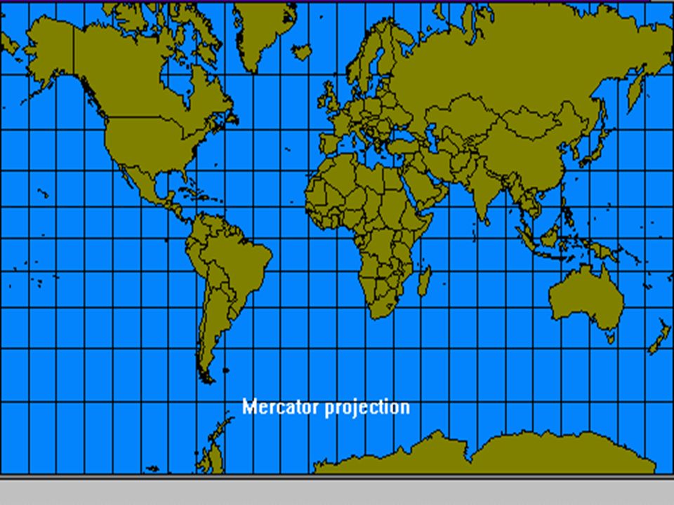
Cylindrical or Mercator Longitude and latitude are on a grid. It is easy to locate positions using a ruler. The farther locations are from the equator, the more distorted in size they become.

8
Azimuthal Great help in using this type of projection for use in air travel. (Helps in finding the shortest distance between two points.) Can cause distortion in direction and distance.
 Can cause distortion in direction and distance..")
10
Conic A series of conic projections can be used to create a flat map.

11
Reading a Map Maps have symbols for a variety of features. Symbols are explained in the legend of the map. Maps are drawn to scale. The scale is the relationship between actual distance and the distance on the map.

13
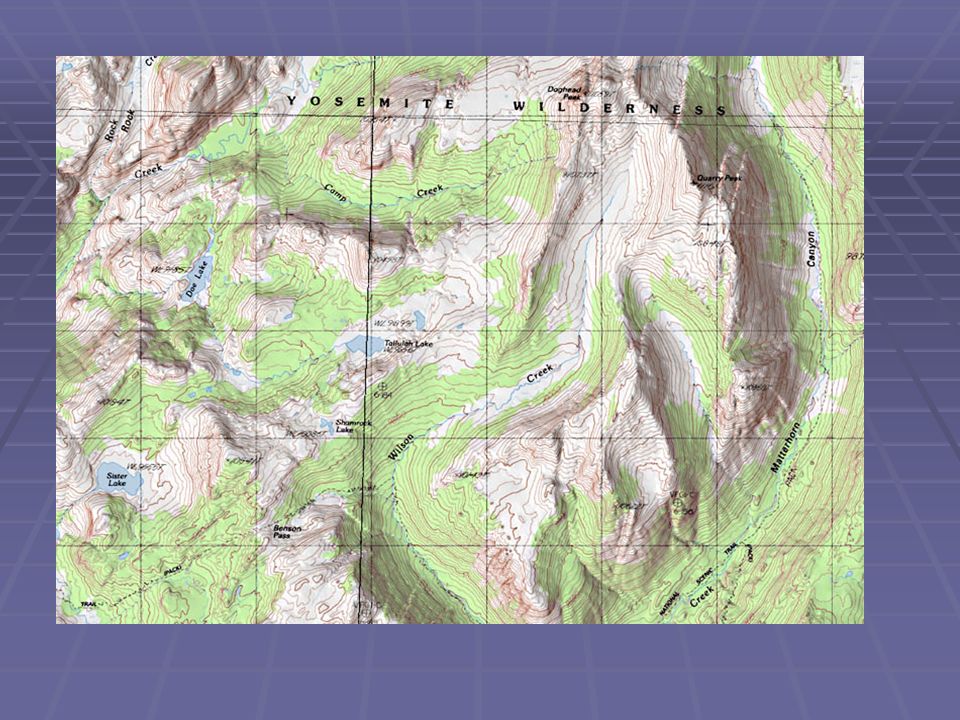
Topographic Map Topographic maps show surface features or topography. Show natural features such as mountains and rivers, but can also show manmade features such as buildings and roads.

15
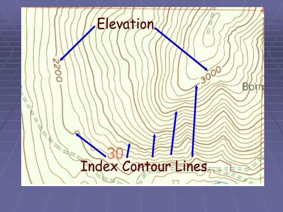
Topographic Map Characteristics: Elevation: height above sea level. Contour Lines: lines on the map used to show elevation. -the shape of the contour lines reflects the shape of the land. Contour Interval: difference in elevation between one contour line and the next. Relief: difference in elevation between the highest and lowest points being mapped. Index Contours: every fifth contour line is printed in bold.

16
Contour Lines that form closed loops indicate a hilltop or a depression. Depression Contours: are marked with short, straight lines.

17
Closely spaced contour lines indicate the change in elevation is rapid and that the slope is steep. Widely spaced contour lines indicate the change in elevation is gradual or the land is flat. Contour lines that bend and form a “V” indicate a valley. If a stream flows through a valley, the “V” in the contour lines will point towards the direction from which the water flows.

Similar presentations


 W (Want to know) L (What I learned) Warm up- take out a piece of paper and do the “K” and the “W” for the above topic.>")


