Download presentation
Presentation is loading. Please wait.

1
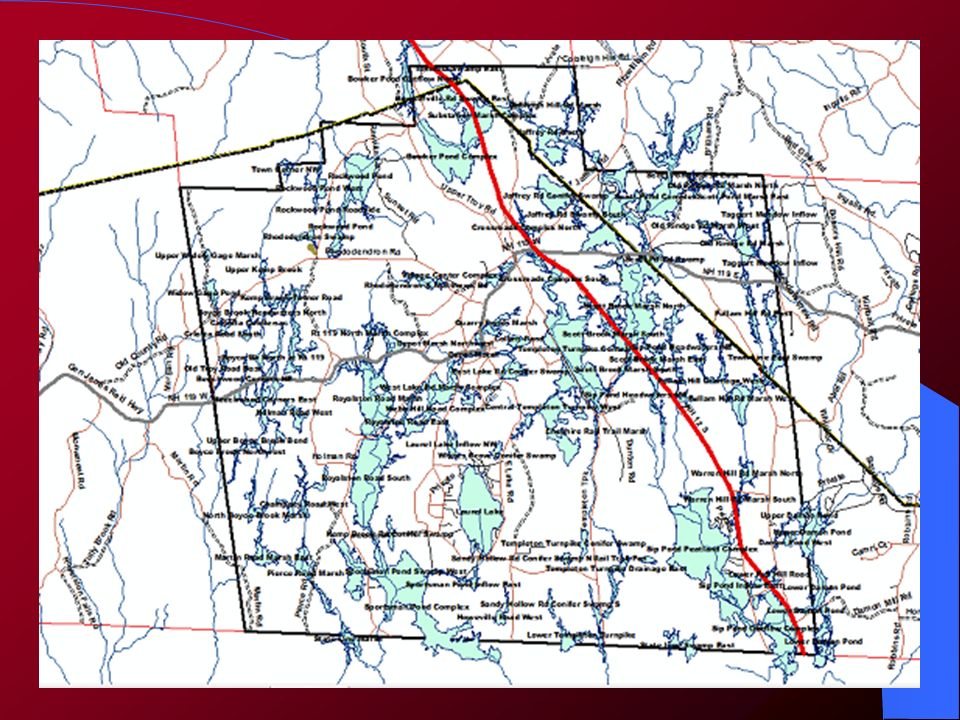
PRIME WETLAND STUDY OF FITZWILLIAM – INITIAL FINDINGS Dr. Rick Van de Poll Ecosystem Management Consultants Sandwich NH

2
Fitzwilliam Prime Wetland Study 1) Identification & Mapping 2) Classification 3)Assessment of Functions & Values 4)Conservation & Restoration Recommendations
 Identification & Mapping 2) Classification 3)Assessment of Functions & Values 4)Conservation & Restoration Recommendations")
3
Wetland Identification & Mapping NWI Total Acreage: 3714 acres Number of map units: 565 Min. Size:.06 acres Max. Size: 177.4 acres Ave. Unit Size: 6.58 acres HYDRIC SOILS Total Acreage: 5721 acres Amount of PD Soil: 1976 ac. Amount of VPD Soil: 2911 ac. Amount of WATER: 834 ac. Ave. Unit Size: 17.7 acres Wetland Statistics to Start Fitzwilliam: 23060 acres

4
Wetland Identification & Mapping In Town Only Total Acreage: 4432 acres Number of map units: 2359 Min. Size:.0003 acres Max. Size: 236.5 acres Ave. Unit Size: 1.88 acres All Contiguous Wetlands Total Acreage: 4862 acres Number of map units: 2674 Min. Size:.0003 acres Max. Size: 144.8 acres Ave. Unit Size: 1.13 acres Wetland Statistics - API Fitzwilliam: 23060 acres

5
Wetland Identification & Mapping In Town Only Amount Undetermined: 1905 ac. Amount of PD Soil: 590 ac. Amount of VPD Soil: 1331 ac. Amount of WATER: 552 ac. Amount of Upland Islands: 54 ac. (N = 125) All Contiguous Wetlands Amount Undetermined: 2018 ac. Amount of PD Soil: 648 ac. Amount of VPD Soil: 1482 ac. Amount of WATER: 654 ac. Amount of Upland Islands: 61 ac. (N = 154) Wetland Statistics - API Fitzwilliam: 23060 acres
 All Contiguous Wetlands Amount Undetermined: 2018 ac. Amount of PD Soil: 648 ac. Amount of VPD Soil: 1482 ac. Amount of WATER: 654 ac. Amount of Upland Islands: 61 ac. (N = 154) Wetland Statistics - API Fitzwilliam: acres.")
6
Fitzwilliam Wetlands - NWI

7
Fitzwilliam Wetlands – Hydric Soils

8
Fitzwilliam Wetlands – API

9
Sample Wetlands Map - NWI

10
Sample Wetlands Map – Hydric Soils

11
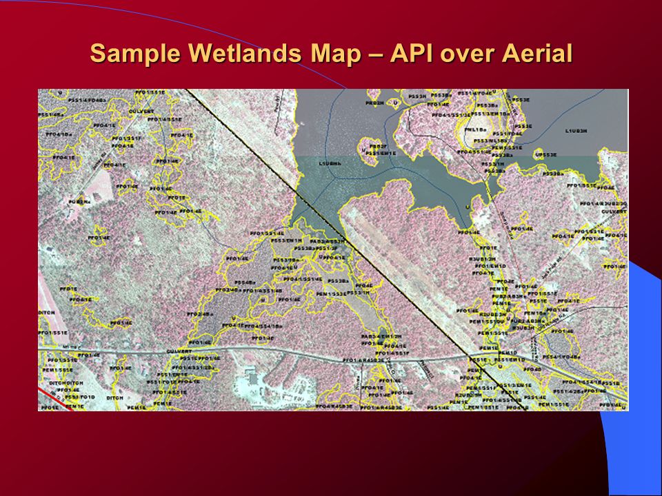
Sample Wetlands Map – API

12
Sample Wetlands Map – API over NWI

13
Sample Wetlands Map – API over Aerial

15
Wetland Evaluation Units Based on the NH Method of determining discrete wetland assessment units All wetland units that are hydrologically connected are treated together, unless: – They narrow to less than 50 feet in width – Are crossed by a major road – Are otherwise blocked in part that prevents adequate continuance of wetland function

16
Wetlands Assessment – Point Ranking Based on basic attributes of each wetland evaluation unit (WEU) Configured on actual, mapped cover classes and soil types Includes basic parameters at right: # of NWI types # of soil types % hydric A soils % hydric B soils % open water % upland islands # of wetland type units Size
 Configured on actual, mapped cover classes and soil types Includes basic parameters at right: # of NWI types # of soil types % hydric A soils % hydric B soils % open water % upland islands # of wetland type units Size")
17
WEU’s 92 wetland evaluation units identified Smallest: 2.7 acres – Rockwood Pond Roadside Largest: 347 acres – Sip Pond Peatland Complex Mean: 47 acres

20
Wetlands Assessment – Point Ranking Point Values 0 – 11 based on each attribute category, e.g. # 9) Point Range: 0 – 4 0 – WEU lies outside of any protected area in town 1 – WEU lies partly within a private conservation area 2 – WEU lies partly within a public (i.e. town) conservation area 3 – WEU lies wholly within a private conservation area 4 – WEU lies wholly within a public (i.e. town) conservation area 1) Adjacent to water? 2) In active floodplain? 3) Overlying an aquifer? 4) Within unfragmented land block > 500 acres? 5) Within highest ranked WAP habitat type? 6) NWI cover class interspersion? 7) Presence of rare or endangered species of nat. communities? 8) Within significant ecological area? 9) Long-term sustainability?
 Point Range: 0 – 4 0 – WEU lies outside of any protected area in town 1 – WEU lies partly within a private conservation area 2 – WEU lies partly within a public (i.e. town) conservation area 3 – WEU lies wholly within a private conservation area 4 – WEU lies wholly within a public (i.e. town) conservation area 1) Adjacent to water. 2) In active floodplain. 3) Overlying an aquifer. 4) Within unfragmented land block > 500 acres. 5) Within highest ranked WAP habitat type. 6) NWI cover class interspersion. 7) Presence of rare or endangered species of nat. communities. 8) Within significant ecological area. 9) Long-term sustainability .")
21
Point Ranking Table (sample)
")
22
Final NH Method Assessment of Functions & Values 1) Ecological Integrity 2) Wetland-dependent Wildlife Habitat 3) Fish & Aquatic Life Habitat 4) Scenic Quality 5) Educational Potential 6) Wetland-based Recreation 7) Flood Storage Potential 8) Groundwater Recharge 9) Sediment Trapping 10) Nutrient Transformation 11) Shoreline Anchoring 12) Noteworthiness
 Ecological Integrity 2) Wetland-dependent Wildlife Habitat 3) Fish & Aquatic Life Habitat 4) Scenic Quality 5) Educational Potential 6) Wetland-based Recreation 7) Flood Storage Potential 8) Groundwater Recharge 9) Sediment Trapping 10) Nutrient Transformation 11) Shoreline Anchoring 12) Noteworthiness")
23
Wetland Project Next Steps Finish NWI & Soil Type Mapping Finish NWI & Soil Type Mapping Apply points for Point Rank Assessment Apply points for Point Rank Assessment Select “first cut” of highest ranked wetlands for complete NH Method assessment Select “first cut” of highest ranked wetlands for complete NH Method assessment Finalize NH Method evaluation Finalize NH Method evaluation Submit nominees for consideration as candidate prime wetlands Submit nominees for consideration as candidate prime wetlands

Similar presentations


 Ramsar Convention on Wetlands (www.ramsar.org) Convention on Wetlands “The conservation and wise use of.>")


