Download presentation
Presentation is loading. Please wait.

1
Vision: Conceptual Map Connecting Communities 2.3 million people Over 40 destinations 7,300 sq. miles 15 counties Community Self- Determination

2
OVERALL MAP

3
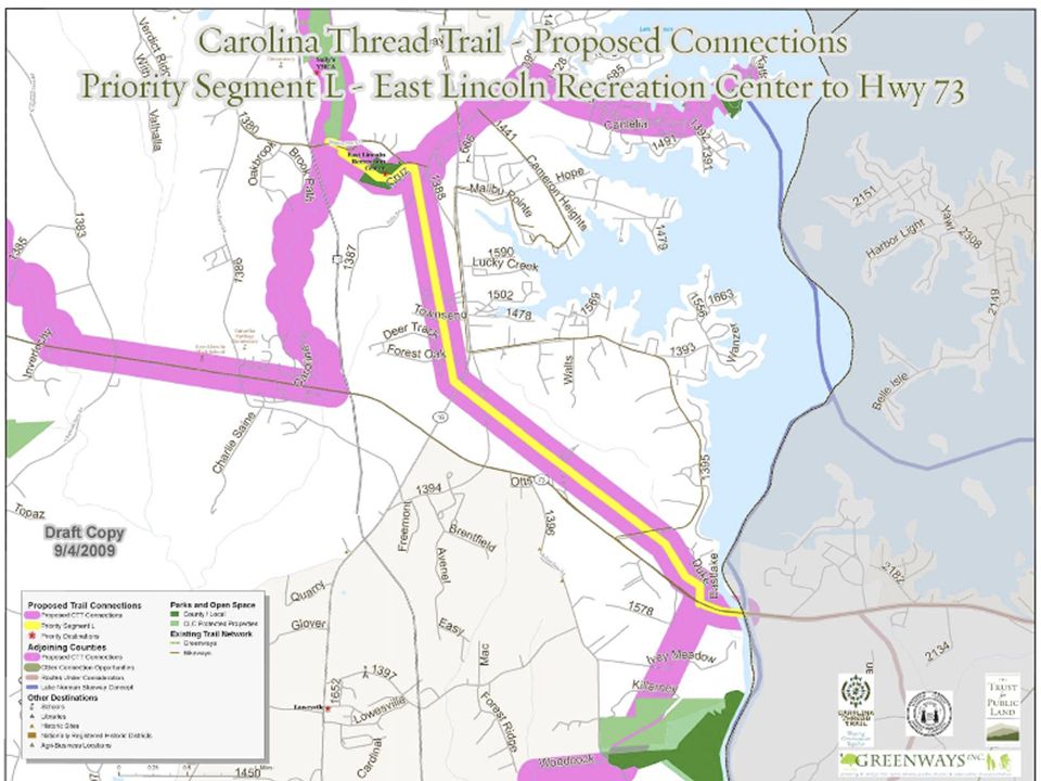
ROUTE METRICS The metrics in this chart correspond to the route of the proposed Carolina Thread Trail in Lincoln County

4
OVERALL MAP

5
PRIORITIZATION 1) Near Population 2) Available Land/Right-of-Way 3) Functional Segment 4) Ease of Development 5) Available Funding
 Near Population 2) Available Land/Right-of-Way 3) Functional Segment 4) Ease of Development 5) Available Funding")
10
Design Guidelines: Paved Multi-Use Trail

11
Design Guidelines: Unpaved Multi-Use Trail

12
Design Guidelines: Street Based Trail

13
What does it mean to adopt this plan? This plan will not take the place of any existing plans, nor conflict with any future planning efforts. Adopting this Master Plan does not commit Lincolnton or the County to fund implementation itself. Once the route of The Thread has been adopted, grants will be available to provide seed funding for implementation of some segments of The Thread. Thread staff can and will assist local communities in creating a strategy for funding the implementation of their trails taking into consideration both private and public funding sources.

Similar presentations


 Master Plan Active Communities Summit – October 3, 2011.>")


