Download presentation
Presentation is loading. Please wait.

1
Meteorological Overview for SEAC4RS Character and evolution of circulation during the experiment. – How is it different from an “average year”, how significant are those differences Convective influence of the different types of convection from the different regions on the area we sampled. – Variation during the experiment

2
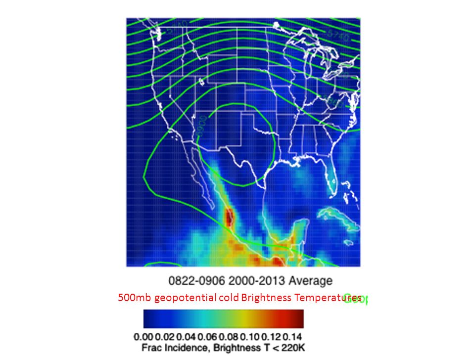
500mb geopotential cold Brightness Temperatures

5
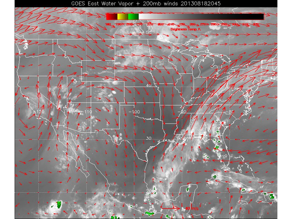
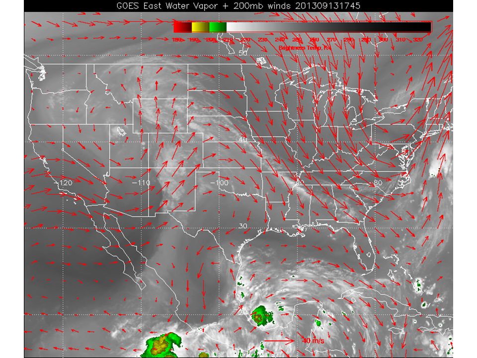
Strong Pacific and east central US trough more apparent in these first two weeks (relative to climo). Clearly period of enhanced convection getting to upper trop in SE, and Gulf, suppressed in Mexico and American West

6
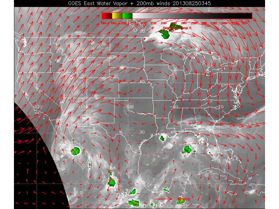
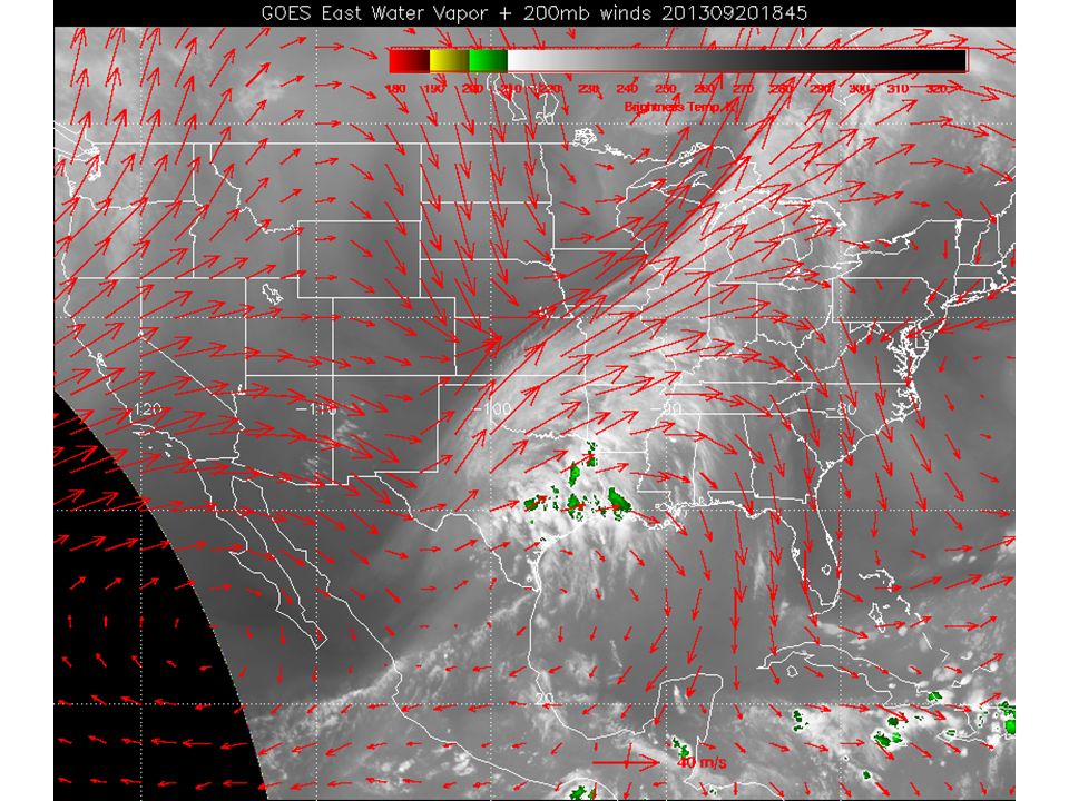
Pacific trough (enhanced) still present, but eastern trough is pushed eastward, suppressing convection in SE US. Can see enhancement in convection in Gulf, Mexico, Western US.

7
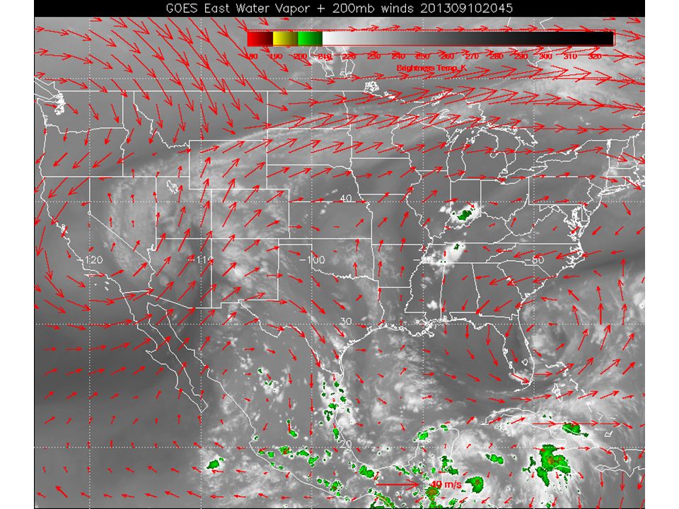
Zonal flow in climo, with anomalous ridge over central US in 2013.

8
Central US SE US Gulf of Mexico W Mexico SW US

9
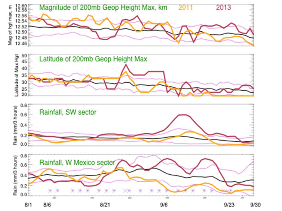
We know that 2013 was not an average year There is no such thing as an average year. How does the deviation of various meteorological quantities through the experiment compare to typical variance. Look at the following variables. Magnitude of maximum geopotential height of the monsoon anticyclone Latitude of that maximum Rainfall in the five sectors (W Mexico, SW US, C US, Se US, and Gulf of Mexico

10
PTC (2) PTC ATC
 PTC ATC")
11
PTC PTC (2) PTC ATC
 PTC ATC")
12
PTC (2) PTC ATC
 PTC ATC")
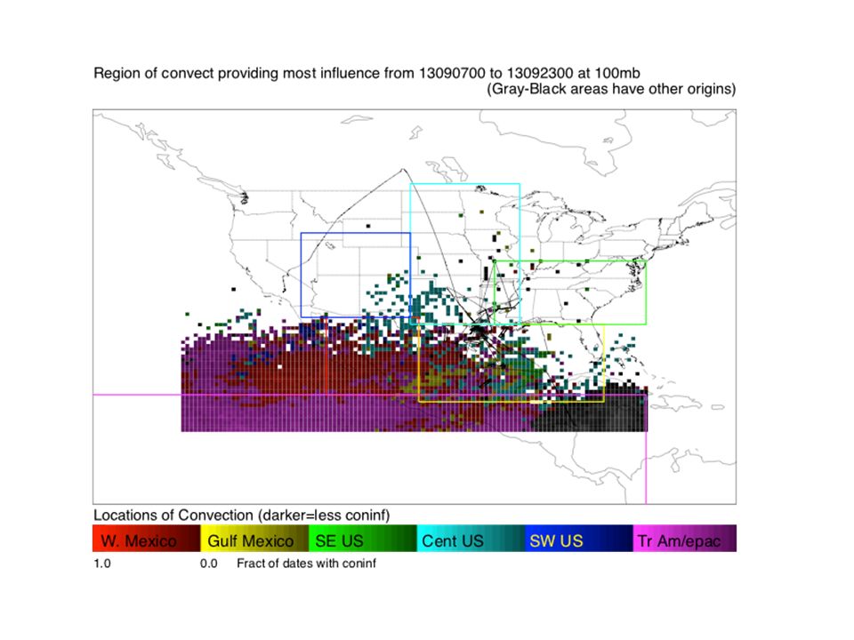
21
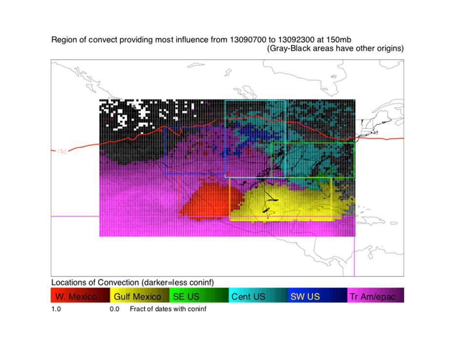
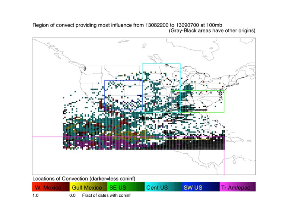
Convective Influence on UTLS UTLS over North America affected by convection of different types from different regions. Anticyclone is likely to “confine” this influence to North America.

22
Use a technique that uses back trajectories to 3-hourly cloud top potential temperatures based on global rainfall and IT brightness temperature data (Pfister et al 2001; Bergman et al, 2011). Evaluate “climatologies” for different periods during SEAC4RS and different altitudes.

23
PTC PTC (2) PTC ATC
 PTC ATC")
24
PTC (2) PTC ATC
 PTC ATC")
25
Examining convective influence 10 days or younger at 13.5 km.

26
14 km

27
16 km

28
Examining convective influence 10 days or younger at 13.5 km.

31
16 km

34
Summary No such thing as an average year, but 2013 was a bit of an outlier in a few important respects. Notably, an unusually strong ridge persisted into September, implying an unusually strong monsoon anticyclone, including warm and dry conditions in the SEUS. Northward displacement 1SD above the mean was the longest (almost 2 weeks) in 25 years MCS’s were less than usual (and displaced northward) during the middle of the experiment. Early August monsoon conditions were weaker than normal Convective influence in the UTLS varied, as expected, during the experiment. SEUS and CUS convective influence were less than average except in the first third of the experiment
 in 25 years MCS’s were less than usual (and displaced northward) during the middle of the experiment. Early August monsoon conditions were weaker than normal Convective influence in the UTLS varied, as expected, during the experiment. SEUS and CUS convective influence were less than average except in the first third of the experiment.")
Similar presentations


. The Atmosphere, 10ed. Upper Saddle.>")


>")


 1.>")

