Download presentation
Presentation is loading. Please wait.

1
Greenprint Development and Trail Planning in Bonner County and Sandpoint Fred Gifford, Senior GIS Program Manager

2
Our Mission The Trust for Public Land conserves land for people to enjoy as parks, gardens, and other natural places, ensuring livable communities for generations to come.

3
Conservation Service Areas

4
What we do—our two initiatives INITIATIVES Parks for People Our Land and Water

5
Community Gardens: NYC

8
The Hoback Basin, Wyoming Hoback Basin, Wyoming

9
Leveraging GIS for Strategic Programmatic Efforts at the Landscape Scale Frame Objectives & Metrics into GIS-Based Decision Support Tell The Story Track Progress by Metrics

10
TPL’s Greenprinting is an interactive, community modeling process that uses GIS to identify priorities for planning and conserving parks and natural resources based on local input. Greenprinting - Community Driven Land Conservation

11
The Trust for Public Land Greenprinting Process Constituency Building Conservation Finance Community- informed mapping (GIS) Action Planning 452 transactions from Greenprints since 2006
 Action Planning 452 transactions from Greenprints since 2006")
12
Technical Advisory Team

13
Greenprint Model 50% 10% 30% Overall Priority (Stacked Benefits) Wildlife Protection Park Equity Water Quality Trail Connections
 Wildlife Protection Park Equity Water Quality Trail Connections")
14
Innovation: Stakeholder Goal Weighting – Interactive Polling and Geoprocessing 1.Rank Greenprint goals in priority order 2.Use keypads to enter your personal ranking 3.System will compile all entries and display a summary graph 4.Entries feed into ArcGIS to create a sample map that reflects group weightings 5.Discussion and refinement of weights will follow

15
Web-based Decision Support Brings It All Together Data Library Priority Modeling

16
Advanced Query Tools for Targeted Prioritization

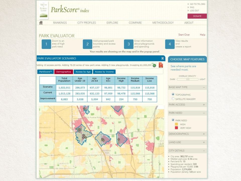
17
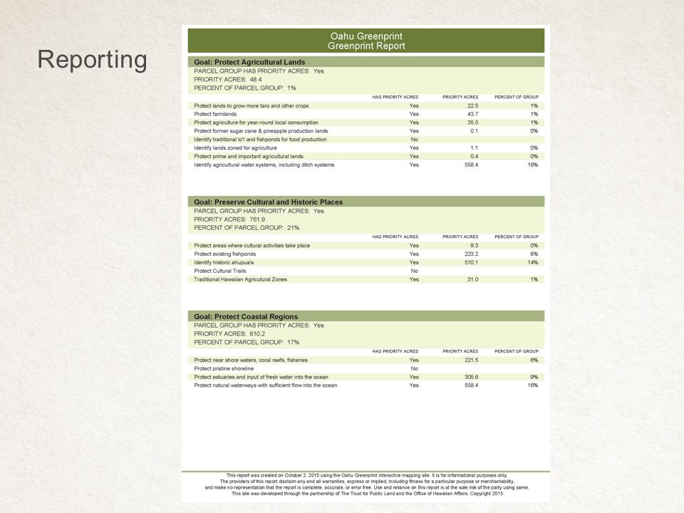
Reporting

19
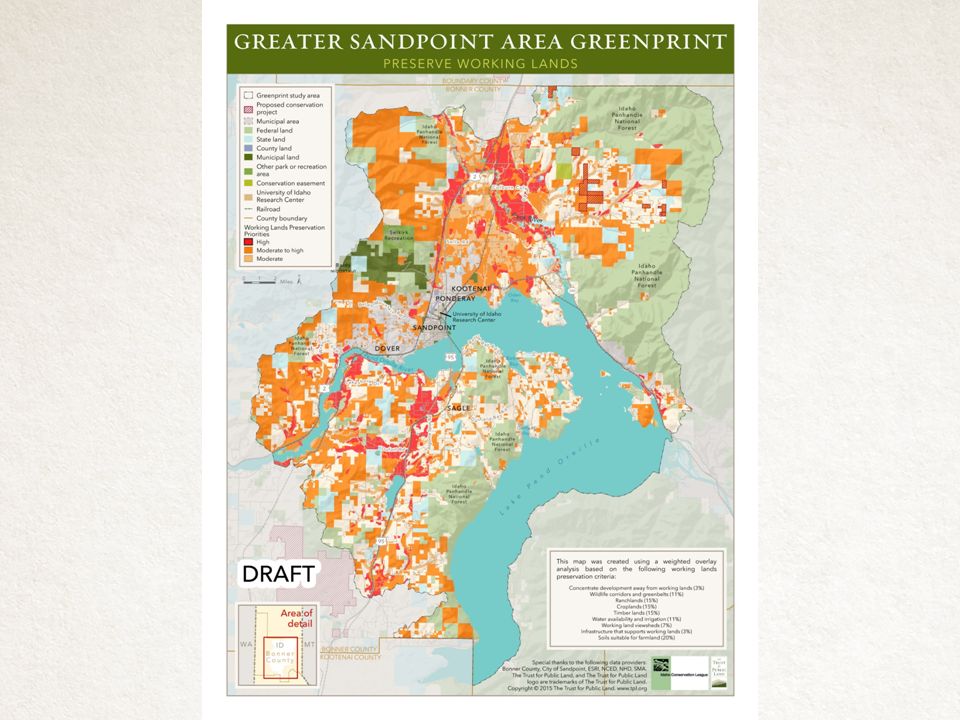
Work To Date Current Conditions Analysis Public Outreach (8 Events) and Community Survey Greenprint Goal Development -Preserve Water Quality -Provide Recreation -Protect Wildlife Habitat -Protect Working Lands Draft Priority Map Tasks To Come Final Priority Map Action Plan Web Portal Greater Sandpoint Greenprint
 and Community Survey Greenprint Goal Development -Preserve Water Quality -Provide Recreation -Protect Wildlife Habitat -Protect Working Lands Draft Priority Map Tasks To Come Final Priority Map Action Plan Web Portal Greater Sandpoint Greenprint")
20
Preserve Working Lands Analysis Model

22
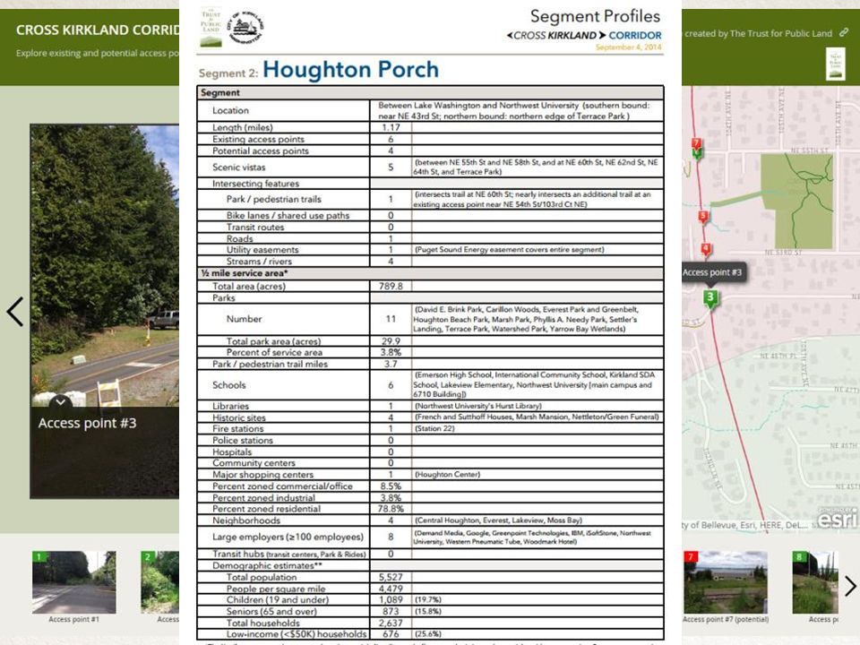
TPL’s trail planning approach combines local knowledge with qualitative and quantitative analysis to help communities identify trails, rank their priority, and communicate benefits to stakeholders and potential funders. Trail Planning

23
Modeling to Visualize “Hyper-Connectivity” Destinations Users

24
Finn Hill neighborhood to Google, Inc. 0.38% Mode Shift 2.07% Mode ShiftUnits Days 1 215 days of use/year Average length of bicycle trips 2 5.8 miles Annual average daily traffic 3 650 trips per day Mode shift from driving to biking0.00380.0207 Credit for activity centers near the project 4 0.002 Annual Auto Trips Reduced810.553172.33trips/year Annual Auto VMT Reduced4701.1918399.49miles/year Annual Emission Reductions4280.0916751.38lbs CO 2 /year CO 2 saving per VMT reduced0.91 lbs CO 2 /mile Quantifying CO2 Benefits for Connect Solutions

26
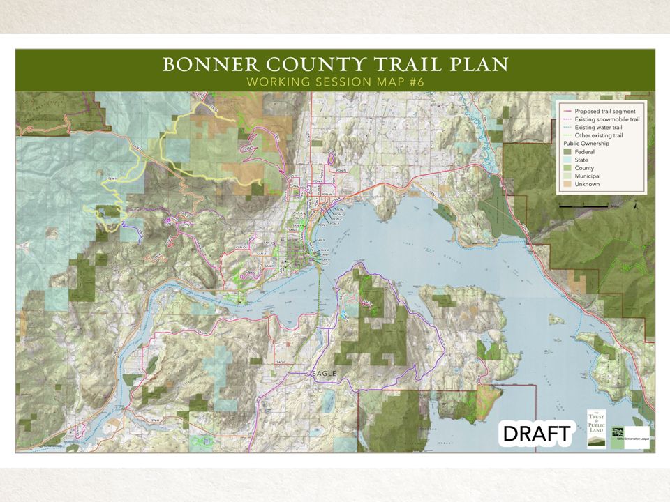
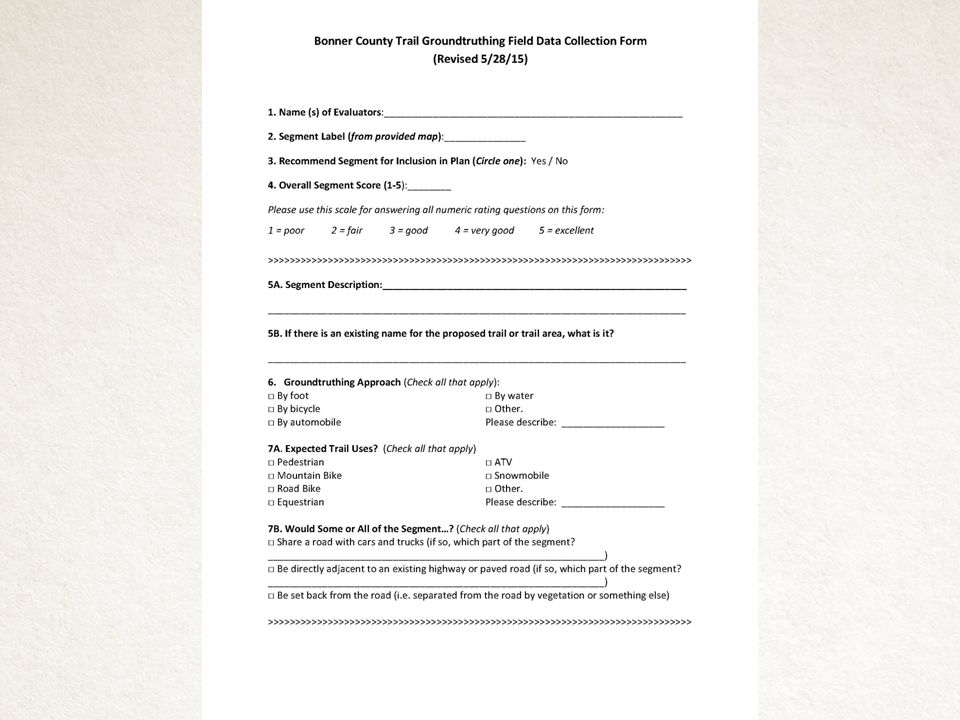
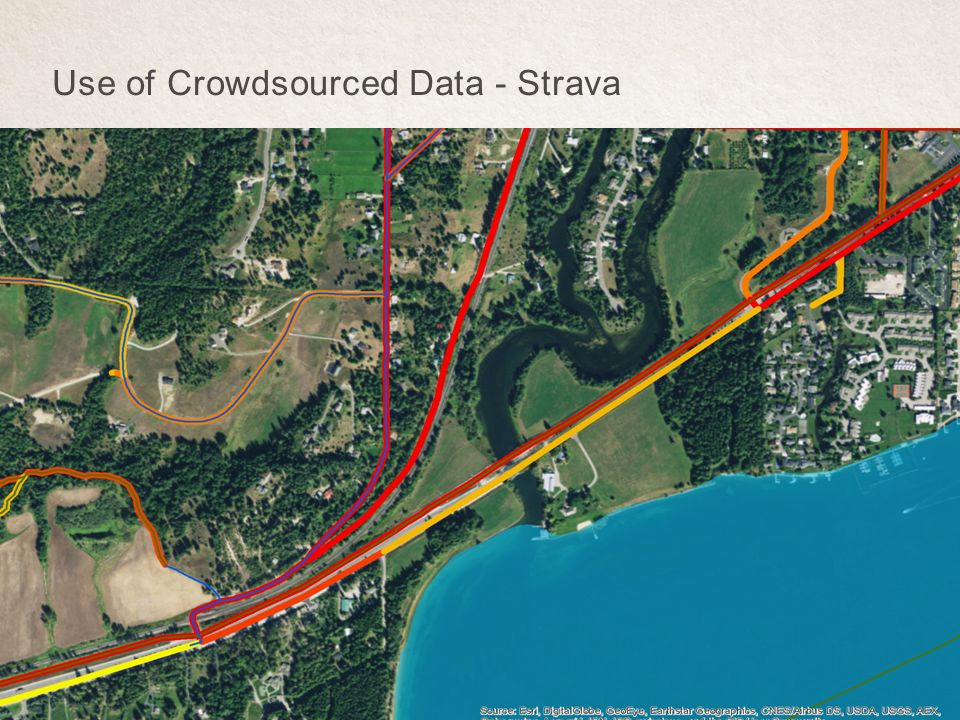
Work To Date Gather Data Create New Data Trail Verification Analyze Crowd Sourced Data Tasks To Come Develop Metrics Prioritize Trails Bonner County Conceptual Trail Planning

30
Use of Crowdsourced Data - Strava

Similar presentations


 Eastgate Shopping Center Chapel Hill, NC September 9, 2008.>")


