Download presentation
Presentation is loading. Please wait.

2
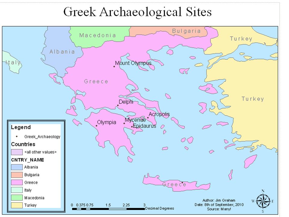
Frame the Spatial Data Frame the area of interest – Should fill the area allotted Colorize the background as blue – Right click on "Data Frame" -> Properties -> Frame -> Background

10
Legend Clean Up Right click on the Layer -> Properties -> Symbology – Click on “Cluture” and press “Delete” – Click on “all other values” to disable it – Click on the “Labels” to rename them Click on the layer to rename it – Greek_Archaeology -> “Archaeological Sites”

12
Halos Around Labels Add Halos if needed: – Right click on the layer -> Properties -> Labels -> Symbol -> Properties -> Mask – Click on “Halo”

14
Use Appropriate Scale Right click on the scale bar – Properties -> Scale and Units – Set the “Scale and Units” Rarely use “Decimal Degrees” – Rare to publish a map in Geographic (more on this later) Use metric when in doubt Use English for traditional agency users – Better yet, use both! Use the appropriate granularity – Miles or kilometers for large extents – Feet or meters for small extents

Similar presentations


 Dr. David Arctur Lecturer, Research Fellow University of Texas at Austin Lectures.>")


 732-7188 GIS and Mapping Procedures in ArcMap 9.x Creating an ArcMap Project Editing an ArcMap Project Printing an ArcMap Project.>")


>")
