Download presentation
Presentation is loading. Please wait.

1
2015

2
equator Normally, trade winds converge at the equator and push warm water westward. In the eastern Pacific, cold water rises to the surface - upwelling. Normal Conditions

3
equator Normally, the air pressure in the western Pacific is lower than the eastern Pacific. The ocean surface is also about 2 feet higher in the western Pacific. H L Normal Conditions Warm surface water heats the air above which lowers the air pressure. Cold surface water due to upwelling cools the air which increases air pressure.

4
equator The warm surface waters create unstable atmospheric conditions and rain results. Normal Conditions

5
equator About every 3 – 7 years, the air pressure reverses. HL Normal Conditions LH El Nino Conditions

6
equator The warm surface water in the eastern Pacific encourages convection and heavy rainfall along the coastal regions. Normal ConditionsEl Nino Conditions

7
Looking at the Pacific Ocean during a strong El Nino event, the eastern Pacific surface waters are very warm. The west coast of the United States generally receives quite a bit of rain. equator

8
Reno

9
Reno While a weak El Nino is less likely to bring rain to northern Nevada, a strong one would probably bring rain to the Reno area.

10
The position of the jet stream is influenced by the strength of the El Nino. During El Nino, the jet stream is position further south than normal. Warm, wet storms track across the southern portion of the U.S.

11
Precipitation (inches) Reno avg. 7.4” LV avg. 4.17” Precipitation for Reno and Las Vegas Averages are based on last 30 years (1981 – 2010)
.")
12
Precipitation (inches) El Nino Reno avg. 7.4” LV avg. 4.17” La Nina Precipitation for Reno and Las Vegas Averages are based on last 30 years (1981 – 2010)
.")
13
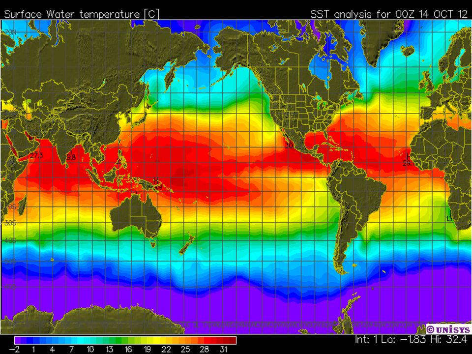
SSTs for October

14
El Nino

32
SSTs for this year

43
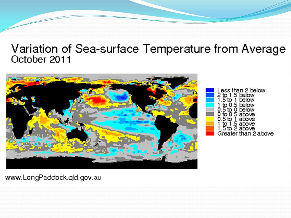
Variation from the norm (1996 – 2015)
")
45
El Nino

64
Summary When the trade winds slow down or even reverse, warm surface water moves from the western Pacific to the eastern Pacific. Warm ocean water off the west coasts of North and South America create convection in the atmosphere which creates storms. The southwestern U.S. typically get more rainfall.

Similar presentations


 Physical Oceanography>")


 El Nino circulation La Nina circulation.>")


