Download presentation
Presentation is loading. Please wait.

1
Agenda ► This week: Map and compass practicum Field maps ► Walk and estimate distances Add bearings, scale Sampling Sampling statistics: Why randomness?

2
Compass and Map Field walking and orienting site features.

4
Before you begin ► You need to know your stride length Set up a 100 ft tape and walk from 0 to 100 feet in a natural stride while counting steps. Repeat 4 times Add up the number of steps for all 4 trials Divide the number of steps into 400. This is your average stride length. You can now estimate distance by counting strides. How might this vary with terrain?

5
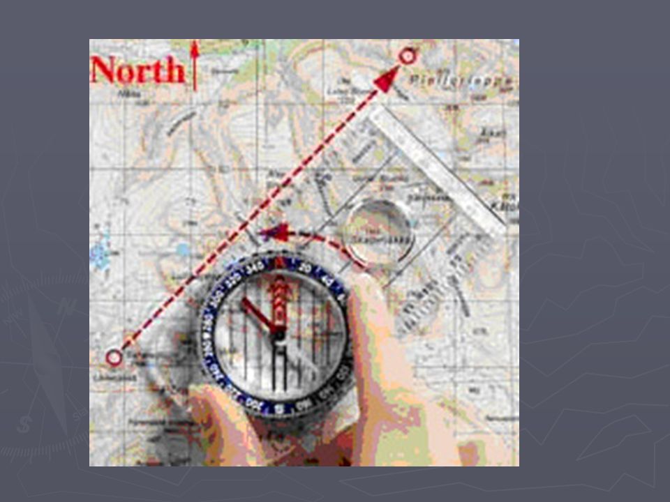
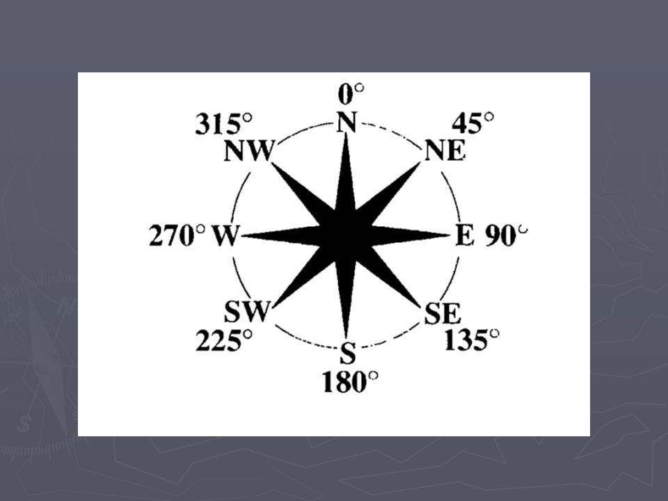
To orient a compass ► We will use a handy web site for compass preparation. ► Remember: the red arrow always points to magnetic north, not in the direction you want to go. ► The degree plate on a compass will turn to allow you to make measures or set a bearing.

6
Useful websites ► http://www.buckskin.org/Resources/Outdoo r/compass1.htm http://www.buckskin.org/Resources/Outdoo r/compass1.htm http://www.buckskin.org/Resources/Outdoo r/compass1.htm ► http://www.scoutbase.org.uk/library/hqdocs /facts/pdfs/fs315074.pdf

7
To follow a course ► Find north, line up the needle and the arrow at 0/360 degrees ► Turn toward the direction you want to go. Realign the arrow on the plate with the needle. ► Read the degrees that now are showing at the top of the compass.

8
Phase I survey: Walking a compass transect. Line-of-sight.

11
Continuing on course ► Make a line of sight reading on a distant feature. As long as the needle stays aligned with the arrow and you aim at your distant line-of-sight target you will be on course. ► To change course you can again turn the plate to a new heading or to a specified bearing. Sight on a new feature and proceed.

13
To determine an alignment of a feature, such as a building. ► Orient yourself in such a place that will allow you to look along the feature’s axis. ► Align the compass so that the long edge is parallel to the feature. ► Adjust the arrow plate until it is aligned with the north arrow. ► Read the degrees (your bearing) from the scale at the top of the compass.
 from the scale at the top of the compass..")
14
Compass and topo map ► Reading a topographic maps ► Understanding landform features and landscape ► http://egsc.usgs.gov/isb/pubs/booklets/sym bols/

19
Compass course ► Follow compass bearings and distances from station to station to retrieve tags. ► At each station there will be new bearings given to the next station. ► Use pacing to determine distances. ► Hand in all tags at completion of the course.

Similar presentations


 team of Otto Gonzalez-USDA Foreign Agricultural Service (Team Leader), Jon Fripp.>")


: 1 /50 to 1 /100 Taping (ordinary.>")

