Download presentation
Presentation is loading. Please wait.

1
U.S. Department of the Interior U.S. Geological Survey The National Map Mark L. DeMulder Director, National Geospatial Program

2
National Mapping Program Employees (Selected years for which data could be found) Number of Employees
 Number of Employees")
3
Quadrangles Year of original printing Original 7.5-minute coverage of the lower 48 States

4
A seamless, continuously maintained, nationally consistent set of base geographic data Developed and maintained through partnerships A national foundation for science, land and resource management, recreation, policy making, and homeland security Available over the Internet The source for revised topographic maps The National Map Vision

5
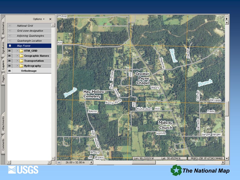
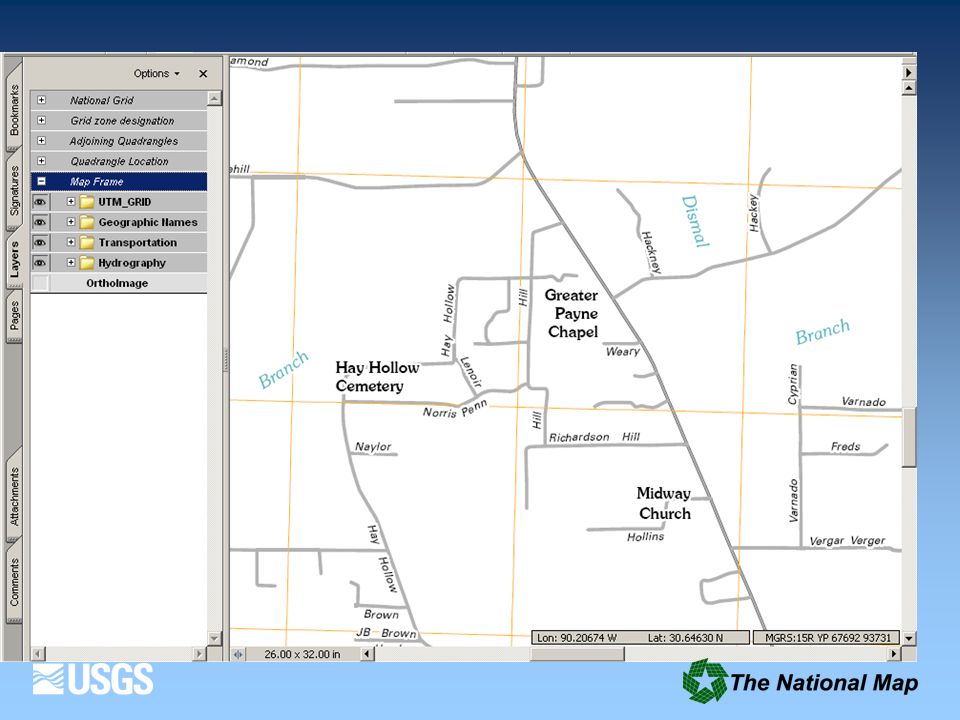
The National Map The National Map contributes to the NSDI The National Map includes eight data layers: hydrography, elevation, orthoimagery, geographic names, land cover, boundaries, transportation, structures Public domain data to support USGS topographic maps at 1:24,000-scale Products and services at multiple scales and resolutions Analysis, modeling and other applications at multiple scales and resolutions The National Map is built on partnerships and standards

6
The National Map Products and Services National Hydrography Dataset (NHD) and NHD stewardship Seamless Server National Elevation Dataset (NED) Best Practices Database – transportation, boundaries and structures Geographic Names Information System (GNIS) Scanned 7.5-Minute Topographic Maps (DRGs and GeoPDFs) If you’ve ever used or partnered on any of these, you are a user and partner of The National Map
 and NHD stewardship Seamless Server National Elevation Dataset (NED) Best Practices Database – transportation, boundaries and structures Geographic Names Information System (GNIS) Scanned 7.5-Minute Topographic Maps (DRGs and GeoPDFs) If you’ve ever used or partnered on any of these, you are a user and partner of The National Map")
7
New National Map Viewer Late 2009 Release Fast Base Map 100% National Map Content One-stop to Download National Map Data and view Map Services Direct Access to Topo Maps (USGS store) New Advanced Features
 New Advanced Features")
8
Topographic Maps from the National Map Create next generation 7.5- minute USGS topographic maps Bundle with scanned historic topographic maps

11
Public Access Through USGS Store As of August 28, 2009, 8,288 maps (all produced since May, 2009) are available for immediate download. GeoPDFs distributed free Hardcopy maps (Map on Demand) - a priced product Initial hardcopy products through USGS as plotted maps on demand
 - a priced product Initial hardcopy products through USGS as plotted maps on demand.")
12
Historic USGS quadrangle scanning Scan complete collection of approximately 250,000 USGS quadrangles existing as paper copies, using consistent, high quality specifications Provide all editions and all scales matching US Topo release cycle All maps will have complete Metadata GeoPDF files available for download from USGS Store

13
3.0 1.0 Intelligent knowledge base Ontology-driven Feature-based, Quality aware User-centered web interface 2.0 Consistent, integrated data Trusted data source Digital topographic maps Print maps on demand National coverage 8 data layers Seamless elevation, imagery, land cover, hydrography

14
Research cannot be controlled by some central authority, as an army by its general, from the fact that scientific men, competent to pursue original research, are peculiarly averse to dictation and official management. USGS Culture

16
National Map – A Proud Heritage and a Bright Future www.nationalmap.gov

Similar presentations


>")


