Download presentation
Presentation is loading. Please wait.

1
Presented by: Chuck Lawson, PE Roadway Designer and Machine Control – What You Need to Know

2
What Is Machine Control Grade control automation via earth moving equipment outfitted with GPS\Total Station\ Laser Augmentation or a combination of the three. Can be accurate from.1 to.01 feet depending on sensors. Makes use of high quality design data to control the earth moving equipment. Eliminates the need for tedious layout.

3
Bentley’s Role In Machine Control Create and export the intelligent data to the contractor Types of data to export: –Surfaces –Geometry –Reports

4
Template Creation Continue the use of classic Template creation techniques Supplement with Alternate Surfaces Project to Design Constraints

5
Design Project Introductions Meadow Park Alignment Rural 2-Lane Roadway New Construction

6
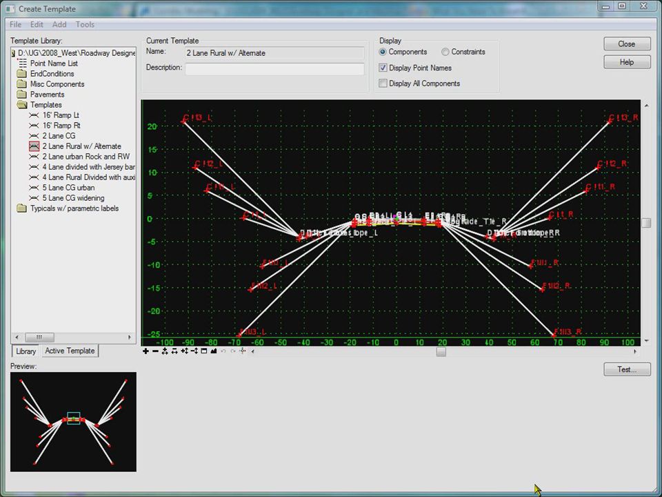
Creating the Template

7
12’ Travel Lane 6’ Shoulder Variable Slope End Conditions

8
Creating the Template

9
Template - Subgrade Extension Use “Vector – Offset” Constraint Use “Project To Design” Constraint Testing your changes

10
Template - Subgrade Extension

11
Template – Adding an Alternate Surface Each point property along the desired machine control sub-surface path needs to activate the the Alternate Surface option by assigning an alternate surface name. Alternate surface name must be consistent. No vertical lines allowed in the alternate surface path. Alternate surface will not show in testing, but only in surface creation.

13
Creating the Corridor Rural undivided pavement w/ shoulders 10’ interval drop for template Superelevation Shoulder roll-over at 4% max

15
Proposed / Alternate Surface Creation Turn on the Cardinal and Control Points Turn on option for Alternate Surface Creates proposed surface and alternate at the same time Generates LandXML files of surfaces

17
Reviewing the Cross Sections Two new surfaces now available Proposed and the alternate Subgrade surface Set different styles for the two surfaces to easily distinguish the differences

18
Reviewing the Cross Sections

19
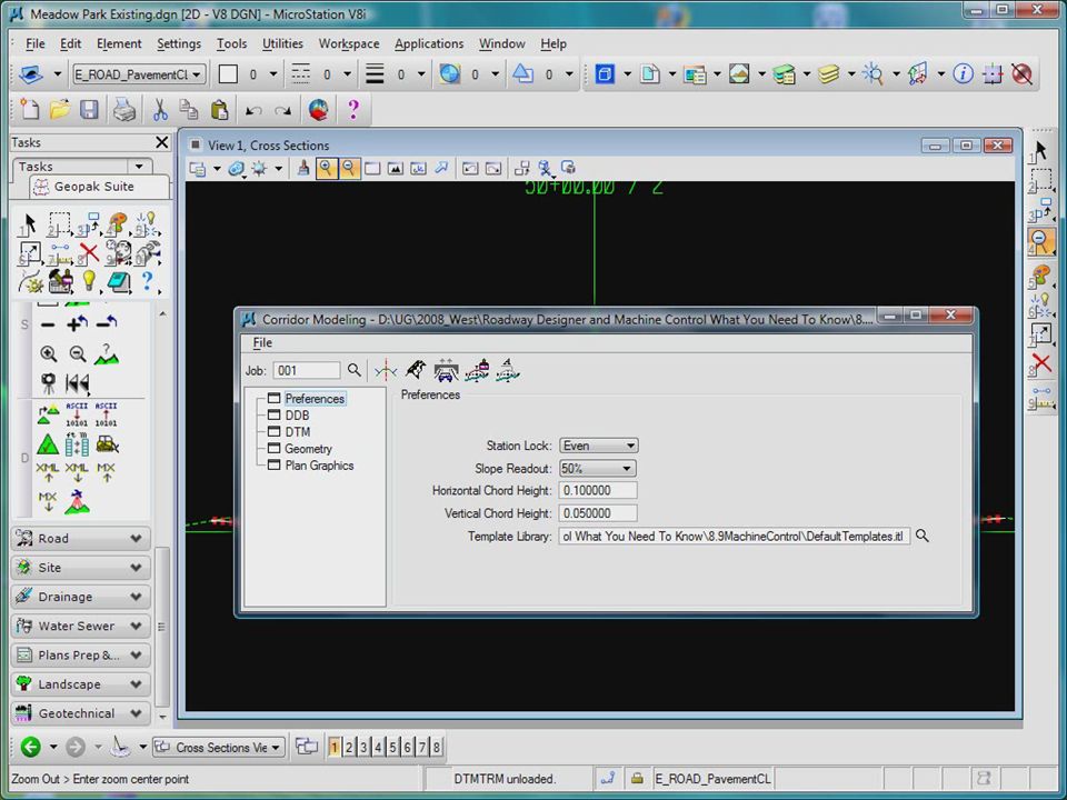
Exporting Data Trimble, Leica, Topcon, LandXML formats… Need to convert the LandXML file to GEOPAK DAT Need to create a GEOPAK TIN from the DAT file

21
Questions?

Similar presentations


>")
>")


 The following topics (pages) are covered in this lecture: Pavement (p.4-1 – 4-7) Pavement (p.4-1 – 4-7)>")

