Download presentation
Presentation is loading. Please wait.

1
Tracking Landscape Performance for Integrated Bird Management Joint Venture Meeting Austin, TX December, 2006

2
Landscape’s ability to function for waterfowl, shorebirds, waterbirds, landbirds Urban PLAYAS Riparian Cropland CRP Riparian PLAYAS Mid-Grass Other Shortgrass Other Sand Sage Shortgrass Cropland Riparian CRP Urban The PASTThe FUTURE

3
Groups/Species Prairie-Chicken Ducks Songbirds Habitats CRP Wetlands All Result More chickens More Ducks More songbirds How Much is Enough? Condition Native Wet Lots Competing interests Little cooperation Every species for itself, etc...

4
Groups/Taxa Dabblers Cranes Bl-cr Night-Heron Lesser Prairie-Chicken Long-billed Curlew Lark Bunting etc. Habitats Playas Mid-grass Riparian Shortgrass Sand Sage Marsh etc. Conditions grazed moist-soil wet fragmented pitted Fenced w/shrubs Neither can thinking or planning. Birds use habitat in many, many ways – tracking can’t be linear

5
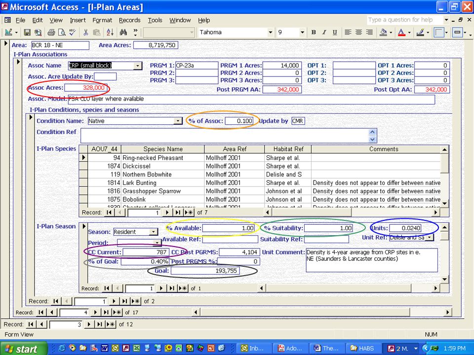
Concept -- A Hierarchical Approach AREAAREA (BCR part of a state) –ASSOCIATIONS –ASSOCIATIONS (habitats with a suite of associated species) CONDITIONSCONDITIONS (Variations within habitat associations) –SEASONS –SEASONS (Breeding, Non-breeding, months, etc) »SPECIES »SPECIES (Found in each condition of each association) “In BCR 18 - NM” “Shortgrass” “with few shrubs and moderate grazing” in the “ breeding” season for “Lark Bunting”
 –ASSOCIATIONS –ASSOCIATIONS (habitats with a suite of associated species) CONDITIONSCONDITIONS (Variations within habitat associations) –SEASONS –SEASONS (Breeding, Non-breeding, months, etc) »SPECIES »SPECIES (Found in each condition of each association) In BCR 18 - NM Shortgrass with few shrubs and moderate grazing in the breeding season for Lark Bunting")
6
Landcover

7
A link from landcover to birds (usually density, duck-use-days or shorebird-use-days).
.")
8
Goals

9
Acres of Habitat in an Area X Density/use-days of a Species in an Area = Carrying Capacity of a Species in an Area ÷ Population Objective for the Area = % of Goal for Area Then, if needed, develop habitat to meet goal. MODEL

10
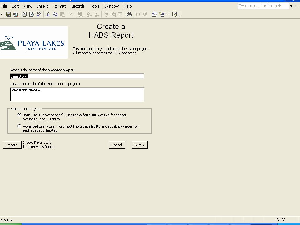
HABS: A tool that manages the concept, landcover, models, linkages and goals.

13
End Product: Area Implementation Plan (AIP) Simple, specific, updateable Shows current and desired acres of habitat Describes specific habitats and priority species for work in that area Represents habitat goals over 30 years and reveals the magnitude of conservation work needed. Provides support for developing new conservation initiatives or tweaking existing ones Provides justification for budgetary requests AIP BCR 18 Colorado

16
Jamestown NAWCA Waterfowl (DUDs) Shorebirds (SUDs) PLJV Goal for BCR 19-Kansas107 M25 M PLJV Deficit for BCR 19- Kansas N/A13 M Jamestown project current carrying capacity700,0004,000 Jamestown project future carrying capacity 3,200,000 (4.6x increase) 276,000 (69x increase) Jamestown project gain in carrying capacity (post- NAWCA) 2,500,000272,000 K Gain as percent of PLJV shortfall N/A2.1% Gain as percent of PLJV goal2.3%1.1%
 Shorebirds (SUDs) PLJV Goal for BCR 19-Kansas107 M25 M PLJV Deficit for BCR 19- Kansas N/A13 M Jamestown project current carrying capacity700,0004,000 Jamestown project future carrying capacity 3,200,000 (4.6x increase) 276,000 (69x increase) Jamestown project gain in carrying capacity (post- NAWCA) 2,500,000272,000 K Gain as percent of PLJV shortfall N/A2.1% Gain as percent of PLJV goal2.3%1.1%")
17
Guild/speciesGoal % of Goal Non-breeding Waterfowl (Spring) 86,792,883 DUDs 68.36 Non-breeding Shorebirds (wetland) 6,564,863 SUDS 6.08 Lesser Prairie- Chicken 33,222 Individuals 82.22 Ring-necked Pheasant 1,065,590 Individuals 4.96 Ferruginous Hawk 279 Individuals 117.80
 86,792,883 DUDs Non-breeding Shorebirds (wetland) 6,564,863 SUDS 6.08 Lesser Prairie- Chicken 33,222 Individuals Ring-necked Pheasant 1,065,590 Individuals 4.96 Ferruginous Hawk 279 Individuals")
19
Conclusion There are 159,129,630 acres of land in PLJV of which approximately 6,428,000 are permanently developed, leaving 152,697,742 to support birds, of which 12,891,769 need to change type or condition to meet priority bird goals.

20
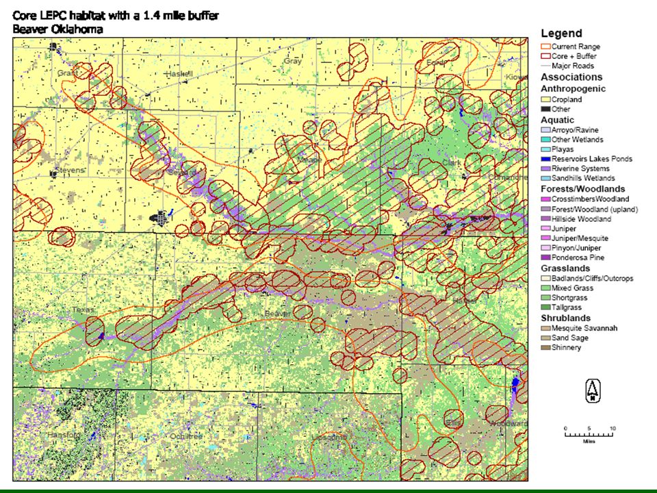
Lesser Prairie-Chicken Minimum of 5,000 acres of appropriate contiguous habitat (a large block)Minimum of 5,000 acres of appropriate contiguous habitat (a large block) Min. 2,000 acres of native prairieMin. 2,000 acres of native prairie Max. 3,000 acres of CRP and/or croplandMax. 3,000 acres of CRP and/or cropland No 4-lane roads bisecting and < 50 ac. other roadsNo 4-lane roads bisecting and < 50 ac. other roads < 100 acres of all water types< 100 acres of all water types CRP/cropland and native prairie min. ac. switched for shinneryCRP/cropland and native prairie min. ac. switched for shinnery Model: Densities/acre:.0125 in Mixed Grass Prairie.0156 in Sand Sage Prairie data from KS, R. Rodgers pers.comm. data from KS, R. Rodgers pers.comm.

Similar presentations


 United States Department of Agriculture Natural Resources Conservation Service.>")


 Citizen Science: Past, Present, and Future Efforts in Wisconsin Bill Mueller and Andy Paulios.>")