Download presentation
Presentation is loading. Please wait.

1
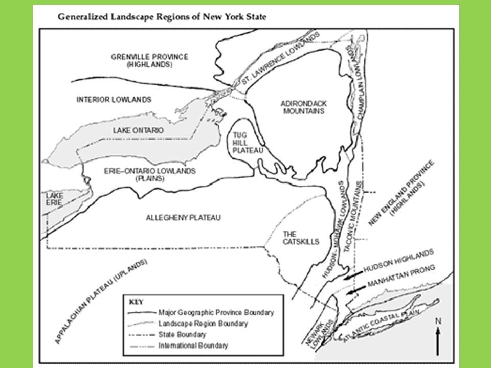
Landscapes

2
Landscape Development Landscapes: A region on Earth’s surface in which various landforms are related by a common origin.

3
Factors That Impact Landscape Development Climate Local Bedrock Geologic Structures Human Activities

4
Types of Landscape Regions Mountains: Has the greatest relief between the highest peak and the deepest valley. Relief: (change in elevation from the highest point to the lowest point) RELIEF: 10m 0m 10m-0m=10m
 RELIEF: 10m 0m 10m-0m=10m.")
5
HOW ARE MOUNTAINS CREATED? A daddy mtn and a mommy mtn fall in love and because they love each other so much……. MR. O’D!!!!!!!!!!!!!!!!!!!!!!!!!!!! Hey Mama!!!!

6
HEHEHE Tectonic forces push Earth up to create a mtn.Tectonic forces Convergent plate boundary

7
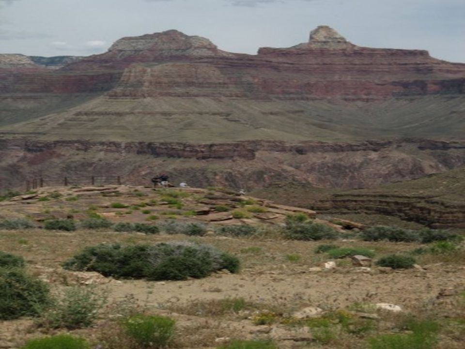
Plateau A plateau landscape is often relatively flat or rolling uplands that streams have cut valleys into. Rock structure: “It’s sedimentary my dear Watson” Smaller relief than mtns Larger than plains Examples of plateaus: Colorado Plateaus near the Grand Canyon

9
Plains Plains are generally flat and are at a lower elevation. Rock Structure: flat layers of sedimentary rocks. Midwest and Florida

10
Landscapes and Culture Landscapes help shape the culture of an area. Physical boundaries can help bring together communities for a common need or shut off a community.

11
Climate and Landscapes Landscapes in moist environments are generally rounded. (Chemical Weathering, Good Soil) Those is arid environments show sharp angles and steeper slopes. (Physical Weathering, Not Enriched Soil)
 Those is arid environments show sharp angles and steeper slopes. (Physical Weathering, Not Enriched Soil).")
13
Drainage Patterns Drainage Patterns: The way water runs off of a landscape. Rule of thumb: Streams will tend to follow zones of weaker rocks.

14
Four Types of Drainage Patterns 1.Dendritic: Branching Usually found on flat laying rock or uniform rock. Ex. Appalachian Plateau near Oneonta

15
2. Radial Rolls off of a dome Usually found by a circular volcano or dome mountain. Ex. The rim of the Adirondacks

16
3. Rectangular Follows zone of weaker rocks in rectangular patterns. Usually found in faulted, tilted or folded rock layers. Ex. Finger Lakes and the Central Adirondacks.

17
4. Annular Circles, then down, circles, then down. Usually found when you have a dome with upturned layers. Ex. Esopus Creek near Phoenicia, NY.

18
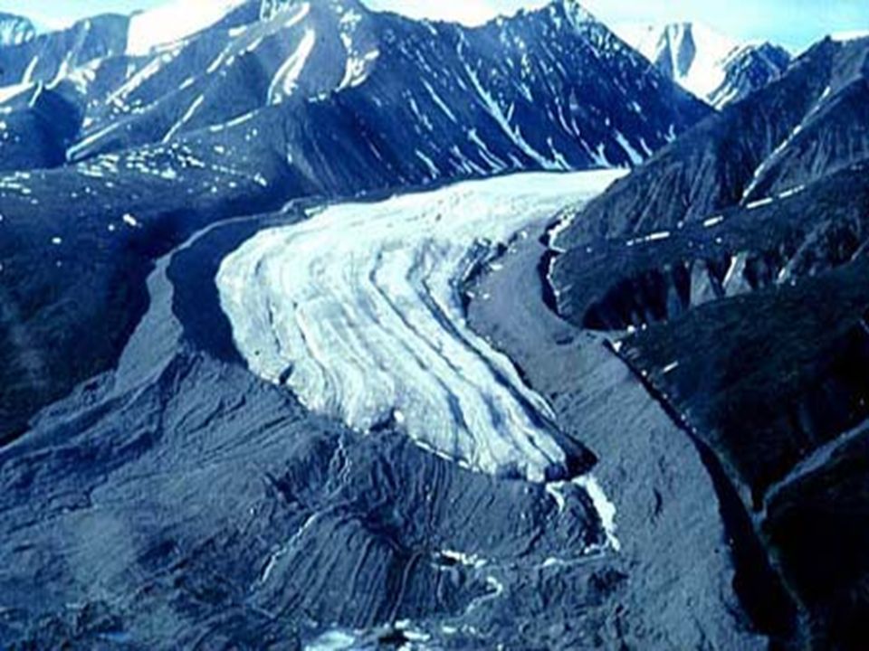
New York and the Ice Ages New York was covered with glaciers Alpine glaciers: valley glaciers, these are the ones that make U shaped valleys and move due to their weight and the slope of the land they are on. Continental glaciers: ice sheets that move solely on their own weight. The Finger Lakes were created by advancing glaciers.

19
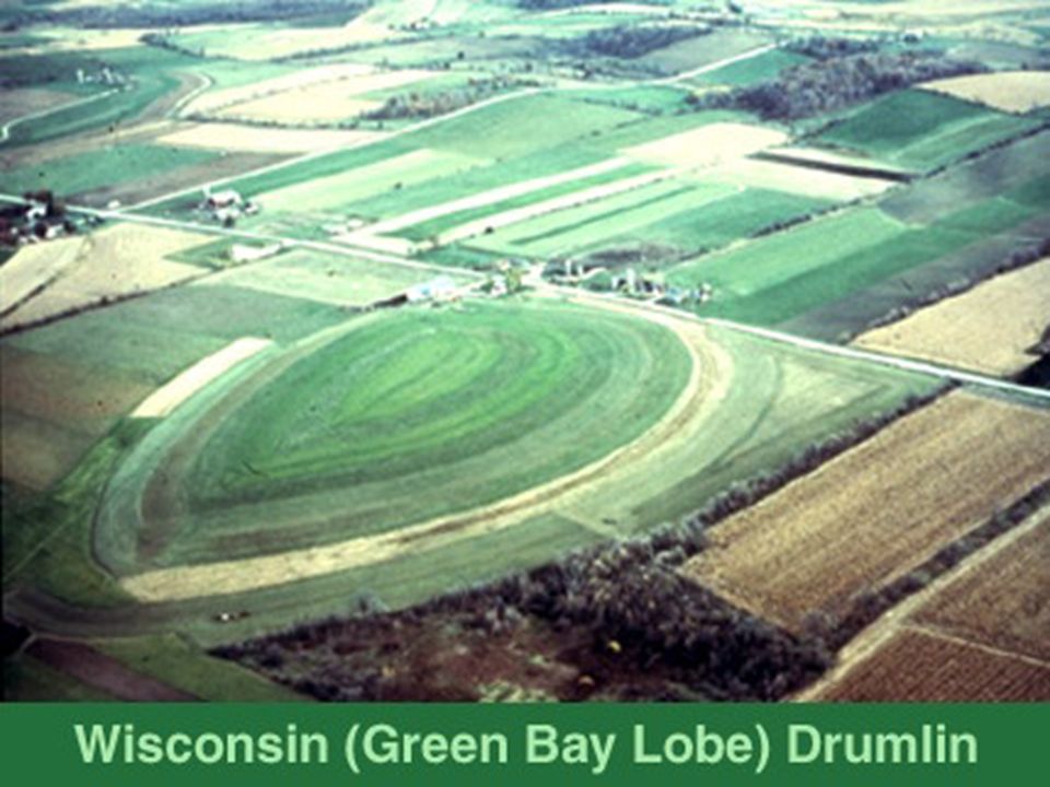
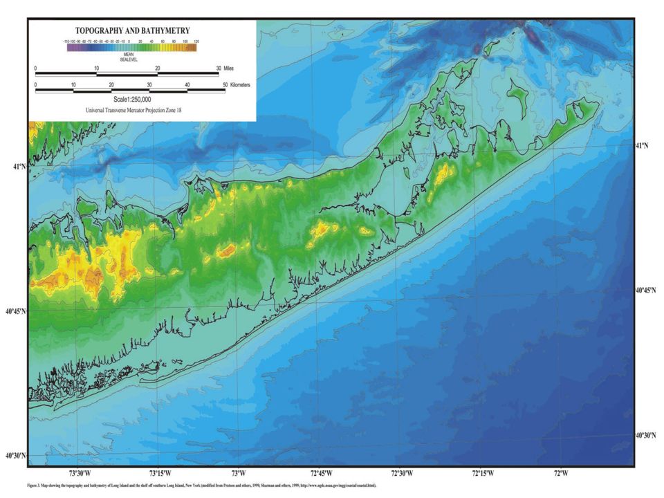
Erosion and Deposition by Glaciers Erosion: takes away from the land Ex. Finger Lakes Deposition: adds to the land Ex. Drumlin: tear shaped hills created in front of the advancing glacier. Ex. Moraines: plies of unsorted soil and rocks left where the glacier stopped advancing. (Long Island shows this)
.")
20
Drumlin

22
Terminal Moraine

25
Kettle Lakes : when buried blocks of ice cause a depression in the ground and it fills with water.

Similar presentations


 and composition of the landscape.>")


 tell me the three general landscapes found in New York State. 2. Take out a calculator. HW: R&H 302-304.>")


 formed? Landforms are the results of interaction of tectonic forces, processes of weathering, erosion, deposition,>")