Download presentation
Presentation is loading. Please wait.

1
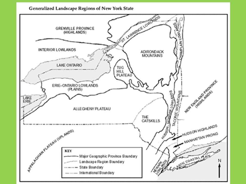
Landscapes

2
Landscape Development
Landscapes: A region on Earth’s surface in which various landforms are related by a common origin.

3
How Do Soils Form? Soil is the mixture of weathered rock, microorganisms, and organic remains that usually covers bedrock. The composition of a soil depends on the rocks from which it weathered and the local climate. Physical weathering breaks down solid rock into small particles. Chemical weathering changes the minerals, often increasing the clay content. The decay of organic remains produces organic acids, which accelerate chemical weathering.

4
Let’s See, Very Scientifically, How Soil Is Formed

5
Different Layers of Soil
The gradual formation of soil in place produces layers known as soil horizons. The top layer is usually the best layer for growing crops because it is rich in dark-colored organic matter called humus. However, some important minerals maybe have been transported deeper into the soil by ground-water infiltration. The lowest layer of the soil is broken bedrock, which may merge into solid bedrock. - Most of the soils of New York State do not show the complete development of horizons.

6
THE LAYERS ILLSUTRATED

7
Protecting the Soil soil is a resource that must be protected.
It may take hundreds of years for one cm of topsoil to form. Human technology has contributed to the loss of soil. Mining took rocks and soil form the original locations. By killing plant covers, bad farming and forestry practices, the soil is left exposed and unprotected.

8
Factors That Impact Landscape Development
Climate Local Bedrock Geologic Structures Human Activities

9
Types of Landscape Regions
Mountains: Has the greatest relief between the highest peak and the deepest valley. Relief: (change in elevation from the highest point to the lowest point) RELIEF: 10m - 0m = 10m 10m 0m
 RELIEF: 10m. - 0m. = 10m. 10m. 0m.")
10
HOW ARE MOUNTAINS CREATED?
A daddy mtn and a mommy mtn fall in love and because they love each other so much……. MR. O’D!!!!!!!!!!!!!!!!!!!!!!!!!!!! Hey Mama!!!!

11
HEHEHE Tectonic forces push Earth up to create a mtn.
Convergent plate boundary

12
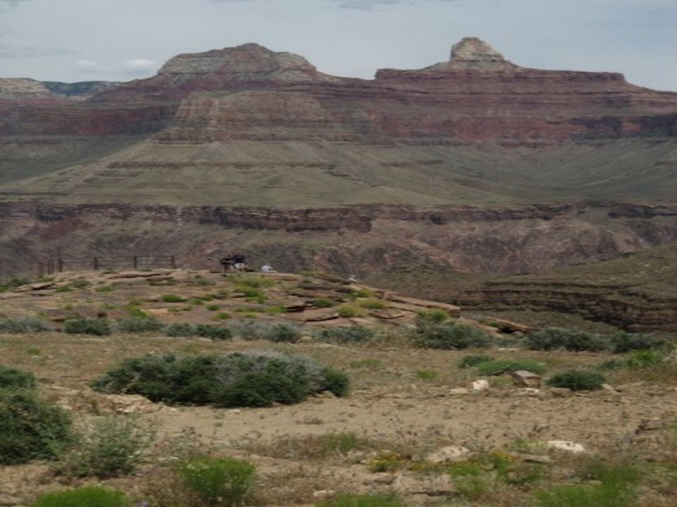
Plateau A plateau landscape is often relatively flat or rolling uplands that streams have cut valleys into. Rock structure: “It’s sedimentary my dear Watson” Smaller relief than mtns Larger than plains Examples of plateaus: Colorado Plateaus near the Grand Canyon

14
Plains Plains are generally flat and are at a lower elevation.
Rock Structure: flat layers of sedimentary rocks. Midwest and Florida

15
Humans and Landscape Development
Increased air pollution will lead to more chemical weathering. Mining will impact how the land looks. Isolation has led to these changes in the landscapes.

16
Climate and Landscapes
Landscapes in moist environments are generally rounded. (Chemical Weathering, Good Soil) Those is arid environments show sharp angles and steeper slopes. (Physical Weathering, Not Enriched Soil)
 Those is arid environments show sharp angles and steeper slopes. (Physical Weathering, Not Enriched Soil)")
18
Drainage Patterns Drainage Patterns: The way water runs off of a landscape. Rule of thumb: Streams will tend to follow zones of weaker rocks.

19
Four Types of Drainage Patterns
Dendritic: Branching Usually found on flat laying rock or uniform rock. Ex. Appalachian Plateau near Oneonta

20
2. Radial Rolls off of a dome
Usually found by a circular volcano or dome mountain. Ex. The rim of the Adirondacks

21
3. Rectangular Follows zone of weaker rocks in rectangular patterns.
Usually found in faulted, tilted or folded rock layers. Ex. Finger Lakes and the Central Adirondacks.

22
4. Annular Circles, then down, circles, then down.
Usually found when you have a dome with upturned layers. Ex. Esopus Creek near Phoenicia, NY.

23
New York and the Ice Ages
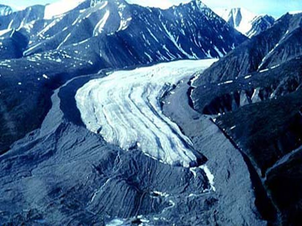
New York was covered with glaciers Alpine glaciers: valley glaciers, these are the ones that make U shaped valleys and move due to their weight and the slope of the land they are on. Continental glaciers: ice sheets that move solely on their own weight. The Finger Lakes were created by advancing glaciers.

24
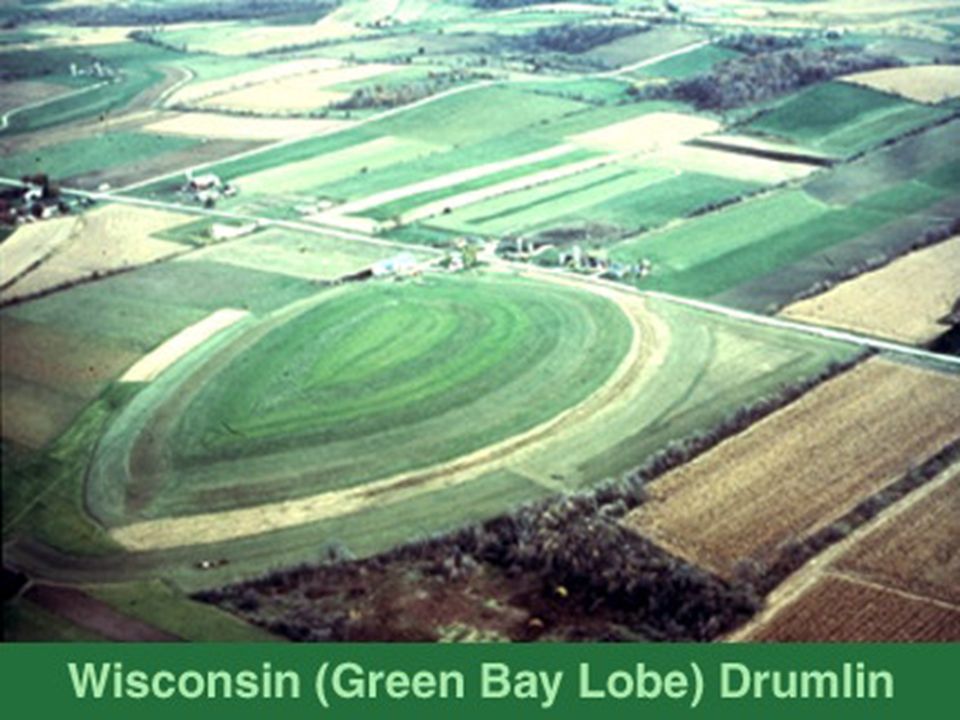
Erosion and Deposition by Glaciers
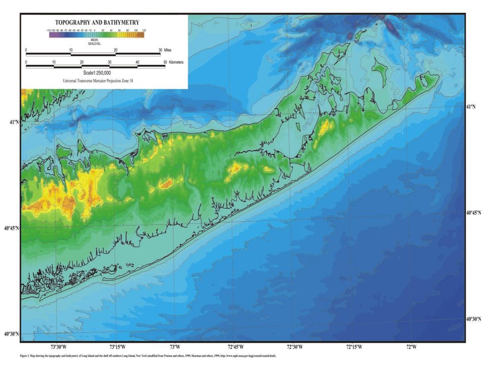
Erosion: takes away from the land Ex. Finger Lakes Deposition: adds to the land Ex. Drumlin: tear shaped hills created in front of the advancing glacier. Ex. Moraines: plies of unsorted soil and rocks left where the glacier stopped advancing. (Long Island shows this)
")
25
Drumlin

27
Terminal Moraine

30
Kettle Lakes : when buried blocks of ice cause a depression in the ground and it fills with water.

Similar presentations


 and composition of the landscape.>")


