Download presentation
Presentation is loading. Please wait.

2
Meteorological and Oceanographic Monitoring at Diablo Canyon Nuclear Power Plant John Lindsey

3
l The Diablo Canyon Power located on a fourteen mile stretch of open coastline.

4
l Diablo Canyon Power Plant produces 2.1 Megawatts

6
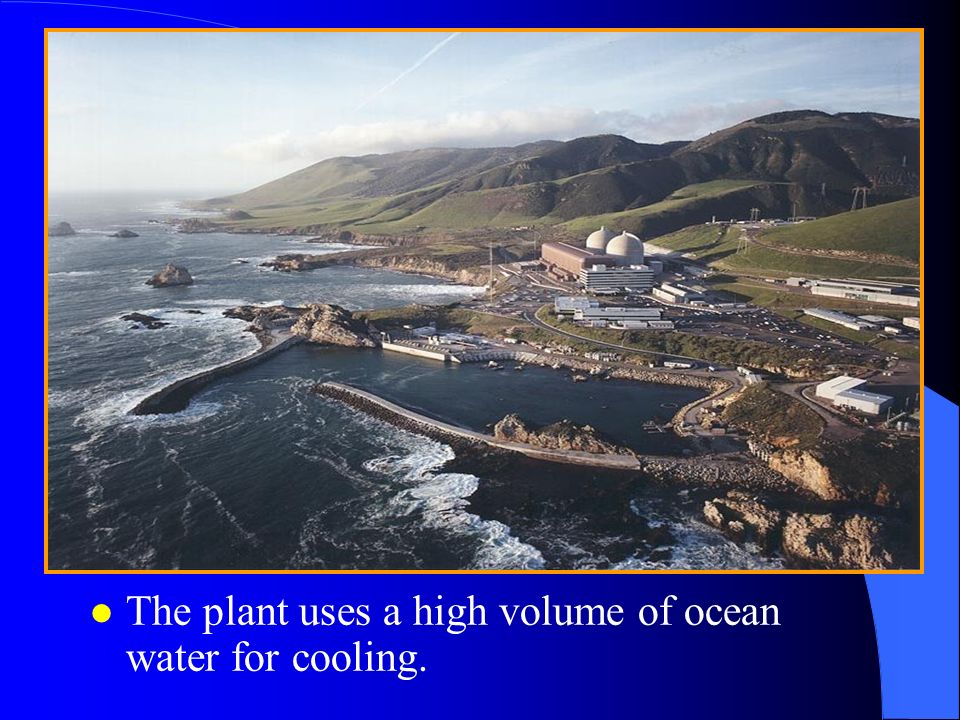
l The plant uses a high volume of ocean water for cooling.

7
l Each Circulating Water Pump rated at 13,000 horsepower.

8
l 1.7 million gallons per minute, or 2.5 billion gallons per day.

9
Biofouling Control Team Storm Swell Intake Evaluation Summary Note: This Evaluation Summary and Worksheet is for guidance only. Date: Evaluator: Team Recommendations: Plant impact potential:Primary threat to: Screens Condenser

11
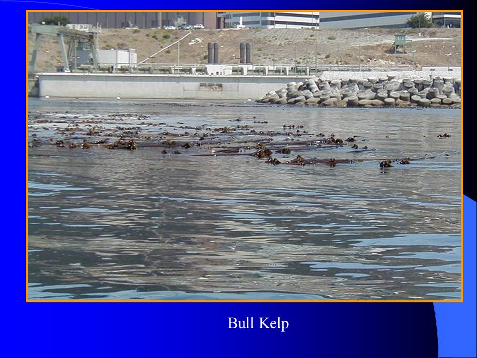
Bull Kelp

13
1. Wind speed. 2. Wind duration. 3. Length of wind fetch.

16
l During periods of extreme swell activity, power plant operations can be challenged.

20
27.6 MHz Waverider receiver at the DCPP Ocean Lab

21
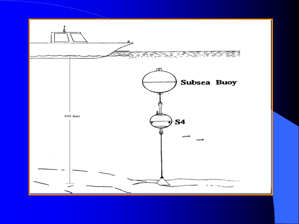
S4 Current Meter

24
Ekman Spiral

29
The Diablo Canyon Weather Forecast ============= DCPP Weather Forecast for Saturday 05/04/02 =================== SWELL: A 3 to 5 feet combined northwesterly sea/swell with a 5 to 9 second period will continue through tomorrow. Fresh to strong northwesterly winds will generate a 5 to 7 foot combined northwesterly sea/swell with a 7 to 11 second period on Monday and Tuesday. Combined with this northwesterly sea/swell will be a 1 to 2 foot southern hemisphere swell with a 13 to 17 second period through Sunday. Southern hemisphere swell will increase to 2 to 4 with a 14 to 18 second period on Monday and Tuesday. ATMOSPHERIC CONDITIONS: Low clouds and fog will develop during the night and morning hours along coastline. Otherwise, mostly fair weather will continue through Friday.

30
WINDS: Moderate to fresh northwesterly winds will continue through Sunday. Fresh to strong northwesterly winds will develop on Monday and Tuesday. Northwesterly winds will decrease on Wednesday and Thursday. Today's winds: Max sustained wind: NW 23.3 mph (1800) Max peak winds: NW 24.3 mph (1800) Yesterday's Winds Max sustained wind: NW 26.8 mph (1600) Max peak winds: NW 34.7 mph (1600)
 Max peak winds: NW 24.3 mph (1800) Yesterday s Winds Max sustained wind: NW 26.8 mph (1600) Max peak winds: NW 34.7 mph (1600).")
31
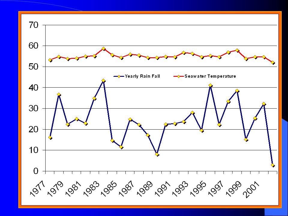
DIABLO CANYON AIR TEMPERATURES: Yesterday's Today's Tomorrow's Min Max Min Max Min Max 48.9 F 55.6 F 48.8 F 54.4 F 48.0 F 55.0 F SEAWATER TEMPERATURES: Intake seawater temperatures will range between 49 to 51 degrees through Sunday, decreasing to 48 to 50 degrees on Monday through Wednesday. OCEAN CURRENTS: A southerly flowing (offshore) current will continue through Wednesday. SEAWATER VISIBILITY: Seawater visibility was 32 feet (top to bottom) at the Diablo Canyon Intake.
 current will continue through Wednesday. SEAWATER VISIBILITY: Seawater visibility was 32 feet (top to bottom) at the Diablo Canyon Intake..")
32
========================================================================== 24-Hour Ocean Condition Outlook for Saturday 05/04 through Sunday 05/05 SEA/SWELL: DIR. NW HT. 3-5 PER. 5-9 morning Remaining at: DIR. NW HT. 3-5 PER. 5-9 afternoon Remaining at: DIR. NW HT. 3-5 PER. 5-9 tonight WINDS: DIR. NW SPEED 10-15 morning Increasing to: DIR. NW SPEED 20-25 afternoon Decreasing to: DIR. NW SPEED 5-10 tonight =========================================================================== 48-Hour Ocean Condition Outlook for Sunday 05/05 through Monday 05/06 SEA/SWELL: DIR. NW HT. 3-5 PER. 5-9 Sunday morning Remaining at: DIR. NW HT. 3-5 PER. 5-9 Sunday afternoon Remaining at: DIR. NW HT. 3-5 PER. 5-9 Sunday night WINDS: DIR. NW SPEED 5-10 Sunday morning Increasing to: DIR. NW SPEED 20-25 + 30 Sunday afternoon Decreasing to: DIR. NW SPEED 15-20 Sunday night ==========================================================================

Similar presentations


 General Weather: While weather patterns continue to improve, temperatures will remain near or well below freezing. Some.>")


