Download presentation
Presentation is loading. Please wait.

1
Tidal Constituent and Residual Interpolation Survey Planning and Weighting Function Computation

2
1. General Description of TCARI 2. Survey Planning and Data Mining 3. Execution 4. Final Review Process Overview

3
TCARI Tidal Constituent And Residual Interpolation generates tide correctors for bathymetric soundings tide correction = astronomical tide + residual + datum offset

4
astronomical tide= sum of Harmonic (i.e. predicted tide) Constituents (i.e. predicted tide) Constituents residual water level= observed – predicted datum offset= MSL – MLLW or MSL – ellipsoid or MSL – ellipsoid etc. etc. Overview of TCARI Overview of TCARI TCARI Separately Interpolates:
 Constituents residual water level= observed – predicted datum offset= MSL – MLLW or MSL – ellipsoid or MSL – ellipsoid etc. etc. Overview of TCARI Overview of TCARI TCARI Separately Interpolates:.")
5
Tidal Constituents Tidal component may be broken down into its “harmonic constants”. 37 Used by NOAA. Used to create Tide Predictions M21.01317.9S20.15845.8 N20.2192.2 K10.110200.7 M40.042248.1 O10.079206.5 M60.00660.4 MK30.00933.1 S40.00749.4 MN40.020241.9 NU20.044355.4 S60.0000.0 MU20.03250.2 2N20.028349.1 OO10.005213.3 LAM20.0185.6 S10.019168.1 M10.006249.2 J10.006228.0 MM0.0000.0 SSA0.06051.8 SA0.084176.0 MSF0.0000.0 MF0.0000.0 RHO0.003204.7 Q10.017198.9 T20.01930.7 R20.011285.6 Tidal portion induced Tidal portion induced by the interaction between by the interaction between the earth, sun, and moon. the earth, sun, and moon.

6
Residuals Non-tidal is induced by weather and riverine discharge. Obtained from water level station information during time of survey Weather at Baltimore, MD Riverine discharge Providence, RI

7
Datum Offset Harmonic Constituents in the CO-OPS database are not referenced to a datum. When creating predictions in the database, the user must specify datum. For Hydrographic surveys, chart datum is MLLW. To put the final tide reducer on MLLW, TCARI uses the MSL to MLLW offset. For photogrammetric surveys MHW, MLW and MLLW datums are used. 0.951

8
Interpolated datum offsets (MLLW)
")
9
Survey Planning and Data Mining

10
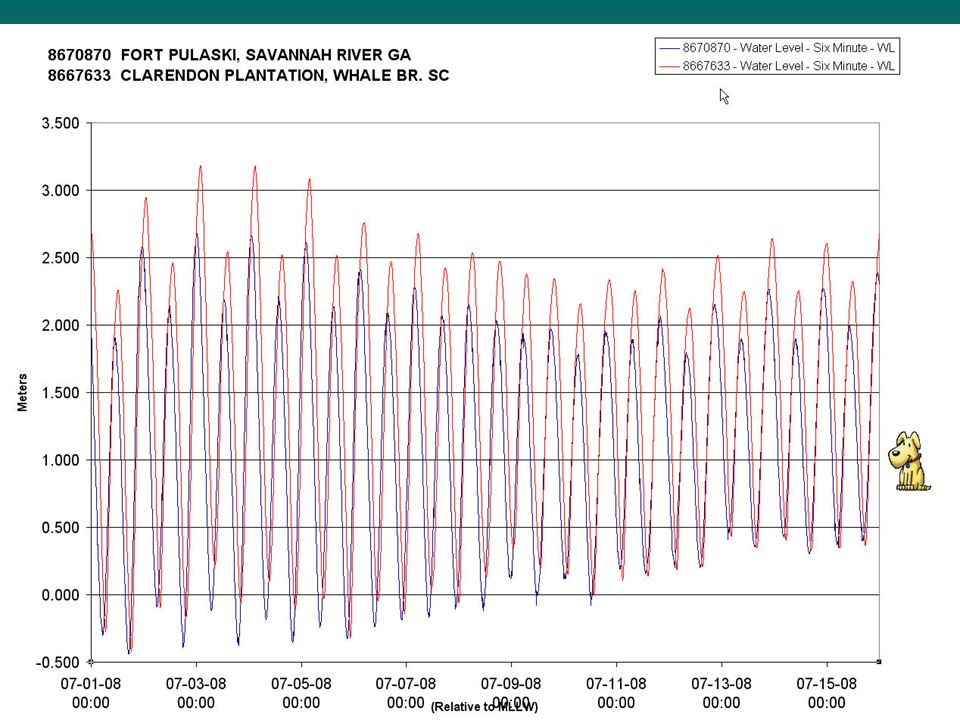
Fort Pulaski Clarendon Standard Discrete Tidal Zoning Use what is available to make estimates in TCARI

11
After reviewing Discrete Tidal Zoning move to building the layers of TCARI

15
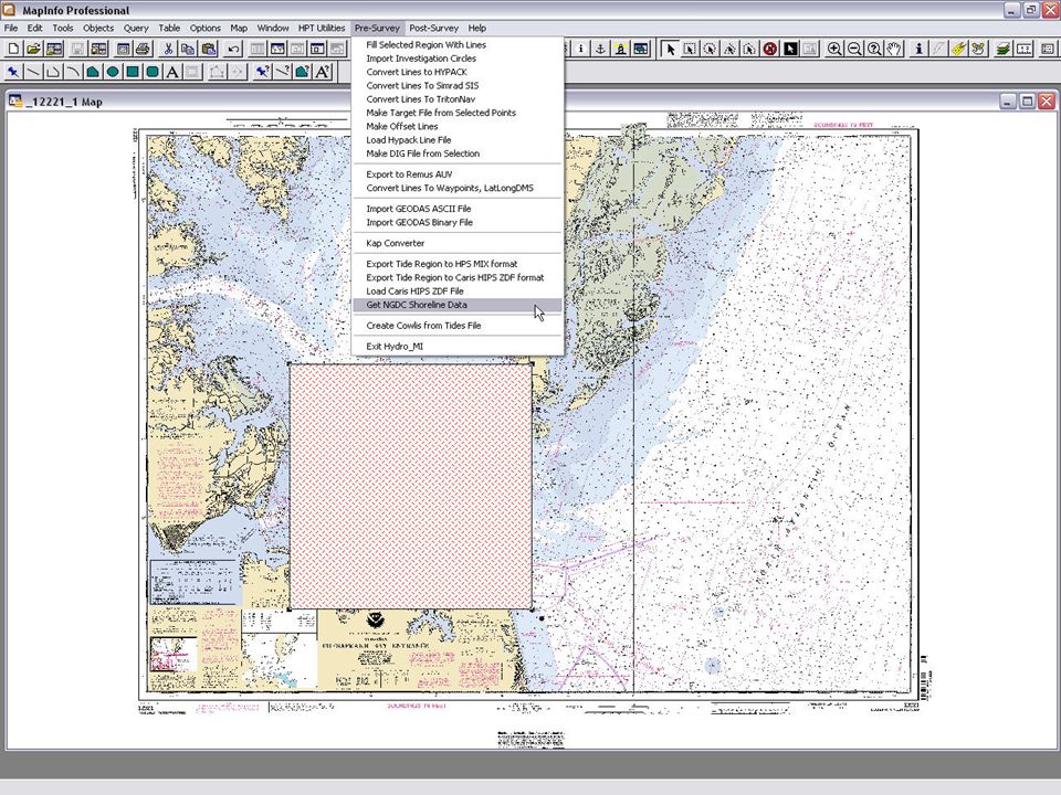
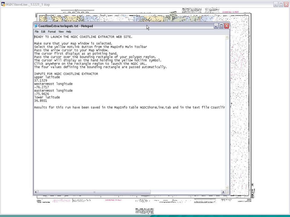
Save as “Shoreline” NGDC Shoreline is the basis for TCARI Mesh Grid

17
Data Inventory Harmonic Analysis (29d or 365d) Retrieve Local Results Store Constituents
 Retrieve Local Results Store Constituents")
18
Clean Shoreline (Find Bad Segments) Loading and Cleaning Shoreline 1.Load Shoreline. 2.Close off all open shoreline 3.Create ocean boundary 4.Find bad segments 5.Jump to bad segments to clean each one. Close all open segments Create ocean boundary Bad shoreline point

19
Some stations fall outside of the shore- line. You can move then inside the shore- line by adjusting the lat/lon. If they are not inside, they will not get used. Triangulated Mesh Create Triangulated Mesh

20
1500m Clarendon station radius increased to 3500m A Stations radius can be increased To increase the influence of its Weighting characeristics.

21
Weights for Skull Creek 8669133 100% 80% 70% 60% 50% 40% 30% 10% 0% 8669133 1500m

22
Weighting Percentages for harmonic constituents

23
Weighting percentages for residuals Fort Pulaski Weighting percentages for residuals Clarendon

25
Differences up to ~0.4m If Clarendon were to drop out, can you just use Fort Pulaski?

26
Error Estimation Fort Pulaski and Clarendon Analysis shows that Clarendon needs to be operating during the time of the survey.

27
Tide Station Info Two stations are in and operating. The rest are all historic stations that can be used for harmonics and datums Only check “Solve Combinations” if your analysis shows that it is acceptable for an operating gauge to drop out.

28
Spot Checking for Final Analysis Comparing TCARI results against our Traditional discrete zoning 1.Load verified 6-minute water level data into TCARI 2.Review WL Graphs (Show water level graphs) 3. Choose a spot in the grid, a landmark, buoy, or other feature. Show Tide Corrector

29
Comparing TCARI results with zoning at that spot

30
San Francisco Bay TCARI Results Mesh Grid created by TCARI used to base analysis on NGS Shoreline Ocean Boundary

31
San Francisco Bay TCARI Results Error Estimates based on Current TCARI Input

32
Suggested Gauge Locations

33
TCARI inputs : CO-OPS Oceanographer portion / End User portion NGDC Shoreline from NGDC website (1:70,000 or 1:250,000 ) TCARI Mesh Grid Creation Harmonic Constituents pulled from CO-OPS Database Tidal Datum information pulled from CO-OPS Database Operating or Live Data loaded via CO-OPS website or OpenDap TCARI is dependant on accurate shoreline. If the shoreline is not accurate the grid and weighting functions will be questionable. TCARI is dependant upon having Harmonic Constituents and Tidal Datums for the water level stations. The constituents should be reviewed carefully prior to creating the TCARI grid and weighting values. (QA/QC) Harmonic Constituents must exist in digital form in the CO-OPS database from which TCARI can pull – limits data to hourly and 6 min data (data from 1975 to present) Handles operating station dropouts gracefully by recombining calculations on the fly. Valid TCARI Points
 Harmonic Constituents must exist in digital form in the CO-OPS database from which TCARI can pull – limits data to hourly and 6 min data (data from 1975 to present) Handles operating station dropouts gracefully by recombining calculations on the fly. Valid TCARI Points.")
Similar presentations


TOOLS TO OBTAIN GEODETIC CONTROL.>")


