Download presentation
Presentation is loading. Please wait.

1
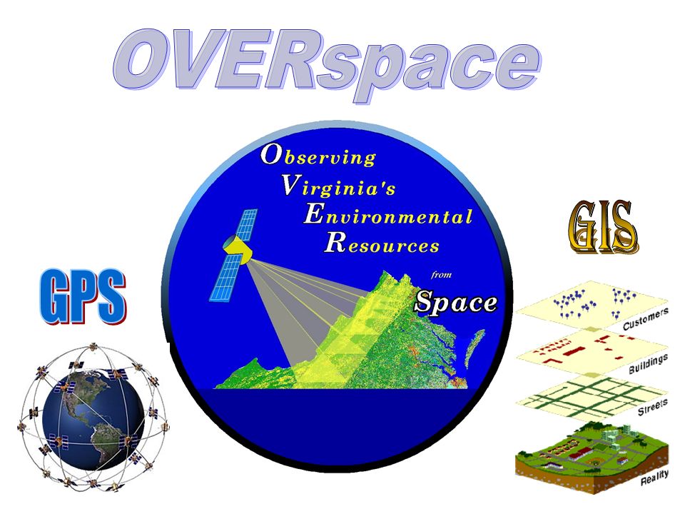
OVER space “ Observing Virginia’s Environmental Resources from Space” Barbara Murray OVERspace Project Director brmurray@odu.edu Barbara Murray OVERspace Project Director brmurray@odu.edu Virginia Space Grant Consortium Educational Programs Manager Virginia Space Grant Consortium Educational Programs Manager What is GIS?

3
The goal of the OVERspace project is to develop and implement for Virginia’s educators, a state-wide professional development program and network for using remotely sensed data, GIS, and GPS as effective teaching and learning tools.

4
GIS is a System of computer software, hardware and data, and personnel to help manipulate, analyze and present information that is tied to a spatial location – spatial location – usually a geographic location information – visualization of analysis of data system - linking software, hardware, data personnel – a thinking explorer who is key to the power of GIS - Geographic Information Systems A Definition of GIS

5
A method to visualize, manipulate, analyze, and display spatial data to study the world “Smart Maps” linking a database to the map, creating dynamic displays

6
States Five Data Layers “Alike” Features Roads Capitals Rivers Lakes

7
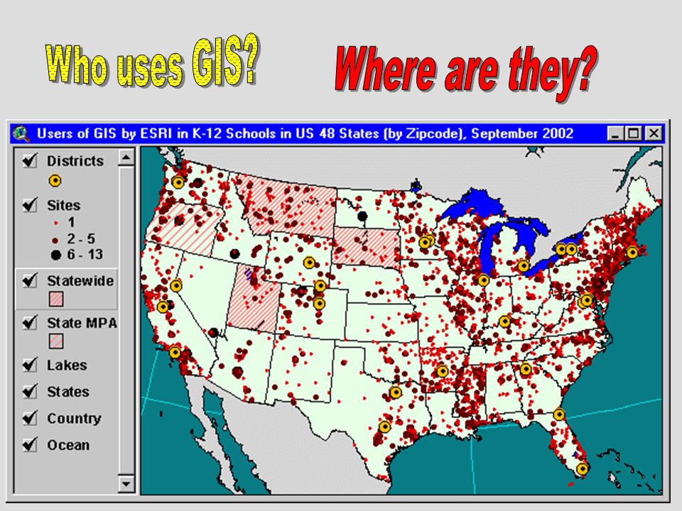
Some Ways GIS is Used Emergency Services Environmental Natural Disasters Education Government Medical Industry, Businesses Defense

8
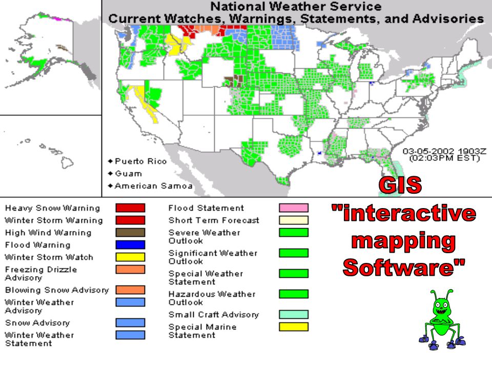
GPS – Global Positioning System A static map – paper or digital –Maps are often a “product” of a GIS –A way to visualize the analysis A software package

9
Database “Not Easy to Interpret”

10
Visualization “Worth a Thousand Words”

11
Multiple Databases can be Linked and Related

12
1.Upper Roanoke River Watershed-A Learning Adventure 2.Nifty Fifty! – (Studies of VA provinces and regions) 3.Water, Water Everywhere, But not a Drop to Drink! (Water supply issues) 4.Medical Geography- Vaccination in the U.S. -( Mapping disease spread) 5.Colonial Economics and Immigration- (Mapping historic sites & battles) 6.Living Life on the Edge! -(GIS uses in natural disasters ) 7.Light My Fire! -(Studies of controlled burns and wildfires & satellite data)) 8.A Bird’s EyeView -( Studies of the NASA SATS aircraft with GPS) 9.It’s Raining, It’s Pouring! -( Studies of precipitation and its impacts) 10.Virginia Physiography -( A study of the specific provinces of VA) 11.MicroClimates - (Student data collection and analysis of climate types) 12.Healthy Chesapeake? -(Studies of Virginia’s watersheds) 12 OVERspace GIS related lesson plans in development include:
 3.Water, Water Everywhere, But not a Drop to Drink. (Water supply issues) 4.Medical Geography- Vaccination in the U.S. -( Mapping disease spread) 5.Colonial Economics and Immigration- (Mapping historic sites & battles) 6.Living Life on the Edge. -(GIS uses in natural disasters ) 7.Light My Fire. -(Studies of controlled burns and wildfires & satellite data)) 8.A Bird’s EyeView -( Studies of the NASA SATS aircraft with GPS) 9.It’s Raining, It’s Pouring. -( Studies of precipitation and its impacts) 10.Virginia Physiography -( A study of the specific provinces of VA) 11.MicroClimates - (Student data collection and analysis of climate types) 12.Healthy Chesapeake. -(Studies of Virginia’s watersheds) 12 OVERspace GIS related lesson plans in development include:.")
13
Science –ES.1, ES.2, ES.3, ES.9 Social Studies Computer Technology Math skills English (communications) –8.5, 9.2, 9.6, 10.1, 10.7, 10.9 Geographic Information Systems “GIS” @ your school
 –8.5, 9.2, 9.6, 10.1, 10.7, 10.9 Geographic Information Systems your school")
15
GIS helps learners of any age think critically, learn in an integrated fashion, and exercise multiple intelligences. The infinite variations possible in topic of study, scale of exploration, data engaged, analyses used, and questions asked help teachers model the importance of being a lifelong learner.

16
Data - Data - Data We all ‘got data’ Location Data – How Many – What Kind – Where Scale of Data – Local to Global Data Presentation – Words, Charts, Graphs, Tables, or Maps Exploring data using GIS turns data into information into knowledge

17
3D Mine with Well Data

18
Combining Various Display Methods

19
Modeling of Future Trends

20
GIS @ your school You need: –Computers –Software (free or commercial) –Some experience –Lots of enthusiasm –Applicable lesson plans for integration in current curriculum
 –Some experience –Lots of enthusiasm –Applicable lesson plans for integration in current curriculum")
21
GIS @ your school You could use: –Digital cameras –More software –GPS equipment –Satellite/aerial images (Remote Sensing) –Identify a question (tap into local people/organizations)
 –Identify a question (tap into local people/organizations)")
23
The Global Positioning System (GPS) is a satellite-based navigation system made up of a network of 24 satellites placed into orbit by the U.S. department of Defense. GPS was originally intended for military applications, but in the 1980s, the government made the system available for civilian use. GPS works in any weather conditions, anywhere in the world, 24 hours a day. There are no subscription fees or setup charges to use GPS.

24
Set of GPS units for classroom use is available for use, through VSGC. VDOE provided grant for 1 st class set. Other grants will provide for more equipment OVERspace teachers were provided with a high quality GPS unit Future plans: 8 classroom sets in Virginia for loan in teaching students

Similar presentations


 John Wiley and Sons Ltd 1. Systems, Science and.>")


 Geography is the study of locational and spatial trends about the earth’s surface, the objects found on it, and the.>")


