Download presentation
Presentation is loading. Please wait.

3
Agendas DEFINITION AND CONCEPTS OF WATERSHED MANAGEMENTDEFINITION AND CONCEPTS OF WATERSHED MANAGEMENT RATIONALES OF WATERSHED APPROACHRATIONALES OF WATERSHED APPROACH DATA COLLECTION –CONTOUR LINESCONTOUR LINES –SIZE OF WATERSHEDSIZE OF WATERSHED –SLOPESLOPE –CLIMATIC CHARACTERISTICSCLIMATIC CHARACTERISTICS –AGRO CLIMATIC ZONATIONAGRO CLIMATIC ZONATION –SOILSSOILS –PRESENT LAND USE AND LAND COVERPRESENT LAND USE AND LAND COVER WATERSHED PROBLEMS PROBLEM ANALYSIS OF WATERSHEDPROBLEM ANALYSIS OF WATERSHED BROAD SPECTRUM TECHNIQUESBROAD SPECTRUM TECHNIQUES SPECIFIC ANALYSIS TECHNIQUESSPECIFIC ANALYSIS TECHNIQUES COMMUNITY PARTICIPATIONCOMMUNITY PARTICIPATION Styles of Conflict managementConflict management GENDER ANALYSISGENDER A PRA Gender Analysis Watershed appraisal

4
DEFINITION AND CONCEPTS OF WATERSHED MANAGEMENT DEFINITION AND CONCEPTS OF WATERSHED MANAGEMENT The term watershed refers to the area drained by a stream in such a way that all flow originating in that area is discharged through a single out let. watershed management is an integration of technologies with in the natural boundaries of a drainage area for optimum development of land, water livestock and plant resources to meet the basic minimum needs of the people in a sustainable manner.

5
DEFINITION AND CONCEPTSDEFINITION AND CONCEPTS… Sustainable WS development sustainable watershed development plan needs to integrate the biophysical, social, and economic factors to ensure that the project will be: Accepted socially, Technically sound Economically feasible, Environmentally sound

6
Major failures with the past approaches Lack of clear and consistent policy for sustainable development Failure to address the legitimate goals of target communities and to involve them in planning process, Failure to address all issues relevant to the problem, Failure to integrate all the necessary disciplines and activities Undue emphasis on technical solutions Institutional problems, Inadequate or ineffective regulations of land use, Lack of well integrated incentives, or inappropriate incentives, Lack of funds and inappropriate utilization of funds. Lack of information, tools or training to make informed decisions

7
The solutions for Past Failures Improvement and strengthening of planning, management, monitoring and evaluation systems Strengthening of institutions and coordinating mechanisms Creation of mechanisms to facilitate the active involvement and participation of communities and people at all levels

8
The solutions … The choice of appropriate technology is a factor in ensuring the sustainability of development activities. Farmers reject available technologies not because they are conservative or ignorant, but because they randomly weigh the changes in incomes and risk associated with these technologies under their natural and economic circumstances. Integrated approach to problem solving and understanding issues at a system level

9
RATIONALES OF WATERSHED APPROACH Orderly and systematic resource use and management Concentrations of efforts: Optimal use of resources: Enhance community participation in resource management. gives more chance to establish and strengthen sustainable village institutions such as –Users group –Self help group –Women thrift and credit group –Village watershed committee Watershed management projects involve actions that are aimed at "production with protection

10
DATA COLLECTION Type of Data: 1.Quantitative or hard data is precise, numerical information, which can be measured or counted 2.Qualitative or soft data is descriptive, verbal information that emphasizes personal perceptions. Data sources: primary or secondary

11
possible to delineate Using topographic maps or air photos. In delineating Watershed boundary; at the upper limit often defined by natural crest and their lower limit by natural waterways. DELINEATING WATERSHED BOUNDARY DELINEATING WATERSHED BOUNDARY

12
Base Maps are maps constituted major features of an area i.e. roads, drainage patterns, contour lines, ecological zones, water body, etc. could be prepared from topographic maps or using PRA tools In most cases, topographic maps serve as base maps. N

13
CONTOUR LINES are lines representing points of equal elevation relative to a fixed base level set at zero. are usually shown in brown color on the maps available in Ethiopia The interval between successive contour lines varies according to the map scale and the steepness of the landscape. 1. Maps of 1:50,000 has a contour interval of 40 meters 2. Maps of 1:250,000 has a contour interval of 100 meters

14
Map Grid It is used to define positions on a map. The position of a watershed can be indicated in Degrees of latitude (North or South) and longitude (East or West)
 and longitude (East or West).")
15
SIZE OF WATERSHED SIZE OF WATERSHED Enlarging a map To enlarge a map 1) the method of square can be applied. 2X

16
SIZE OF WATERSHED SIZE OF WATERSHED Enlarging a map 2) it is possible to enlarge a map using the overhead projector –first a known size line is put on the overhead projector –Decide how much should be enlarged and its size on the screen –Move the overhead projector back and forth or use the focus till the decided size is obtained.
 it is possible to enlarge a map using the overhead projector –first a known size line is put on the overhead projector –Decide how much should be enlarged and its size on the screen –Move the overhead projector back and forth or use the focus till the decided size is obtained.")
17
Area Measurement using UTM grid square On the 1: 50000 Topomap each UTM grid square represents 10x10km or 100sqkm/10000ha. These big squares divide in to small grid cells of 1km x1km=100ha or 1Km2. This facilitate area calculation using the topographic map.

18
Area Measurement using A Grid square The method involves 1/counting squares and/or dots with in a square which fully or partially falls with in the watershed area. 2/ after counting the total number of squares (or dots in a square) the total area of the watershed is estimated by multiplying the total number of squares (or dots in a square) by scale conversion
 the total area of the watershed is estimated by multiplying the total number of squares (or dots in a square) by scale conversion.")
19
Table : Example of approximate correction for boundary squares. ObservationFull squares 75% inside the area 50% inside the area 25% inside the area Total number No of observation 128913 Corresponds to No of full squares 1286.756.53.25144.5 Therefore the estimated area of the hypothetical watershed will be 144.5*25=3612.5ha

20
Slope the slope of the land is calculated by dividing the difference in elevation between the two points by the horizontal distance Closely spaced contours on the map indicate that steeper sloping Alternatively using topographic map, slopes of various categories can be classified easily using circles of different diameters on a small piece of clean flexible plastic.

21
Slope… For example to delineate 2% land class on 1:50000- scale topographic map with 40m contour interval, Circle diameter to delineate 2% slope includes the following steps. Scale = 1:50000 VI= 40m Slope = 2% Slope = D= EX 8% slope.

22
Agro-ecological zoning: is a definition of areas or zones on the basis of combination of soil, landform and climatic characteristics. Based On Traditional Altitude Zones –Kola (500 to 1500m) –Woina Dega (1500 to 2300m) –Dega (2300 to 3200m) –Wurch (3200 to 3700m) –High Wurch (>3700m) These altitude ranges can be derived from the contour map of 1:50,000 scale topographic map.
 –Woina Dega (1500 to 2300m) –Dega (2300 to 3200m) –Wurch (3200 to 3700m) –High Wurch (>3700m) These altitude ranges can be derived from the contour map of 1:50,000 scale topographic map..")
23
Soil … Soil Depth It refers to depth of soil above a layer of hard rocks, stones, or other material, which hinders root penetration Very shallow <25cm Shallow 25-50cm Moderately deep 50-100cm Deep 100-150cm Very deep >150cm

24
Soil… Soil Drainage Usually the soil color mottling and topographic positions indicate the drainage class Poorly drained: - Gray or black vertic soils Sometimes with mottles common water logging in rain season. Imperfectly drained: - gray or black vertic soils, some times with mottles possible short duration of water logging in rainy season. Well-drained: - Red, brown or non-vertic black soils with out mottles, No water logging in rainy season.

25
Present Land use And Land cover Land use can be categorized into present and potential land uses. Land use is the function of the land determined by natural conditions and human interventions”. The cover types include crops, water body, grasses, shrubs, bushes and forests.

26
Present Land use And Land cover… In order to develop a sustainable land use one has to discuss with farmers the problems of the current land uses and their patterns to seek solutions together with them. Reliable information about present land use is essential for decision –making and land use planning. Present land use/cover data helps a lot as a base for planning future land use options.

27
Types of Land Use Cultivated land 1. Intensively cultivated about 80% to 85% of the land is under annual crops during the cropping season 2. Moderately cultivated land about 60 to 80 % is under annual crop during the cropping season 3. Less moderately cultivated land about 30% to 60% is under annual crops during the cropping season 4. Sparsely cultivated land about 15 to 30% is under annual crops during the cropping season.

28
Classification Of Native Pastures Or Ranges Source: - USSCS (1957 Hydrologic condition Vegetative condition PoorHeavily grazed, no mulch or plant cover on less than 50% of the area FareModerately grazed, 50 To 75% of the area with plant cover GoodLightly grazed, More than 75% of the areas with plant cover.

29
Classification of woodlands Hydrologic condition Vegetative condition PoorHeavily grazed, regularly burnt so that litter, small trees and bushes are destroyed FareGrazed but not burned, there may be some litter, but the wood lands are not fully protected from grazing GoodProtected from grazing so that litter and shrubs, cover the soil

30
Watershed Problems When describing the problem: Avoid absent solutions as problem description (e.g. 'Lack of dairy cattle', 'Lack of transport'). Describe real, existing negative situations (e.g. 'Cattle do not produce enough milk'). Be as specific as possible, and avoid general descriptions like 'Insufficient education'.
. Describe real, existing negative situations (e.g. Cattle do not produce enough milk ). Be as specific as possible, and avoid general descriptions like Insufficient education ..")
31
Watershed Problems The problem should not be described only in biophysical terms, such as soil erosion or sedimentation of reservoirs, but also from the human point of view.

32
SOCIO ECONOMIC PROBLEMS Though the type and extent of problem area varies from a watershed-to-watershed, the commonest core problem areas low crop production. Low livestock production, land resource degradation, shortage of wood and water and lack of adequate infrastructure

33
Problem analysis Of Watershed Problem diagnosis and analysis is the core step in the whole planning exercises. In analyzing a given watershed situation the up land and immediate down stream areas, and the over all situation in the region should all be considered. The ideas obtained from the land resource and socioeconomic survey should be analyzed.

34
Problem analysis… Principal issues to be analysed include the types of problems and their nature of severity. the causes to these problems must be analysed. it is also important to note concept differences between symptoms and actual problems. Often many development approach partly failed simply because the interventions were geared to arrest symptoms.

35
Problem Diagnosis Once problem and constraint statements are clearly defined, causes to the problems have to be clearly analysed and articulated. There are several techniques and tools, which are designed to diagnose problems and constraints –Problem Area Specific –Broad Spectrum Since every method has its own advantages and limitations, it is useful to combine them.

36
SPECIFIC PROBLEM ANALYSIS TECHNIQUES Land Capability Classification

37
Land Capability Classification Developed To The Ethiopian Condition By Escaped (1986) Principles A. The land is classified mainly based on limitations B. The productivity assessment and the economic aspects are not considered in this classification C. To assess the classes the range of diagnostic characteristics of each land feature is adapted to the physical & soil economic conditions of Ethiopia D. The land classification system proposed should not be confused with the land capability of the USA soil conservation service.

38
Land Capability Classification… Land Class Unit (LCU) is the lowest category of the system. The major limiting factor affecting the use of the land for agricultural purposes determines the land class unit. Soil Conservation Requirement Classes (SCRS) is the major category of the system. It is determined by the most limiting condition permitted in a range of characteristics for each land feature.
 is the major category of the system. It is determined by the most limiting condition permitted in a range of characteristics for each land feature..")
39
Increasing intensity of land use. SCRCWild life Forestr y GrazingCultivation Limit ed Moder ate Inten se Limi ted Moder ate Inten se I II III IV V VI VII VIII

40
Procedure for land classification Use the data collected in the field, which has been coded on the SOILS/LAND FORM description form (see table 31 Page 81) Start at the top left hand corner of table 32(page 82) and find the first occurrence of the slope category recorded in the field when moving from left to right. Proceed down in the same column to next feature, if the data recorded is Within the range allowed proceed down to the next feature, if it is not, move to the right along the line until you find correct range. YOU CANNOT GO BACK TO THE LEFT. Work down after you have followed this procedure for all the features, until you reach the SOIL CONSERVATION REQUIREMENT class at the bottom of the table.

41
Procedure to determine the limiting factor (S) One or a maximum of two limiting factors should be recorded and noted following the land class. The limiting factors are: SLOPE, SOIL DEPTH, PAST EROSION, TEXTURE, WATER LOGGING, INFILTRATION AND STONINESS OR ROCKINESS. The worst condition of each liming factor is located successively to the right of the land classification table. So the feature with an observed range located AT THE MOST RIGHT of this table is the MAJOR LIMITING FACTOR. If all limiting factors are in the same column of the table, the major limiting factor is the first in the column (slope). A second limiting factor may be identified among the other land features if it is considered to be important in the future management or conservation aspects of the land.
. A second limiting factor may be identified among the other land features if it is considered to be important in the future management or conservation aspects of the land..")
42
SYMBOLS OF THE LAND CLASS UNITS SOIL CONSERVATION REQUIREMENT CLASS SYMBOL +LIMITING FACTOR SYMBOL. –Soil conservation requirement class symbols I II IIIIVVVI VII VIII –Limiting factors symbols a) Slope: L b) Soil depth: D c) Past erosion: E d) Water logging W e) Infiltration: I F) Texture: T g) Stoniness or rockiness: S Examples of Land Class Units (LCU) Symbols: IIL, IIIL, IVE, VIIE, VIILD, VW...
 Slope: L b) Soil depth: D c) Past erosion: E d) Water logging W e) Infiltration: I F) Texture: T g) Stoniness or rockiness: S Examples of Land Class Units (LCU) Symbols: IIL, IIIL, IVE, VIIE, VIILD, VW....")
43
Treatment-oriented Land Capability Classification /TOLCC/ For hilly watersheds, a “treatment-oriented” classification has been successfully used in many developed countries since the 1970s. The land is classified according to two major factors: slope and soil depth, When a third factor, soil- limiting factor, is present, the land is classified as suitable only for less intensive use. The classification can be quickly learnt and applied by field experts to find lands suitable for cultivation, orchards, pastures or forest at the watershed level either for land use adjustment, settlement or development purposes.

44
Some Basic Principles –Major factors to be used for the classification are:- Slope: Depth of soils: Other limiting factors i.e. stoniness, wetness, gully dissection, frequent flooding etc. –Land is classified as C (cultivable FT (food/fruit trees). F (forest) P (pasture) (AF) agro forestry. –Each class of land so classified has implications for : Type (s) of soil conservation needed: Tools to be used for construction of conservation treatments and cultivation: Prospects for mechanical cultivation.
. F (forest) P (pasture) (AF) agro forestry. –Each class of land so classified has implications for : Type (s) of soil conservation needed: Tools to be used for construction of conservation treatments and cultivation: Prospects for mechanical cultivation..")
45
TOLCC… Slope and soil depth for classification Slope ClassSoil Depth Classes ClassSlopeClassDepth (cm) 1< 7 0 (12%)1 < 20 cm 27 – 15 0 (27%)2 20 – 50 cm 315 – 20 0 (36%)3 50 – 90 cm 420 – 25 (46%)4 > 90 cm 525 – 30 (58%)5 6>306
 1< 7 0 (12%)1 < 20 cm 27 – 15 0 (27%)2 20 – 50 cm 315 – 20 0 (36%)3 50 – 90 cm 420 – 25 (46%)4 > 90 cm 525 – 30 (58%)5 6>306")
47
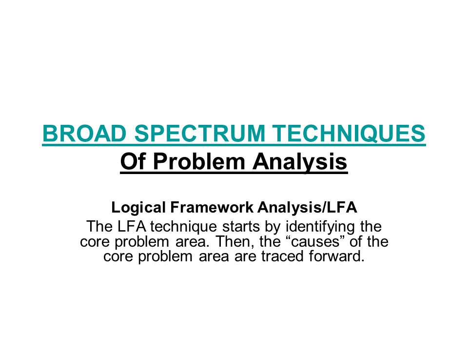
BROAD SPECTRUM TECHNIQUES BROAD SPECTRUM TECHNIQUES Of Problem Analysis Logical Framework Analysis/LFA The LFA technique starts by identifying the core problem area. Then, the “causes” of the core problem area are traced forward.

48
LFA… Problem Tree shows the cause –effect relationship, represented by a tree The following are the major sequential: –If the problem is a cause it goes on the level below –If it is an effect it goes above –If it is neither a cause nor an effect it goes on the same level.

49
LFA… example to build a problem tree on incidence of Malaria. DEATH Incidence Of Malaria Many Mosquitoes Stagnant Water No Bed Net Long Grasses High Temperature Painful joints

50
LFA… Overall objectives/Goals This concerns the wider development aims to which the project should contribute (as opposed to what can be achieved by the project alone). Formulate objectives as positive already achieved situations using the past participle if possible e.g. 'improved...’ increased......' Avoid vague descriptions such as 'to strengthen', 'to rehabilitate'. Be concise: one or two well-described and limited overall objectives are better to explain

51
LFA… Project Purpose/Objective The project purpose relates directly to a clearly identified problem that the project itself intends to solve. It should be clear how the project purpose will contribute to the achievement of the overall objective(s). For clarity and coherence, each project should have only one purpose. needs to be stated in a way that can be measured. By including a quantitative time-bound target (e.g. "to achieve a 40% increase in maize production in area X by the year 2002).
. For clarity and coherence, each project should have only one purpose. needs to be stated in a way that can be measured. By including a quantitative time-bound target (e.g. to achieve a 40% increase in maize production in area X by the year 2002)..")
52
LFA… Result of the Project/Out Put Describe the results of the project in terms of the physical and non-physical services to be delivered. What physical/non-physical services will be delivered to the beneficiaries? Use objectively quantified and verifiable indicators. E.g. X tones of maize grown and sold, Y markets for local products established, Z local farmers trained in improved crop production methods.

53
LFA… Project activities For each of the services and results to be delivered by the project, describe the main activities to be carried out. It needs to be clear how these activities will lead to the project results and integrate to each other and why these particular activities have been chosen. For each activity, the inputs and related costs should be mentioned

54
LFA… Assumptions are external factors, which are essential to the success of the project. They are likely to happen but are outside the control of the project. If they are not crucial to the success of the project, they do not need to be included. Possible negative side effects Activities inevitably have effects other than those intended. Some of these side effects are positive but others may be damaging either to the socio-economic situation or the environment.

55
Logical Framework Intervention logic Objectively verifiable indicators /OVI Source and means of verification Assumptions Overall objectives Specific objective Expected results Activities

56
COMMUNITY PARTICIPATION Community participation is far more than the contribution of labour or supplies; it is participating in decision making, to choose a community project, plan it, implement it, manage it, monitor it, control it.

57
COMMUNITY PARTICIPATIONCOMMUNITY PARTICIPATION, Contribution and Consultation community participation means taking part in a process with a view to determine or at least influence the outcome of the process. community contribution is the donation of the necessary labour or material to ensure that the community members feel that they own the project, community consultation:-is the discussion made by Government, and outside donors with the whole community about their activities.

58
past experiences of people's participation in watershed management Watershed management focused on public lands and activities like conservation and plantation Work was carried out either by directly hiring local labourers or by operating through a contractor. Users' committees were seldom formed. Participation was limited to political leaders and local elites, and users meetings were organised only to satisfy the formalities. Activities accomplished by peoples' participation did not adequately represent women, underprivileged castes and ethnic communities.

59
Models Of People's Participation No Participation Model: - information about programs, budgets and project evaluation is not given. Information Sharing Model: - the project shares information with the district level political unit and discusses project evaluation. Political Participation Model: - the project field staff share information with the village level political unit Users' Participation Model: - Projects negotiate with the users' groups through field staff. Individual Participation Model :- Projects negotiate with individual farmers, who in turn strengthen the users' groups.

60
Factors for The Success Of People's Participation In A Watershed Management Clear and transparent decision making procedures by project management. Clear and simple guidelines and flexible operational procedures to facilitate people's participation in watershed management. Well-defined programs, budgets, plans, implementation procedures and benefit sharing mechanisms. Integration of activities and guarantee of benefits. Strong motivation mechanism

61
Styles of Conflict Management Since conflict is an integral part of life and a basic component of every relationship, efforts should not be directed toward eliminating it, because such efforts will fail. Rather, we should focus on managing/transforming conflict with a view to minimizing its negative impact and maximizing its positive role.

62
Styles of … 1. The competitive style To compete is to try to meet one's own needs at the expense of the other party. To achieve this desired outcome, a competitor will use whatever power is available or acceptable - all the sources of power: A competitive strategy might, then, be appropriate when: –Quick, decisive action is vital; –An unpopular action needs to be taken; –There is no doubt about what is the right course of action; –Defensive measures are urgently required.

63
Styles of … 2. Accommodation Style Accommodation means putting the other party's needs above one's own Accommodation is an appropriate strategy to use when : –One party is not as concerned as the other; –One party is clearly "in the wrong"; –Preserving harmony is the most important consideration; –Gaining goodwill and credit is the most important consideration; –There are opportunities for learning from the other party

64
Styles of … 3. Avoiding Style Withdrawing from the discussion or not bothering to press for a resolution The strengths of this approach are: –sometimes be employed effectively as an interim strategy: –If discussion becomes overheated, it might be advisable to allow a "cooling-off" period; –to allow time for information to be gathered or for a close analysis to be made; –If the issue is relatively unimportant; –When there is not enough time to come to a resolution; –If the issue is identified as only a symptom of a major problem that should be dealt with later.

65
Styles of … 3. Avoiding Style An inappropriate use of avoidance procedures can lead to: –Communication breakdowns, as people who are themselves "left in the dark" stop taking initiatives; –Reduced effectiveness, as decisions are made by default; –Conflicts persisting and then flaring up dramatically at a later stage.

66
Styles of … 4. Collaborative style seek to satisfy the needs of both parties. has been called the "win/win" strategy. this is the most time-consuming and energy- consuming style of all It is most appropriately used when; –It is essential that both parties be committed to the solution; –One desired outcome is the growth in confidence and skill in one or both parties.

67
Styles of … 5. Compromising style Compromise is an intermediate strategy - in a midway position between competition and collaboration, avoidance and accommodation. The style is characterized by the well-known phrase "splitting the difference". when to use Compromise solutions : –Temporary solutions are sought for complex issues – when the time for decision-making is short; –When the goals of both parties are fairly important but not worth the effort needed for collaboration; –When the parties are strongly committed to mutually exclusive goals, and there is little chance that one party will gain an advantage over the other.

Similar presentations


: Overview>")


