Download presentation
Presentation is loading. Please wait.

1
Lithological and Structural Mapping Using Satellite Data Mohamed Abdelsalam Missouri S&T

2
Vision Vision is the ability to recognize shapes, patterns and colors and to detect and estimate motion, distance and size The eye has evolved independently in many animals groups such as the composite eye of insects and that of our own The perceptual ability of human beings are learned entirely through experience

3
Vision - The structure of the Eye The cornea for refraction The iris for controlling the pupil diameter to control the amount of light gathered and the depth of field The lens with 17 mm focal length to adjust focus for objects at different distances The retina (180˚ field of view) is a light-sensitive spherical surface where inverted image are formed through receptors known as rods (130 million) for black and white images) and cones (7 million for color images) www.vrmny.com/anatomy.htm
 is a light-sensitive spherical surface where inverted image are formed through receptors known as rods (130 million) for black and white images) and cones (7 million for color images)")
4
Rods and Cones Rods peaks at about 20˚ away from the fovea and gradually fall off in number towards the edge of the retina Cones contains pigments sensitive to red, green and blue and are concentrated immediately around the fovea The blind spot where the optic nerve leaves the eye (the blind spot) there are neither rods nor cones
 there are neither rods nor cones")
5
Electromagnetic Spectrum

6
Additive Primary Colors Additive primary colors: –Red –Green –Blue In equal portions other spectral color are produced: –Red+Green=Yellow –Red+Blue=Magenta –Green+Blue=Cyan –Red+Blue+Green=White In non equal portions non-spectral colors are produced

7
Subtractive Primary Colors Additive subtractive colors: –Magenta –Cyan –Yellow In equal portions other spectral color are produced: –Magenta+Yellow=Red –Magenta+Cyan=Blue –Yellow+Cyan=Green –Magenta+Cyan+Yellow=Black In non equal portions non-spectral colors are produced

8
Hue-Saturation-Intensity Hue is the nature of the color and can be described by the wavelength. Red = 0˚ or 360˚, green = 120˚, and blue = 240˚ Saturation = Purity of the color. Zero is completely impure and 90˚ is completely pure Intensity Level, or Value is the grayscale In 8 bit radiometric resolution scheme, Zero is black and 255 is white.

9
Hue-Saturation-Intensity

10
Color Cube for Additive and Subtractive Primary Colors

11
Color Cube for Additive Primary Colors and H-S-I Color cube for Additive additive primary colors and H-S-I defines the relationship between Red-Green-Blue color space and Hue-Saturation- Intensity color space The H-S-I color space is defined by a cone extending from black (0,0,0) to white (255,255,255) in 8 bit radiometric resolution scheme The Hue is defined by an angle in which Red=0˚ or 360˚; Green=120˚; and Blue=240˚ Saturation ranges between 0˚ for completely impure color and 90˚ for completely pure color
 to white (255,255,255) in 8 bit radiometric resolution scheme The Hue is defined by an angle in which Red=0˚ or 360˚; Green=120˚; and Blue=240˚ Saturation ranges between 0˚ for completely impure color and 90˚ for completely pure color")
12
Band 3 Band 2 Band 1 RGB color combination images

13
Color Triangle for Additive and Subtractive primary Colors Color triangle for additive and subtractive primary colors illustrates the relationship between Red-Green- Blue and Magenta-Cyan-Yellow The triangle corners are occupied by Red, Green and Blue whereas the mid-points between these corners are occupied by Magenta, cyan and Yellow The center of the triangle is occupied by white which resulted from the sum of equal portions of Red, Green and Blue

15
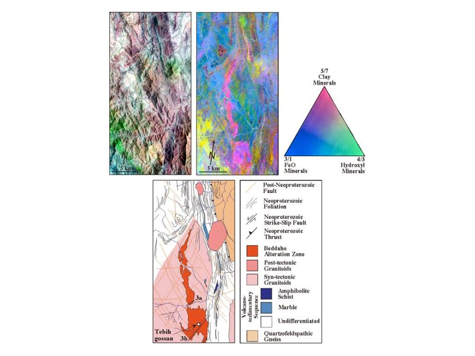
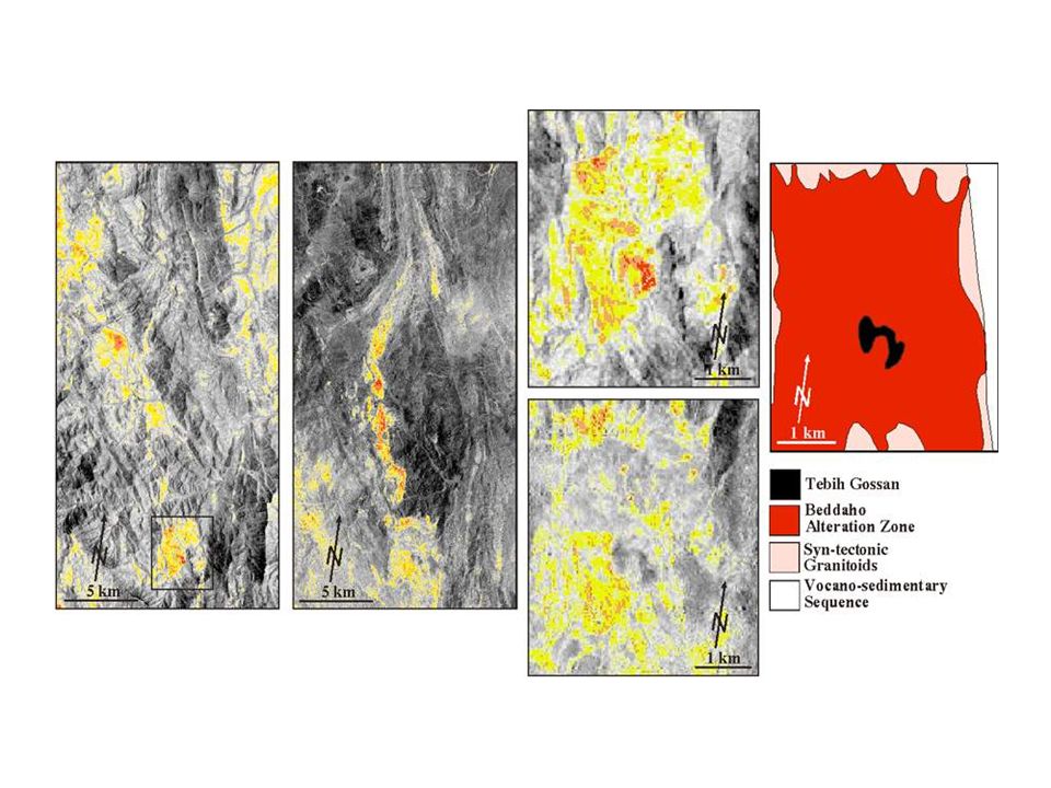
Examples 1: Density Slicing The Beddaho Alteration Zone, Eritrea

19
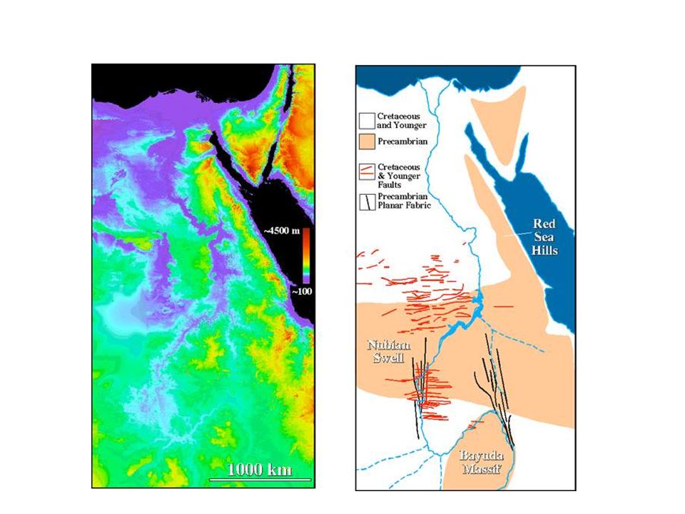
Examples 2: Synthetic Color Images The Nubian Nile, Sudan

22
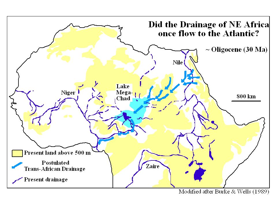
The Nile System

27
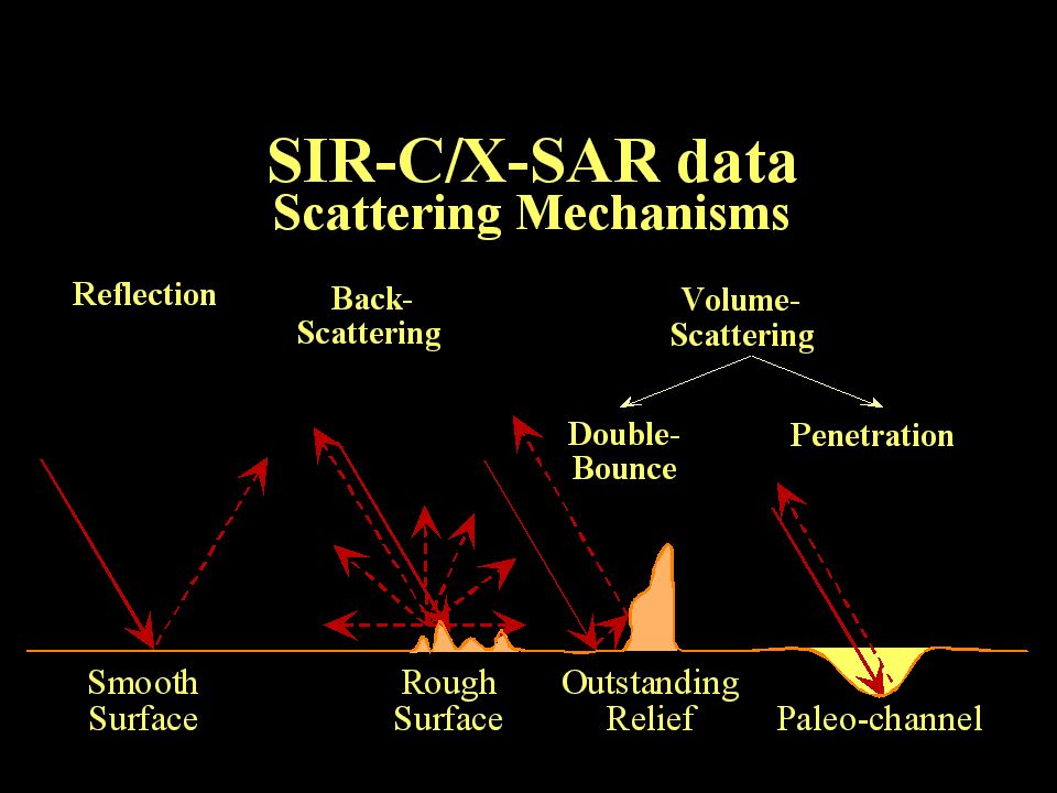
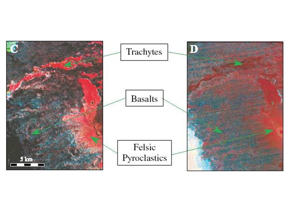
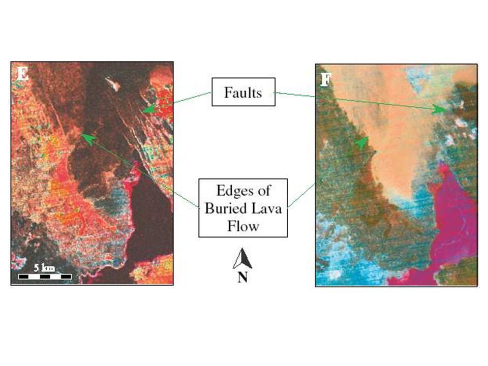
Examples 3: Data Fusion The Erta Ale Volcano, Ethiopia

Similar presentations